All Activity
- Past hour
-
Central west shore, town of Travis.
-
We are within an 1" or so for the season.
-
@The 4 Seasons 1" new refresher, 62.25" for the season.
-
Somehow still snowing here
-
whereabouts, you dont have to give me your exact coordinates just north, south, central etc
-
Last week, I thought we could sneak in one decent event this week, but I guess not. I’m just hoping we get one last hurrah mid month and then we sit back smoke a cigar and call this a season.
-
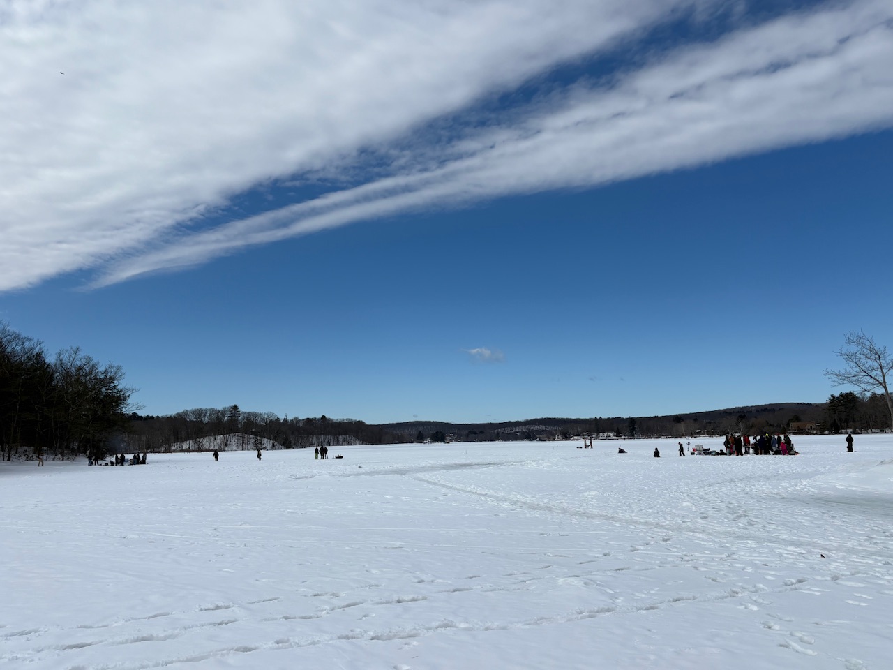
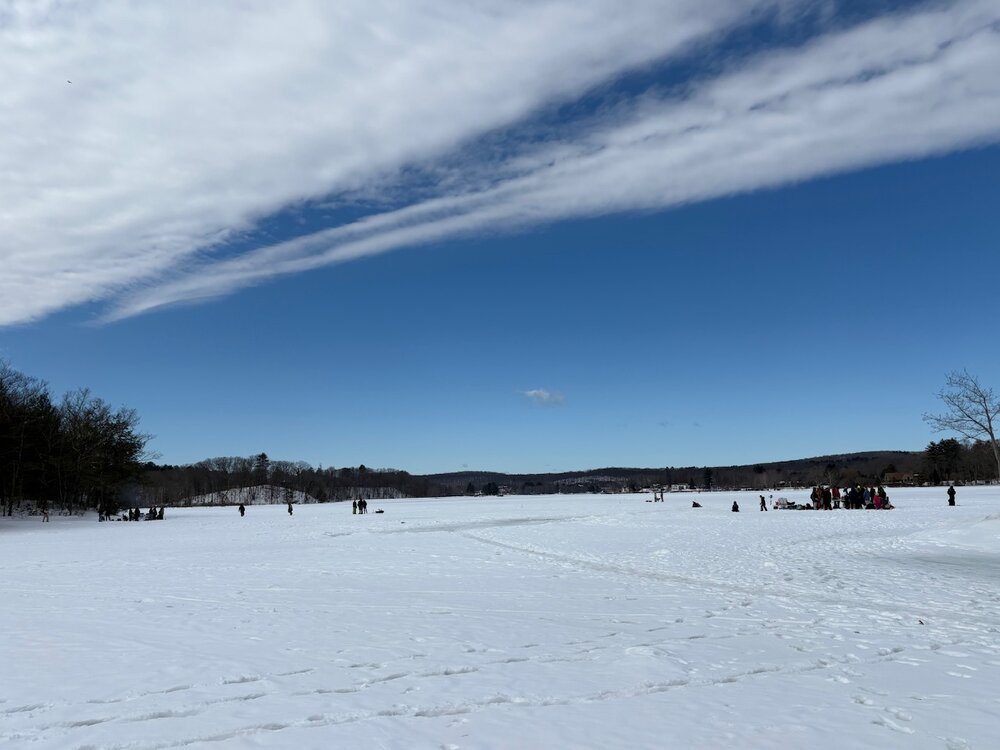
Ice fishing party out on the Connecticut River above the Turner Falls dam. There’s gotta be close to 18 inches of ice!
-
53.9" here on si.
-
61.1" on the season including today.
-
Let’s get a mid-month icestorm.
-
Yes, it's definitely heading in the spring direction. But it's not completely over. Not just a wish in my brain but there are are some tricks still up the sleeve of old man winter. Once we get past that warm weather in the beginning of next week there is going to be a downturn in temps that could also coincide with a storm. Not saying you're wrong and I'm right, but also not saying you're right and that I'm wrong. Makes sense?
-
This Feb was my 9th coldest with a 29.4° mean and 5th snowiest with 25.9". Also 5th coldest met winter... 50 years of record.
-

-
Hey suzook, I don’t know if you’ve seen it but latest FFC has only ~68 in your area and only ~62 closer in to ATL due to their stronger wedged E winds for Mon’s highs. CHS has us here similar to your 68 with brisk NE winds from the wedge. But indeed, this with lots of sunshine is still a far cry from the 40s cloudy/rainy highs in NC
-

Outta gas and Outta Time: Early March Winter Storm finale
DDweatherman replied to Ji's topic in Mid Atlantic
Now getting ready to piss on some more local yards it appears -
Well, in any event ... first day of Meteorological spring. Time of the year when the streets can start steaming while it is snowing.. more so toward mid month+ but we're gettin' there. As I pointed out earlier, the indices are giving numerical values that have correlated to some impressively warm departures in springs of the past. However, the operational models ( save maybe the 00Z CMC) are not expanding their solution to fill that gap. They're coming out with solutions that are 50 (GFS) or 70% (Euro). I have to say, I don't really have a problem with that limited idea. The PV is decidedly on our side of the NP/hemisphere... These overnight ensemble means are showing a rather extraordinarily deep signature out there between the 15th and 20th anchored around the Canadian archipelago - granted that's a long ways off, during a spring month no less doesn't lend a lot of confidence/stability expectations, but they all three have it. Pure speculation, but that being there (if/when...) likely compresses the gradient and keeps the atmosphere fast, as well as chillier from the GL-NE at those latter times. We'll see.
-
10" 0.1" new this morning. It started to whiten colder pavement, but fell short.
-
Just need to put the garden hose on it and they'll fly down that track.
-
Did you end up hitting 60 yesterday?
-
It’s been pounding here for the last hour. Over 1”and still falling moderate/heavy.
-
I got close top 2 inches, surprised you didn't get more.
-

"Don’t do it" 2026 Blizzard obs, updates and pictures.
40/70 Benchmark replied to Ginx snewx's topic in New England
Winter was okay for me RE snowfall...nothing that stands out. The blizzard being mundane here failed to distinguish this winter from the pack in terms of snowfall. -
Low of 39 this first morning of March. Already 69 at 11:30. Low 70's today, low 50's tomorrow then 70's from Wednesday to the 12th at least. Weeds are growing, trees starting to bud. Spring is arriving quickly.
-
Not sure a flake fell here
-

Outta gas and Outta Time: Early March Winter Storm finale
NorthArlington101 replied to Ji's topic in Mid Atlantic
Someone order a clown map?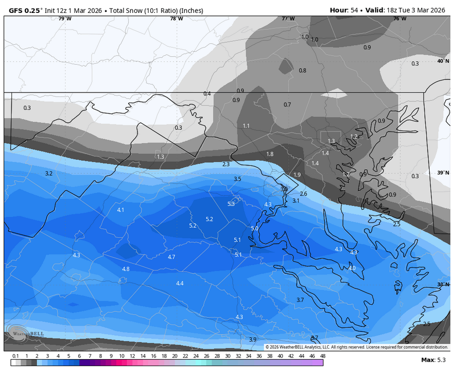


.thumb.png.4150b06c63a21f61052e47a612bf1818.png)