All Activity
- Past hour
-
Example... https://phys.org/news/2025-05-year-mountain-wont-fast-climate.html
-
-
Not sure what you’re talking about, I posted a warm map for the 19th. Was not meant to be funny . DJT waves hi
-

2025 Lawns & Gardens Thread. Making Lawns Great Again
SJonesWX replied to Damage In Tolland's topic in New England
yup there is, but just be patient. it will dry out before you know it seriously though, i know you're talking about rainfall, which you obviously can't control. but when not raining, just need to keep it moist -
Was it?
-
Friday could be a prolific rainer in western areas again, especially if some storms fire up there later tomorrow along front. Eventually everyone gets a good drink.
-
Per X New ECMWF guidance shows near or slightly above average sea temperatures in the main development region for hurricanes this coming season. Well above average temperatures are forecast in the Gulf and western Atlantic, which can enhance activity close to land.
-
Your schtick was funny 10 years ago.
-
I ended up getting in some nice bands and logged 1.2" A flurry or two mixed in once in a while but the cooler air never arrived.
-
Why wouldn’t I ?
-
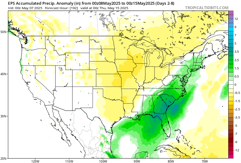
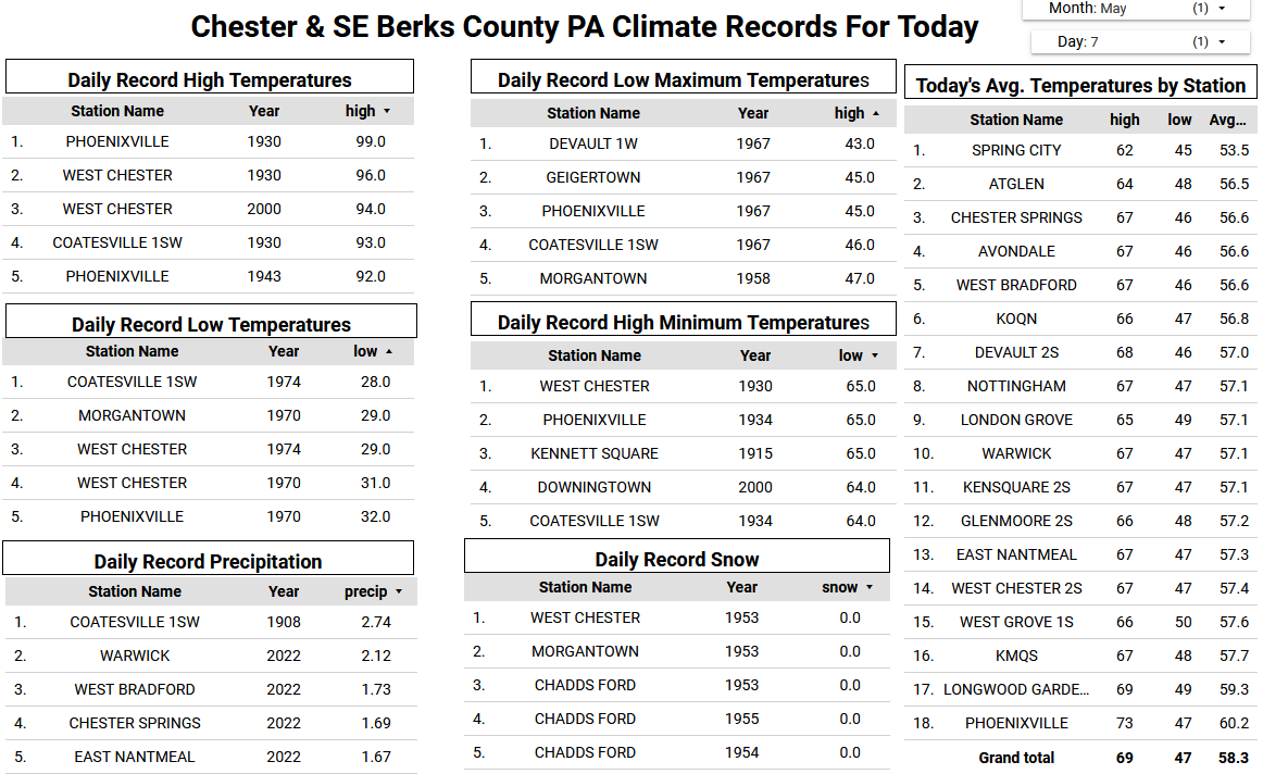
Over the last 4 days we have received 2.19" of rain here in East Nantmeal. We are now only 2.40" below normal or 85% of normal rainfall as those drought conditions continue to lessen. A beauty of a day today with temps near normal around 70 degrees. However, we see more rain arriving again by tomorrow night and lasting through Friday morning. The rain associated with a cold front could drop between an 1.0" to 1.5" of rain across the area. We turn much chillier on Friday with some higher ridge locations remaining in the upper 50's for high temperatures. We warm nicely by the weekend with temperatures within a few degrees of normal at around 70 degrees.


-

E PA/NJ/DE Spring 2025 Obs/Discussion
ChescoWx replied to PhiEaglesfan712's topic in Philadelphia Region
Over the last 4 days we have received 2.19" of rain here in East Nantmeal. We are now only 2.40" below normal or 85% of normal rainfall as those drought conditions continue to lessen. A beauty of a day today with temps near normal around 70 degrees. However, we see more rain arriving again by tomorrow night and lasting through Friday morning. The rain associated with a cold front could drop between an 1.0" to 1.5" of rain across the area. We turn much chillier on Friday with some higher ridge locations remaining in the upper 50's for high temperatures. We warm nicely by the weekend with temperatures within a few degrees of normal at around 70 degrees.
-
Why would you post Monday the following week?
-
New owners announce major upgrades after finalizing sale of Burke Mountain Resort
-
Picked up 0.10” in quick thunderstorm yesterday 2.19” total
-
1.99” here
- Today
-
They’re laughing and thinking cold rainy week .
-
I actually don’t mind getting good rains in May. The last thing we want is a Stein May. If that happens, we’re screwed.
-
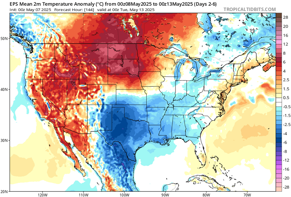
I’m just saying to watch that cut off. It could cause some bad weather for sure and also cooler temps. There’s still some uncertainty.
-
Friday looking like a washout on all the models
-
1.29 rain yesterday, event total 2.67.
-
No idea what you two are talking about. Doesn’t look cold or wet next week lol. Scooter wasn’t calling for that either . Next week should be nice overall . Maybe showers mid week but warm, dewy flow vs cold. ACATT lol
-
this is easily going to be my latest install.. Theres usually one day by now it gets impressive. Maybe I can wait until June this year?
-
ya Hammer is going to have to change his forecast.. Kev uninstalling @CoastalWx FTW
-
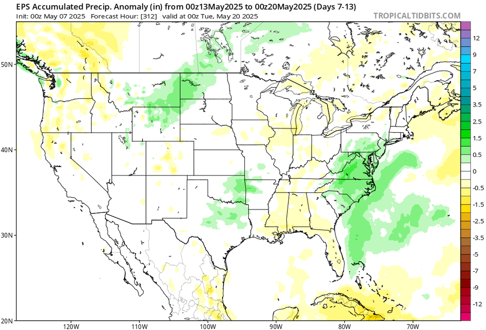
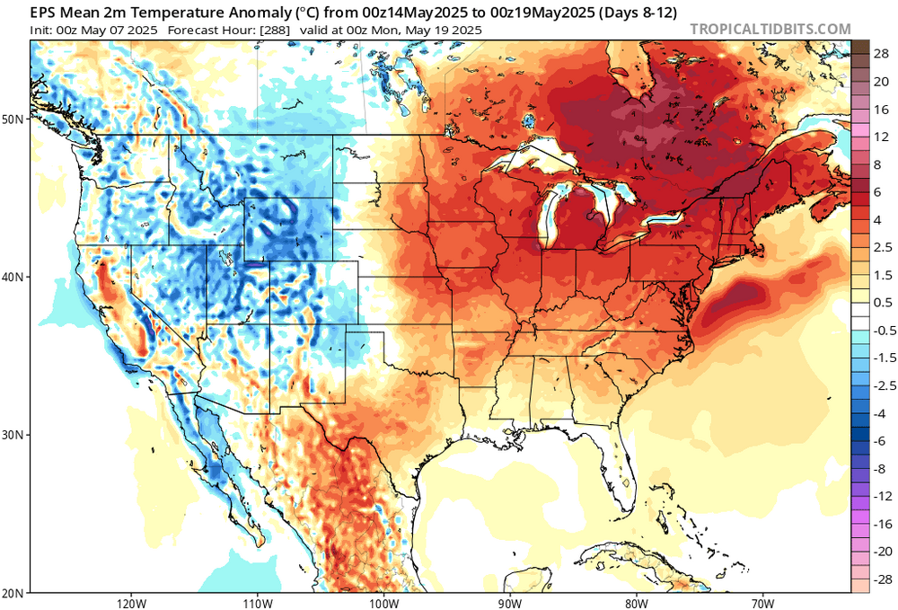
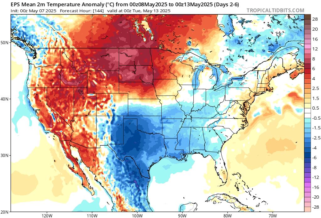
Warm and wet pattern next few weeks as the cutoff lows undercut the ridge over Southeast Canada. So an early preview of the Euro summer forecast. Very close to our summers since 2018. Many days in the 60s and 70s with a few low 80s sprinkled in especially the closer you get to Philly and CNJ.