All Activity
- Past hour
-

November 2025 general discussions and probable topic derailings ...
WinterWolf replied to Typhoon Tip's topic in New England
Stein is a dork, and Julia Childs was drunk most of the time. -
Thanks Don, I see your point about the unpredictability of upcoming NE snow. Moreover, this thread isn’t strictly about NE snow (as you know). It’s of course also about NE and other areas’ temperatures, wintry precip in other areas, and many other things. Wintry precip, which is usually more variable/localized than the cold influence of Arctic airmasses, is thus often less predictable than temperatures. Therefore, regarding the potential lagged effects of an SSWE, I’m guessing that temperatures in the NE US as well as for other areas for whatever period would be less unpredictable than snowfall. From what I’ve read, there’s a significantly better chance than normal for a multi week long period of cold domination in the E US likely starting 2-3+ weeks after an SSW. More often than not the cold will appear in the E US. Most likely that would naturally mean increased wintry precip in parts of the E US, but where is the question?
-
After the last couple years, I'm not believing any epic pattern 10+ days out stuff until its slapping me in the face with stinging cold snow.
-
I would rather have a source of cold air, than hoping for the exact right setup...
-
I don’t think anyone would’ve bet any sort of money on November snow lol. I’ll concur insofar as if we have another hyped December pattern only to get shut out I’m gonna make a New Years’ resolution to never care about December again. Might just not be able to snow here anymore til January
-
See talk has now drifted to December instead of Thanksgiving with even some later patter. Can’t duck our heads and just sluff off the start of the infamous “delayed but” potential pattern
-
I remember numerous modeled snowstorms at day 10 over the past few years. Even some as early as late October. Since there are 4 runs per day of each global model that goes out past day 10 (CMC, ECM, GFS), there will always be more modeled snowstorms than real ones in the long range. It doesn't mean much until it's inside day 7 on more than one model. I'd rather see negative height anomalies and deep trofs at day 10 too. But it doesn't mean I'm excited for any particular snow threat and it doesn't mean I think anything looks different this year than last. What does feel different is that I've already observed falling snow locally on 4 separate occasions and observed accumulations twice. That feels different.
-
We have had year after year where models in the medium and long range have had raging SE Ridges and wildly warm anomalies for December. I'll take models showing a nice trough in the east with some energy around and take my chances with that any day.
-

November 2025 general discussions and probable topic derailings ...
klw replied to Typhoon Tip's topic in New England
The Vermont DMV uses this as a code for a suspension for Failure to pay Fines. -
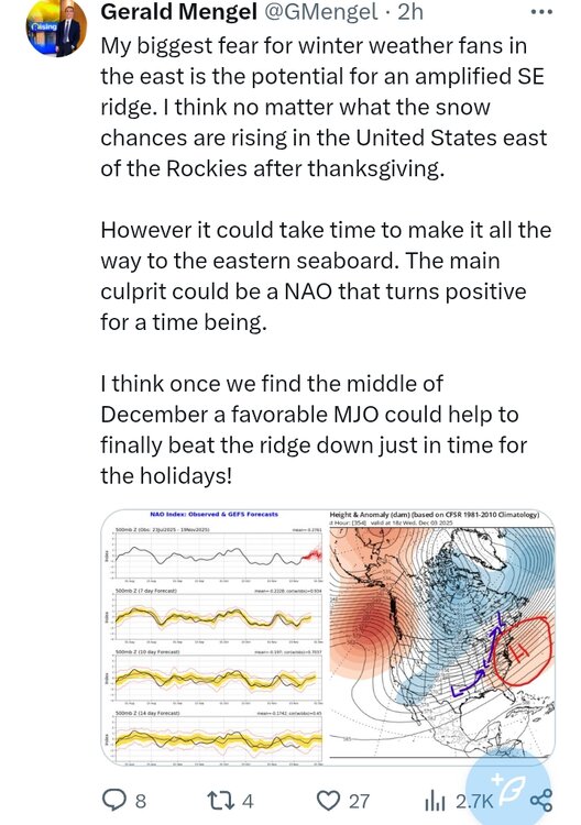
Models still have it progressing to Ph. 7 by the 1st and crawling through 7.
-
So what was your guess last year during a La Nina dominated by +PNA? PDO was even more negative at this point last year. Could it be more -PNA? Yes! Is it a given? No!
-

MO/KS/AR/OK 2025-2026 Winter Discussion
stormdragonwx replied to stormdragonwx's topic in Central/Western States
Euro is coming on board with the GFS with some interesting weather looking possible around the Nov 28th-29th and Dec 4th-5th timeframe. -

November 2025 general discussions and probable topic derailings ...
H2Otown_WX replied to Typhoon Tip's topic in New England
Scooter said NO -
I hate being a downer, but I'm not high on snow chances in the mid- or long-range yet. I think there will probably be a cold shot after Thanksgiving, but wintry chances locally will depend on very favorable wave spacing and evolution, which is still too low confidence for me to get excited. The good news to me is that we are transitioning into the season where we can realistically analyze the models for snow threats. The bad news is we are still in a rut where legit chances seem very hard to come by.
-

November 2025 general discussions and probable topic derailings ...
Ginx snewx replied to Typhoon Tip's topic in New England
If lakes in November can hold a duck the rest of winter is mud and muck??? -

November 2025 general discussions and probable topic derailings ...
Ginx snewx replied to Typhoon Tip's topic in New England
Lost 90 lbs down to high school playing weight 234. Hopefully hit 225 by New Year's. Good eating and a honey do list longer than a Mt Mansfield winter. Prefrontal days are always warmer than normal especially this late in fall. -
-
Lest anyone be in doubt that we are still in a -----PDO Lan Nina basestate take a look at the MJO forecast. It actually did a backwards propagation (often forecasted rarely occurring) in phase 5 and looks poised to do it again in phase 6. Convection REALLY likes to be in Maritime Continent/E Pac.
- Today
-

December 2025 Short/Medium Range Forecast Thread
Daniel Boone replied to John1122's topic in Tennessee Valley
Makes sense imo. The solid wall to wall Winter's did basically what you described. High latitude blocking helped mitigate what trips the MJO made through the warm Phases. In some cases, it would go either low amp through or COD and come back into cold Phases( SST'S were supportive of that then). My guess is as your's, in that the MJO will make it back to warm Phases at some point as the SST'S are still supportive for that to occur at decent Amp. As you noted, the -QBO should help. Also, NATL SST'S have became more favorable in supporting a -NAO. -
Just seeing a long range paste bomb brings seasonal joy after the past few years. Nothing like a little hope-porn to get the tracking juices flowing.
-
0.13" for Muttontown & 0.11" for Syosset
-
November 2025 general discussions and probable topic derailings ...
Typhoon Tip replied to Typhoon Tip's topic in New England
12z oper GFS's 29th NJ model impacter should not be summarily tossed... Not saying it's high confidence - how could I ... But typically the front side wave spaces, while major hemispheric mode changes are underway, are cyclogen active. In principle ...the period of time is okay for activation of storm systems. Way too early to be detailed beyond... -

December 2025 Short/Medium Range Forecast Thread
Carvers Gap replied to John1122's topic in Tennessee Valley
MJO stuff...First off, that is not a warm look for December. In fact, it kind of just crawls through the left side of the plot which is not something we have seen in recent years. It seems like the MJO almost defaulted to 4, 5, and 6. How many times have we seen the MJO hit the wall in phase 6 and not move? It looks like this time it might hit the wall while in the cold phases for once. That "could" mean an extended period of cold. If you like really LR thinking, I have to wonder if it can get through the warm phases(before winter fades) if it exits the cold phases in late December or early January. I think it can...and probably by the last third of January. That would give us two decent shots of cold if one assumes winter comes back during that last week of January. But that second cold shot can be difficult, but the QBO may help us in that regard.


