All Activity
- Past hour
-

E PA/NJ/DE Autumn 2025 Obs/Discussion
JTA66 replied to PhiEaglesfan712's topic in Philadelphia Region
Topped out at 84F today. Better than Minneapolis which was supposed to approach 90F! WTF??? I should be wearing hoodies, hockey jerseys or flannels. But no, I’m still in my cabana wear from the Frank Costanza collection -
It’s a kid playing meteorologist on social media. It’s become a playground for weenie mets looking for subscription money, likes, follows, views and retweets and children playing weatherman
-

2025 Atlantic Hurricane Season
WxWatcher007 replied to BarryStantonGBP's topic in Tropical Headquarters
That’s fascinating stuff -
Well we’ve had our first real Fall day and it’s been low 50’s, raining and raw. First widespread mountain snow, foothills down 5-6000’ might even get an inch or two tonight through Monday. Here in town we will struggle to hit 50 tomorrow and are headed for the first frost, possible freeze for the season Monday morning. Think I’ll go on a snow chase an hour south tomorrow into the Beartooths, brand new tires need to be christened.
-
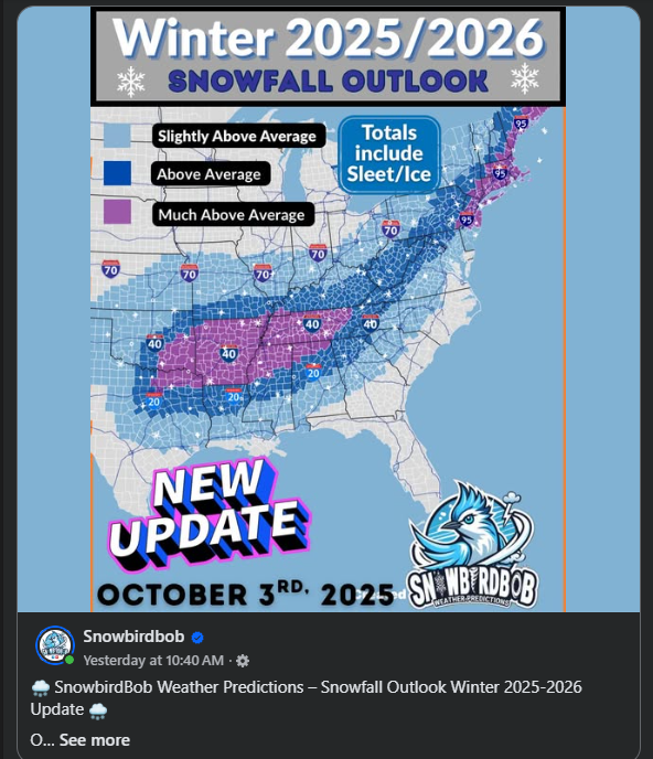
Look what I found! It's build up the subscribers season. Anyone ever heard of this guy?

-
Look what I spied with my little eye. Time to build up the subscribers! Who's SnowbirdBob?
-

Spooky Season (October Disco Thread)
CoastalWx replied to Prismshine Productions's topic in New England
What a waste to have a frost and then be 80F. Talk about fake. -

2025-2026 ENSO
40/70 Benchmark replied to 40/70 Benchmark's topic in Weather Forecasting and Discussion
This jives with my thoughts for January, as my analogs have a stratospheric reflection event getting underway around mid month, which will trigger strong AK ridging and a +TNH pattern, but those reflection events are preceded by Pacific trough patterns....hence +EPO. -
2025-2026 ENSO
40/70 Benchmark replied to 40/70 Benchmark's topic in Weather Forecasting and Discussion
I think that is pretty unlikely independent of GW.....that was an incredibly anomalous stretch that included 2 all-time record snowfall seasons. Let's not get trigger happy with GW attribution. -
Not to minimize TS Chantal, which caused record 24 hour rainfall in some portions of C NC, but will 2025 get through the rest of this season with no Conus hurricane impact for the first season since 2015? The record longest streak with a hurricane impact is 13 seasons (1938-50). -Since 1851 there have been 34 (20%) seasons with no Conus H impact on record. Of these 34, these were only 6 during La Niña (1872, 1890, 1892, 1973, 2000, and 2010) vs a much higher 15 during El Niño, which is intuitive. The highest ACE of these 34 was 2010’s 165 (La Niña) followed by 1951’s 126 (El Nino). -Since 1851 there have been only 6 (3%) seasons with a first Conus H impact on record in Oct or later: all were in Oct and none of these 6 had a second one. None were during La Niña. The highest ACE of these 6 was 1853’s 76 followed by 2002’s 68. So, if 2025 were to join them, it would by a good margin have the highest ACE of this group and would be the first during La Niña: 1853 neutral: Oct 20th (GA) when center passing 40 miles off GA from TC 1st reported ~NW Bahamas 1923 El Nino: Oct 16th (LA) from TCG in the EPAC! 1946 neutral: Oct 7th (W FL pen.) from TCG in NW Caribbean 1968 El Niño: Oct 18th (W FL pen.) from TCG in SW Caribbean (Gladys) 1987 El Niño: Oct 12th (Keys/S FL) from TCG in SW Caribbean (Floyd) 2002 El Niño: Oct 3rd (LA) from TCG in C MDR (Lili)
-
In January? Follow the flow. That better be cold enough with negative h5 heights just to our north under a -NAO. Otherwise we might as well just give up lol.
-
I’m getting some light to moderate showers that are moving W from off the ocean. First rain of the month. The forecast is for scattered showers to continue to occur in the area through the remainder of the night and through tomorrow. There could be a few thunderstorms tomorrow afternoon.
-

Spooky Season (October Disco Thread)
SnoSki14 replied to Prismshine Productions's topic in New England
But some will claim this is totally normal -
I think an oddball anomaly could still be possible in the snowier/colder direction that might generate this.
- Today
-
Might as well go 2017-2024. It’s not just since 2020 that things have been below average. It’s wild to think Baltimore hasn’t seen anything close to a real snowstorm in about 10 years, yet it feels like we’re punting on the odds of one occurring this upcoming winter. That’s not even negative thinking, it’s just realistic given the setup. Seems like even the most optimistic outlook would say we would need to piece together multiple different smaller events to get near or above average snowfall. I know a lot of us will still be hoping for a rare major snowstorm in a La Niña, and maybe the further we get away from January 2016, the more likely we get lucky with some funky setup just because we’re “due.” It just kind of sucks that hope is already pretty drained before we even get to November.
-
Actually it would mean +EPO October would beget +EPO Jan-Feb. The map is showing -EPO as the default state, but the correlation has both signs considered. We needed a +PNA/-EPO October, like 2002. The Pacific H5 has >+0.2 correlation, or 60% chance to roll forward to the Winter, which is more than usual.
-

Spooky Season (October Disco Thread)
Snowcrazed71 replied to Prismshine Productions's topic in New England
You might be in that lucky 90° spot tomorrow. -
From your mouth to the ear of the weather gods.
-
Expect another SE ridge then
-
Would you be considered at the zonal flow into western Canada? Would argue that's a Pacific puke setup to our north.
-

Spooky Season (October Disco Thread)
powderfreak replied to Prismshine Productions's topic in New England
Hit 80F today here. Climate report says the record is 87F back in 2023, so not close to that… yet. -

Central PA Fall Discussions and Obs
Itstrainingtime replied to ChescoWx's topic in Upstate New York/Pennsylvania
The seed for today was sewn in the first couple of weeks. A couple of uninspiring wins against vastly inferior competition left me feeling like what we're witnessing now was inevitable. -
Some places have dropped 25 degrees already since 5pm. Clear and dry conditions ftw
-
Record high of 91 at MSP. This is the latest occurrence in the year of a 90+ temperature on record for Minneapolis. Presumably we will also set a record high min of 72 today as well.
-
Big time +EPO this October.. models are showing it for the 2nd half of the month. EPO carries very well from October to January-February


