All Activity
- Past hour
-
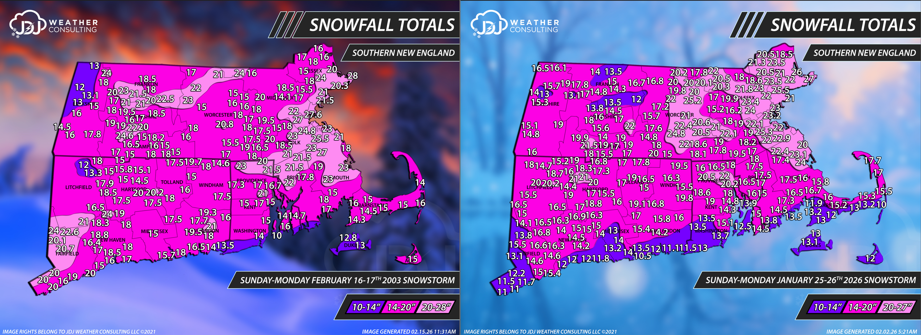
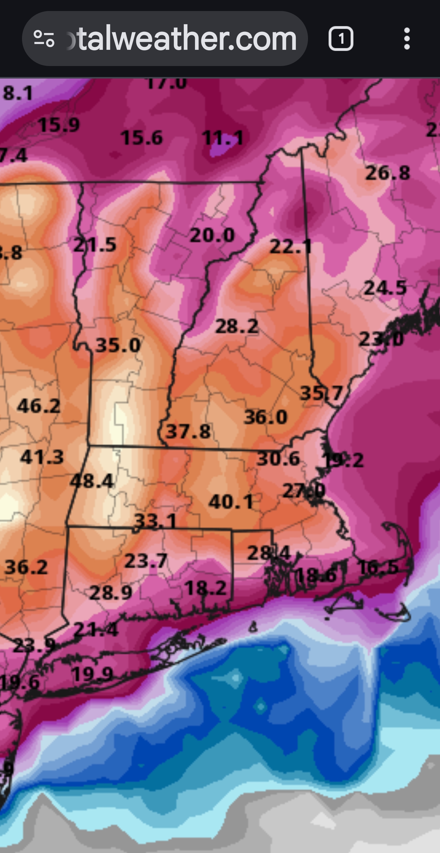
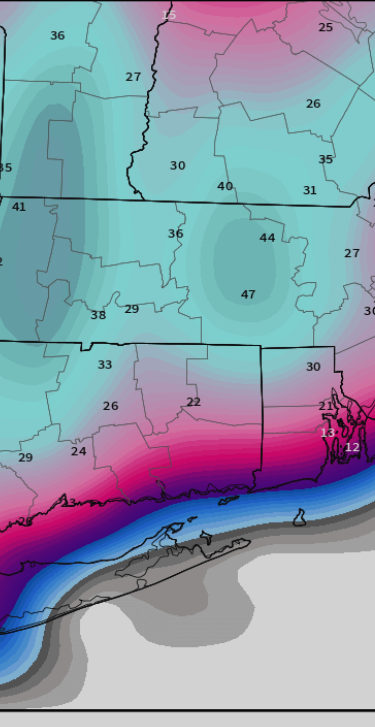
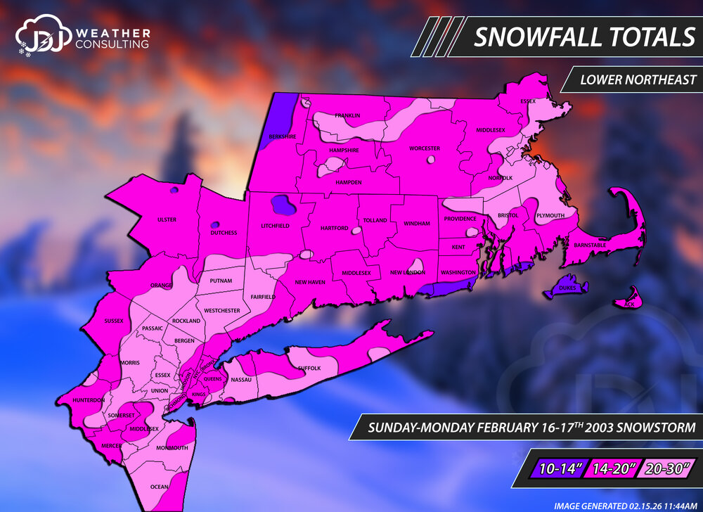
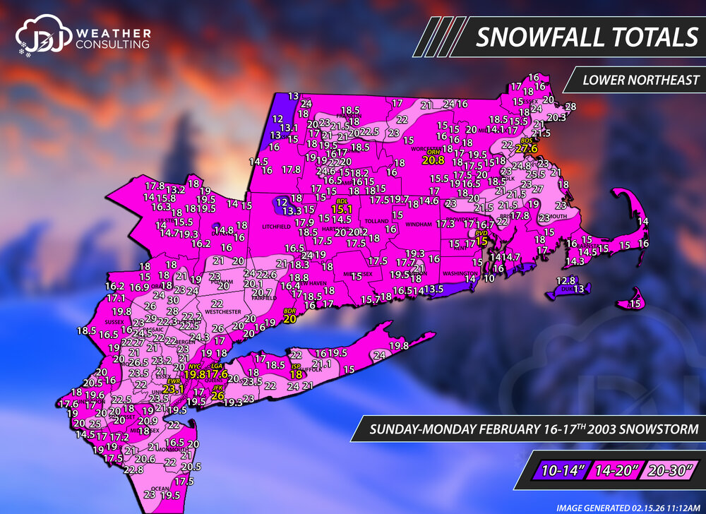
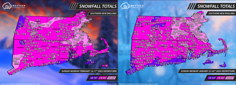
Today (and tomorrow) is the 23rd anniversary of PDII. For that i have refreshed the maps for the event and created a new L Northeast map as well. It is Bostons #1 all time storm and BDRs #2 all time and only the 2nd time ever they reached 20" or more. 15-28" at every single climate site in OKX and BOX is impressive. Full radar/sfc loops up here: https://www.jdjweatherconsulting.com/feb-16-17-2003 A similar type storm we had on Jan 25-26th was almost on the level for SNE but id say about a couple/few inches lower on average.
-
Won’t be anything close to offset this week of +10 to +25 AN readings. Winter is over for the piedmont. We’re chasing freezes now
-

Central PA Winter 25/26 Discussion and Obs
NepaJames8602 replied to MAG5035's topic in Upstate New York/Pennsylvania
Woke up to a surprise 2.5" inches here in my part of the Poconos. Areas just 20 to 30 miles north of me, absolutely nothing. Sharp cutoff and nice surprise! Had to wake up early to shovel and clean up before work. -
We get clowns like that a few times per winter
-
GFS and EURO not too alike.
-
GGW
-
Ha! Never was supposed to. It'd be a little bit on the shoreline but that was about it.
-
Cmon guys no one posted most epic clown map of all time? Lol just to piss off the regulars


-
That was a weenie GFS run for sure. Very cold after the storm Sunday. See what happens. .
-
Euro Ai took it further south. Looks like a colder version of this weekend
-
Long, long way to go for that weekend potential. I wouldn’t bite yet.
-
i think that's the first time in the 12 or so years of being on here that i saw Will like or react to a reply.
-

Presidents' day Snow potential
WestBabylonWeather replied to WeatherGeek2025's topic in New York City Metro
2” -

2025-2026 Fall/Winter Mountain Thread
Buckethead replied to Buckethead's topic in Southeastern States
I had black ice the entire way into town this morning. Sent from my Pixel 10 Pro using Tapatalk -
Pretty view of the pond across the street from us, as the fairly wet snow clung nicely to the trees, although some was knocked off by the wind. Also, as an fyi, I measured again, just to check compression, and I now have 1.25" on the existing snow vs. 1.5" about 4 hours ago when the snow was over, so I had about 17% compaction, which is fairly typical in my experience. It certainly wasn't melting, as the sun just came up and it's 29F now vs. 31F at 3:30 am. Always being awake and measuring the snow right at the end, when that's in the middle of the night is certainly the main reason I often have slightly higher numbers than those near me who wait until morning.
-
This is exactly what I have been complaining about for weeks now on the ensemble mean while others have been trying to defend them.
-
Ugh
-
2.2" new snow. temp 27.9
-
What’s the deal with Wednesdays system? Looks like most models have snow line at the MA/NH boarder except the GFS which practically brings snow to the CT coast.
-
6z Euro is congrats Dendrite for Wed but then a qpf inch plus of snow on SNE Friday Saturday
-

Early Monday morning 2/16 last minute event OBS/Discussion
BBasile replied to The Iceman's topic in Philadelphia Region
0.33" of rain. -

Presidents' day Snow potential
weathermedic replied to WeatherGeek2025's topic in New York City Metro
Picked up 1" on colder surfaces. Temp made it down to 30 at my station in Sheepshead Bay Brooklyn -

Is we back? February discussion thread
Damage In Tolland replied to mahk_webstah's topic in New England
That Sunday night storm has some eps support but that setup the GFS shows is shaky -

Presidents' day Snow potential
sussexcountyobs replied to WeatherGeek2025's topic in New York City Metro
Picked up .7" last night -
6z GEFS has it.