All Activity
- Past hour
-

2026-2027 Fall/Winter Mountain Thread
Maggie Valley Steve replied to BlueRidgeFolklore's topic in Southeastern States
Updated Excessive Rainfall Outlook from the WPC. Folks need to be aware of the Flooding possibility with this storm.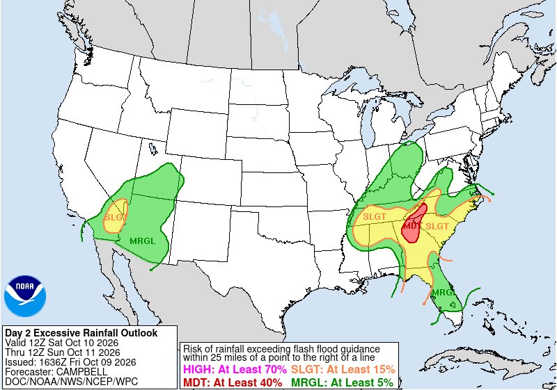
-
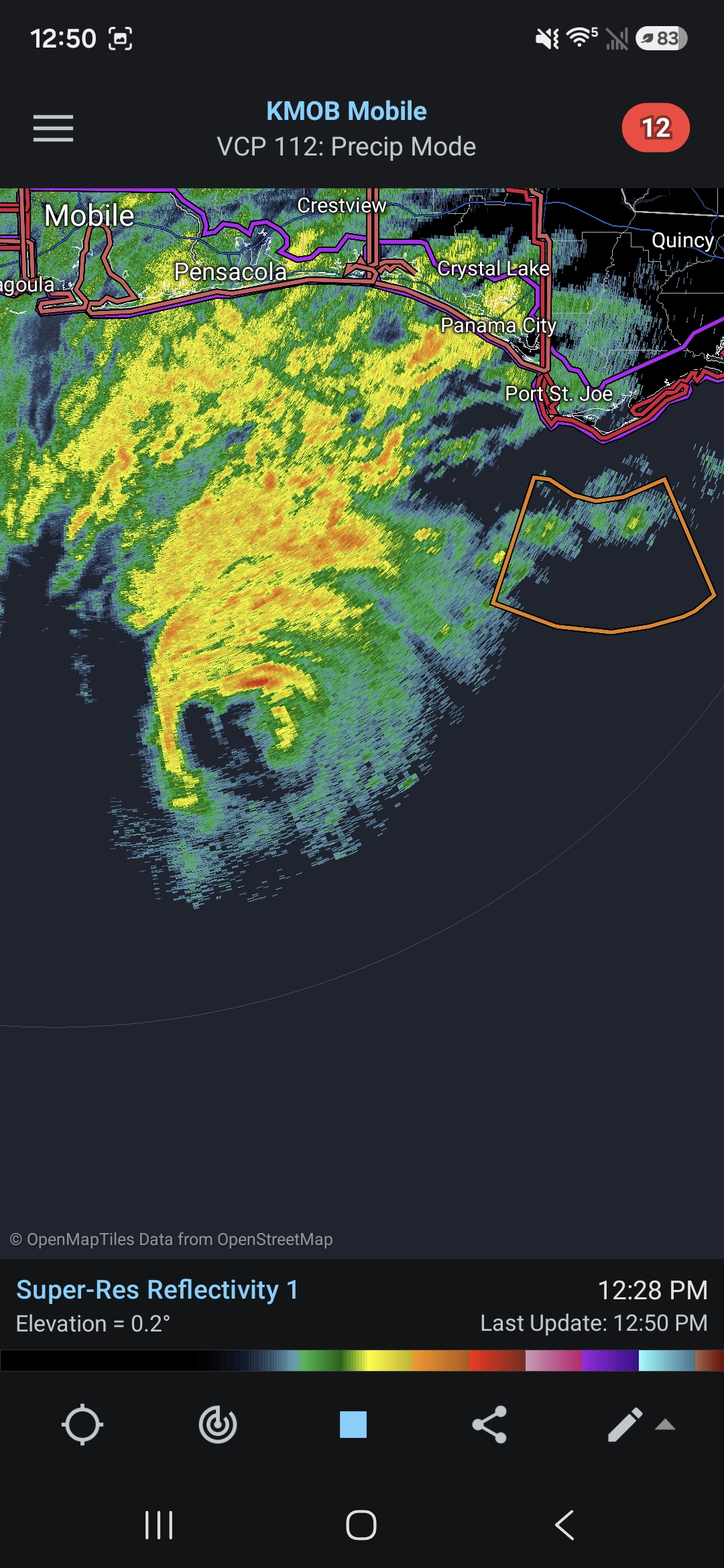
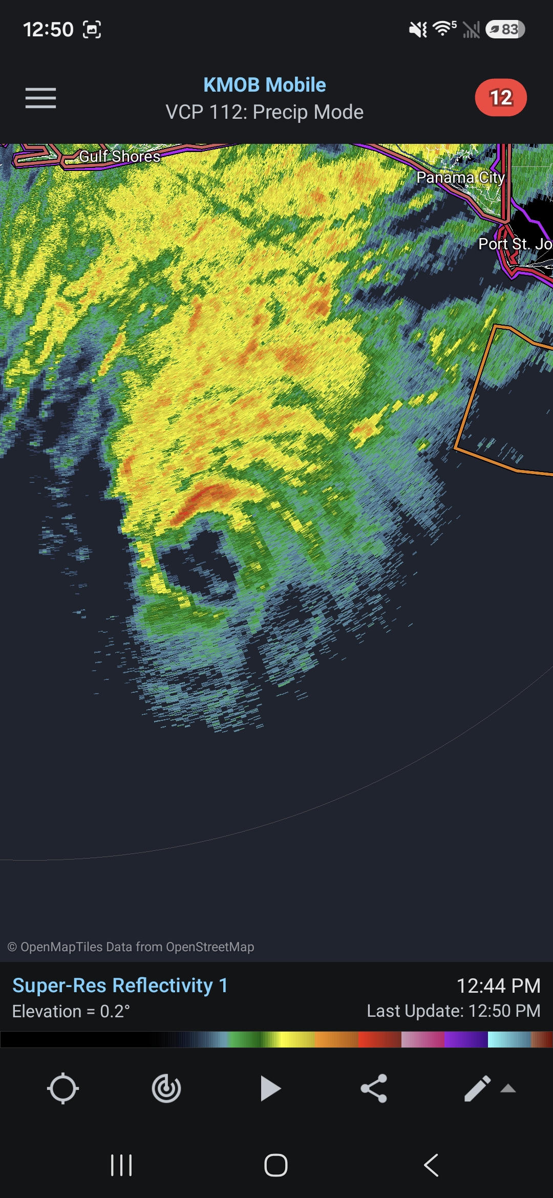
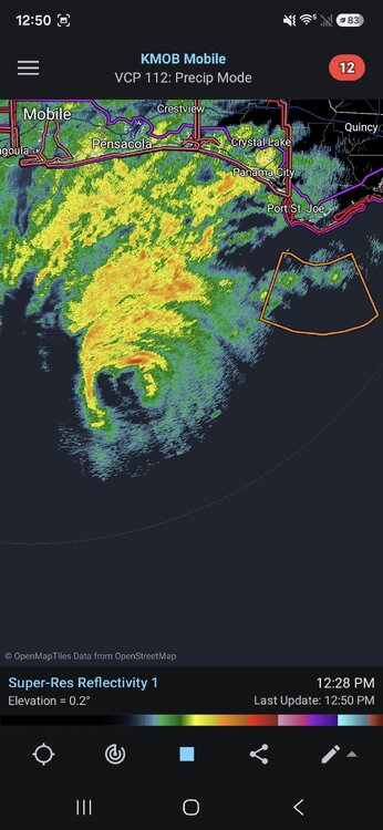
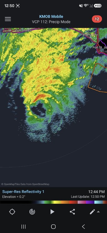
Radar (and the microwave pass posted above) did show some signs of degrading and possibly starting an EWRC, but radar has since improved.
-
That’s the next priority, as much as the wife thinks buying new furniture is, ha.
-
Some of the radar hallucinations are due to attenuation.
-
This hurricane must have body insecurity issues with everything that people have said about it in the last couple of days It looks pretty normal for a Category 3 hurricane, and unfortunately does not appear to be weakening yet
-

2026-2027 Record-breaking El Nino
GaWx replied to Stormchaserchuck1's topic in Weather Forecasting and Discussion
The last 10 days of the PDO have had a decent rise overall though nothing extreme: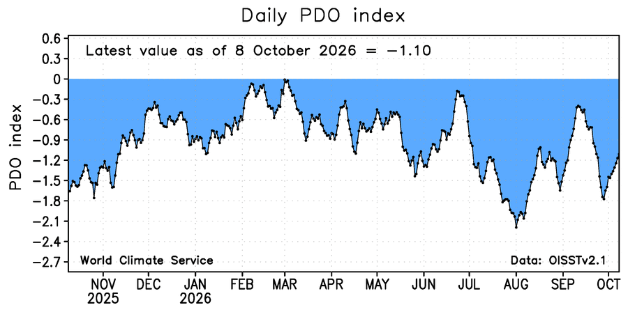
-
Recon doesn't show degradation. I'm not sure what people are seeing. It's still generating very strong convection near center. It looks very steady to me.
-
Destin has a bunch of dense housing and touristy buildings/hotels right on/near the beach too, one of the more vulnerable areas that's more urban
-
Based on radar it could be a bit more of an eyewall meld than a true EWRC (which is sometimes common as it approaches land and the friction causes it to tighten up a bit) but it's definitely degrading which is welcome timing.
-
Not a great day no matter how you slice it. More a question of how bad will it be.
-
Ah yes. Better indeed. Nonetheless, speedy recovery my friend!
-

Occasional Thoughts on Climate Change
WolfStock1 replied to donsutherland1's topic in Climate Change
I'm sensing a cognitive disconnect here. We keep hearing about supposedly-good shifts in CC trends, for years now, and yet this most-important trend - the end result - seems to be unaffected by these shifts: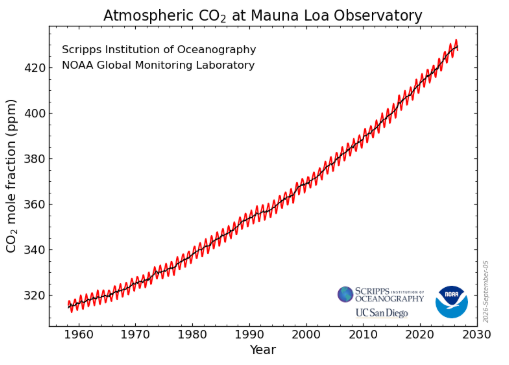
-
Destin over towards Miramar Beach are going to take the brunt of this one. The location of the landfall along with the direction of the coastline will funnel a lot of water into those areas.
-
Agreed. Just have to see how it plays out…but at the moment there’s model support. That’s all that can be said currently .
-
You know you have reached weather nerd status when you notice high clouds rolling in and say to yourself, those must be from the hurricane, then look at a satellite pic to confirm. Hope we get some juice from this thing
-
I agree with the portion that points out the forward motion direction (NNE) aligning with the shear vector reducing its impact on the system. Sure, it may eliminate any chance of strengthening, but a massive drop in strength prior to landfall looks pretty unlikely at this point.
-
lol…first of all at these lead times, it’s not worth much either way. And, there are no hard a fast rules that work in every scenario. Those that have any knowledge about weather, know this. And at this time of the year…nobody is forecasting cold, even if there is troughing in the eastern U.S., so I don’t really get what you’re saying? Troughing to produce a system is all that is being discussed.
-
Happy Birthday Ant!!
-
Damn just noticed that in the radar frames as you said it. Yeah, that will expand the wind field for sure.
-
Seemingly no pressure rose yet. First pass 957 extrap
-
 http://hydropressdirect.com/# international pharmacy
 -
I meant Imelda from 2019. You don't see 43" of rain from a TC in the CONUS every day, and Imelda is the second costliest TS on record ($5B), so impact was very high. Net societal impact matters-more for retirement overall.
-
Looks like it’s made a turn north
-
Thanks. Whereas for TCL they’ve got a TS warning, they didn’t ever predict TS conditions for ATL. Instead they have a high wind warning:
-
Yes the lack of TC activity has allows the waters to warm more. That is largely a function of El NIno. So suppression overall can lead to enhancements for individual TCs that do manage to develop.