All Activity
- Past hour
-
That’s the big saving grace with this storm. The front end thump is a THUMP. Even the torchiest models have warning level snow before the changeover happens.
-

January 24-26: Miracle or Mirage JV/Banter Thread!
LP08 replied to SnowenOutThere's topic in Mid Atlantic
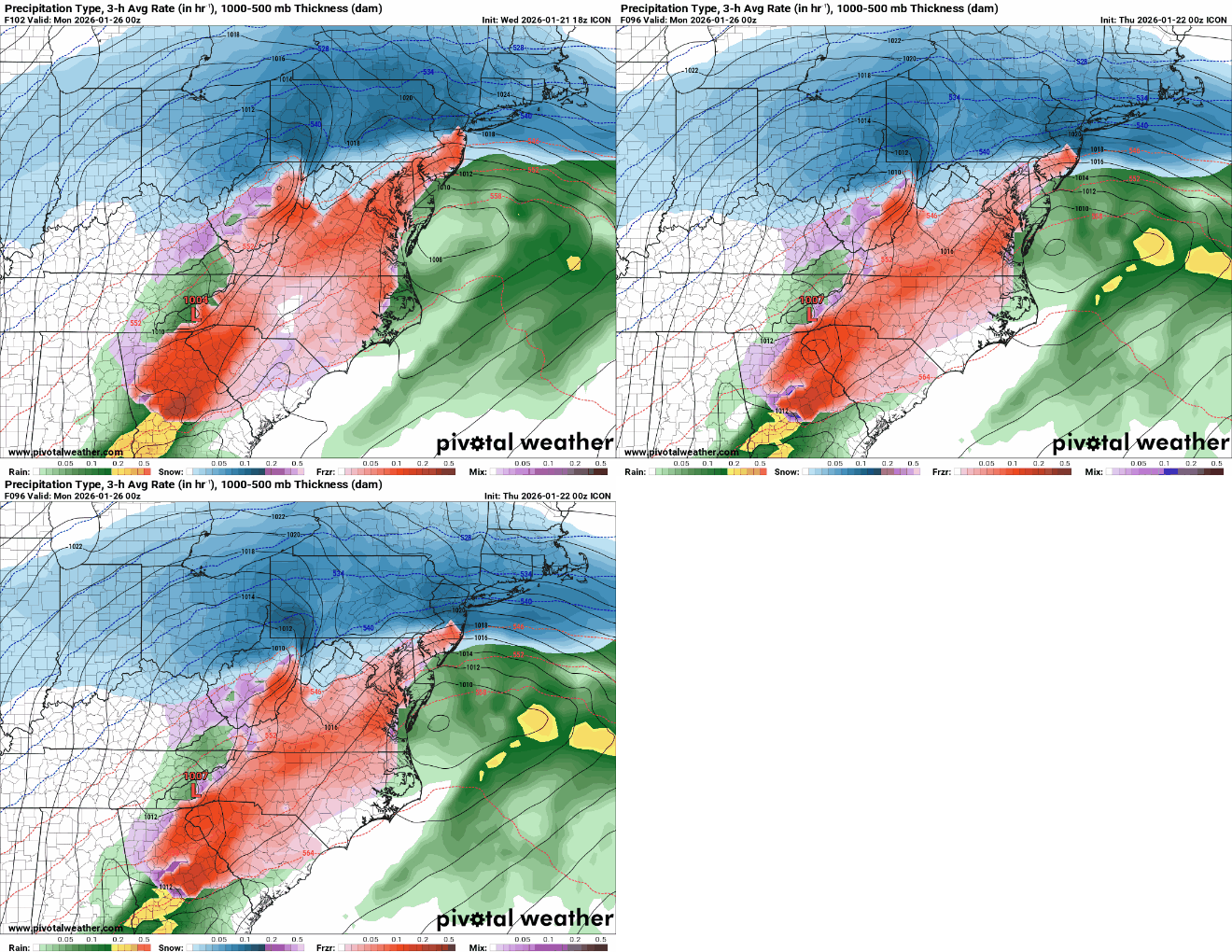
ICON was a bad run for Chicago -
For us it is yeah.
-
RGEM will probably hold so far
-

January 24-26: Miracle or Mirage JV/Banter Thread!
nj2va replied to SnowenOutThere's topic in Mid Atlantic
Didn’t you know we live on Tug hill -

Central PA Winter 25/26 Discussion and Obs
mahantango#1 replied to MAG5035's topic in Upstate New York/Pennsylvania
You can't give up on this now, we're so close. You gotta close this one out just like Mendoza did on Monday night with a win. -
I actually like this Icon run. The dryslot and the changeover hit at the same time north of I95, which means we dont waste a lot of heavy precip.
-
2025-2026 New England Snow Recordkeeping Thread
codfishsnowman replied to bristolri_wx's topic in New England
With weekend event and one little event up to 17.8 for the season not counting tonight. -
RGEM for whoever cares looks to probably shift everything a bit East out west so far. While I'm looking at worthless things the FV3 looks more suppressed than everything else
-
Are we Buffalo that we can scoff at 6-10” of snow?
-
thats 7pm sunday though...isnt the storm over by then?
-
Great source! We appreciate the share!
-
MO/KS/AR/OK 2025-2026 Winter Discussion
stormdragonwx replied to stormdragonwx's topic in Central/Western States
00z ICON is now clobbering the 412/US 60 corridor. Looks to not end till late Sunday night. -
ICON… This screams trapped cold air in the valley which our in-house met said today. The icon also handled today’s system the best 2-3 days out. (I know that doesn’t mean much m) .
-
Possible Record Breaking Cold + Snow Sunday 1/25 - Tuesday 1/27
Jt17 replied to TriPol's topic in New York City Metro
Icon a lot better at 0z than it was at 18z! . -
Avoid the potential devastating freezing rain event and then let's enjoy the big snow-sleet/mix/severe cold.
-

“Cory’s in LA! Let’s MECS!” Jan. 24-26 Disco
40/70 Benchmark replied to TheSnowman's topic in New England
Just depends how quickly and proficiently they phase. -
Yeah Icon would be a devastating ice storm for much of NC/SC!
-
Icon a bit less amped vs 18z at H5 and surface, but still good
-

“Cory’s in LA! Let’s MECS!” Jan. 24-26 Disco
40/70 Benchmark replied to TheSnowman's topic in New England
Often SWFEs trend N to go time. -
i think the main thing tonight is with this new 00z that its still going to snow more than we have seen in a long time. Last February we went from 25 to 12 to 7 to 0 very quickly.....no sign of that. yet


