All Activity
- Past hour
-
 Exactly what the HRRR fcst Tue eve.
 -
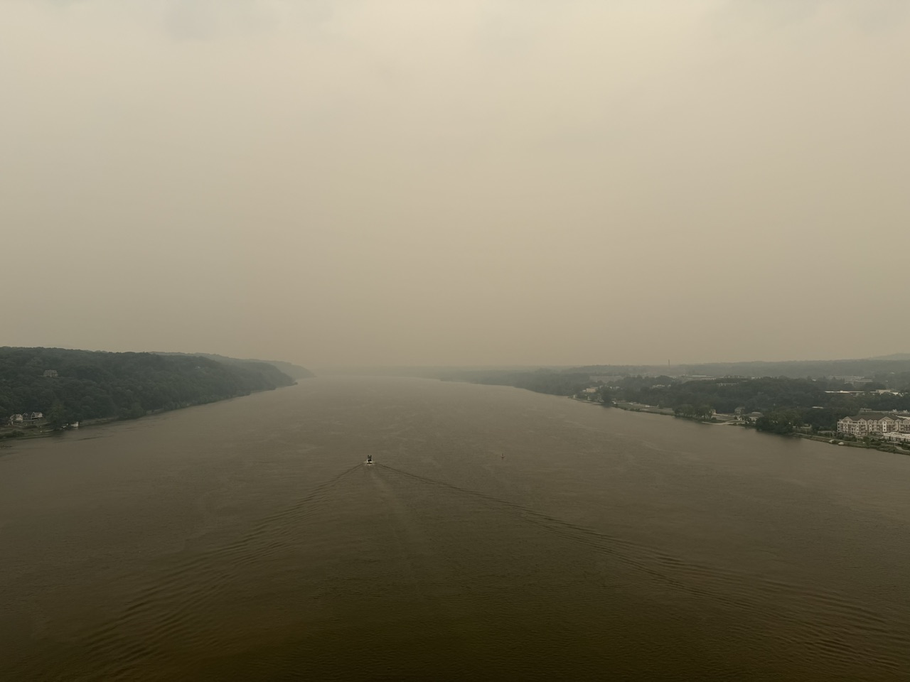
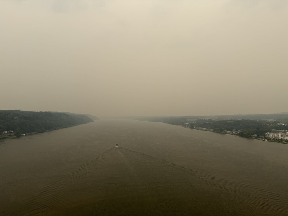
Smoke followed me home. Temps dropping now due to smoke it seems. Picture from the walkway over the Hudson, a little before 1pm.
-
AQI is bad esp NYC and north. Unhealthy category from Lower Manhattan and north from there. Not as bad in SI and increasingly better into NJ S and W of SI
-
Yes, so I do not want to hear this is a complete bust! The daylight hours were and the smoke is the likely cause of the bust here, but again, there is far too much focus on what did *not* go right rather than what did! I can count on one hand how many times in the last 30 years that anywhere in New England has had golf ball sized hail between midnight and noon. Bona fide supercells between midnight-noon in New England are rare. And even thought the models overdid the overnight convection, it all quickly dissipated once near the MA border by 10z, which is exactly what the HRRR showed Tue eve. So is the above just to be discounted? Sometimes events do not work out at fcst, and I can't tell you how many times in the Midwest/Plains/Southeast on paper everything looks awesome for svr wx parameters and a HIGH risk is issued, and under-performs. Things do not change meteorologically just b/c this is the NEUS. Sure, volatile atmospheres like this are uncommon here, esp. a strong EML, but that is irrelevant as to if it works out all as fcst or not. This is an excellent opportunity to learn from our mistakes, model shortcomings, and conditional factors that can crop up at the last minute (e.g. thick smoke). I for one will be investigating/researching the role of wildfire smoke on convection now. It was already mentioned earlier about how it impacts +CG frequency. And just b/c the smoke was a determinant to convection this time, does not necessarily mean it always is. You need to ask, does it matter if it is thin or thick smoke? Does the height and vertical depth of the smoke layer matter? Not all smoke particulates are the same, so that does matter as to things like CCN (CoastalWx should appreciate this b/c he is big on sea salt CCN for OES! ). Turn an experience that was not good or did not work out into something positive. Experience is what you get when you don't get what you want/expect, and thus you are that much better off going forward!
-
my place has 95.5 with heat index 107.2. Toledo airports have heat index 101-102
-
Definitely cut the temps here, currently 83 with the smoke visibility about 3 miles
-
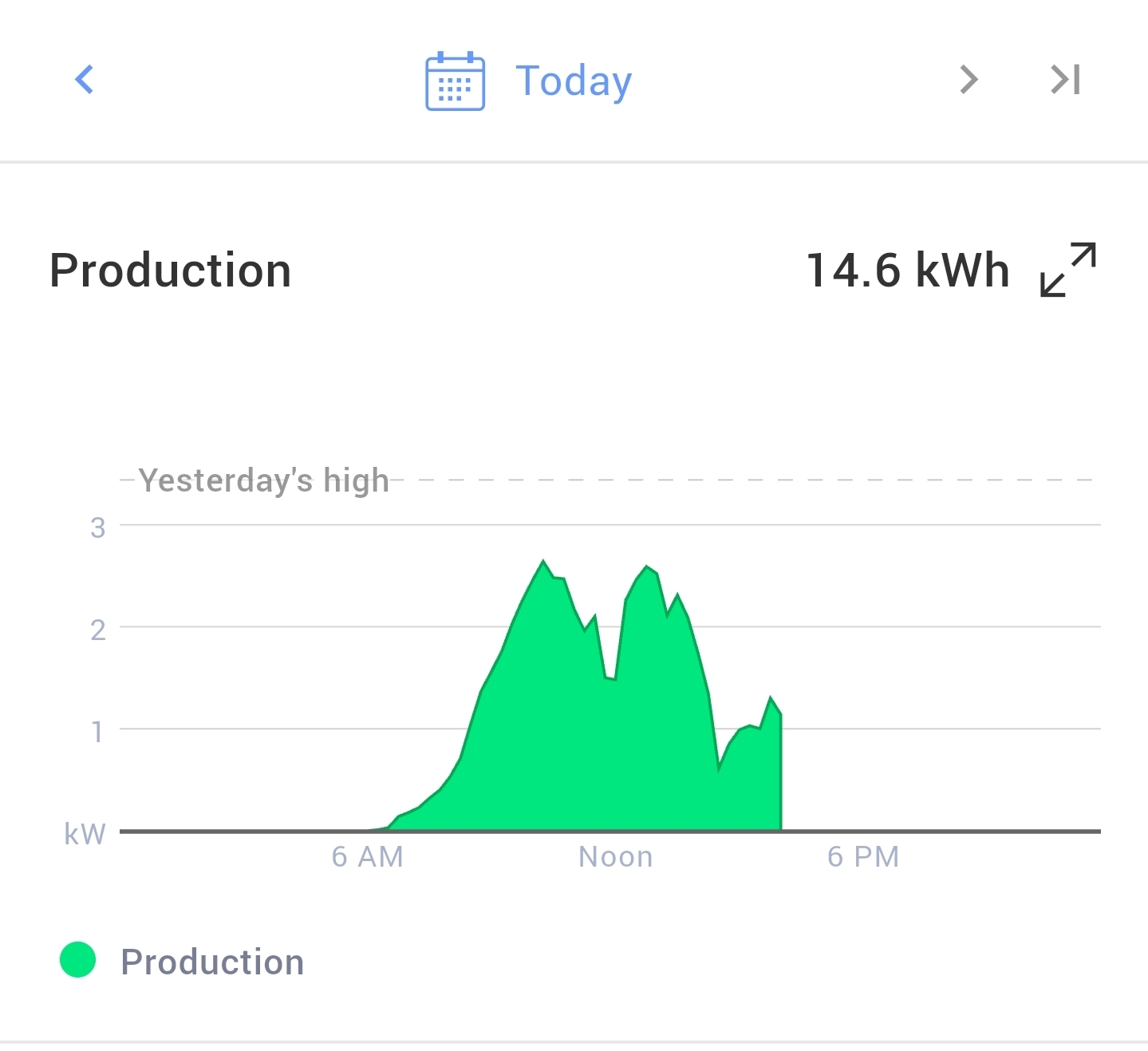
 I lost around 50% production today on my solar panels compared to a clear sunny day. My system is only 5kw and maxed out around 2.75kw today. I usually produce around 30-35 kwh on a sunny day.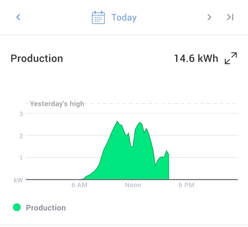
-
High topped showers or storms now forming in NE PA
-
The air here is now officially disgusting.
-
Could have been near 100 or greater for most of the island if it wasn't for all the smoke. Low 80's on the north fork. High of 94 down to 92 with the smoke getting thicker. Shadows are gone, not too much smoke near the ground but it's definitely visible.
-
Just a wall of smoke coming in from the north. Will undercut temps by several degrees tomorrow
-

Central PA Summer 2026 Discussion/Obs Thread
canderson replied to Voyager's topic in Upstate New York/Pennsylvania
Good to see another human like me who married out of his league! -
 Best event of summeh 2026
 -
98 here right now.
-

E PA/NJ/DE Summer 2026 Obs/Discussion
LVblizzard replied to PhiEaglesfan712's topic in Philadelphia Region
Some storms forming north of I-80 and moving southeast. One of them is severe warned. Let’s see how long they can hold together. -
 Here https://x.com/hotshotwake/status/2077232582375116970?s=46
 -
 Have you seen the video? It’s wild.
 -
 I just saw a meme on Instacrap that labeled 838 concurrent wild fires draped from N Alberta to western Quebec across the Canadian Shield Who knows if that's true or not but it does spark the question for me, what is the average number of Canadian wild fires per season? assuming a 'season' is whatever April through whenever October
 -
 so looks like an 80% reduction
 -
Some of the AQIs in MI are well into the 300s. Hopefully those mix out before getting here. NYC already over 150 though and it's likely getting worse today.
-
I checked my weather station. The heavy smoke came in around 1:00, temp dropped from 89.6 at 1:00 to 85 by 1:30.
-
Playing catch-up and just checking things now after a busy first part of the day. Working from the posts last evening first. Scott's just mad there was svr winds and tree downed on Rt 16 and in West Ossipee and he wasn't up at the lake!
-
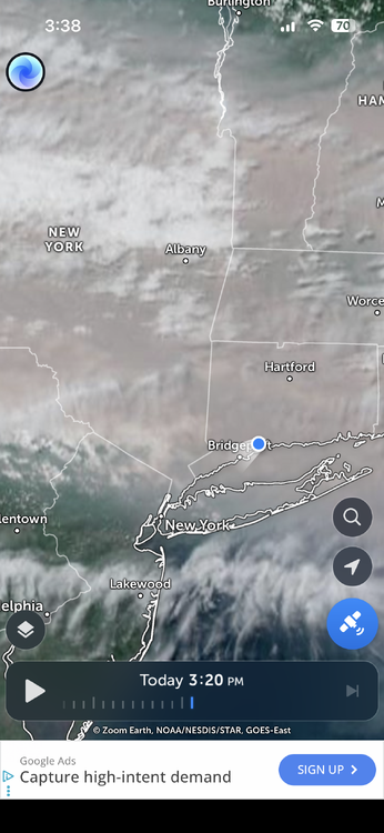
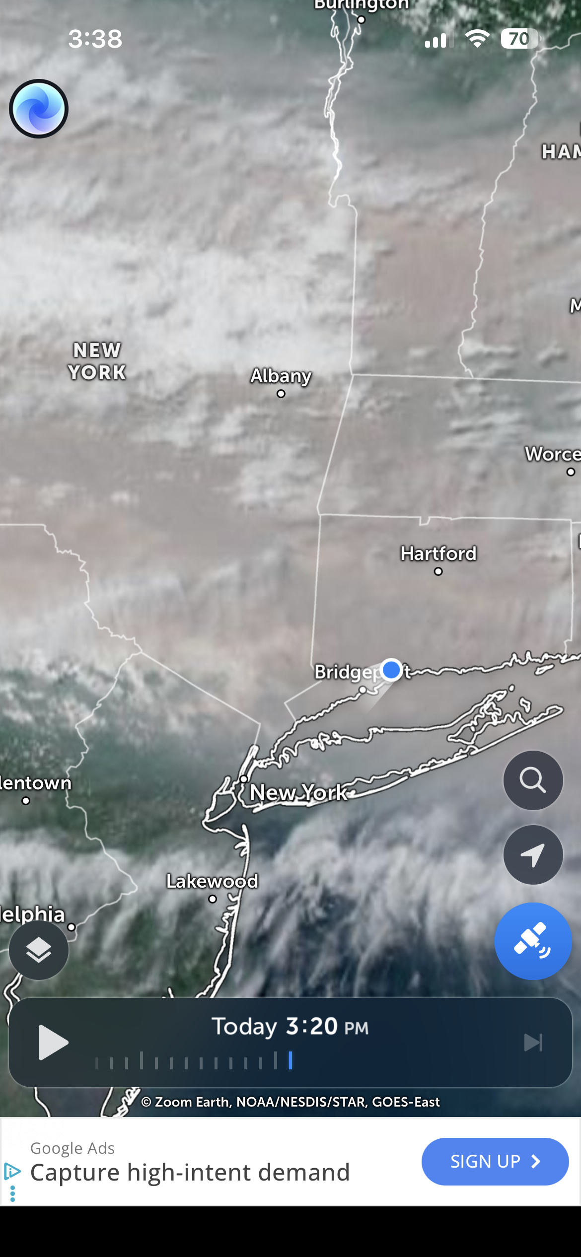
CLouds in NJ CNJ smoke coming south into far extrem Northern NEew Jersy
-
 Should be close to this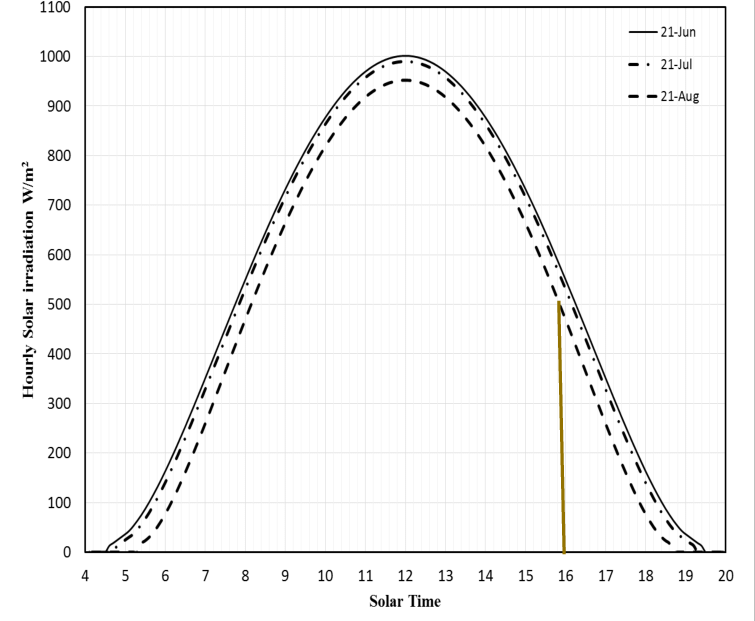
-
Yes the worse of it is approaching the NYC metro area. Thinking tomorrow will be even worse too.