All Activity
- Past hour
-

Central PA Fall Discussions and Obs
Superstorm replied to ChescoWx's topic in Upstate New York/Pennsylvania
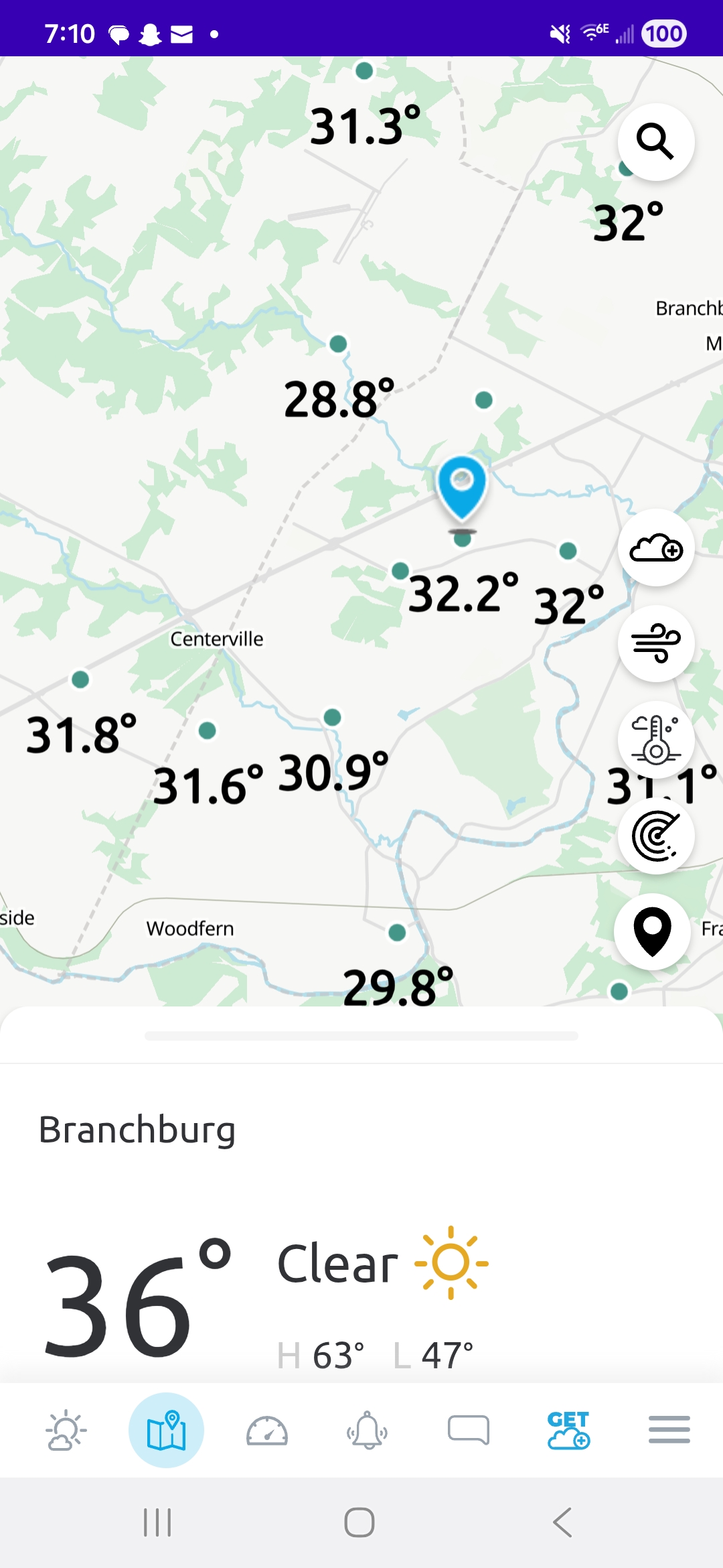
34F this morning. Lots of frost around! . -

The return of the elusive Nor'easter. Drought buster or bust?
dailylurker replied to dailylurker's topic in Mid Atlantic
Yay. Days of drizzle and wind. The boring streak continues. -
There’s enough agreement to know it’s gonna rain, but I don’t think this is gonna be a huge deal overall. They’ll probably a little bit of wind damage on the south coast or CT and over southeast mass.
-
41 here
-
30 degree's in Mahwah when i got here. WOW, that was refreshing feeling walking in.
-

Spooky Season (October Disco Thread)
Baroclinic Zone replied to Prismshine Productions's topic in New England
30-31 here. frosties all around -
36 here.
-
Leave it for me to have a long weekend planned in Hilton head this weekend. Grrrr. Rainy and windy today and tomorrow....FUN??? Yet back at home in the ATL area gonna be beautiful with Sunshine and 80. As a matter of fact looks to be in the low 80's with sunshine for the next 10 days. DRY as a bone around here.
-

Spooky Season (October Disco Thread)
Damage In Tolland replied to Prismshine Productions's topic in New England
37.1. I was too cold by 2 degrees. So fake . Growing season carries on and on and on -

The return of the elusive Nor'easter. Drought buster or bust?
TSSN+ replied to dailylurker's topic in Mid Atlantic
I mean it’s been with pretty much anything lately even a cold front passage haha. It’s just best to temper expectations till 2-3 days out then don’t have to have meltdowns when things go to crap. -
31.8, some upper 20s within a mile

-
Glad to see we have zero agreement and we are two days out.
-

The return of the elusive Nor'easter. Drought buster or bust?
WxUSAF replied to dailylurker's topic in Mid Atlantic
Forecast is always going to be very razor-edge when you’re counting on a phase happening right on top of us essentially. The “locked in” coastal storms phase much farther southwest. -

Spooky Season (October Disco Thread)
Modfan2 replied to Prismshine Productions's topic in New England
Down to 29F here in E CT with a light frost -

Spooky Season (October Disco Thread)
dendrite replied to Prismshine Productions's topic in New England
28.4° so far -
41 for me. No 30s. Boooo
-
Hops and barley?
-

Spooky Season (October Disco Thread)
UnitedWx replied to Prismshine Productions's topic in New England
30 in Westfield at 5:30 A.M. 31 in Simsbury now. First windshield scrape of the season -

Spooky Season (October Disco Thread)
512high replied to Prismshine Productions's topic in New England
28F first frost a lot of frosty roofs and windshields this am! -

Spooky Season (October Disco Thread)
kdxken replied to Prismshine Productions's topic in New England
29° first Frost.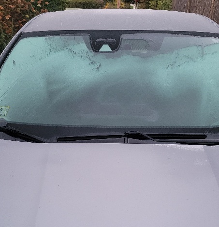
-
52F in Queens. 17 mile drive, +14 degrees. haha
-
 Yea, I hear ya. A good place to check real time tide guages and overlay them against predicted tides is on the USGS sites. Every location, obviously will be different based on fetch, stage of tide, orientation, etc... But, ill tell ya this... water levels in the back of barnegat bay are actually running slightly lower right now. Im actually getting ready to head out on the water for work now. Until late last night, we hadn't yet had any easterly flow since the previous NE blow. Infact, we has northwesterlies and SW. Nevertheless, spring tides only generally exacerbate the tidal flooding 10-15 percent. That 10-15 percent can make all the difference in the world though with a long duration easterly blow, especially with a strong or stalled system inside of the benchmark. Hoping we get more of a scraper, as im not necessarily enthusiastic about working vessel salvages 24/7 during and after the storm. Still approximately 60-70 percent of vessels are in the water for the fall run/locals summer. Towards the end of the season, bilge pumps and batteries on ignored vessels are often not working. Hope you have a nice day. It is chilly, but gorgeous this morning. At least we have something local and interesting to track. Ill post many pictures as the storm unfolds.
 -
 Models backed off big time on this. Gonna be a long winter with these inconsistent model runs
 -
It was likely the combination of thick fresh snow cover and strong radiational cooling that produced the subzero November temperatures in 1938.
-
10-22-40 was the earliest single digits that I could find for the old Sussex COOP. There used to be a station at Layton in the Delaware water gap not far from the current Walpack station with had their first single digits on 10-28-36. The earliest below 0° reading for Layton and other surrounding sites was 11-26-38. NJ SUSSEX 1 NW COOP 1940-10-22 49 7 28.0 -21.1 Data for October 28, 1936 through October 28, 1936 Click column heading to sort ascending, click again to sort descending. NJ LAYTON 3 NW COOP 9 Data for November 26, 1938 through November 26, 1938 Click column heading to sort ascending, click again to sort descending. RUNYON COOP -7 CANOE BROOK COOP -5 LAYTON 3 NW COOP -5 CHARLOTTEBURG RESERVOIR COOP -1 INDIAN MILLS 2 W COOP 0 HIGHTSTOWN 2 W COOP 0 BELVIDERE COOP 1 Belvidere Area ThreadEx 1 FLEMINGTON 5 NNW COOP 2 PEMBERTON COOP 4 LONG VALLEY COOP 4 SOMERVILLE 4 NW COOP 5