All Activity
- Past hour
-
2026-2027 Record-breaking El Nino
Daniel Boone replied to Stormchaserchuck1's topic in Weather Forecasting and Discussion
Let's hope it's nothing like that one. Severe wx lover's would like it. -
Maine coon :x

-
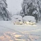
If the SSW works out and things move along quickly, may be looking at the possibility of an old fashioned Thanksgiving Mountain Snowstorm.
-
Models today have trended towards a complete precip screw job for the Front Range. Hopefully tomorrow they snap back.
-
Winter 2026-2027 Seasonal Outlook
Daniel Boone replied to WinstonSalemArlington's topic in Southeastern States
Could be a memorable Thanksgiving Snowstorm in the Mountains. -
is that a cat?
-
 best online canadian pharmacy: canada pharmacy world - canadian pharmacy meds
-
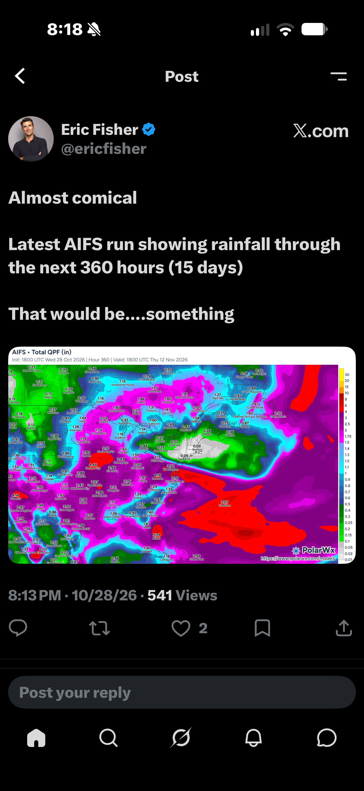
Don’t mean to be the bearer of bad news but I’m hearing that next weeks system could be a gulf coast scraper that could leave us and southeast in cool stable air and just cold rain from spann besides the point of a rouge post on Facebook calling for strong long track tornadoes this far out hahaha lol .
-
reliable canadian pharmacy and online canadian drugstore canadian pharmacy reviews http://www.barnedekor.com/url?q=https://canpointerx.shop canadian pharmacy meds and http://jonnywalker.net/user/ybpdvsljgl/ online pharmacy canada [url=https://images.google.co.kr/url?q=https://canpointerx.shop]canada online pharmacy[/url] canadian pharmacy reviews or [url=http://www.garmoniya.uglich.ru/user/uuiyeocyfx/]canadian pharmacy store[/url] legit canadian online pharmacy
-
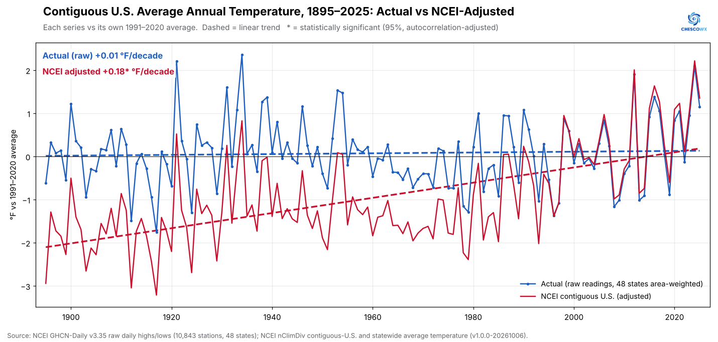
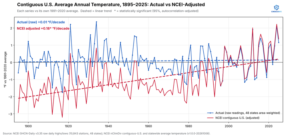
Since this concerns the impact of Climate Change across the entire USA and not just one individual county - I am happy to share the below study of Actual raw temperature data vs. the NCEI adjusted data for the entire Continental USA. Please find the below combined US 48 state findings (PA and NY are already posted an online). For the full reports and individual state and county findings as they are released over the next 46 days please check out https://chescowx.com/raw-vs-ncei-state-by-state/ THE MAIN STUDY FINDINGS FOR THE CONTINENTAL USA The NWS raw trained observer temperature record shows no significant warming at all in the contiguous 48 states since 1895!! (+0.01 °F per decade). In fact the temperature trend lines across the entire USA are basically flat from 1895 through 2026! However by contrast NCEI's adjusted temperatures show significant warming in the contiguous 48 states since 1895 (+0.18 °F per decade). That difference between the two trend lines is statistically significant. Combining the 48 statewide records of actual readings, each weighted by the state's land area, gives +0.01 °F per decade from 1895 to 2025 (95% range -0.04 to +0.05), about +0.1 °F in total. NCEI's published contiguous-U.S. series gives +0.18 °F per decade (range +0.12 to +0.23), about +2.3 °F in total. Of note NCEI's adjusted temperatures are lower than the actual readings in every single decade from the 1890s through the 1990s. To dig deeper into these continental US wide findings including please check out https://chescowx.com/raw-vs-ncei-co ntiguous-us/
-
Was there a mild nuclear accident- there’s a turn of phrase, at the Savannah River Site tonight or nah?
-
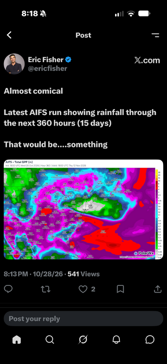
Record warmth affected parts of the upper Midwest today. Some of that air will move across the region over the next few days. As a result, it will turn noticeably milder tomorrow. The temperature will warm into the middle and upper 60s for the remainder of the work week. Much of the region could approach or reach 70° on Friday. Unseasonable warmth will continue into the start of November. Dry conditions will likely persist through next week. The ENSO Region 1+2 anomaly was +5.2°C and the Region 3.4 anomaly was +3.4°C for the week centered around October 14. For the past six weeks, the ENSO Region 1+2 anomaly has averaged +5.08°C and the ENSO Region 3.4 anomaly has averaged +3.22°C. ENSO Region 3.4 breaks the all-time record most recently set in the prior week. The ongoing strong El Niño, will continue to strengthen through the mid-fall. The SOI was +10.31 today. The preliminary Arctic Oscillation (AO) was +1.219 today. Based on sensitivity analysis applied to the latest guidance, there is an implied near 100% probability that New York City will have a warmer than normal October (1991-2020 normal). October will likely finish with a mean temperature near 59.2° (1.3° above normal). Supplemental Information: The projected mean would be 2.3° above the 1981-2010 normal monthly value.
- Today
-
-

2026-2027 Record-breaking El Nino
40/70 Benchmark replied to Stormchaserchuck1's topic in Weather Forecasting and Discussion
Larry, I wouldn't say "lack of any seasonal model support".....EURO and UK have hitting blocking hard. -
Perfect. Add another 30 . Hell why not 60?
-
2026-2027 Record-breaking El Nino
40/70 Benchmark replied to Stormchaserchuck1's topic in Weather Forecasting and Discussion
He is brutal. -
A 40% chance of partly sunny, a 30% chance of a coating to 5 inches, and a 30% chance of 5" - 12". They'll apologize when it turns out cloudy.
-
-
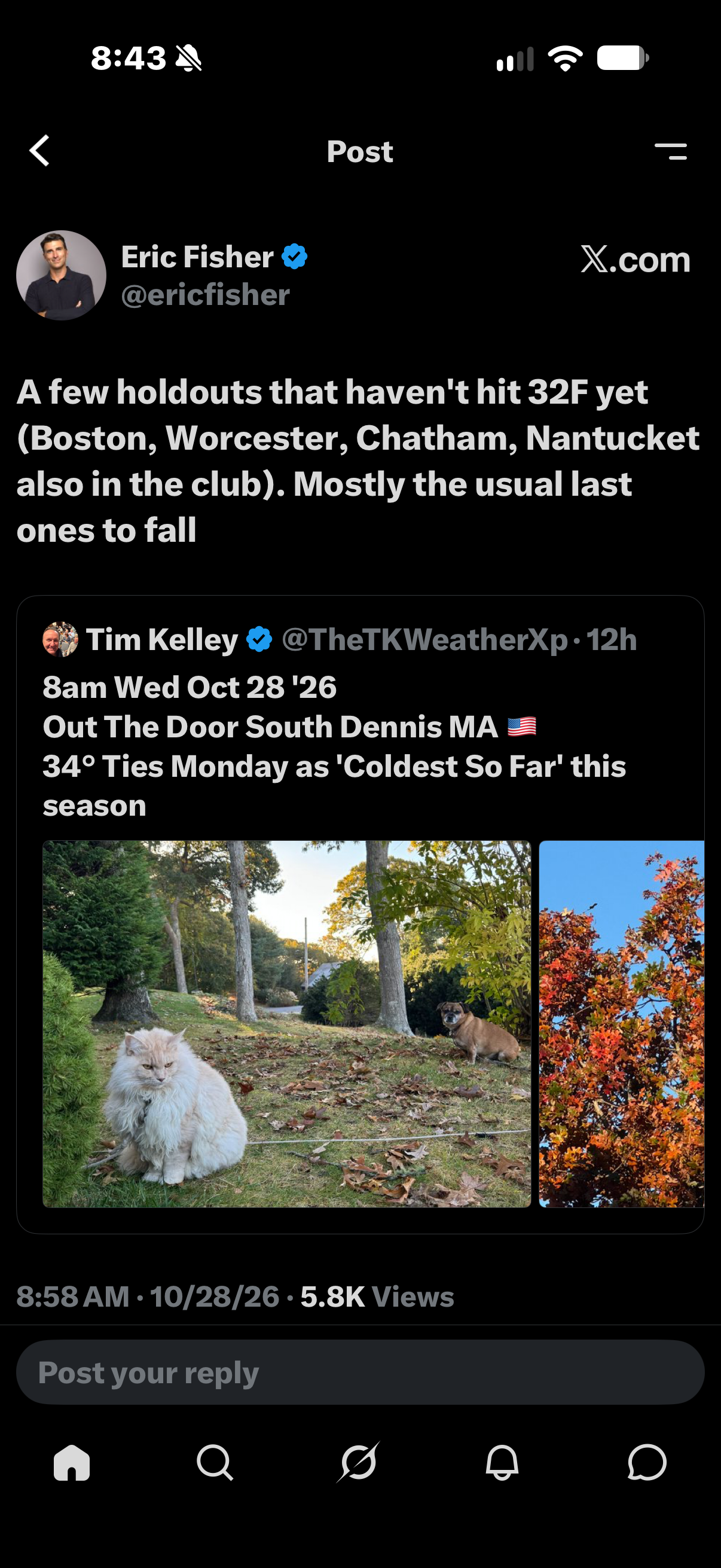
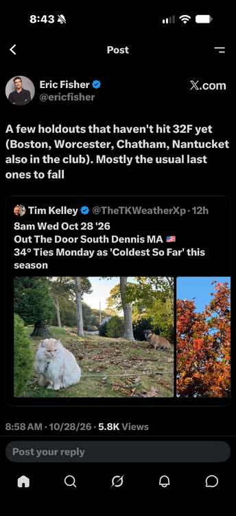
That area has a lot of higher elevated valleys with small hills. That’s different than your hill or KORH that stick out prominently. Then again I think blue hill got below 32 as well. Regardless that’s a big part of it.
-
2026-2027 Record-breaking El Nino
40/70 Benchmark replied to Stormchaserchuck1's topic in Weather Forecasting and Discussion
I DMed you... -
I LOVE to watch that sea water comin up thru the drain grids! If I were there I'd be layin in it, saying The Water Level is Going Up! They'd be callin me the Old Man of the Sea lol
-
Chemtrails!
-
Record Breaking High Tides Continue | Extreme Coastal Flooding in California
-
 Baum changed their profile photo
-
Thank you.
- Yesterday
-
what did CWG call for?