All Activity
- Past hour
-
.thumb.jpg.6a4895b2a43f87359e4e7d04a6fa0d14.jpg)
Central PA Winter 25/26 Discussion and Obs
Yardstickgozinya replied to MAG5035's topic in Upstate New York/Pennsylvania
Calm cold crunchy, I'll see you at the top.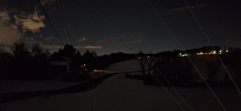

-
Assuming no shallow cold air sneaks down my way (certainly possible) we are probably going to have a good shot of record heat on Christmas. It's a surprisingly low record at 73 F in Tulsa, very doable given the pattern.
-
1962 was -7.7. 1989 was -13.3. Both also bonkers, by my memory
-
Adam, I am going to say this once and that’s it. Do not reply to my posts or make comments. I do not like you or respect you as a human being. You claimed I am unhinged, I’m going to be upfront with you. I do in fact have a few screws loose just like you do. I am the one guy on this board who is arguably more unhinged and insane than you, which is saying something. So pissing me off is not in your best interest. It would be better for both of us if we ignore each-other from now on. You do you, I’ll do me. Understood?
-
Agree
-

Central PA Winter 25/26 Discussion and Obs
Ruin replied to MAG5035's topic in Upstate New York/Pennsylvania
makes you wonder none of the local forecasts mentioned it. they said it was going to clear up this afternoon nothing about even clouds let alone a night shot of snow. -

December 2025 Short/Medium Range Forecast Thread
Carvers Gap replied to John1122's topic in Tennessee Valley
And it could end up being warm. But in the end, it is just something none of us can control. The thing that will irritate me when tracking winter patterns....a model flip away from a cold, storm pattern. In this case, the chinook pattern has been well advertised. What I want to see is that pattern to be muted. Modeling is apparently going to miss at least two cold fronts...maybe more. Those fronts are getting colder as reality approaches. That is a sure tell that modeling is correcting. There is also a bit of a disconnect between 500 and the surface. So, interesting times ahead. Prim climatology is still almost a month away. And yes, I could use a few warm days just to thaw out. It has been BN here since Thanksgiving...I need a break from the cold. You won't hear me say that often! -
this is like the 3rd so called warm up they forecasted for long range the others never really happenend I highly doubt most of the usa is this warm a ridge never has actually been across the whole lower 48
-

December 2025 regional war/obs/disco thread
WxWatcher007 replied to Torch Tiger's topic in New England
After King Grinch in 2020 I’m always gonna be wary of a big cutter wiping pack to bare ground, but this looks like it’s been trending toward quite a blast of cold at the end without high end warmth here. Maybe some backend snow. -
100% -8 for the month is bonkers.
-
I have a sneaking suspicion looking at satellite that places in N Baltimore and higher elevations of Harford co are plummeting right now.
-

December 2025 regional war/obs/disco thread
Ginx snewx replied to Torch Tiger's topic in New England
You will have another foot at Mt Friday to Sunday -
That west coast trough crashing in after Christmas will lead to that massive and near record warm ridge over central US to eventually move towards east coast. Hopefully it’s transient, but Central and south US will really torch Christmas week
-
Yeah once that trough knocks into west coast, that ridge will roll over into the east coast. Looks like that would be closer to new years. Christmas could be record warm over parts of the plains. Yuck. Hopefully there’s a limit to the west coast troughs because those will keep knocking the ridge over and we can’t get a coastal storm with a pattern like that.
-
Its like all new technology. Easy to abuse. Not well regulated and the longterm effects of using it aren't really known. I know a lot of folks love it because it does a lot of their work for them but it also takes human skill and the human touch out of things.
-
I don’t. Probably put a ruler into the ground & called it a day. I think our area got around 7” with more further E into W Suffolk.
-

December 2025 regional war/obs/disco thread
powderfreak replied to Torch Tiger's topic in New England
What a run its been. The rainless streak is about to end for the mountains, and this one could be a solid soaker. It won't be out of the ordinary, IMO, for a cutter this time of year... but its felt like a good month since we've had a healthy cutter. Two straight weeks to start December at -10.5F departure and plentiful snow, following a cool and wet November that featured plenty of higher elevation snows. Sucks, but it wasn't going to be snowless and warm out west all season... same with it wasn't going to be cold, deep powder all season here. Once it starts to snow in the Sierra and Rockies, it will signal a change. The surface conditions are going to change in New England, but the snowpack should still be solidly above normal. -

December 2025 Short/Medium Range Forecast Thread
Matthew70 replied to John1122's topic in Tennessee Valley
It’s amazing how if a model shows a winter storm 15 days out so many will say ah that’s not happening. Yet when a model shows dry & warm they take it as 100% happening. Negativity is rampant in many forums. Yeah it sucks having no snow in December but when did December become the only month of winter? I missed the memo that says after December winter is over. I know for Middle & West TN February has most of the top 10 snows. December is running way below average & we still hear winter is over. Good gracious. -

2025-2026 ENSO
TheClimateChanger replied to 40/70 Benchmark's topic in Weather Forecasting and Discussion
Brutal timing for that west coast trough --> central US ridge. -
-
You believe it? Seems unlikely for such a small distance, no?
-
2025-2026 ENSO
TheClimateChanger replied to 40/70 Benchmark's topic in Weather Forecasting and Discussion
-
Sounds like a good way to put it to work. Like you, otherwise it's sus in my book. Already feels out of control on social media.
-
December 14th - Snow showers or Plowable snow?
powderfreak replied to Sey-Mour Snow's topic in New England
This is the content I sign on to see. Nice, wintry scene. Classic New England scene. That’s legit December. -
December 2025 regional war/obs/disco thread
Ginx snewx replied to Torch Tiger's topic in New England
Wth temps near 40 and only for a few hours followed quickly by upslope and a surprise Sunday storm its back to your regularly scheduled program