All Activity
- Past hour
-

Hoisting the Sultan Signal: Heavy Rain Event July 5-7
vortex95 replied to WxWatcher007's topic in New England
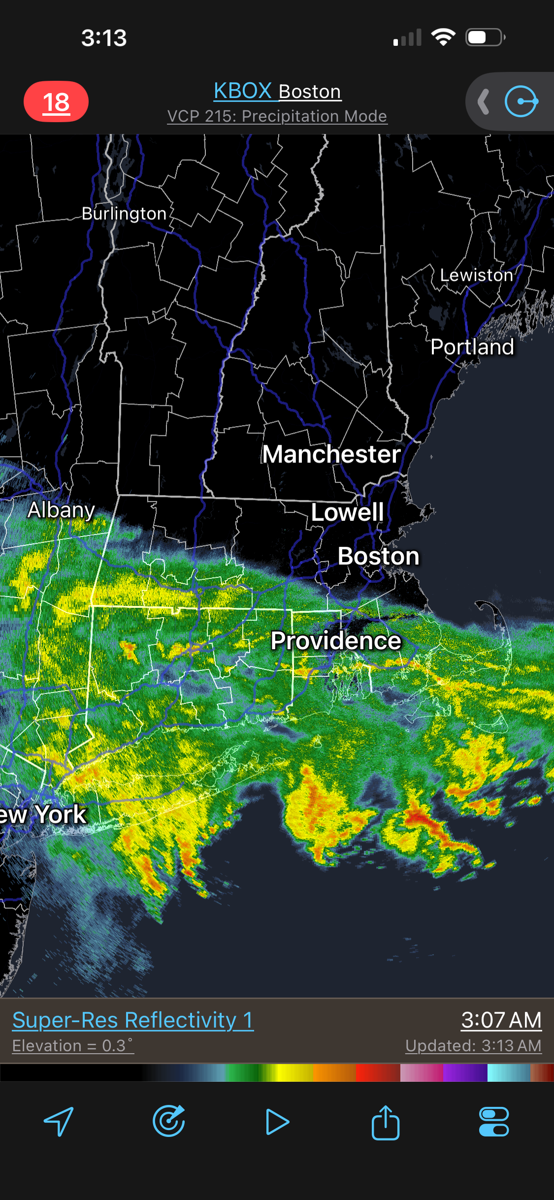
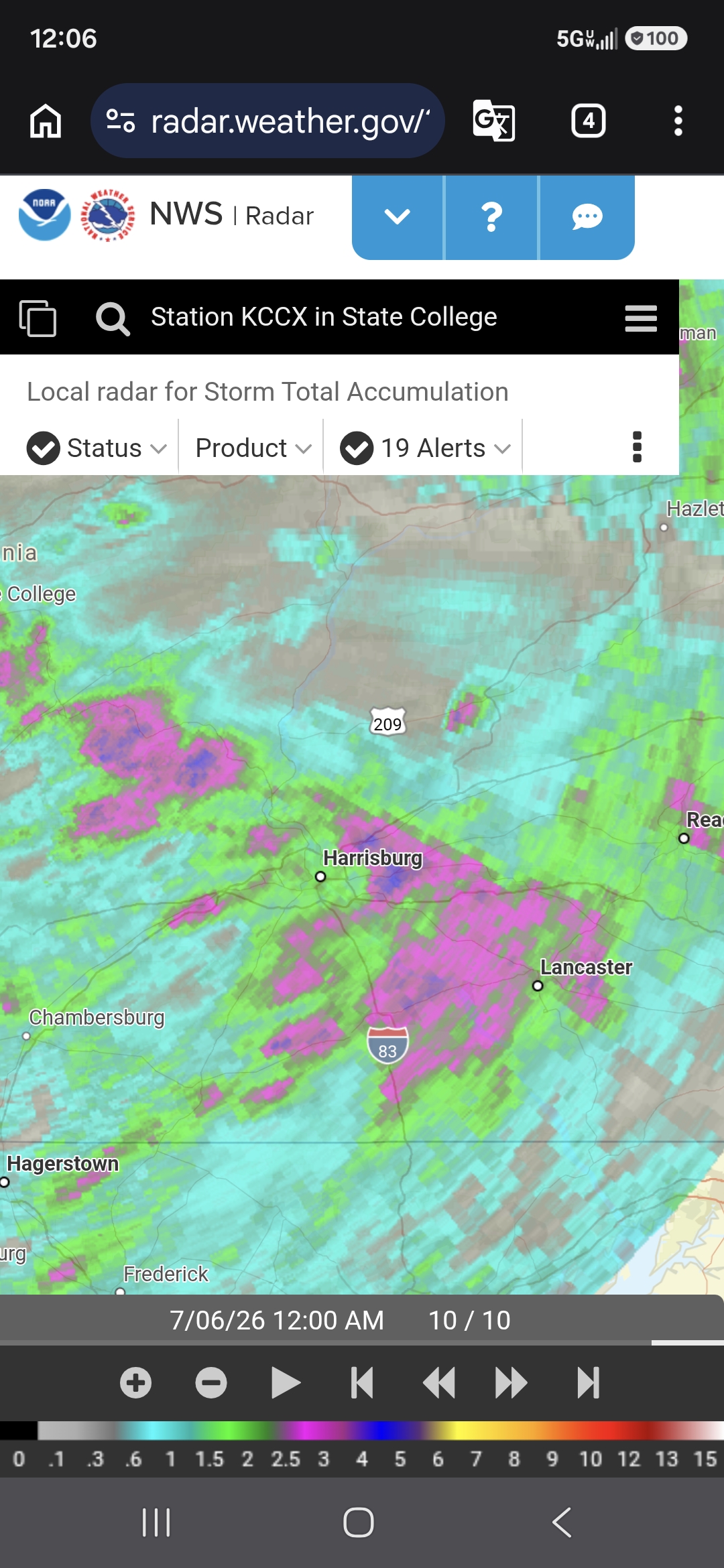
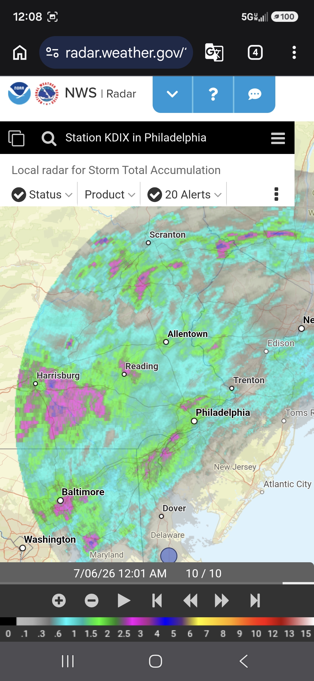
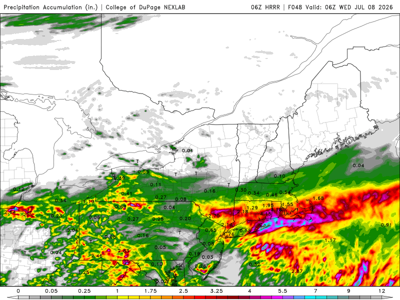
BDR 1.23" so far as of 4am. Radar has the look CoastalWx *hates* in the winter b/c he knows there will be a sharp line between S+ and "diamond dust!" And the 06z HRRR squishes things S more. 00Z RRFS was more N, but lacks the crazy QPF. HRRR shows some mesoscale thingee forming in ern LI sounds and tracking E. That has the big QPF but largely stays offshore except for MVY/ACK. Also, half-decent backlash comma head pcpn at the end. Sfc only low goes from 1015 to 1009 mb, but is tight/coherent and sets up a small solid gradient along the S Coast and CC. Wind pretty good for July. Sustained max 25G40KT shown front end and 30G45KT max in the rear GON-CQX-PYM. Li'l July Nor'easter!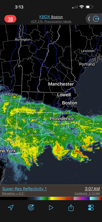
-
Could have been some gustnadoes in there, but yes, it was trying to "derecho." Let's makes nouns into verbs for weenie sake! CoastalWx does things this except he omits verbs such as, "WE SNOW!" He also likes to say, "I HAZ..."!
-
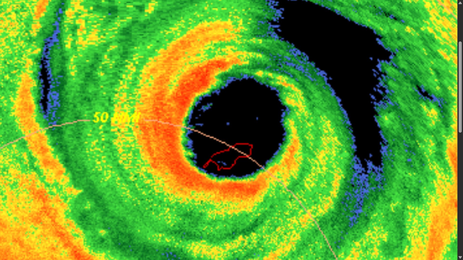
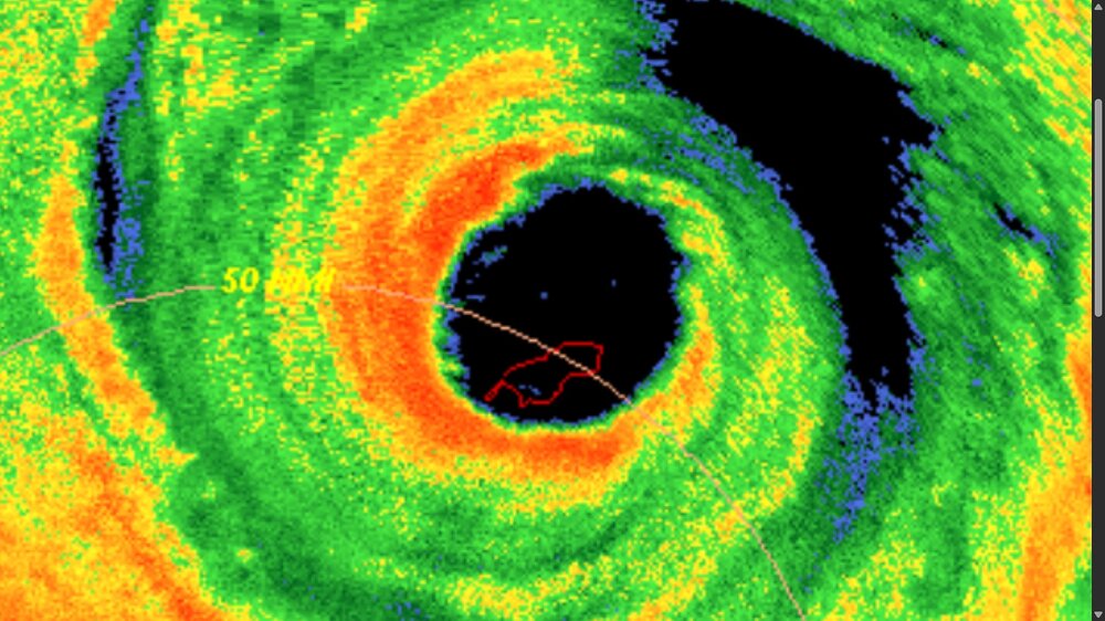
Just by going by sat imagery alone and Bavi's clear and large eye, the centroid of the eye looks like it passed about 6 nm N of the N tip of Rota using EIR. VIS is tougher b/c you have mesovorts within the eye rotating around one another. Each mesovort has its own pressure minimum, and one of those may have crossed Rota. Just curious how this is counted. It is obviously a direct hit but does it count as a landfall? Rota clearly got in the eye, but the centroid was just N. Looking at radar at is closest, looks like the centroid just passed to the N. Radar is better than sat in this case b/c even at 14N, there is a bit of a parallax error in geostationary imagery.
- Today
-

2026-2027 Super El Nino
TriPol replied to Stormchaserchuck1's topic in Weather Forecasting and Discussion
Just wait until we get a SSW event or the polar vortex dives. We can't forecast those this far out. I'm not worried about this upcoming winter at all. -

2026-2027 Super El Nino
snowman19 replied to Stormchaserchuck1's topic in Weather Forecasting and Discussion
Despite the delusions and lies being peddled by the usual cast of weenies on twitter, the EURO seasonal is NOT showing a cold December and January in the Northeast/Mid-Atlantic. It’s actually showing a canonical super El Niño pattern with a big Aleutian Low displaced way east to the west coast; ++EPO/EPO floodgates wide open with nothing but Pacific maritime air flooding Canada and the CONUS. No arctic connection at all. This is not cold in Canada or the Northeast/Mid-Atlantic, not even close. Before someone says it, no, it’s not a torch either. Again, not a torch, but it’s not cold. Deep denial and delusions, fake news and false info from the weenie crowd on twitter, which is no surprise. Year after year it’s the same old show from the same clowns -
Booming thunder and legit heavy rain just woke me up. Finally something decent.
-
.thumb.gif.f92b16c631a1d15d405ed77b33f0710d.gif)
Hoisting the Sultan Signal: Heavy Rain Event July 5-7
Torch Tiger replied to WxWatcher007's topic in New England
Love the overlapping bands, and hopefully that sets up right over north-central CT. We all want at least 6 to 12" in a good swath HFD-PVD -
Hoisting the Sultan Signal: Heavy Rain Event July 5-7
Torch Tiger replied to WxWatcher007's topic in New England
Let's gooooo!!!! -
Just had a pretty good downpour. 0.45" so far tonight.
-
-

Hoisting the Sultan Signal: Heavy Rain Event July 5-7
OrangeCTWX replied to WxWatcher007's topic in New England
Already some 4-6 radar estimated rain totals out in the western Hudson valley area. -
That area still looks to be getting pounded. Especially Huguenot to Otisville. Several hours now of 50dbz+. Could be some areas over 4" of rain already.
-
.thumb.jpg.6a4895b2a43f87359e4e7d04a6fa0d14.jpg)
Central PA Summer 2026 Discussion/Obs Thread
Yardstickgozinya replied to Voyager's topic in Upstate New York/Pennsylvania
-

Mountain West Discussion
mayjawintastawm replied to mayjawintastawm's topic in Central/Western States
Fun fact: Precip year to date at my house=4.18 inches, roughly 55% of normal (Centennial). Yikes. Denver has 4.7". -
Central PA Summer 2026 Discussion/Obs Thread
Yardstickgozinya replied to Voyager's topic in Upstate New York/Pennsylvania
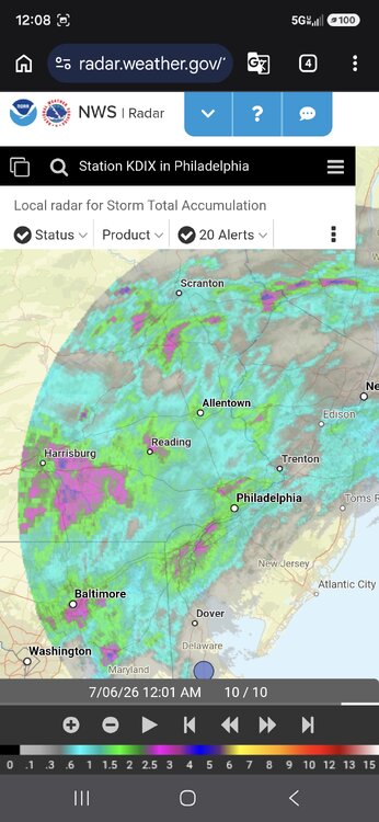
-

Hoisting the Sultan Signal: Heavy Rain Event July 5-7
WxWatcher007 replied to WxWatcher007's topic in New England
Definitely juicy with those reports out west. BDR put .69” in the gauge in about an hour. -

Central PA Summer 2026 Discussion/Obs Thread
CarlislePaWx replied to Voyager's topic in Upstate New York/Pennsylvania
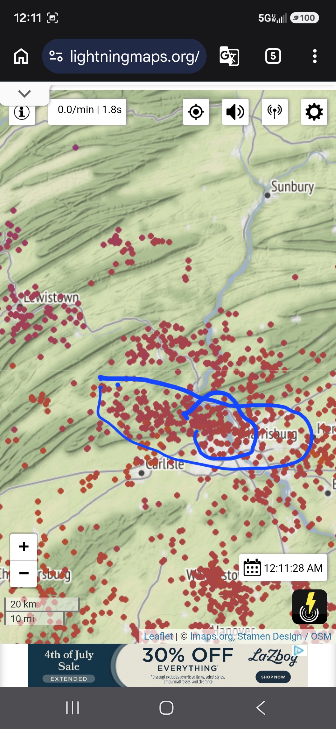
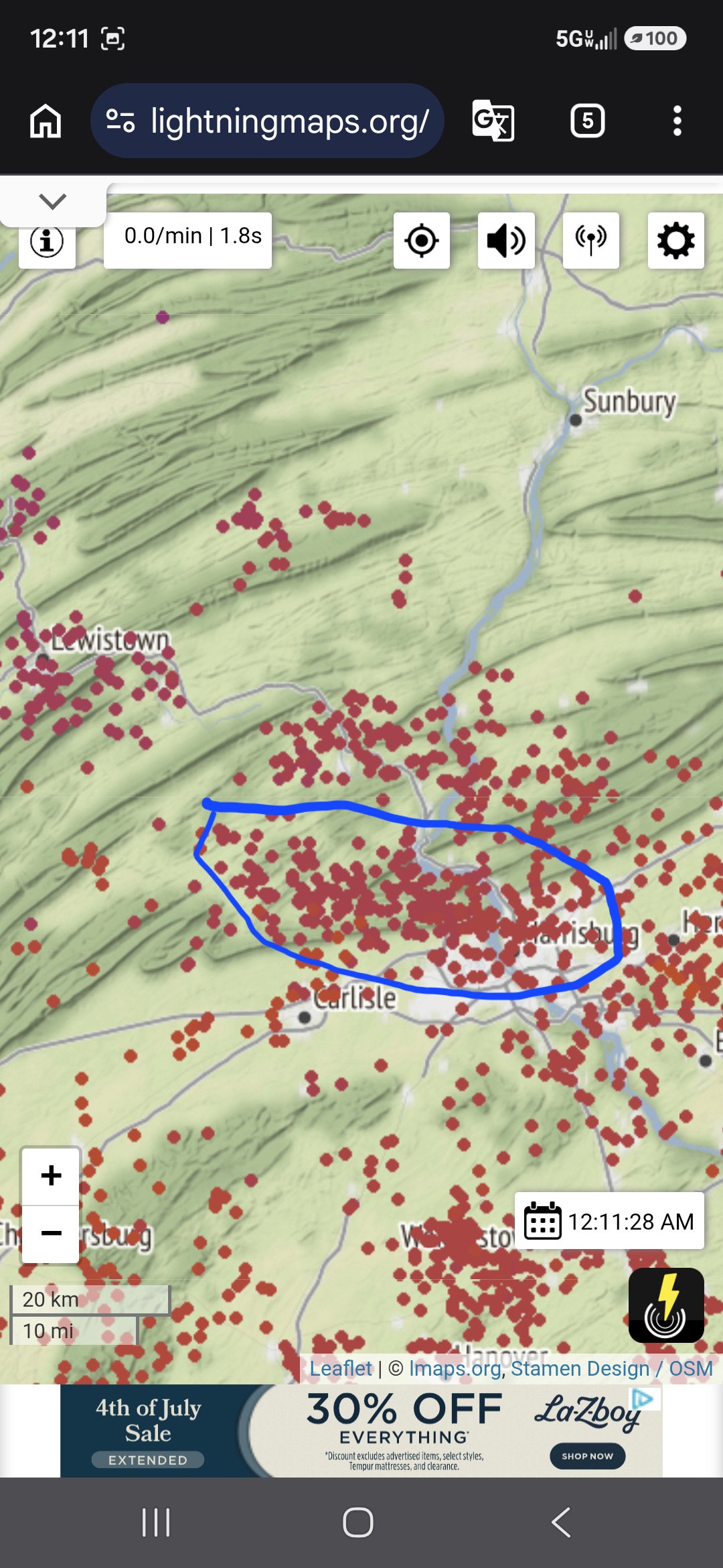
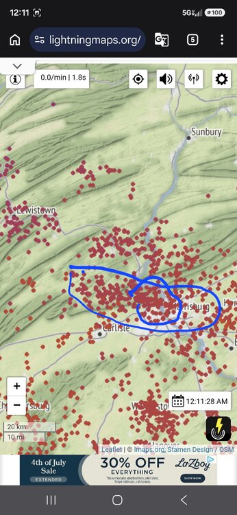
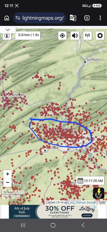
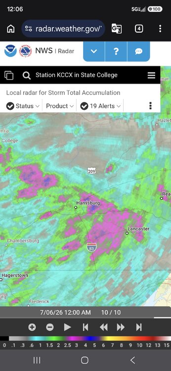
@canderson Hey Chris...It's been a crazy night here and I'm only now getting online to catch up on everyone's posts. Well, I managed to dodge a bullet with yesterday's severe weather, which is pretty amazing considering it was causing damage to my south in Mt. Holly and to my north and to my east. My luck ran out tonight with the first line of severe weather that formed practically over Carlisle and then slowly moved east while strengthening again to my east. The warning went off for me around 6:45pm and initially I thought I was going to escape it again, but not this time. The clouds rapidly darkened, followed by the start of heavy rain and some hail thrown in at the start. Hail wasn't all that much, maybe pea size but it melted pretty quickly. Then all of the sudden I heard the loud rush of wind approach from the west, and when it hit the trees went wild. Twigs and chunks of bark were blowing into my picture window. The wind forced the rain to actually penetrate through the bottom of the window sill. The gusts had to be 60-70 mph. Probably the strongest I've witnessed here in the 6 years I've been here. What I didn't see happen was that a large, heavy branch broke off of an old tree behind my house and shed and crashed through the roof of the shed. The force caused a sidewall to bend in significantly which then caused the two front doors to burst open despite there being a strong pad lock on them. At the same time this happened my next door neighbor had a very large branch from another tree completely split off and tear off the tree which came crashing down almost at her back door. Well, there goes my $2,000 shed. Will have to check out a claim on my insurance. I'm not sure that backyard sheds are covered in homeowner's insurance. Fortunately again, the contents of the shed were not damaged. Water poured over my patio furniture which I hadn't put out yet for the summer. And I had some odds and ends that also were not damaged by water. Through all of this I managed to hold on to power both yesterday and today. I lost internet for almost 24 hours. It came back on at 4:00 this afternoon and then proceeded to be lost again shortly after my storm came through. I'm back to tethering from my phone to leave this message. I'm sorry it's so long but there's been a lot to talk about since yesterday afternoon! I do send out prayers to all those who lost power and have not yet had it restored. But especially to those like @Jns2183who were hit twice even before there was a restoration before it was knocked out again. As it is now midnight I can report that I had 1.78" today from tonight's event with I think a lot more on the way. Everyone stay safe and don't go venturing out unless you know it is safe to do so! -
i figure this is as good of a time for my first post as any. Nother long time lurker. Was quite the show here in mid Staten Island for a bit there
-
Got .26 today. It's better than nothing
-
December of '82 started really warm, that's why it finished AN. Temps were near 80 early in the month. By mid December highs were below freezing and lows were in the low single digits after a 10 inch snow event on the Plateau. Knoxville got around 3-4 from that event, if records are to be believed. Tri had 6+. It warmed dramatically for Christmas of '82 as well, with highs in the 60s/70s.
-
rain seems to be fizzling out as it approaches the beltway - of course.
-
See the flash and then 30-35 seconds later hear the thunder clearly. Someone ne of me had to get hit hard And sweet 250th, 74 feels joyous compared to 110+ heat index
-

Big Heat (and storms?) Week into July 4th Weekend
Maestrobjwa replied to yoda's topic in Mid Atlantic
Goooooood soaking rain now with some wind. Some rumbles of thunder as well! -
Got 1.20 from that line
-
.86” here with light rain still. Getting occasional lightning and soft rolling thunder. I don’t need severe but just some nice rolling thunder.