All Activity
- Past hour
-
northern areas may get another 1-3 wed am
-

"Don’t do it" 2026 Blizzard obs, updates and pictures.
powderfreak replied to Ginx snewx's topic in New England
I have to say, in all my years on the forum I’ve seen him get the biggest storms out of anyone. I remember a photo of him snowblowing across his yard with the snow up to his shoulders, forget which event that was. -
I’m calling it at an approximate 18”. going out for post storm cleanup
-
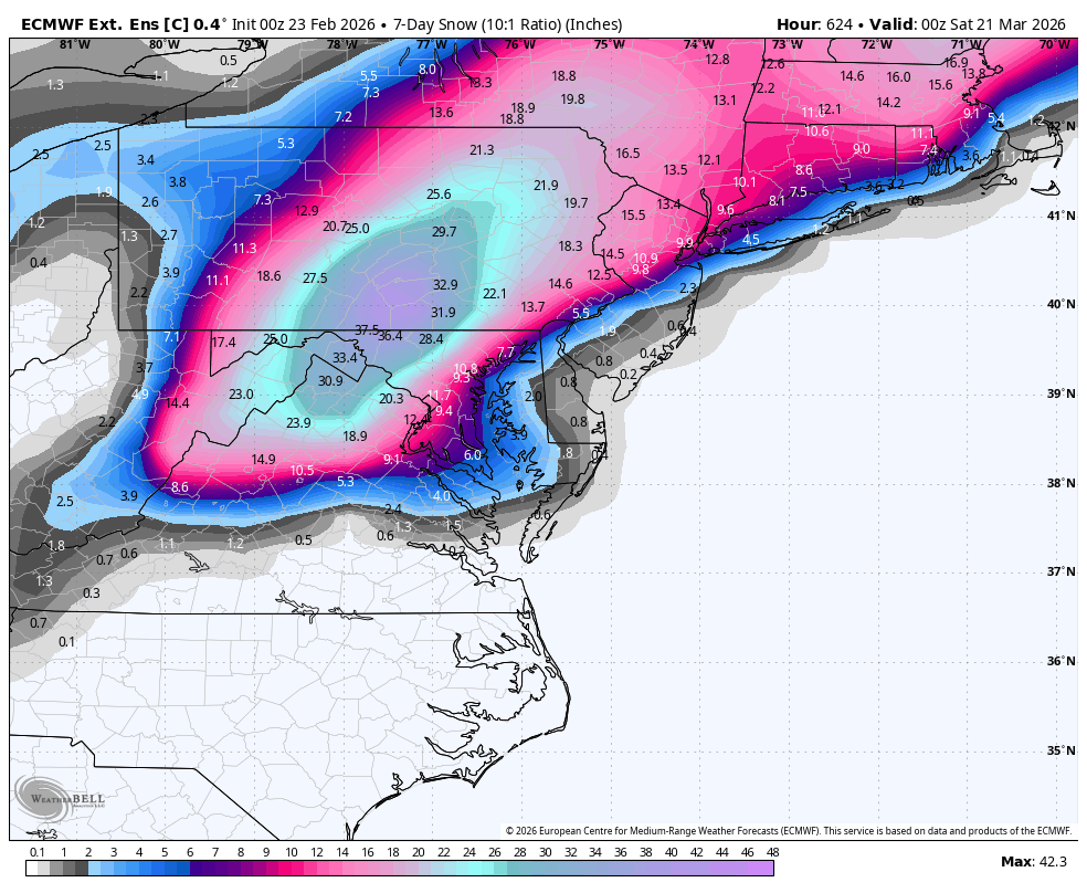
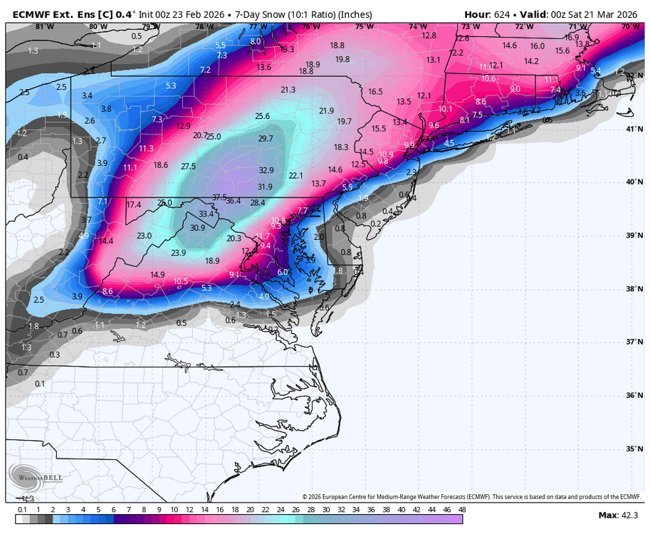
Hail Mary Storm NW crew storm on March 20. WB latest EPS weekly control.
-
I figured this winter would be good after we got the significant amount of snow in December. We know that when we get at least 4 inches of snow in a La Nina December, it usually goes on to be a snowy winter. It worked out that way again. Hopefully we can get some snow with the early March cold next week, before it warms up. I don't think this winter will go out without a fight in March.
-

2/26 - Follow-up Hopium Battlezone Storm
stormtracker replied to DDweatherman's topic in Mid Atlantic
Of course it is. But what else we got? It ain’t like we got a lot going on down here. -
are roads not plowed or something?
-

"Don’t do it" 2026 Blizzard obs, updates and pictures.
NoCORH4L replied to Ginx snewx's topic in New England
Is TBlizz ever allowed to complain again? -
The wind was blowing here, but not like on Long Island. I was able to get some good representative areas in NJ.
-
Finally home. The snow is littered with branches mostly small thankfully. A few bigger ones. Just looking at the snowfall reports from Mount Holly and WOW. Where I was in Easton(west side) might have gotten 6. ..Delaware... ...Kent County... Woodside 20.5 in 1115 AM 02/23 Trained Spotter Leipsic 18.0 in 1029 AM 02/23 Public 1 E Felton 17.5 in 1230 PM 02/23 Trained Spotter Dover 16.5 in 0945 AM 02/23 Public Harrington 16.1 in 1100 AM 02/23 Trained Spotter Smyrna 3.5 SSW 13.2 in 0700 AM 02/23 COCORAHS 3 SW Magnolia 13.0 in 0812 AM 02/23 Public Clayton 10.0 in 0645 AM 02/23 Public ...New Castle County... Hockessin 10.0 in 0555 AM 02/23 Trained Spotter Talleyville 10.0 in 1115 AM 02/23 Public Wilmington 9.5 in 0640 AM 02/23 Public Bellefonte 8.5 in 0900 AM 02/23 Public Holiday Hills 8.3 in 0210 AM 02/23 Trained Spotter New Castle County Airport 8.3 in 0100 PM 02/23 ASOS Wilmington 5.6 N 8.0 in 0700 AM 02/23 COCORAHS Newport 2.4 WNW 7.2 in 0700 AM 02/23 COCORAHS Bear 7.0 in 0630 AM 02/23 Public 1 NW Marshallton 6.3 in 0930 AM 02/23 Trained Spotter Newark 1.5 S 5.5 in 0730 AM 02/23 COCORAHS Newark 5.0 in 0830 AM 02/23 Public ...Sussex County... Bethel 19.3 in 0741 AM 02/23 Broadcast Media 3 N Long Neck 19.3 in 0800 AM 02/23 NWS Employee 4 N Delaware Coastal Airport 19.0 in 0600 AM 02/23 Trained Spotter 2 WSW Long Neck 18.7 in 1030 AM 02/23 Trained Spotter 1 SW Lewes 18.0 in 0430 AM 02/23 Public 2 SE Milton 18.0 in 0945 AM 02/23 Trained Spotter Milton 17.2 in 1121 AM 02/23 Trained Spotter 1 E Millsboro 17.0 in 1100 AM 02/23 Public Bridgeville 2.6 W 16.5 in 0700 AM 02/23 COCORAHS 3 ESE Bridgeville 16.0 in 0800 AM 02/23 COCORAHS Gumboro 15.5 in 0941 AM 02/23 Public Delmar 0.1 WSW 13.0 in 0831 AM 02/23 COCORAHS ...Maryland... ...Caroline County... Greensboro 14.0 in 1037 AM 02/23 Emergency Mngr Denton 12.0 in 1038 AM 02/23 Emergency Mngr 4 SSE Ingleside 12.0 in 1100 AM 02/23 Trained Spotter 3 N Oakland 11.0 in 1035 AM 02/23 Emergency Mngr ...Kent County... Millington 6.0 in 0530 AM 02/23 Public Chestertown 3.9 in 0755 AM 02/23 Trained Spotter ...Queen Annes County... 3 SSE Hope 10.0 in 1036 AM 02/23 Emergency Mngr Sudlersville 10.0 in 1035 AM 02/23 Emergency Mngr Church Hill 8.5 in 1036 AM 02/23 Emergency Mngr 3 SSE Church Hill 8.0 in 1037 AM 02/23 Emergency Mngr Crumpton 8.0 in 1038 AM 02/23 Emergency Mngr Centreville 7.0 in 0715 AM 02/23 Emergency Mngr Grasonville 5.0 in 0459 AM 02/23 NWS Employee Queenstown 4.5 in 1032 AM 02/23 Emergency Mngr 2 SW Stevensville 4.4 in 0700 AM 02/23 CO-OP Obse
-
It was closed for a week for the blizzard of 78. I remember that week vividly. I was 8(yes I am old). What a time!
-
Spoiled brats on the taxpayers dole. Like the teachers in public schools don't have enough days off per year. Go to work. Like everyone else and stop crying.
-
.thumb.jpg.aec747d13df1d95d5fed34574f74d4fd.jpg)
"Don’t do it" 2026 Blizzard obs, updates and pictures.
Vinny Findley replied to Ginx snewx's topic in New England
Only the first 3" here was semi paste. All powder after that. -

"Don’t do it" 2026 Blizzard obs, updates and pictures.
andyhb replied to Ginx snewx's topic in New England
40" within reach? -

"Don’t do it" 2026 Blizzard obs, updates and pictures.
tavwtby replied to Ginx snewx's topic in New England
was just thinking that, we'd be probably close to 100" region wide, and honestly this storm and that norlun last week left some on the table, but nonetheless, still close to climo, I'd give this winter an A right now for that and the temps, think I had one day over 45 since early November! that's nuts -

"Don’t do it" 2026 Blizzard obs, updates and pictures.
LSC97wxnut replied to Ginx snewx's topic in New England
No school in Newton tomorrow. One more burst from that "cell" just inside 128. -
I can’t remember NYC ever closing schools for two days in a row for snow
-

"Don’t do it" 2026 Blizzard obs, updates and pictures.
TauntonBlizzard2013 replied to Ginx snewx's topic in New England
Some of the short range guidsnce suggesting an additional 3-5” here -

"Don’t do it" 2026 Blizzard obs, updates and pictures.
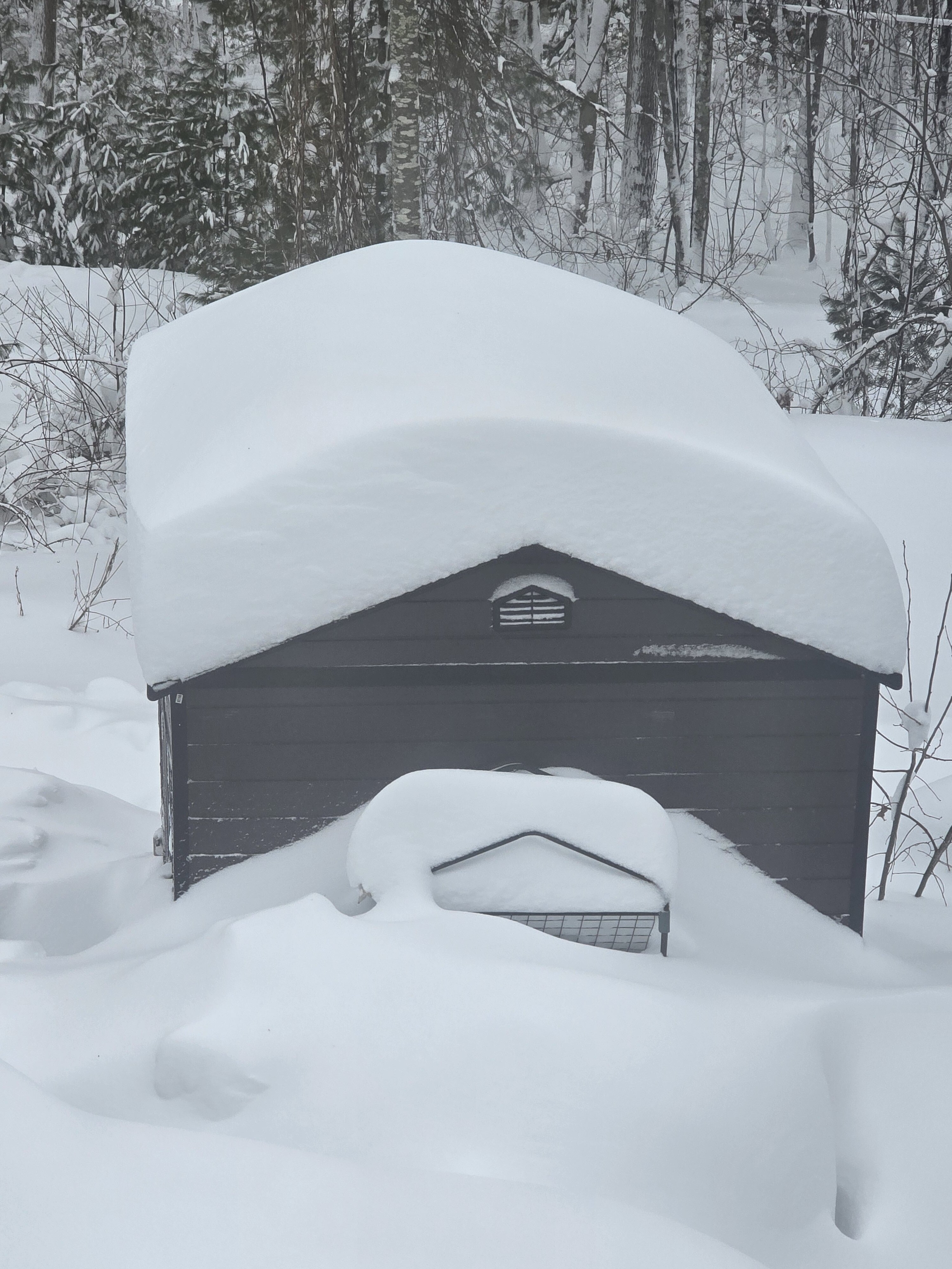
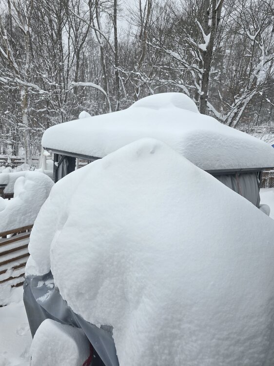
Ginx snewx replied to Ginx snewx's topic in New England
That shed was destroyed in Isiasis Have 4 now. Mowers snow blower tools, shed 2, 2 Generators shed 3 pellets and hay,shed 4 pool and summer stuff.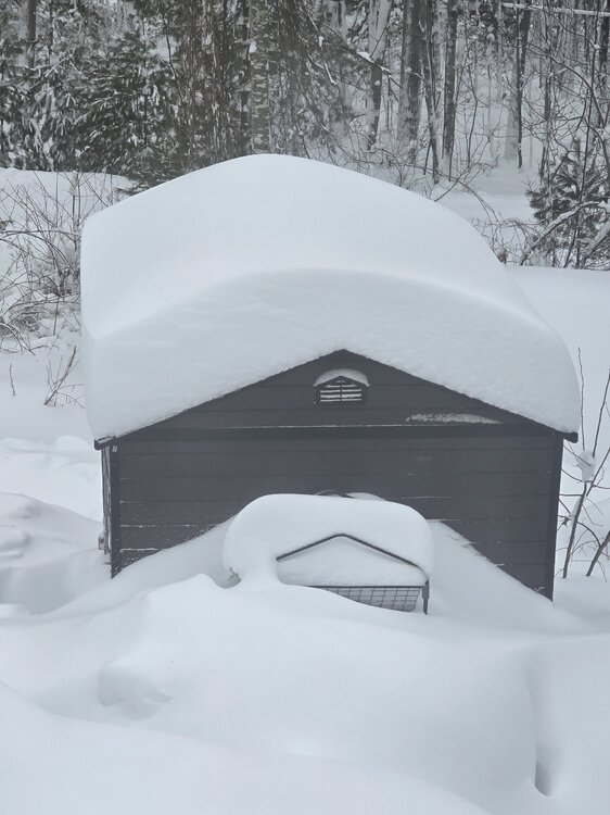
-

"Don’t do it" 2026 Blizzard obs, updates and pictures.
bristolri_wx replied to Ginx snewx's topic in New England
RI State of Emergency extended for another 24 hours (at least). -

"Don’t do it" 2026 Blizzard obs, updates and pictures.
mostman replied to Ginx snewx's topic in New England
3 feet of cement is wild. When we hit that in 15 it was powder. -
"Don’t do it" 2026 Blizzard obs, updates and pictures.
bristolri_wx replied to Ginx snewx's topic in New England
Could build an addition out of this stuff, eskimo style. -

"Don’t do it" 2026 Blizzard obs, updates and pictures.
Greg replied to Ginx snewx's topic in New England
Just curious, what was wrong with their measurements of the past? Too high, too low? -
Damn you were still snowing? lol It stopped here around 8am. The sun was trying to poke out around 1p
-

"Don’t do it" 2026 Blizzard obs, updates and pictures.
FXWX replied to Ginx snewx's topic in New England
Not out of the question... just imagine if we had not been screwed 2 times after the Jan 25-26 event???