All Activity
- Past hour
-
Hey Anthony, Looks great! It isn’t quite as good as yesterday’s, which was the best run yet as it had the mean drop to 7 at the low point, but I still love this!
-
Agree with Walt D. about the possibility of first flakes in the 11/10 - 11/12 period. The GFS, EC, CMC, and ICON show a few different possible scenarios to achieve it. Parts of the mid-Atl may even be favored to get flakes before us. There should be some steep lapse rates and hopefully snow showers if an ULL swings through (ECM/ICON) and/or in the cold northwest flow that develops behind the rain event (GFS).
-
 High school kids again? Why do you follow them and worse.. post them here
 -

November 2025 general discussions and probable topic derailings ...
TheBudMan replied to Typhoon Tip's topic in New England
The old man is back, the hour is near !!! LETS GOOOOOOOOOO -

Mid to long range discussion- 2025
WinstonSalemArlington replied to wncsnow's topic in Southeastern States
-
-
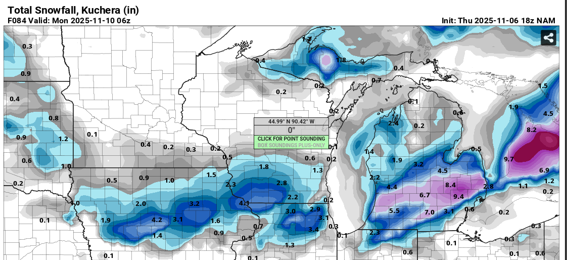
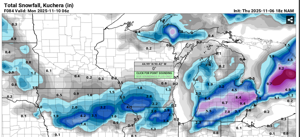
Looks like I am about to get NAM'd. Per usual cut this in half and maybe we are talking something realistic.
-
Snowmap also looks good
-
People cant be happy with the pattern coming up. Its always something .
-
.thumb.png.4150b06c63a21f61052e47a612bf1818.png)
November 2025 general discussions and probable topic derailings ...
HIPPYVALLEY replied to Typhoon Tip's topic in New England
yup, and keep on rocking while you do it! -
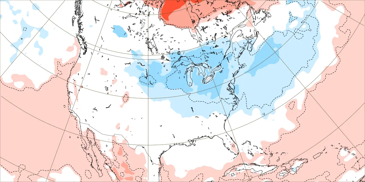
From AFDLWX of 223 PM EST Thu Nov 6 2025 "The airmass moving into the region Monday night is going to be extremely cold, possibly approaching some of the coldest temps ever sampled for the Tuesday 12Z IAD sounding. The GFS and ECMWF both show the potential for 500mb temps to be at or colder than -35C."
-

November 2025 general discussions and probable topic derailings ...
kdxken replied to Typhoon Tip's topic in New England
-

2025-2026 ENSO
40/70 Benchmark replied to 40/70 Benchmark's topic in Weather Forecasting and Discussion
-
South shore oaks laugh at sub 32 temps.
-
2 days away until NAM range lol
-
Digital Snow/Ice Thread 2025-2026
WinstonSalemArlington replied to WinstonSalemArlington's topic in Southeastern States
Tuesday, CMC -
Mid to long range discussion- 2025
WinstonSalemArlington replied to wncsnow's topic in Southeastern States
Tuesday, CMC -

2025-2026 Fall/Winter Mountain Thread
Maggie Valley Steve replied to Buckethead's topic in Southeastern States
Looks like the 12Z Suite of guidance has come in a bit better agreement regarding the NWFS event Sunday night into Tuesday. Temperatures are really going to shock the system with windchill values in the single digits and highs on Monday not getting above freezing. - Today
-

2025-2026 ENSO
brooklynwx99 replied to 40/70 Benchmark's topic in Weather Forecasting and Discussion
i swear, reading this thread is like groundhog day sometimes -

November 2025 general discussions and probable topic derailings ...
Lava Rock replied to Typhoon Tip's topic in New England
Ripping it at Jay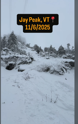
-
showers and storms look like a lock tonight before another day in the 60s (maybe our last of the year?)
-

Central PA Fall Discussions and Obs
Voyager replied to ChescoWx's topic in Upstate New York/Pennsylvania
Yup. I had that spike too. Went up to 65 pre-front.
-
Euro Weeklies Dec 1-7: today’s run is coldest run yet

-
November 2025 general discussions and probable topic derailings ...
Lava Rock replied to Typhoon Tip's topic in New England
and so the pack begins.