All Activity
- Past hour
-
I hope it's got an industrial sized rain gauge.
-
 Love the ebbs and flows of the 4 distinct seasons locally. only other places I can think of with enough variety would be Maine or upstate NY.
 -
Today was the 2nd afternoon in a row that my home had a severe thunderstorm warning. The heaviest was mainly 5-6 PM. Per radar my place likely got a really good dousing, but I’m out of town. I’ll check Cocorahs and other things later to get an estimate on the rainfall.
-
 http://indiamedok.com/# India MedOk
 -
top online pharmacy india or online pharmacy india online pharmacy india https://www.google.so/url?q=https://indiamedok.com reputable indian pharmaciesand http://fog.gain.tw/space.php?uid=474863 indianpharmacy com [url=https://www.lnfcu.com/helpers/choice.asp?h=http://indiamedok.com/]buy medicines online in india[/url] top 10 pharmacies in indiaor [url=https://act2day.eu/profile/fllgmcwwka/]reputable indian online pharmacy[/url] online pharmacy india
-
https://mexisafepharm.com/# purple pharmacy online ordering
-

Augdewst 2026: Summer's Last Stand
Damage In Tolland replied to Prismshine Productions's topic in New England
He’s disappeared as has ACATT -

Augdewst 2026: Summer's Last Stand
dendrite replied to Prismshine Productions's topic in New England
Lots of self destructive sunshine today. Clearing out again now. 72.9/54.5 on the day -
Augdewst 2026: Summer's Last Stand
dendrite replied to Prismshine Productions's topic in New England
Everyone’s favorite
-
Tomorrow will be mostly sunny and pleasantly cool. Highs will generally top out in the upper 70s and lower 80s. Showers and thundershowers could move through the region on Thursday night. Temperatures will remain in the upper 70s and lower 80s into the weekend. No excessive heat appears likely through the remainder of August and opening days of September. The ENSO Region 1+2 anomaly was +4.0°C and the Region 3.4 anomaly was +2.6°C for the week centered around August 19. For the past six weeks, the ENSO Region 1+2 anomaly has averaged +3.87°C and the ENSO Region 3.4 anomaly has averaged +2.43°C. The ongoing strong El Niño, which has reached super El Niño threshold, will continue to strengthen through the summer. The SOI was -6.74 today. The preliminary Arctic Oscillation (AO) was -0.425 today. Based on sensitivity analysis applied to the latest guidance, there is an implied near 53% probability that New York City will have a cooler than normal August (1991-2020 normal). August will likely finish with a mean temperature near 76.0° (0.1° below normal). Supplemental Information: The projected mean would be 0.8° above the 1981-2010 normal monthly value.
-
I am hoping that next week will be our last above 90s until next June.
-

2026-2027 Record-breaking El Nino
LakePaste25 replied to Stormchaserchuck1's topic in Weather Forecasting and Discussion
Starting to think that maybe it’s the hyperactive pac basin that’s pushing all these high heights into the northern latitudes. -
 Just your typical nearly 6000dm ridge south of the Aleutians during El Nino
 -
You realize you just doomed the entire winter by saying this ... right? unreal Okay everybody ... start a thread so we can keep track of every Angus event through next spring -
-

Augdewst 2026: Summer's Last Stand
Baroclinic Zone replied to Prismshine Productions's topic in New England
Top 10 summer day for my liking. -

Central PA Summer 2026 Discussion/Obs Thread
mahantango#1 replied to Voyager's topic in Upstate New York/Pennsylvania
A second tornado was confirmed by NWS in Lancaster County from last weeks storms. - Today
-
Augdewst 2026: Summer's Last Stand
Damage In Tolland replied to Prismshine Productions's topic in New England
https://x.com/jmelmed23/status/2092341874430222499?s=46&t=dhcbvkjmRcyBVQtDxJ3lRg -
Augdewst 2026: Summer's Last Stand
Damage In Tolland replied to Prismshine Productions's topic in New England
Everything dies after the convection hits far W MA and CT later this week . All the hi res kill it before the valley. Shocking -

E PA/NJ/DE Summer 2026 Obs/Discussion
JTA66 replied to PhiEaglesfan712's topic in Philadelphia Region
It’s been nice these last few days to stand up or floss or change the channel and not break out in a sweat. -
 Born and raised in and around the Detroit area. Had to move this past December to the DC area for work and education. After being out here for a while I can say I really enjoy the Appalachians for hiking and camping. DC area is pretty cool and has its own perks. But overall Michigan is my home and being by water is what helps soothe my soul. Potomac and the Chesapeake is not too viable for swimming. Having access to lakes within 30-45 mins of me is the best. And i have full intention on coming back to MI in a few years once my career gets for straightened out. But if I had to pick an area it would be within 30 mins of an ocean. COL aside like FL. Plus side of tropical systems minus the damage. Edit: Cant forget about my beloved UP of MI where i spent a-lot of time in growing up and into my adulthood. The hiking is unreal.
 -

Central PA Summer 2026 Discussion/Obs Thread
canderson replied to Voyager's topic in Upstate New York/Pennsylvania
CBS 21’s Steve Knight, whom iirc posts very blue moon here, is leaving the station tomorrow. The station tried to screw him on his new contract -
Augdewst 2026: Summer's Last Stand
dendrite replied to Prismshine Productions's topic in New England
Secadas? -

Winter 2026-2027 Seasonal Outlook
WinstonSalemArlington replied to WinstonSalemArlington's topic in Southeastern States
-
Low of 68, high of 90.5. Dew points in the low 70's most of the day.
-
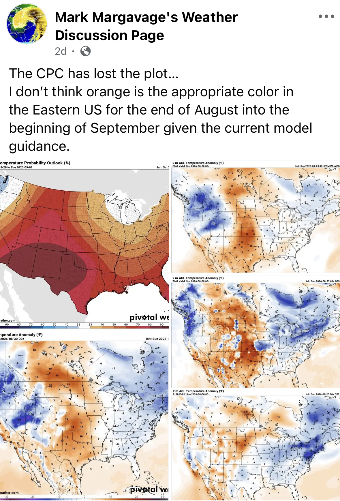
We are less than a week away from met Fall beginning. Looks like extended summer on today's model runs with a very hot first week of September, especially for middle and western parts of the area. With luck they will be too extreme, much like they were with the late month cool shot that had some upper 40s showing up in East Tennessee from around 10 days out. It did get into the mid-50s the last two nights. But 5-8 degrees can be huge either for lows or highs. Hopefully those modeled mid 90s to low 100s verify cooler by 5+ degrees.