All Activity
- Past hour
-
It’s looked overall wet for the most part…and I think that will be the case.
-
What are these things in the sky that were blocking the sun earlier?
-

-
Gfs west again

-
18z GFS shifted west later this week.. drenching for most.. only one run though
-
The STJ is already active. Record rainfall in florida and from arizona thru southern colorado
-
SPC has shifted the 2% tornado even further east now to at and along i65 corridor in middle tn no changes with marginal and 5% wind risk


-

2026-2027 Record-breaking El Nino
Typhoon Tip replied to Stormchaserchuck1's topic in Weather Forecasting and Discussion
lighten up and learn to laugh in commiseration - it's a lot healthier than wasting your time chasing pettiness. -
 Exactly why they need to change the laws down there as to what can and cannot be built to prevent the natural cycle. It’s either that, or move the highway and houses towards the mainland every few decades. The perfect example is what JUST happened in Buxton. After tens of millions were spent to pump sand in, the ACOE did not fix the large jettie/groin in time for the last storm cycle. As a result a significant portion of that sand ended up heading south towards the lighthouse with the natural lateral drift south. .
-

2026-2027 Record-breaking El Nino
mitchnick replied to Stormchaserchuck1's topic in Weather Forecasting and Discussion
I don't despute a parade of ocean storms will damage/destroy homes on the outer banks. But having vacationed there regularly since 1965, they have been losing houses there every year. Barrier islands always move inland toward the sound and nothing can stop them. It's actually pretty incredible imho they were able to save Rt. 12 onto Hatteras Island as long as they did. On a side note, when I first started going there in the mid 60's and we drove down Rt. 12, you could clearly see the conning towers of 2 German subs not far off the coast. Heck, it was only 20 years after the end of WWII at that time. They've long since collapsed into the sea. -
Why? Most guidance/analogs suggest a mild winter....
-
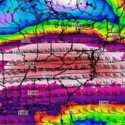
If you animate the PW parameter off the 12Z RRFS it shows a very moisture rich plume coming up the east coast from the deep tropics. PW's up to 1.5 - 2" possible along the NJ coast into SNE. Could be some excessive rainfall totals depending on where the front sets up. Trends suggest along and east of I95. Wiggle room though if the upper low developing over the central lakes digs a little further west and turns the upper flow more southerly along the coast and positive 500 MB anomalies off the northeast coast build back west a bit. I agree. Parts of the Northeast could tap into a small piece of that deep moisture responsible to the FL rains. Interesting setup. Odds favor LI and southern and eastern New England at the current time but still time for a little westward adjustment.


-
Using just snow as a metric, sure. But in reality other extreme weather events other then warm temperatures are likely. I fully expect multiple southern jet on steroids enhanced coastals that will bring damaging winds and major coastal flooding and erosion. It’s going to be a ruff winter if you have a house on fire island or the outter banks. And forget about Southern California. They are screeeeeeewed. .
-
Yes one or two of us called for this middle of last week . Off by a day but the signal was there
-
I’m talking here inland in CT. So It was 60 on Xmas Eve in 2014 at BDL. And it was a few degrees warmer than that at my locale. 2015 was even more crazy with 69 at BDL, and 70 plus here. So both ‘14 and ‘15 were record breaking at BDL for Xmas eve. Boston near the water I’m sure was cooler.
-

2026-2027 Record-breaking El Nino
michsnowfreak replied to Stormchaserchuck1's topic in Weather Forecasting and Discussion
Actually, it will be funnier when we get to April and it was a predictably mild winter with a few noteworthy wintry episodes, but the outrageous "predictions" from the select few never materialized and they will either dissappear or completely ignore accountability, as they do every spring. After a bit of silence, the circus predictions for 2027-28 will commence. -
2026-2027 Record-breaking El Nino
mitchnick replied to Stormchaserchuck1's topic in Weather Forecasting and Discussion
Another cc'er expressing their true desire that things continue to warm. It's beyond routine OCD. -
Dews in the 60’s Friday
-
high temp of 75.3 here
-
78 today...not sure what the record high would be for my little corner of the earth, but it's gotta be close. Beautiful day.
-
2026-2027 Record-breaking El Nino
40/70 Benchmark replied to Stormchaserchuck1's topic in Weather Forecasting and Discussion
Well, if that ever happened... We'd be right here a year from now haplessly doing the same damn thing while Forky laughs away. -
What many don't seem to understand is that we are in a long term drought and the hyper El Nino is no guarantee to bring us out of this drought. This is hilarious.
-
 sending medicines from india to usa: order antibiotics from india - tablets delivery
-
What does a strong El Niño mean for Pittsburgh snow? Historically it has meant less snow and a warmer winter. Across the nine winters NOAA's index classes as strong or very strong El Niño events, Pittsburgh averaged 31.2 inches of snow against a long-term mean of 42.9 inches. Eight of those nine finished below normal. Here is every one of them, with the airport's own measured total. The ONI peak is the highest three-month value the event reached, which is how NOAA classifies event strength. Winter ONI peak Class Pittsburgh snowfall vs 44.1" normal Dec-Feb temp 1957-58 +1.81 Strong 37.0" Below 28.5°F 1965-66 +1.98 Strong 48.0" Above 30.3°F 1972-73 +2.12 Strong 26.3" Below 31.9°F 1982-83 +2.23 Very strong 30.1" Below 34.1°F 1987-88 +1.70 Strong 35.1" Below 30.2°F 1991-92 +1.71 Strong 33.9" Below 33.4°F 1997-98 +2.40 Very strong 24.2" Below 36.3°F 2015-16 +2.75 Very strong 29.6" Below 34.9°F 2023-24 +2.06 Strong 16.3" Below 38.4°F
- Today
-
...they remind me of Jets fans lol..