All Activity
- Past hour
-
Always looked like a .5-1" type deal. maybe a few higher stripes/ lollis
-

E PA/NJ/DE Summer 2026 Obs/Discussion
mattinpa replied to PhiEaglesfan712's topic in Philadelphia Region
Under a severe thunderstorm warning with tornado possible designation right now -
You will get more later on
-

Junorch obs and discussion 2026
Damage In Tolland replied to Damage In Tolland's topic in New England
Steady batch now here . This is our whole rainfall for event next few hours so hoping for at least .50 -
Finally get field work, including concrete and trench digging schedule for tomorrow and it decides to rain.
-

2026 Mid-Atlantic Severe Storm General Discussion
SnowenOutThere replied to Kmlwx's topic in Mid Atlantic
DCA radar shows it well- 838 replies
-
- 1
-

-
- severe
- thunderstorms
- (and 7 more)
-
2026 Mid-Atlantic Severe Storm General Discussion
SnowenOutThere replied to Kmlwx's topic in Mid Atlantic
Cell south of dc has a weak mesocyclone -
It's overall a very messy looking radar so far.
-
After last summer keep it coming. I fertilized and put compost around the fruit trees this morning so I want it drenched in. There's no fungi or water in the basement yet so we good.
-
Round 2 of heavy rain at the office in Berkeley Heights.
-
What's their congressional voting record?
-
Haven't you had enough rain?
-
Euro's just unbearable. Anything imaginable to stop heat getting in New England, at the end of this rendition used a closed low at 590 heights I'm not saying I want it hot per se but jesus with that
-
Issued By New York City - NY, US, National Weather Service Affected Area Portions of northeast New Jersey, including the following counties, Bergen, Essex, Hudson and Union and southeast New York, including the following counties, Bronx, Kings (Brooklyn), New York (Manhattan), Queens and Richmond (Staten Island) Description ...FLOOD ADVISORY IN EFFECT UNTIL 645 PM EDT THIS EVENING... WHAT...Flooding caused by excessive rainfall is expected. WHERE...Portions of northeast New Jersey, including the following counties, Bergen, Essex, Hudson and Union and southeast New York, including the following counties, Bronx, Kings (Brooklyn), New York (Manhattan), Queens and Richmond (Staten Island). WHEN...Until 645 PM EDT. IMPACTS...Minor flooding in low-lying and poor drainage areas. ADDITIONAL DETAILS... - At 339 PM EDT, Doppler radar indicated heavy rain due to thunderstorms. Minor flooding is ongoing or expected to begin shortly in the advisory area. Between 0.5 and 1 inch of rain has fallen. - Additional localized rainfall amounts of 1 to 2 inches are expected over the area through 7pm. This additional rain will result in minor flooding. - Some locations that will experience flooding include... Newark, Jersey City, Jamaica, Elizabeth, Flatbush, Flushing, Bayonne, Mott Haven, Hoboken, Plainfield, Bloomfield, East Tremont, Linden, Orange, Coney Island, Summit, Lyndhurst, Millburn, Rutherford and Secaucus. - This includes the following Event Locations... New York/New Jersey Stadium, Brooklyn Bridge Park, Sports Illustrated Stadium and USTA Billie Jean King National Tennis Center. -
-

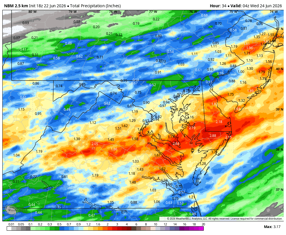
Wet late Monday 6/22 or another Fizzle?
Weather Will replied to Weather Will's topic in Mid Atlantic
WB 18Z NBM through Tuesday.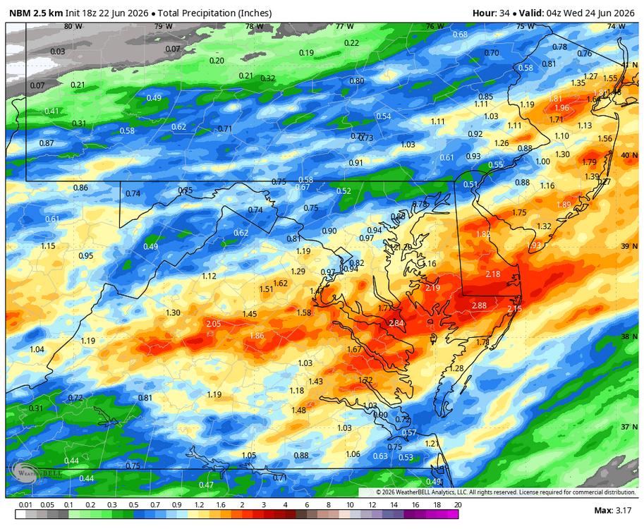
-
Storms fizzled as they crossed the Hudson as is usually the case
-
2026 Mid-Atlantic Severe Storm General Discussion
SnowenOutThere replied to Kmlwx's topic in Mid Atlantic
Debating if I want to drive out on a local chase. Would set up east of Culpepper. -
60.7F 0.30"
-
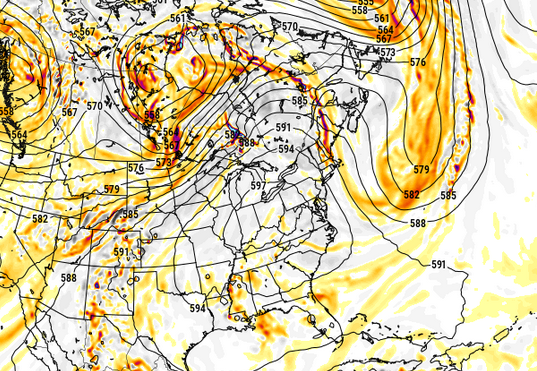
Approaching 600 dm non-hydrostats is nuts since the shit version of the GFS in 2017 was retired...
-
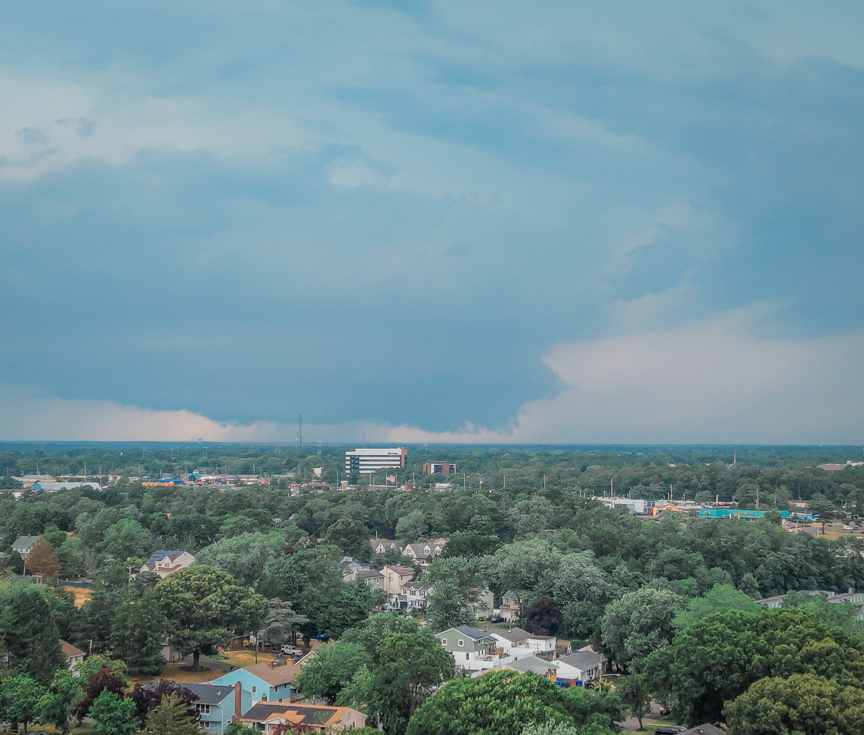
where is that storm and where is that tall white building ?
-
Yep but it was a pretty good downpour. I got 0.28" here between both downpours. Enough to give things a much-needed watering, but hopefully we'll see another downpour later. And hopefully the models are right about the steady rain tomorrow.
-
Steady light rain here since about 1pm. Just what the gardens needed!
-
Warned storm approaching Luray looks semi-interesting on velocity.
-
and if you look at the satellite looks like more hazy sunshine moving in behind which will destabalize the atmosphere and create more storms
.thumb.gif.f92b16c631a1d15d405ed77b33f0710d.gif)


.thumb.jpeg.f5c6ba9d911ec96b3b124f8606aee58e.jpeg)