All Activity
- Past hour
-
 Wish I could show @Roger Smiththis.
-
.12 at my station in Sheepshead Bay. Lots of trees and wires down In northern Queens as per the fire radio earlier this evening
-
Phalanx/dong headed in
-
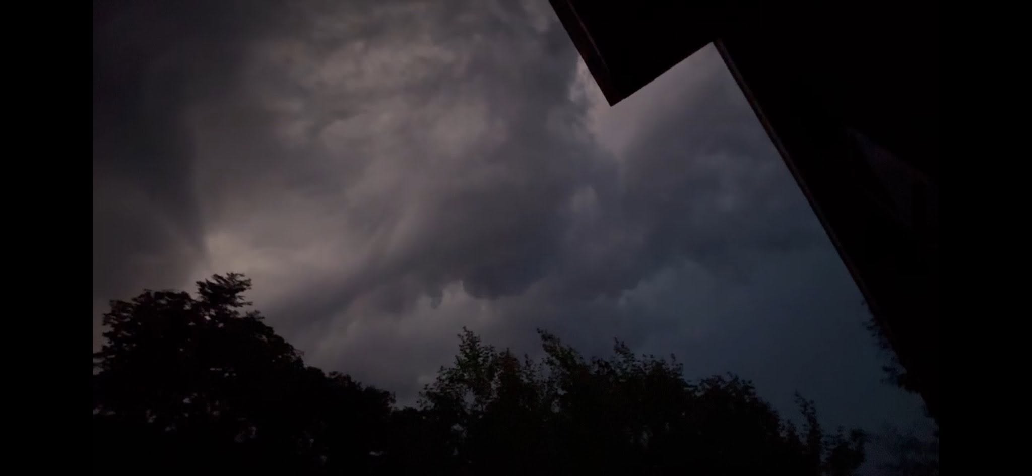
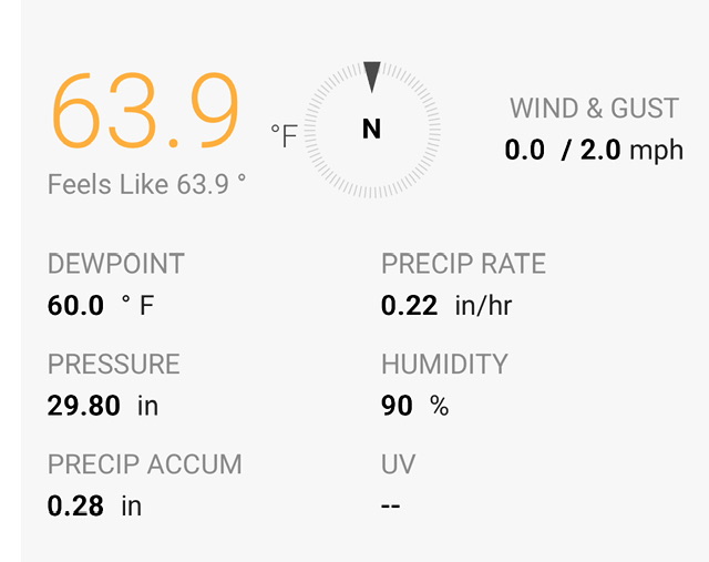
Lightning and maybe 30 mph gust
-
Remarkably coherent.
-
When you're happy you swallow?
- Today
-

E PA/NJ/DE Summer 2026 Obs/Discussion
MGorse replied to PhiEaglesfan712's topic in Philadelphia Region
Strong gust front blew through earlier followed by a whopping 0.08 inches of rain. -
I hate when models back off as an event approaches. First, it was Friday (yesterday) that totally crapped out for this area. Now, the widespread 1-2" Sunday and Monday has been reduced to scattered showers, with more isolated heavy downpours. Some spots may get an inch, but others may get very little. Most of the rain on Monday has been shifted east.
-
Almost hit a tree branch on 684 on my way to KEWR.
-

2026-2027 Super El Nino
mitchnick replied to Stormchaserchuck1's topic in Weather Forecasting and Discussion
The thought that you would question the great JB's claim of a weather record setter is shocking, just shocking. -
There’s a natural feature that fires up storms in eastern New York due to terrain issues late afternoon. By the time they get to us, it’s into the evening and it cools as well. There’s definitely certain set ups that can favor some areas over others. But as far as tonight goes the storms in Southern Rhose Island, that are pretty potent. Carly, the marine issue is not a deal there.
-

2026-2027 Super El Nino
GaWx replied to Stormchaserchuck1's topic in Weather Forecasting and Discussion
A freaky record breaking cold period for N of 80N just occurred May 23rd-June 4th per the image below (records back to 1958). I saw it mentioned by Bastardi but wanted to confirm it, myself. So, I went through the graphs for every year to confirm this and it turns out he’s right with that period averaging ~-6C, which is ~3.5C BN: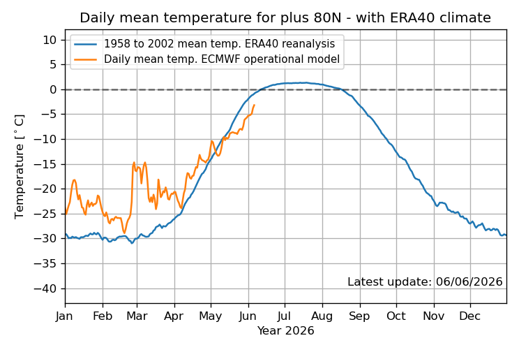
-
We knew
-
Waterfront in Toms River
-
Is it this station? Seems like a good call and enough to soak in.
-
Love it!!!
-
I understand marine air influence but why does Eastern mass always lose these storms? Is there some other factor? This one is setting up for a complete meh again. We used to get real storms. Sorry typed while 6 IPAs deep. .
-
Severe Thunderstorm to my North brought in cool temps and ruined my chances for a nice soaking rain with the line that came through around 8pm. .
-

-
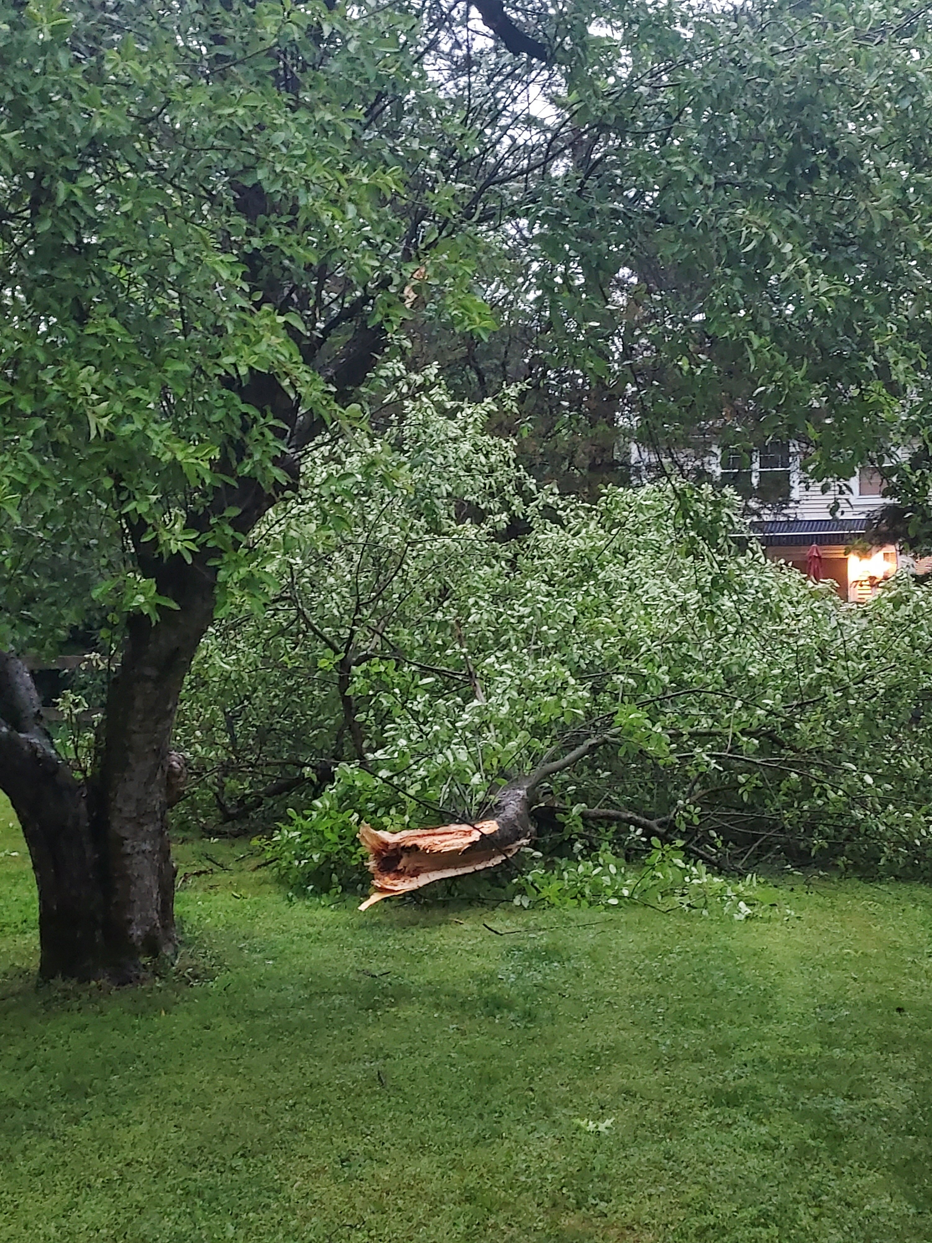
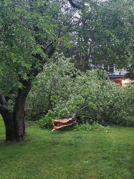
Crazy wind...ruined the last couple hours of my son's graduation/confirmation party
-
Dang! Headed up to Thornton just for the night. Passing lane was closed at around exit 27, with tree in lane. Not sure if it was straight line or tornado, but missed it by about 15 minutes. No power.
-
0.31" here. Not bad considering we didn't even get a heavy downpour since the storm fell apart. Good period of moderate rain.
-
NWS has 102 and 101 for Friday and Saturday of next week right now. Ugh sometimes I really hate it here.
-
Should be near .25 when all is done. You’re welcome.
-
Preliminary Local Storm Report National Weather Service Gray ME 950 PM EDT Sat Jun 6 2026 ..TIME... ...EVENT... ...CITY LOCATION... ...LAT.LON... ..DATE... ....MAG.... ..COUNTY LOCATION..ST.. ...SOURCE.... ..REMARKS.. 0857 PM Tstm Wnd Dmg 1 NNE Plymouth 43.77N 71.68W 06/06/2026 Grafton NH Public Two trees down on Interstate 93 north, blocking several lanes.

.thumb.gif.f92b16c631a1d15d405ed77b33f0710d.gif)


.thumb.jpeg.f5c6ba9d911ec96b3b124f8606aee58e.jpeg)