All Activity
- Past hour
-
For sure. Feb precip up to 0.76" with yesterday's 0.02" and not much in the near future - maybe a few pennies late Saturday. Driest of our first 27 Februarys is 0.95" in 2024, but DJ & M that winter totaled 23.49". DJ this winter: 6.08". I doubt that March will bring 17.4" (precip, not snowfall ) to match 23-24. Would be exciting, though.
-

"Don’t do it" 2026 Blizzard obs, updates and pictures.
Ginx snewx replied to Ginx snewx's topic in New England
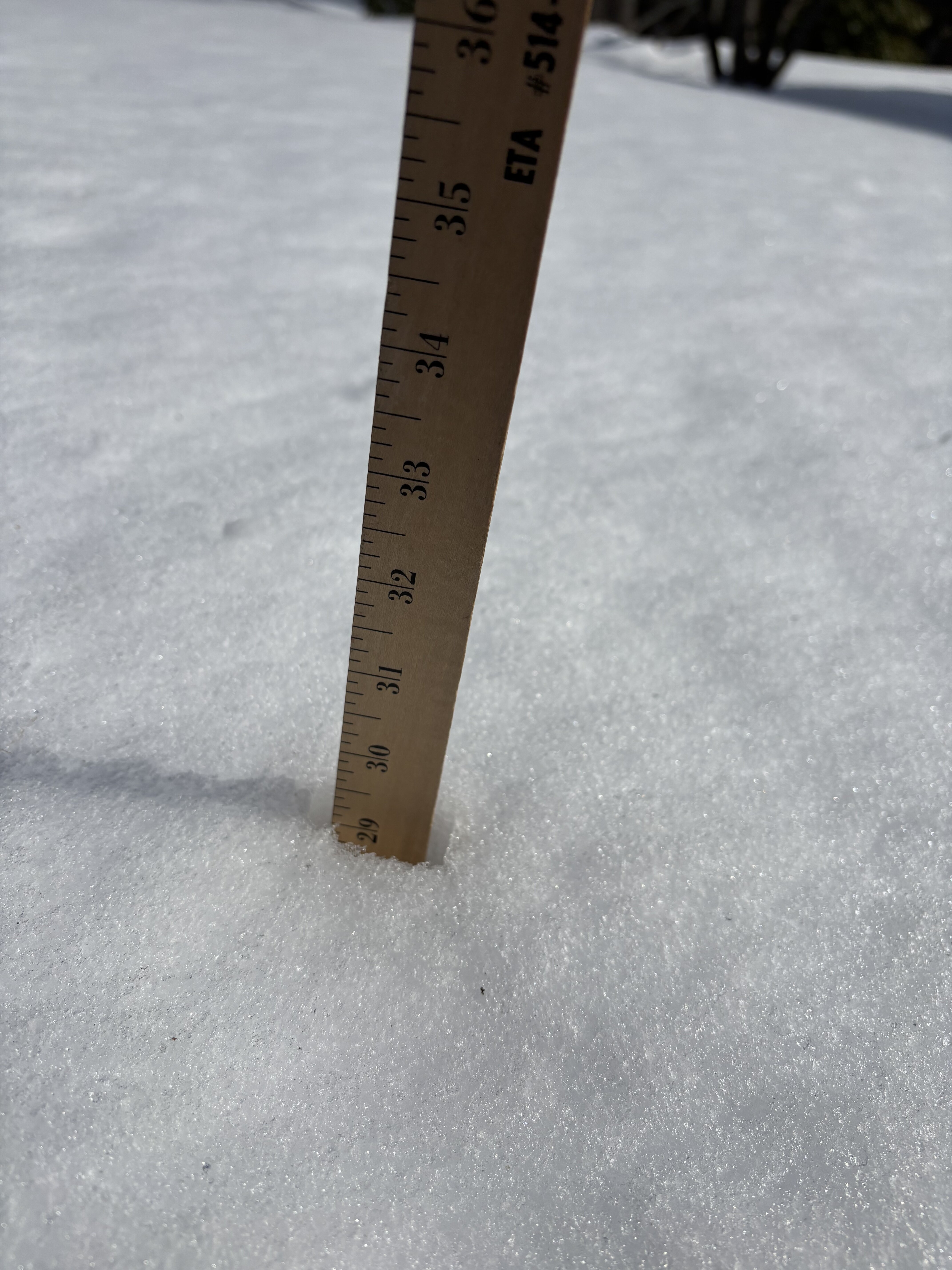
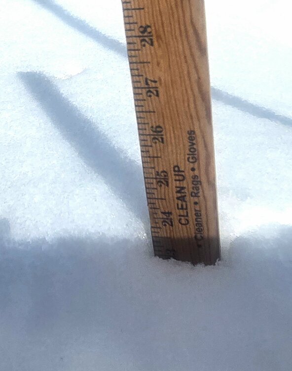
Epic maybe have that dude come measure what 84 hrs later. I went from 38 to 23.5. There peak depth had to be 40+ -

Is we back? February discussion thread
CT Valley Snowman replied to mahk_webstah's topic in New England
Pack taking a hit, especially in the sunny, south facing,highway areas etc. 42 here. -
On repeat. Every year without fail, like clockwork. Cut and pasted. You can set your watch to it
-

"Don’t do it" 2026 Blizzard obs, updates and pictures.
CoastalWx replied to Ginx snewx's topic in New England
There is some deep shit on the S shore even after the settling and mild weather. This is Hanover. No drift. Not shady either.
-
good thought too
-
-
You hyped his post way more than he did, shocking, but you are obsessed with him and have been for years.
-
Decent signal
-

2025-2026 ENSO
donsutherland1 replied to 40/70 Benchmark's topic in Weather Forecasting and Discussion
As always. He always calls for a wild end to winter. -
Strange, but 2009-10 takes the cake - CAR 70.3", BWI 78". That's probably a one-in 200-year phenomenon.
-
I thought yesterday that the shift south in some models was overdone
-
Haha I wasn't even complaining but just giving my take. I know climo, but this season in its entirety for me was eh. Not the most enjoyable despite a couple events. I think the lack of even modeled storms ruined the season too for me because that at least gives hope and opportunity. Too many mid/long range storms went poof and never came back vs. allowing for longer tracking of trends that actually became reality.
-
The Euro AIFS is good with the Monday wave and gives us a few inches of snow during the day. On the regular Euro the Monday wave falls apart, but it gives us a snow changing to rain event on Tuesday. Obviously the models are very confused. It'll be awhile be we know what's going to happen.
-
Euro AI
-
@donsutherland1 No surprisingly, Joe Bastardi is in full on “Strat warm” hype mode, calling for a huge return to deep winter from 3/15 until early April…calling for arctic cold and snowstorms up the east coast….
-
Another underperforming rainfall event. I can't remember the last time one overperformed. I bet it was the big flash flood back in August. Everything since then has delivered less than advertised.
-
was wondering if they moved the sensor around that time, expanded the airport, something....
-
same reason that it seems like we break some sort of rainfall record....everything is juiced up, snows more, rains more
-
the Euro AI insistence that this will be beefier should not be ignored. The euro is struggling
-
It did. It was a little rough being on the outside looking in for that 3-4 hour stretch, where it was like .5-1.5"/hr while just over the canal and beyond as 3-4"/hr but we did dance with good echoes often...especially the first half of the storm, and last several hours.
-

Outta gas and Outta Time: Early March Winter Storm finale
87storms replied to Ji's topic in Mid Atlantic
The current radar is making me think I should delete this post. -

2025-2026 New England Snow Recordkeeping Thread
Damage In Tolland replied to bristolri_wx's topic in New England
68.7” YTD DIT land -
the snow blitzes this winter are just as much a part of CC as the warm bursts IMO