All Activity
- Past hour
-
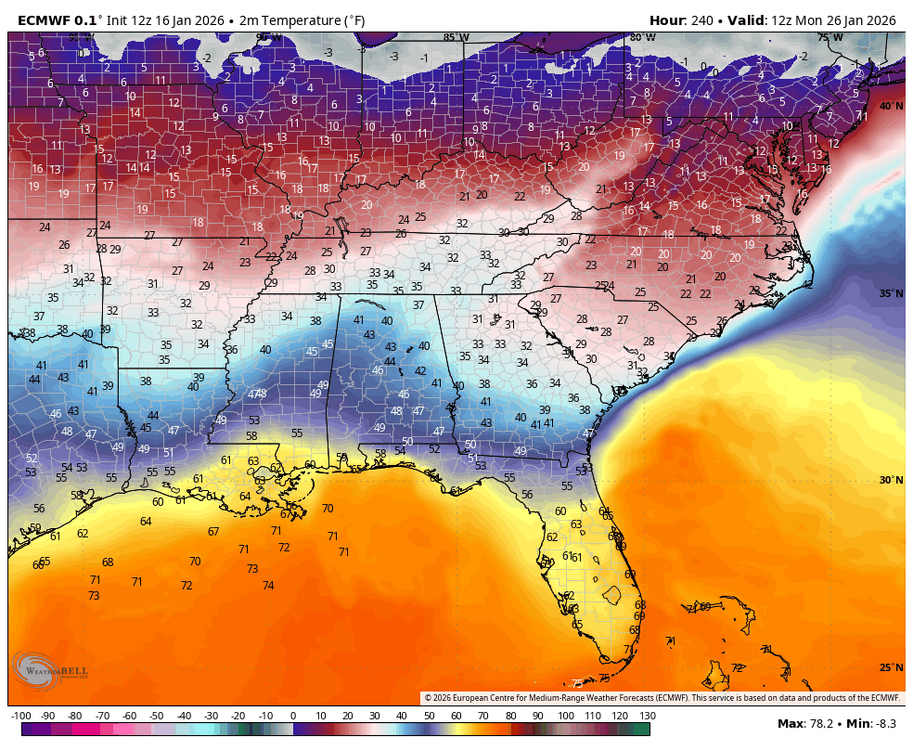
Looks like the Euro is favoring this scenario by driving the GOA low and torching Canada. But GEFS disagrees a bit, it stops short of doing what the euro did and instead retrogrades the trough towards the aleutians.
-
Lucky roads?
-

Another Coating of Snow Saturday - "It's all we Got"
DomNH replied to Sey-Mour Snow's topic in New England
I think it's going to be a fairly tight gradient between 2-4'' of decent snow and C-1'' of slushy crap...likely just NW of my fanny. -

2025-2026 ENSO
donsutherland1 replied to 40/70 Benchmark's topic in Weather Forecasting and Discussion
I don’t know. It wouldn’t surprise me if it’s temporary. -
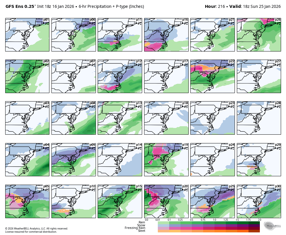
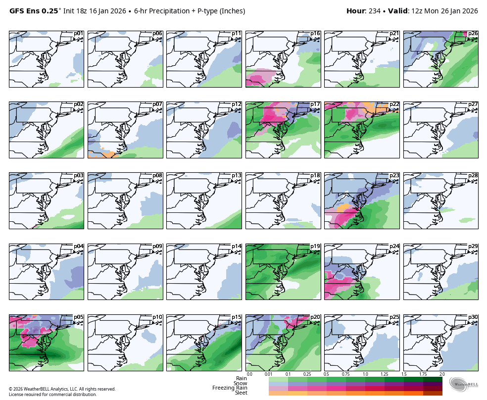
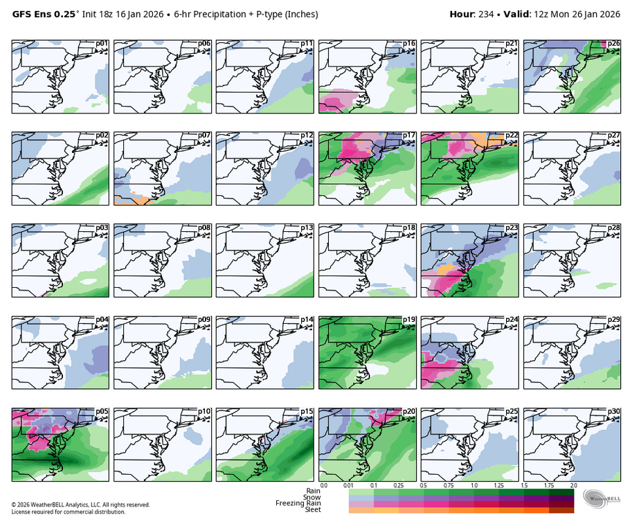
WB 18Z GEFS for 25-26 seems all over the place on whether there will be a storm and whether it will be wet/icy/snowy. Couple of snapshots for Sunday 1pm and Monday 7am.

-
First Legit Storm Potential of the Season Upon Us
J Paul Gordon replied to 40/70 Benchmark's topic in New England
WWA up for my area (Clinton, MA) with 2-4, but I'm not sure whether that's tonight and tomorrow or Sunday. Temperatures--especially tomorrow seem marginal, at best. -

First Legit Storm Potential of the Season Upon Us
dryslot replied to 40/70 Benchmark's topic in New England
Yup -
Another tick north on the Euro
-

Mid-Long Range Discussion 2026
gamecockinupstateSC replied to BooneWX's topic in Southeastern States
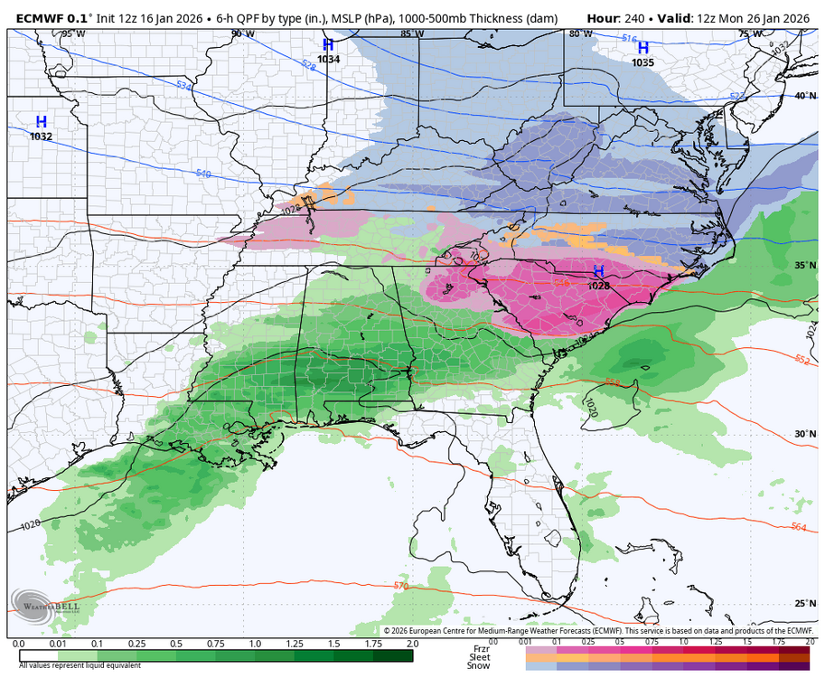
How long has it been since both the GFS and Euro matched 9 days out? Euro is actually colder and further south with ice.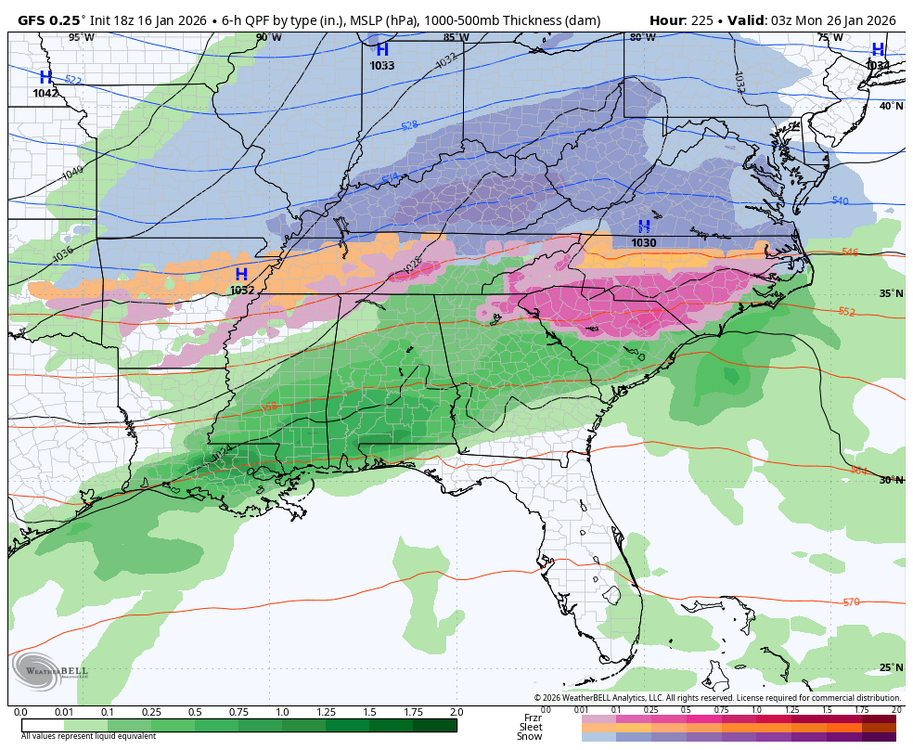

-
Last time I saw snowman19 basically go all in was several days before Jan 2016. Ended up pretty decent lol
-
I only wish this on friends. Ask Mappy when she was worried about this past Thursday.
-

First Legit Storm Potential of the Season Upon Us
SouthCoastMA replied to 40/70 Benchmark's topic in New England
the EC-AI was about a 40-50 mile jog east, but actually not too different than its 18z/0z/6z runs from yesterday/today. 0z will be telling but its clear it won't head back in the other direction (west). -

First Legit Storm Potential of the Season Upon Us
dendrite replied to 40/70 Benchmark's topic in New England
They’re learning that it’s fun to troll weather weenies -

First Legit Storm Potential of the Season Upon Us
Snowcrazed71 replied to 40/70 Benchmark's topic in New England
So it seems the AI models are learning, they're learning to come back to reality with the tried and true lol ( joking of course ) maybe things stay the course. Maybe they don't. I guess we'll know by tomorrow night what the final outcome will be for Sunday -
WB EURO 18Z AI likes the 29th period for a coastal. (Not much for the 25-26).
-

First Legit Storm Potential of the Season Upon Us
TauntonBlizzard2013 replied to 40/70 Benchmark's topic in New England
I expect a rug pull at 00z to be honest. Feels like 18z is laying the ground work -

First Legit Storm Potential of the Season Upon Us
ORH_wxman replied to 40/70 Benchmark's topic in New England
These are slow moves by 18z Skynet. I wonder if it’s going to just be slow caves each run from here or if we get a full rug-pull on one of these runs tonight. -
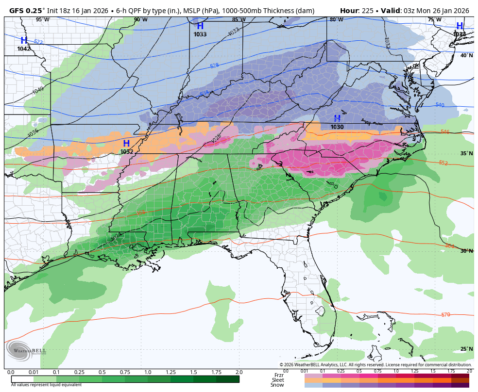
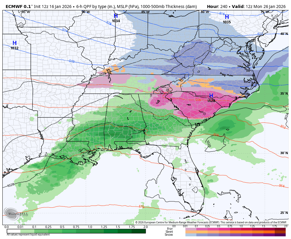
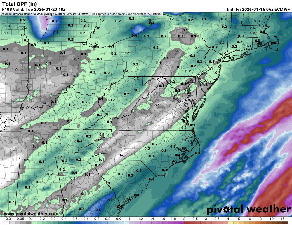
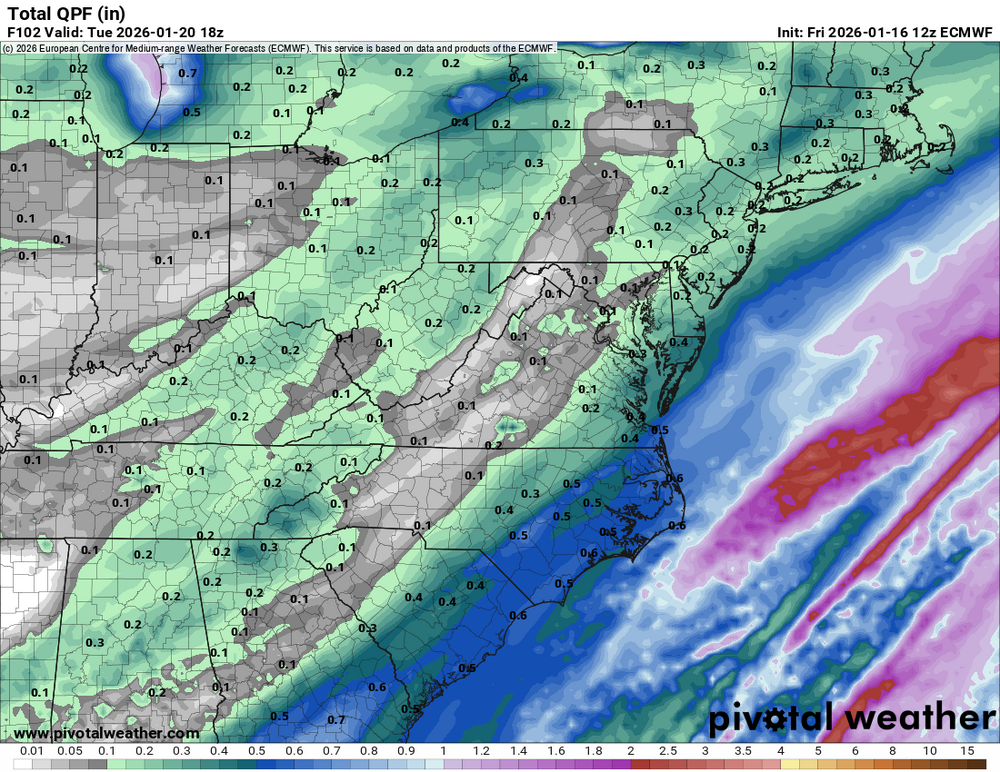
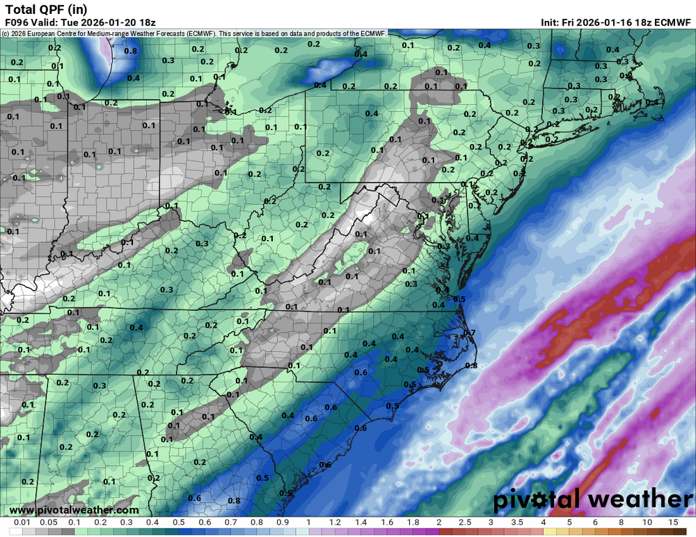
Euro gives DC nearly an inch tonight let's see if its right (although it might be sleet looking at soundings)
-
January 2026 regional war/obs/disco thread
dendrite replied to Baroclinic Zone's topic in New England
Heh…I remember seeing this story before -
If so then that is not 5-10" get your ratios ready.
-

First Legit Storm Potential of the Season Upon Us
ineedsnow replied to 40/70 Benchmark's topic in New England
still not a bad hit for many though -
First Legit Storm Potential of the Season Upon Us
ineedsnow replied to 40/70 Benchmark's topic in New England
18z Euro AI starting to cave a bit -

First Legit Storm Potential of the Season Upon Us
amarshall replied to 40/70 Benchmark's topic in New England
Got to be circa 2010 . -

First Legit Storm Potential of the Season Upon Us
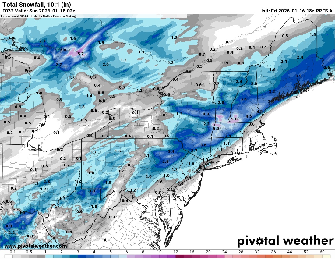
vortex95 replied to 40/70 Benchmark's topic in New England
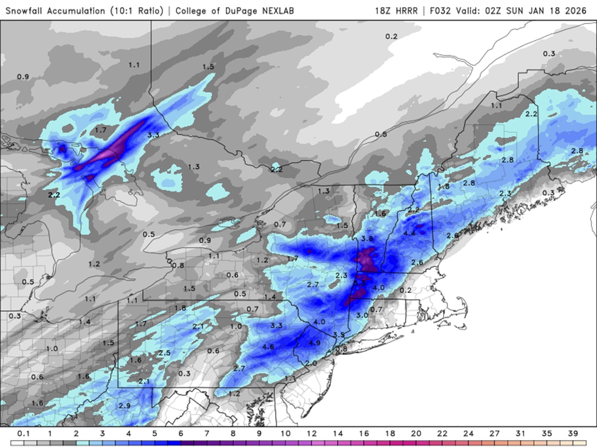
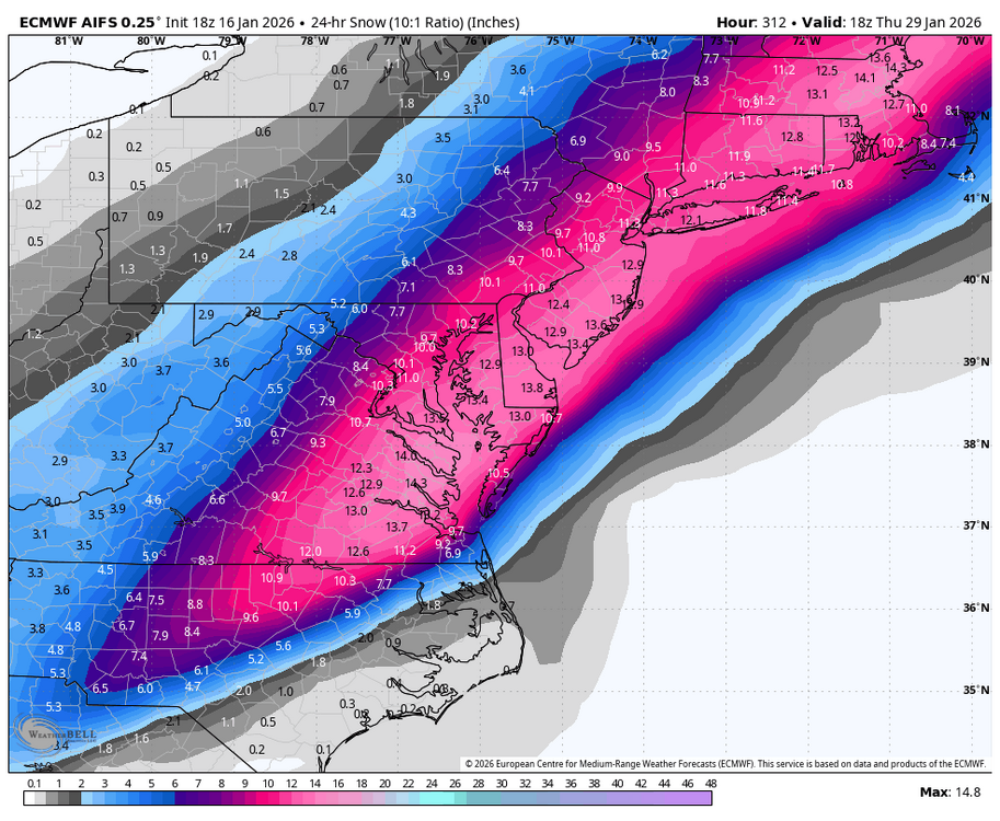
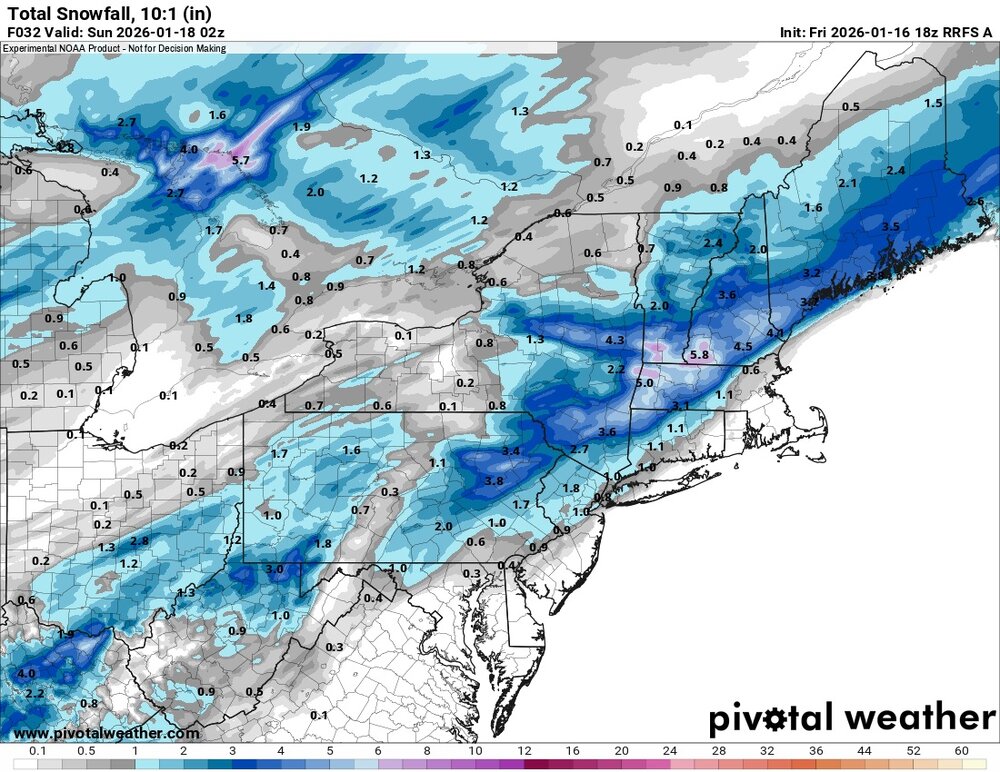
One item that stands out to me for the Sat event, when was the last time you saw that much snow forecast by the models w/ a sfc low passing well N in Quebec and sfc winds blowing the "wrong way" (SW) for a widespread accumulating snowfall, esp, in SNE? I can't recall an event quite like this. And the trough/sfc low is rather MEH. It seems counterintuitive, but the 18z HRRR and RRFS are in excellent agreement (snowfall 10:1 totals attached). Kuchera ratios are better for the higher elevations, showing up to a foot in srn VT. That is remarkable, given the synoptic setup! The odd and piecemeal/selective winter for New England snow events continues, and ern MA centered near Weymouth continues to be "flanked" on all sides, missing out on most events, while other areas are not doing too bad for seasonal snowfall, all things considered. And to add insult to injury, another oddity. It is the coldest time or the year, and a storm goes OTS, yet there are BL temp issues for ptype over SE MA and RI for the precip that makes it in?! This is what happens on Sun. W-T-F???!!! Maybe I shouldn't have said that, just drags down CoastalWx more!
-
First Legit Storm Potential of the Season Upon Us
TauntonBlizzard2013 replied to 40/70 Benchmark's topic in New England
It was fairly obvious the AI models were going to cave