All Activity
- Past hour
-
 Just checked deck and elevated surfaces turning to slush..31.7. Heavy drizzle/micro snowflakes/mist..not sure what to call it lol
 -
Wife and I went for a Jebwalk on Roosevelt Island. After I explained the concept of a Jebwalk to her (which she found super-endearing), we measured a 11.8” here. Solid storm in what’s turning out to be a solid winter. I continue to believe we’ve passed the nadir of craptastic winters.
-

1/24-1/25 Major Winter Storm - S. IL, IN, and OH
michsnowfreak replied to A-L-E-K's topic in Lakes/Ohio Valley
We finished with 5.2". There is 9-10" on the ground. The snow was not fluffy it was like 10-1 arctic powder so it had weight to it. With the existing snowpack and snowbanks there are mountains of powder everywhere...its so cold no salt is being used. It looks like pretty much the same as if it was a foot snowstorm lol. It looks fantastic outside. DTW finished with 4.9" snow on 0.42" liquid so the liquid was actually MORE than the model average forecast of 0.35". It was just pure sugar. Monroe had 6.5". Pretty much 2-4" NW of an Ann Arbor to Livonia to Port Huron line with less than 2" by the time you get to Flint. From Adrian to DTW to Mt Clemens and southeast 4-5" with 5-7" in Monroe Co. So basically...model qpf was fine...once again the assumption of cold equals fluff did not work out. It is very rare to get 20-1 ratios in a synoptic system....Lake effect, that's when you can easily get north of 25-1 ratios.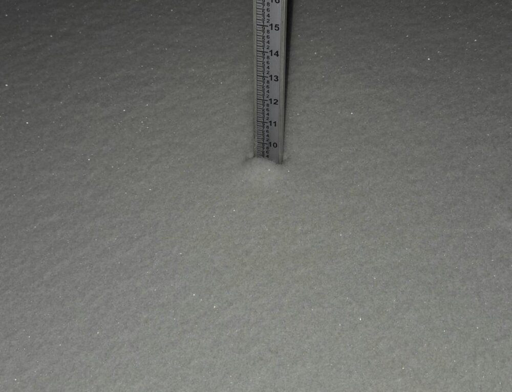
-
Almost always happens when the storm comes in aggressive and heavy that the surface never warms up the way it's modeled to.
-
.thumb.png.4150b06c63a21f61052e47a612bf1818.png)
January 2026 regional war/obs/disco thread
HIPPYVALLEY replied to Baroclinic Zone's topic in New England
Oh how we pray. What did you end up with today in the city? -
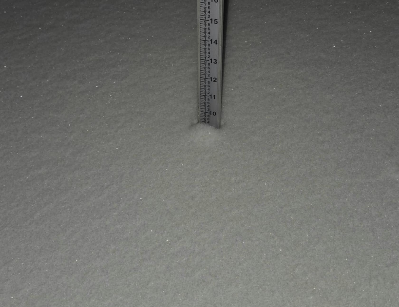
 One last measurement and clear before bed.. 16.3", 1.53" SWE. Still ripping out there
 -
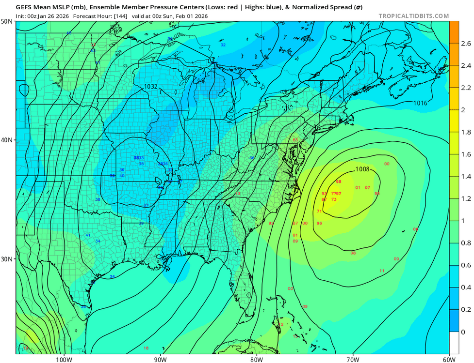
Gefs much closer
-
Gefs on board
-
A thick fog has rolled in with light snow and a current temp of 35 degrees.
-
GEFS more NW
-
967!!! Jesus
-
How is the ice situation up through Middlesex / Union / Essex / the city etc? Down here it’s an ice skating rink; bad. Be safe all. Temp crashing too, 23F and falling.
-

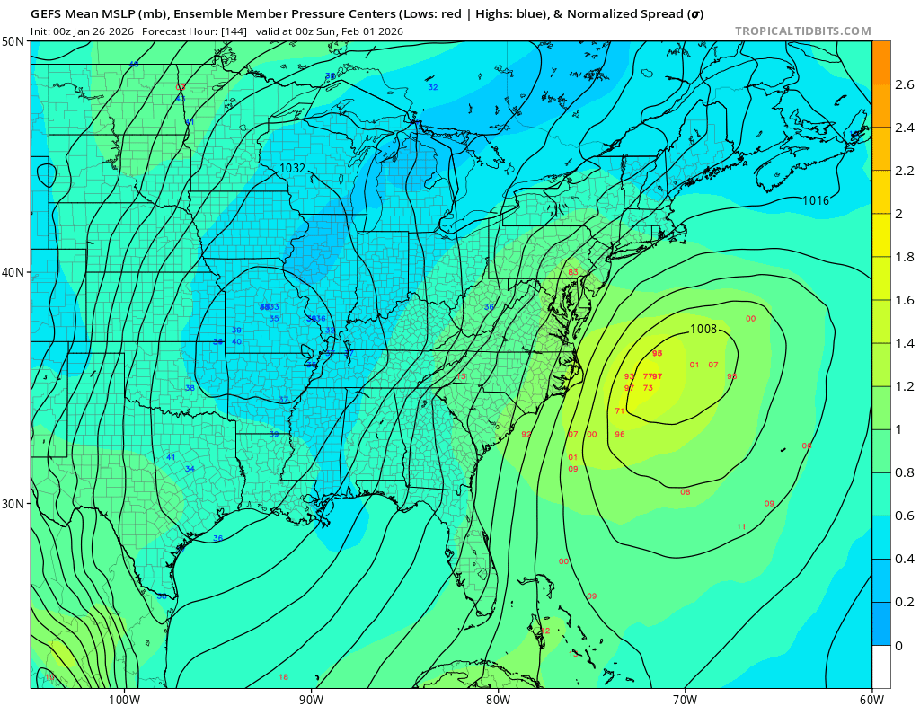
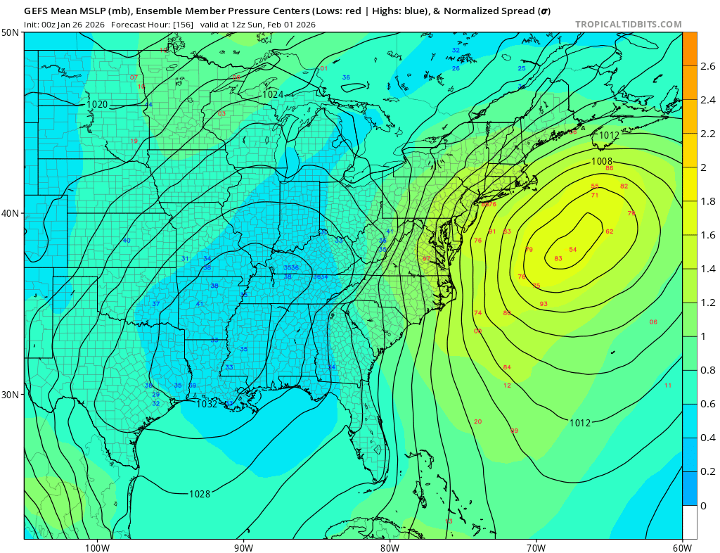
The “I bring the mojo” Jan 30-Feb 1 potential winter storm
BornAgain13 replied to lilj4425's topic in Southeastern States
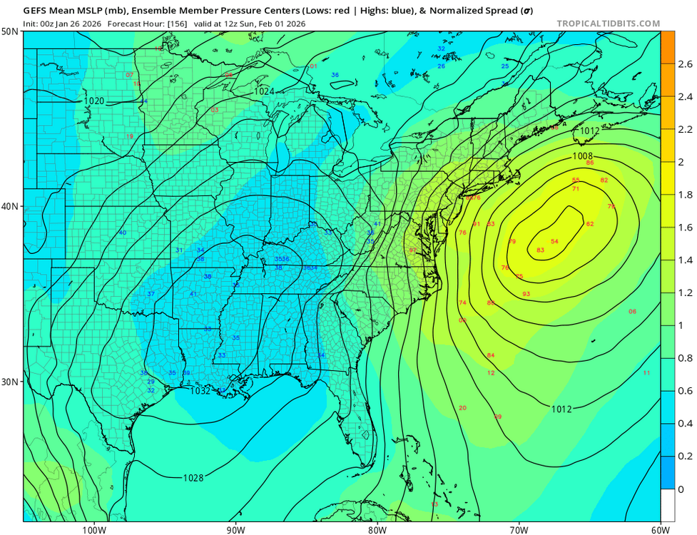
0z GEFS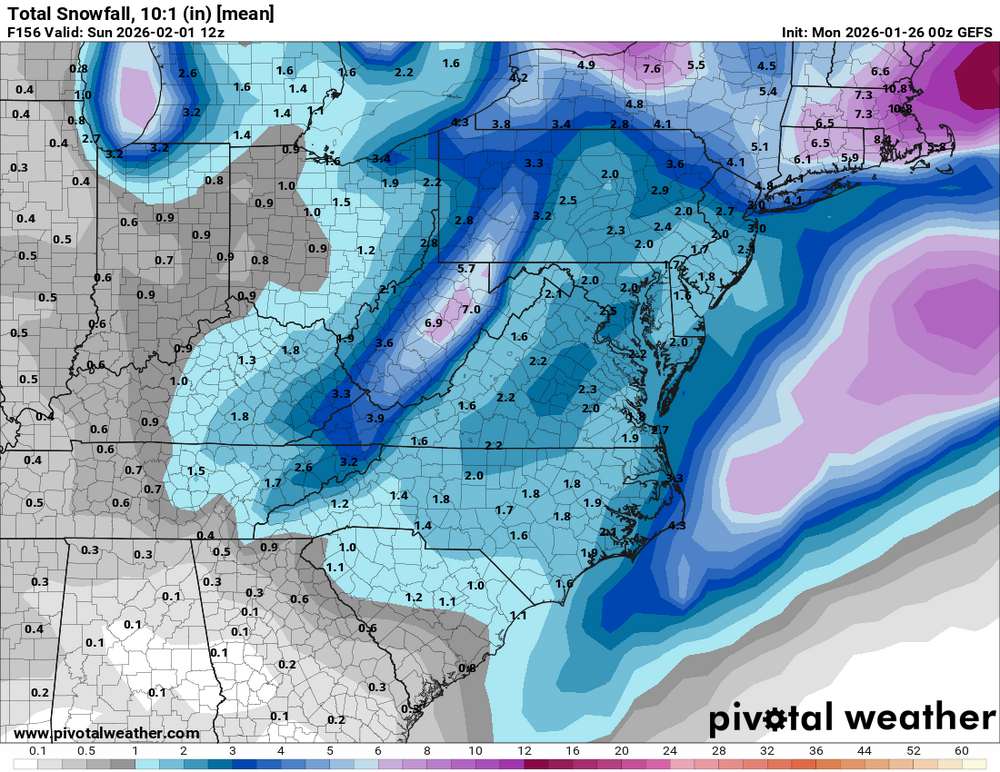
-
Similar here. Approximately 14.5" - 15" settled to 13" I won't be accurate on this one because I'm crashing soon and there will be blowing and drifting tonight.
-
I agree!!!
-
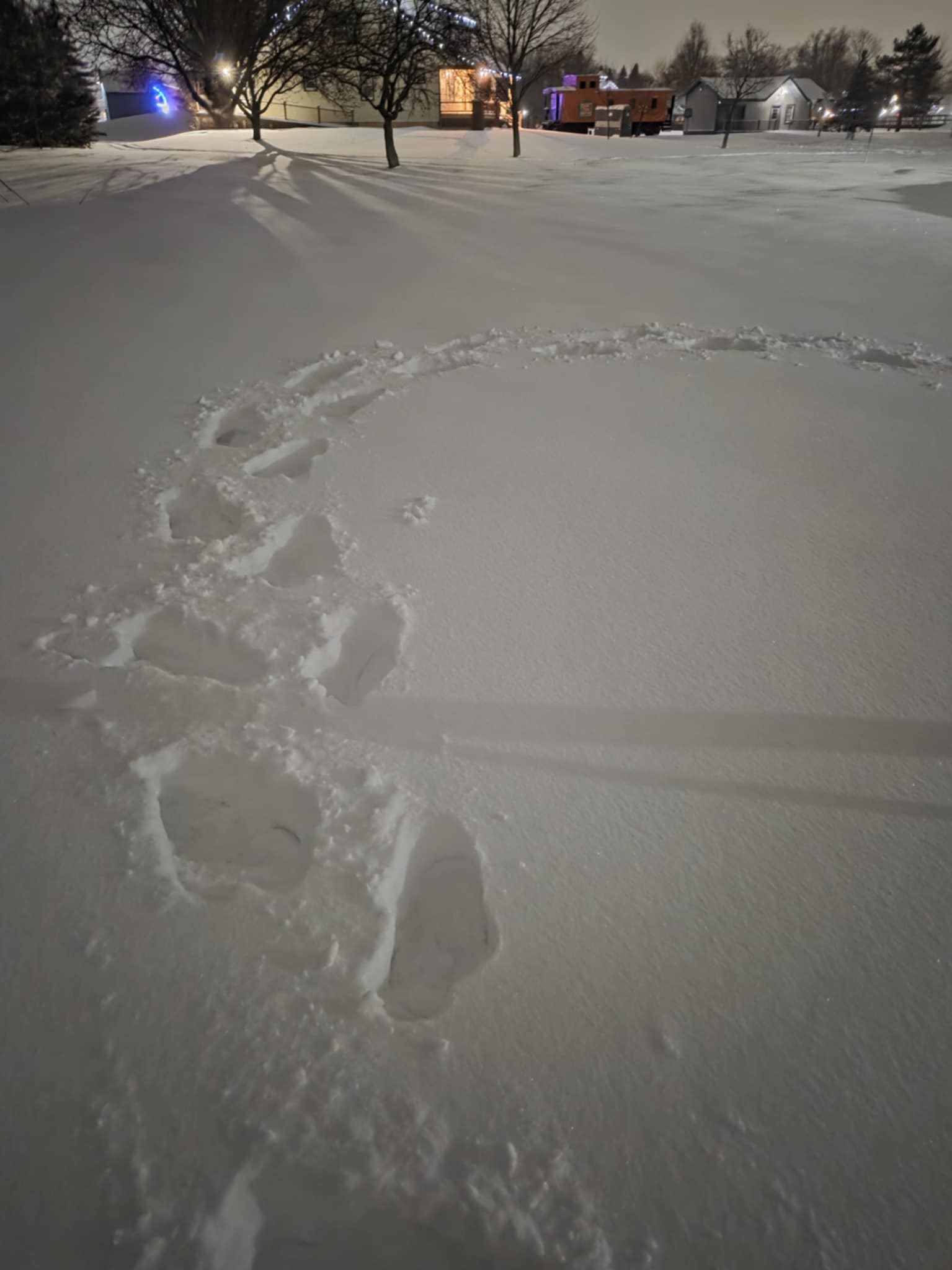
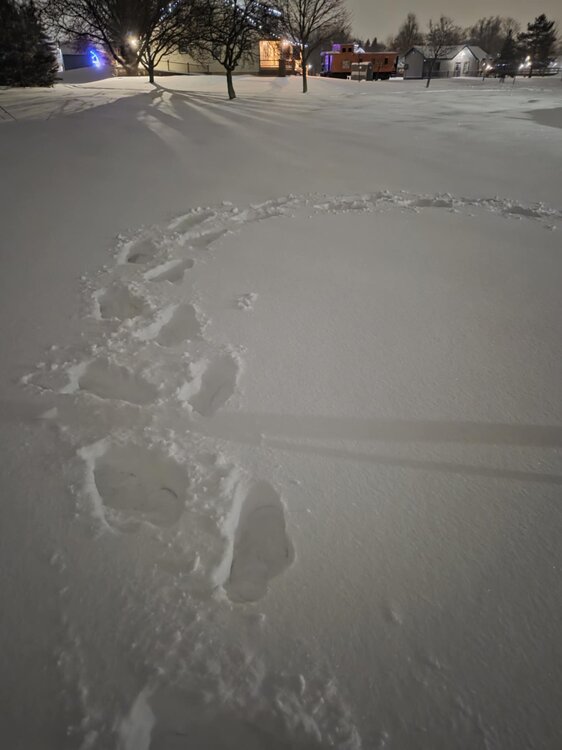
Yup totals will depend on tomorrow evening, but I think we will still wake up to more than expected....you want science, all the dog tracks from the past 2 weeks are filled in. Thats an epic feat...I jest that its science, but it is a big deal it shows how much snow we got and thank goodness I was getting sick of them.
-

The “I bring the mojo” Jan 30-Feb 1 potential winter storm
cbmclean replied to lilj4425's topic in Southeastern States
The sad fact is that me being in the bullseye 6 days out means I am likely already out of the game. -
Pure powder. It makes a big difference even though the snowfall intensity may be lower than earlier today. HRRR has it going a couple more hours and then we're relying on tomorrow. Just want to get to a respectable total.
-
you never know what your gonna get with radar in VT, it's the nature of the business
-

The “I bring the mojo” Jan 30-Feb 1 potential winter storm
chris624wx replied to lilj4425's topic in Southeastern States
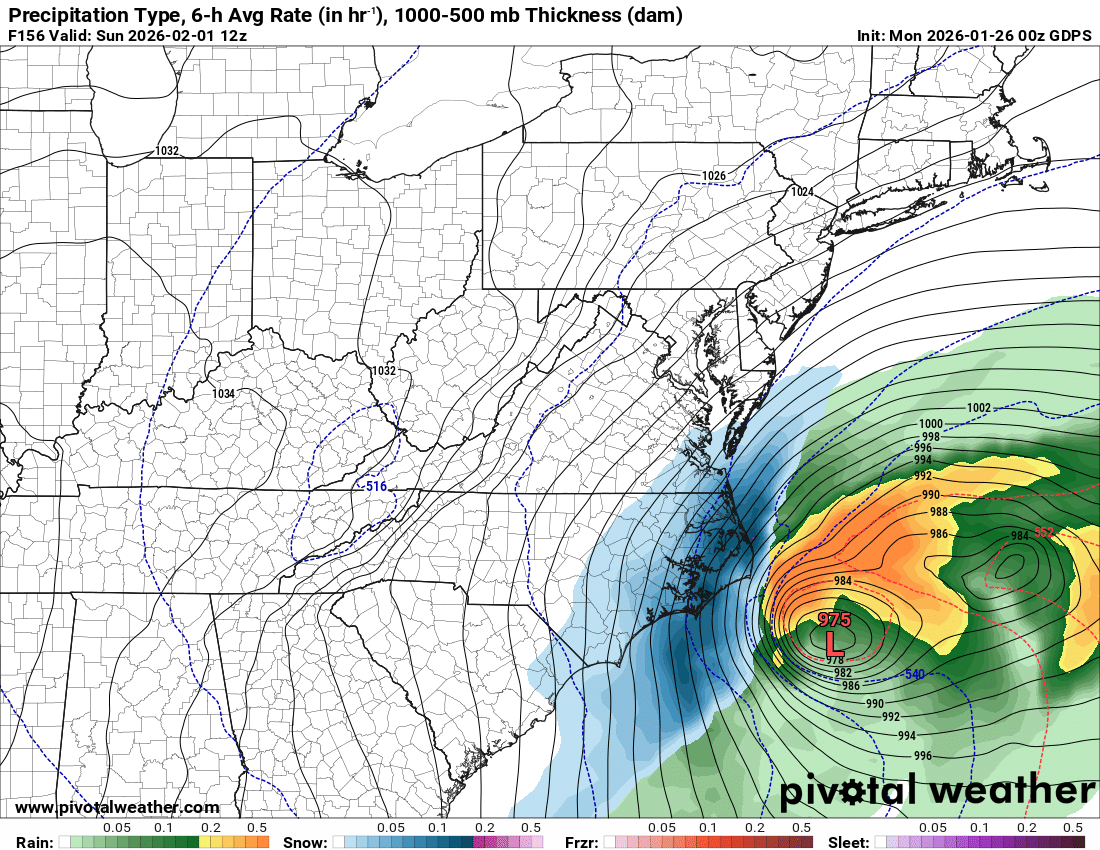
If the NW trend doesn't go crazy, this is how we can get a big snow in NE NC/SE VA! (see last winter) -
 I need to move to you guys' part of town because I still just mist here. Below freezing now though, standing water is starting to freeze up
 -
Richmond Metro/Hampton Roads Area Discussion
chris624wx replied to RIC Airport's topic in Mid Atlantic
00z CMC is a deeper coastal low closer to the coast!
-
another long week of tracking

-
Really curious what the asking is gonna do in like 45 mins
-
I can't go tomorrow but Berkshire East will be fantastic. Probably 16"-18" of dense needle fluff. Medium light with a silky feel but enough weight to feel and roll over like small waves.