All Activity
- Past hour
-
Areas that got the snow today, temps are diving off a cliff this evening with the clear skies.
-

January 18th Back Door NW Trend Snow OBS Thread
KamuSnow replied to Mikeymac5306's topic in Philadelphia Region
Wow, just measured 1.6" additional since the last measurement, makes 3.5" for the day, 5.5" for the weekend. This kind of snuck up on us, lol. I mean the chances were there, but this exceeded expectations for sure. -
Io have no idea. Lord only knows when it comes from his goofy head
-
Areas with even a minimal amount of snow cover are seeing their air temps crash. Parkton mesonet already down to 18 degrees.
-

Rise of the Machines: January 18-19 Winter Storm Obs Thread
CCHurricane replied to WxWatcher007's topic in New England
2.5” @ 8:30PM here in Barnstable/Hyannis. -

Storm potential January 17th-18th
Brasiluvsnow replied to WeatherGeek2025's topic in New York City Metro
we have a very long driveway its on an incline ,,,,,,,,,true story in the old days when I first moved here I drove a thunderbird and when it would snow I would have to back into my neighbors driveway across the street and then look left then right and if no cars or people were coming I would have to gun it to get up my driveway LOL,,,,,fast forward to when one of my other neighbors invited us to there house for a Holiday Party they were introducing me to neighbors whom I had never met and I shake hands with this one guy and who says " OHHHHH your the guy who drives that blue T Bird, I laugh my ass off when it snows and you back up into Gerrys driveway " ---ps my kid is still at work not coming home for a while -
Looking for measurements for our next PNS. Please include location/time of ob. Thanks!
-

Rise of the Machines: January 18-19 Winter Storm Obs Thread
WxWatcher007 replied to WxWatcher007's topic in New England
I know it’s been tough being wrong about winter being over in the northeast since December, but keep your head up. You’ll eventually nail it sometime in March or April. -

January 18th Back Door NW Trend Snow OBS Thread
Ralph Wiggum replied to Mikeymac5306's topic in Philadelphia Region
Thats funny, my wife says the same thing to me every now and again. -
He is referring to Google AI model that you can view on the ECMWF charts: https://charts.ecmwf.int/products/graphcast_medium-mslp-rain?base_time=202601181200&interval=12&projection=opencharts_north_america&valid_time=202601250000

-

Rise of the Machines: January 18-19 Winter Storm Obs Thread
moneypitmike replied to WxWatcher007's topic in New England
AFD update from BOX .WHAT HAS CHANGED... Despite marginal boundary layer temperatures, bands of moderate to heavy snow have developed across much of SE Massachusetts and the Cape. Snowfall reports in these areas indicate that around 1-3 inches of snow has already fallen with an additional 2-4 inches possible. Heaviest snow will continue through 06z before gradually tapering tomorrow morning. As a result, have opted to adjust snow totals to 4-6" with localized amounts up to 7 inches possible. -

January 2026 regional war/obs/disco thread
Damage In Tolland replied to Baroclinic Zone's topic in New England
They seem to be better than the ops at the storm track and areal extent of snowfall . But they are too heavy on the hand with qpf -
Anytime a 'suppression' is mentioned the further north you are the greater the chance of it happening.
-

-
I get the sense that some of our younger and newer posters feel like the more they post, that they will literally "will" the storm closer. Friendly annual reminder that your post count means nothing. We have established "regulars" here with post counts well under what you'd think. Sure, many of us are in the thousands. But who cares? Take it from somebody who grew up on Eastern and then here....you will not gain any favor with people by beating the same horse over and over and over and over again - and posting 3 word posts all day and night. It clutters the thread. Most of us have gone through the phase you are going through. It will either snow or it won't, It's okay to be excited...but you don't have to reply to EVERY post. And not EVERY post needs to be morphed into an inside joke. Sit back and learn a little. Enjoy the hunt. It's okay to read a bit more than you post. THINK about whether you REALLY need to be post every time you go to hit the reply button. In all likelihood (and I mean this in a lovingly/mentoring way) your post will, in the realm of things, be barely a speck in terms of significance.
-
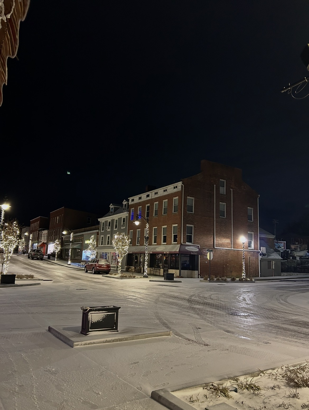
Back edge past here. Just a few flurries remaining. Sure looks nice out there. After no wind all day, was near dead calm since daybreak the wind has picked up some and snow has started blowing off the rooftops. Total for the day 2.8”. Yesterday 3.4” Two day total 6.2”. Total depth currently is exactly 6”. Real nice multi day event!
-
Number 23 and we will call it a season.
-

Rise of the Machines: January 18-19 Winter Storm Obs Thread
Go Kart Mozart replied to WxWatcher007's topic in New England
This evening underachieved a bit down here, but tomorrow I will wake up and it will look like real winter outside! -
I know this is for Philly, but this just underscores the upside potential for this general area in the next 7 days.
-
Havre de Grace got a solid half inch+. Downtown’s total is probably around 6.0” for the season.

-
Probably squeezed out an inch from today. City Metro was too warm, too wet and the storm got going too late
-

January 18th Back Door NW Trend Snow OBS Thread
Hurricane Agnes replied to Mikeymac5306's topic in Philadelphia Region
Holy crap. Just went out to measure (had cleared the board a few hours ago just as it started) and got another 2.5" on top of the earlier 1.25", making it 3.75" for the day and 5.25" over the 2 days. Once that temp got below 32, the stuff started piling up. That officially took me over the foot mark for snow this season so far. Currently partly cloudy (with stars visible) and 27 with dp 26.
-

Storm potential January 17th-18th
WestBabylonWeather replied to WeatherGeek2025's topic in New York City Metro
We’re going to bust low here. Maybe end with an inch. Is what it is. The next few weeks look interesting. -
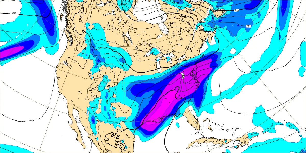
Not that it matters since it’ll be different at 00z, but I don’t think the euro was coming any farther N than it was at the end of its run. My guess is a light-mod snow event if it played out post 144. There was a shortwave sitting over the lakes that was about shunt everything E. We’ll see how the N stream eventually orients itself. Here is 18z euro vs the Ai to better illustrate… .
-
Snowing hard here. Sticking pretty good.