All Activity
- Past hour
-

Feb 22nd/23rd "There's no way..." Obs Thread
wawarriors4 replied to Maestrobjwa's topic in Mid Atlantic
Just got in from Richmond back to Stafford. Snow, 32 1.6 inches on the board -

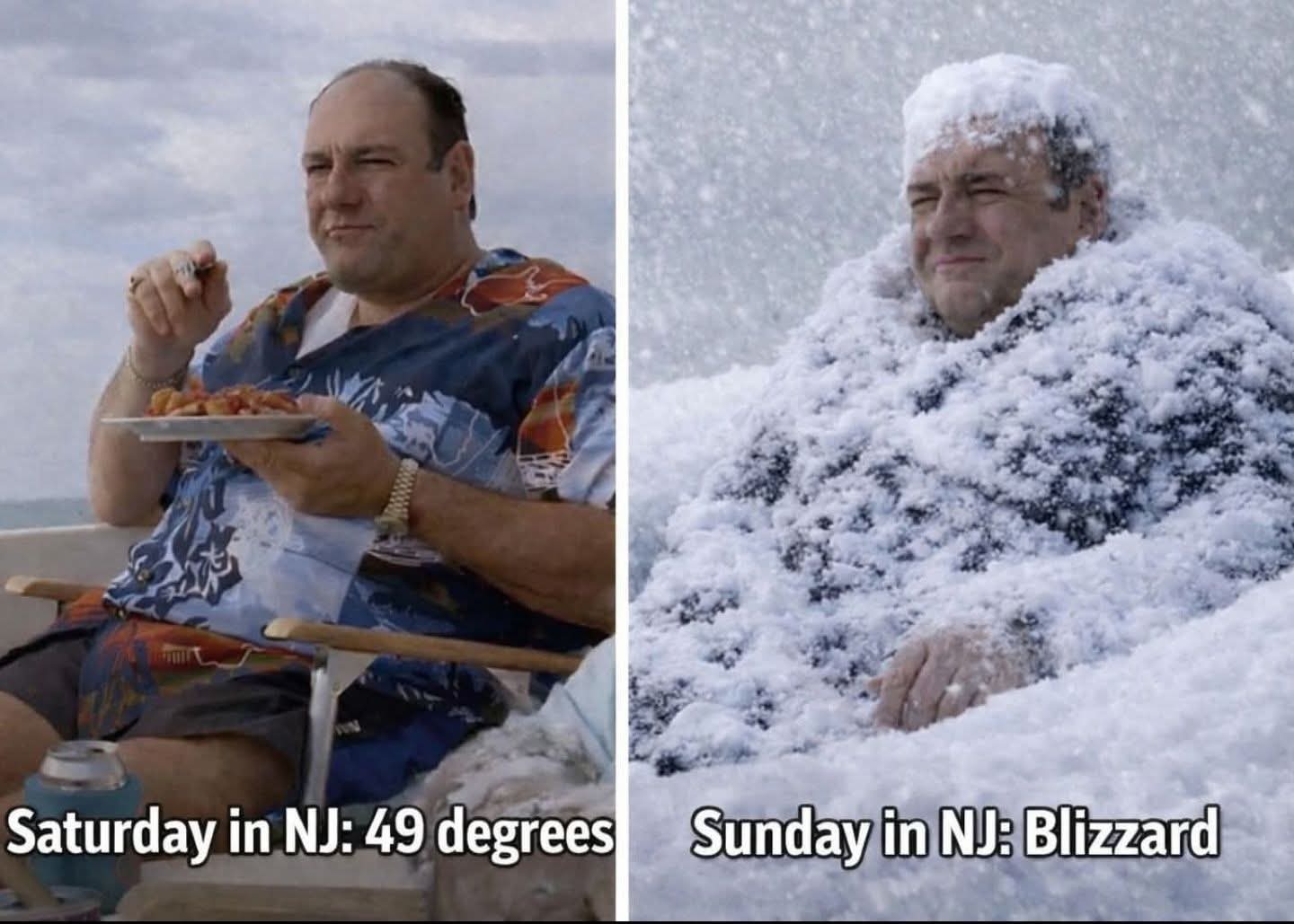
"Don’t do it" 2026 Blizzard obs, updates and pictures.
WxWatcher007 replied to Ginx snewx's topic in New England
I’m in East Hartford. Let’s rock. -
what i see there is the best bands stopping just south of staten island....a thing i've seen before.
-
What bourbon is everyone drinking tonight?
-

Feb 22nd/23rd "There's no way..." Obs Thread
mitchnick replied to Maestrobjwa's topic in Mid Atlantic
18z Euro w/norlun obviously!.thumb.png.c6394fdd6db4ba2ff3780857bf82e094.png)
-

Feb 22nd/23rd "There's no way..." Obs Thread
MillvilleWx replied to Maestrobjwa's topic in Mid Atlantic
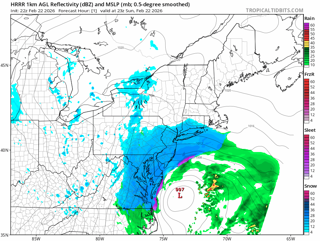
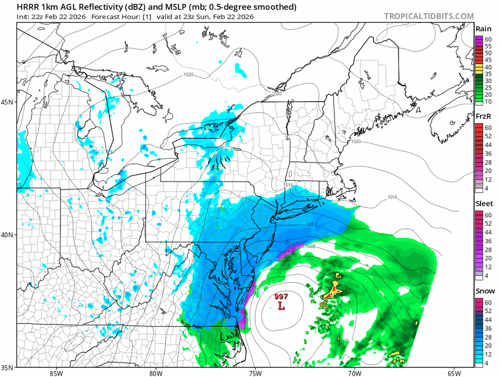
The model ratio on the NBM is too high and it’s overshooting the QPF. Unless I’m completely missing something (plausible), this will be overdone west of the bay outside the norlun, which you can see is absent from this output because it’s a blend. -
So far even moderate snow has been having a hard time rotating / backing into my area of NJ. Still just light snow with small flakes. Eyeballing 1/4 to 1/2" tops.
-

“Cory’s in NYC! Let’s HECS!” Feb. 22-24 Disco
VivaManchVegas replied to TheSnowman's topic in New England
We live in different times. We all have enough information in the palm of our hand, sometimes too much. We lived in SNH at the time and my dad was smart enough to get out of Boston early as he was a Local 103 member. I should revisit that with him and why he got out on time. But anyway, it is interesting to note I think SNH did not get that much snow but the drifts were crazy. Our neighbor had a drive in basement garage that was completely covered over by snow. It appears the wind will be wild with this one. -

Feb 22nd/23rd "There's no way..." Obs Thread
Maestrobjwa replied to Maestrobjwa's topic in Mid Atlantic
Lol....told y'all the last week of Feb was bad fortune for warning level snow! This definitely will NOT count--best we get is a couple inches during this week. Gotta be either before Feb 20th or after March 1st! -
Early afternoon. Light stuff may linger but probably end of accumulations by 1 or 2
-

“Cory’s in NYC! Let’s HECS!” Feb. 22-24 Disco
HoarfrostHubb replied to TheSnowman's topic in New England
Dec 2007 didn’t care if people had AWD or FWD -

Feb 22nd/23rd "There's no way..." Obs Thread
Whitecheddar replied to Maestrobjwa's topic in Mid Atlantic
-

Feb 22nd/23rd "There's no way..." Obs Thread
Random Chaos replied to Maestrobjwa's topic in Mid Atlantic
35.2F, moderate to heavy snow, minimal sticking - mostly melting on contact. -
Still snowing 18hrs from now.
-

"Don’t do it" 2026 Blizzard obs, updates and pictures.
Ginx snewx replied to Ginx snewx's topic in New England
1 or 2 lol Where in the World is Donny Bell? -

Feb 22nd/23rd "There's no way..." Obs Thread
EastCoast NPZ replied to Maestrobjwa's topic in Mid Atlantic
We could've had 2 - 3 inches today if it had been colder. 5 - 6 hours of moderate snow with absolutely nothing to show for it. This part of the storm was always what we were getting. Clear for a while that we were missing all of the coastal, and anyone thinking a Norlun was happening out here has never paid attention to weather out here. The 10 year curse continues. -
This is a Miller Highlife storm.
-

Feb 22nd/23rd "There's no way..." Obs Thread
TheColtrane replied to Maestrobjwa's topic in Mid Atlantic
An incredible 0.75" on my deck in Reston so far. At least 0.25" on the pavement. -
Sidewalks and neighborhood paved surfaces all slushy and getting snowy. Wind picking up. Probably accumulated 0.2-0.3” in my 40 min @Jebman Jebwalk
-

Feb 22nd/23rd "There's no way..." Obs Thread
JakkelWx replied to Maestrobjwa's topic in Mid Atlantic
4.2" -
Part 2 of my Blizzard of 78 comparison "rant"! So for the meteorological aspects of this storm compared to the Blizzard of '78?, it really does not hold a candle to it IMHO. Yes, I know the intensity of the low pressure itself will be stronger than than 78 and the pressure difference from the low S of New England and the high pressure center over western Ontario is significantly larger now than 78, but that is just one aspect, and you can't treat one factor in a vacuum or use single aspect, and say, "it's going to be worse for sensible weather!" That's not how it works in the atmosphere as many other factors come into play. The upcoming storm will not stall for 24 hr like the Blizzard of '78 did. The pattern is progressive and not blocked. Also, when the Blizzard of '78 stalled and rapidly deepened, it was in an absolutely ] ideal location for southern New England to get the worst of it. In many storms, there is a "sweet spot," so to speak, where the low rapidly intensifies and one area, usually N of the sfc low, gets the max sensible wx impacts, whether than be the most intense precip rates or or highest winds. For this storm, the RI will take place tonight not far off the Delmarva, well S of the region, by the time the low gets close enough for its biggest impacts to the region, that rapid intensification period is done. Oh, don't get me wrong, it is still a very powerful storm, but we are not in the absolute "sweet spot" like we had in the Blizzard of '78. Yes, I know I sound like I am splitting hairs here, but these details count. For instance, it may be the difference between getting "only" 3"/hr snowfall rates instead of 5"/hr. I know looking from a broad view that may seem insignificant, but snowfall rates do count for impact, esp. for airport operations and road crews. The overall pattern over NAMR now is nothing like it was leading up and during the Blizzard of '78. This is the biggest difference overall. For 78, the evolution was about as ideal and extreme as you could get, with a very deep trough amplifying in the eastern U.S. to form a very large, cut-off low pressure at 500 that stalled. At the same time, an enormous ridge built up in the western U.S. and Canada, actually forming a cut-off high pressure at 500 in Canada, which is quite rare, in fact, the only case I know of for a big East Coast storm. It was about as textbook classic as you could get! This NAMR pattern in Feb 78 was along the lines of what happened for the Blizzard of '93. Not exactly the same pattern for the 1993 storm (the "triple phaser!"), but still extraordinary, and the result both times were record storms. The pattern now? You look at it yesterday and the day before, and it looks nothing that unusual, and actually it was pointed out to me two days ago, "would you think looking at the 500 over the Lower 48, a blockbuster blizzard would occur on the East Coast a few days later???" So kind of non-standard or lacking classic setup, but the wx has virtually endless combinations and can spit out some odd events that don't fit the textbook classic what you learn in college! This is what keeps forecasting a challenge and enjoyable, always learning! And how about the other big thing w/ the Blizzard of '78?, the coastal flooding, and not just one big storm tide, 4 in a row, and many locations had their highest storm tide on record, which was not exceeded in some locations until 2018. Not going to see that w/ this storm. There should be some significant coastal flooding, but since the storm is moving along, and the actual size of the storm is not as quite large to set up a big wind fetch which really builds the storm tides, I don't see how you can compare much to 78. Another item? There was a frigid arctic air mass in place in the NEUS prior to the Blizzard of '78. We don't have that this time. This does make a difference often for total precip. Having a frigid air mass at low-levels makes for great overrunning. Recall the big storm last month? That had a frigid air mass in place, yet | rather weak sfc low development, but it didn't matter for blockbuster snow amounts. Now this time, we have an intense surface low, so that in itself will result in a lot of precip. But compared to 78, which had an intense surface low *and* a frigid air mass in place for it to run into, that made for some exceptional snowfall amounts. Regarding snowfall, no model is forecasting 3 ft or more snow for any location. Max amounts in the Blizzard of '78 reached 50" in RI and eastern MA. 3 feet was widespread. So the Blizzard of '26 is not forecast to have snowfall amounts *this* high, so one needs to be careful when bringing up our "big one" for comparison since it can and does cause confusion, worry, and stress, among other things! I would say that this blizzard will be a lot like the Blizzard of '13, which was a solid biggie/classic in all respects. That *should* be enough for CoastalWx, and Weatherwiz for that matter! LOL. Weatherwiz though w/ his uber level of excitement (exceeding CoastalWx I think now) will not be happy w/ anything less that 0SM TSGS+ SNOINCR 6 at his home!
-

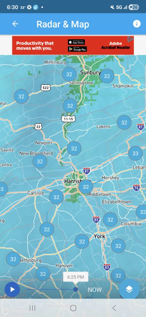
Central PA Winter 25/26 Discussion and Obs
Jns2183 replied to MAG5035's topic in Upstate New York/Pennsylvania
That's special Sent from my SM-S731U using Tapatalk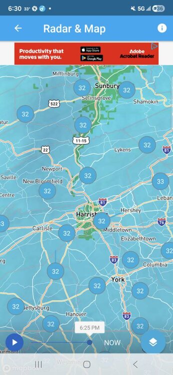
-
Heavier band moving into Brooklyn, should reach CPK in 20 or so
-

February 2026 OBS & Discussion
CPcantmeasuresnow replied to Stormlover74's topic in New York City Metro
In the words of Tom Petty, they won't back down. Good to see.


.png.e740325e12bd393767fb8cd62ff1aa1d.png)