All Activity
- Past hour
-
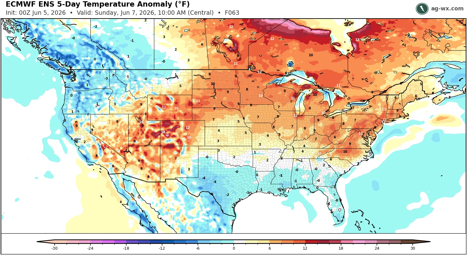
Yeah, step-by-step we are getting into summer now. Everyone rejoice!
-
Next week looks hot after Monday. Tuesday won’t be scorching but it’s getting there
-

Texas 2026 Discussion/Observations
Stx_Thunder replied to Stx_Thunder's topic in Central/Western States
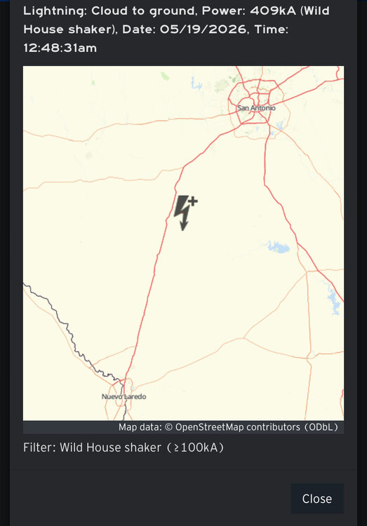
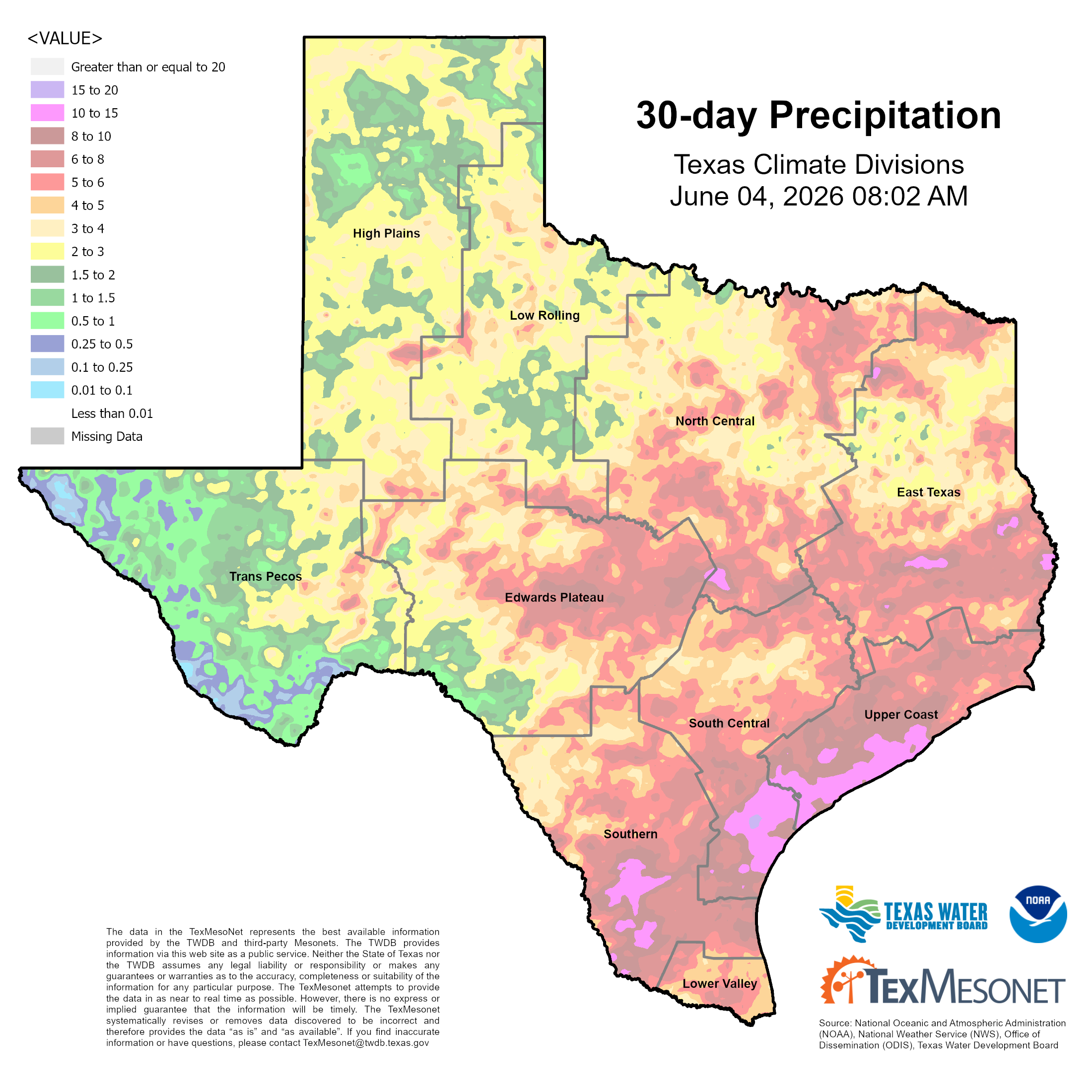
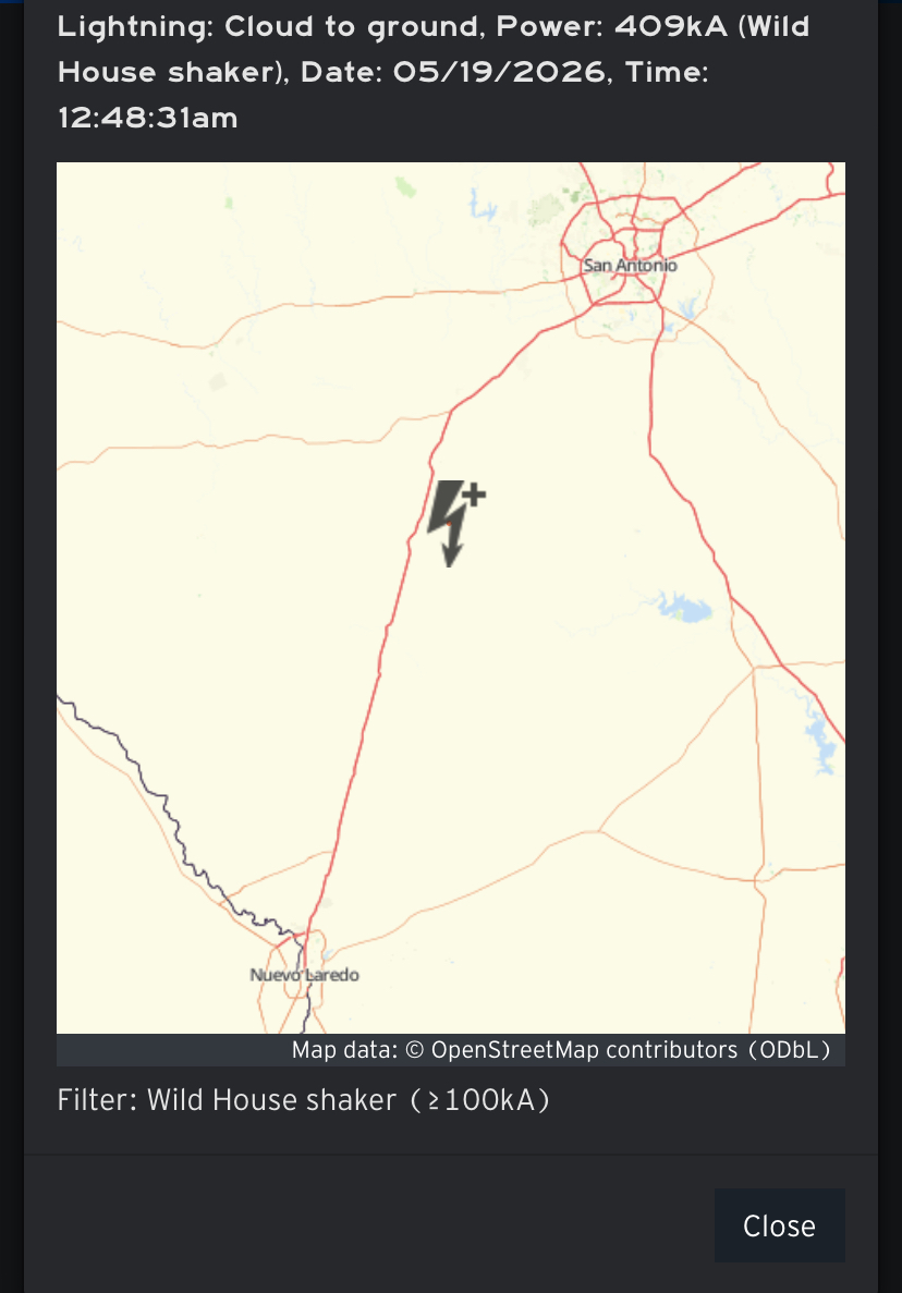
Definitely been quite substantial MCS activity the past 2 weeks before May ended. With a good amount of power outage-causing CG lightning (even structural lightning fire & damage reports also). Along with severe wind and flood reports at least over the southern part of state. With all the steep ML lapse rates (over -8) that were definitely in place, there were even a few very powerful + CG lightning strikes. And the most powerful + strike (400 kiloamps), I've ever seen on lightning strike data that must've sounded like a hydrogen bomb even 40 miles away. - - - - - S/SETX has gotten the most rainfall with over 10 inches now in the past 30 days. With some spots over a foot in the Coastal Bend region.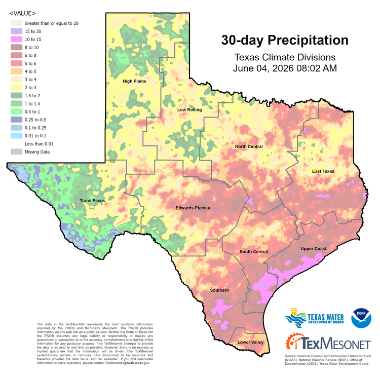
-

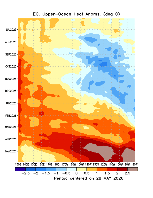
2026-2027 Strong/Super El Nino
mitchnick replied to Stormchaserchuck1's topic in Weather Forecasting and Discussion
-
Code orange air quality alert here today
-
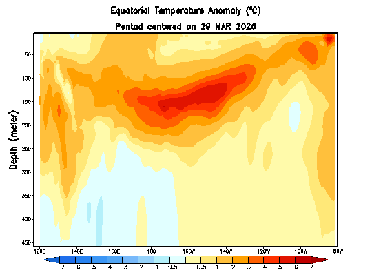
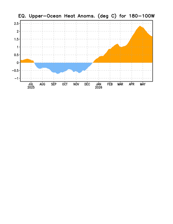
The super El Niño warmth has traditionally began later in the summer and persisted into the following summer. So this year we are getting off to an early start with the warmth. Even against the warmest 1991-2020 means, the ensembles have the usual warm spots close to +7 to +10 over the next 10 days. Since normal highs this time of year are only in the upper 70s to around 80° next week.


-

Central PA Summer 2026 Discussion/Obs Thread
mahantango#1 replied to Voyager's topic in Upstate New York/Pennsylvania
- Today
-
Some signs of life in the long range as tropical moisturizer potentially heads our way
.thumb.png.1b28b07ee543b1ace44b1befc75931fd.png)
.thumb.png.7985eb053e07c6b5298e94496803fcfb.png)
-

Central PA Summer 2026 Discussion/Obs Thread
pawatch replied to Voyager's topic in Upstate New York/Pennsylvania
48 degrees this morning. More clouds -
I actually think the risk could extend right to the coast, but they’re probably going with typical climo.
-
-

Central PA Summer 2026 Discussion/Obs Thread
Voyager replied to Voyager's topic in Upstate New York/Pennsylvania
Yesterday's high and low were 87 and 48, which is a testament to the dry air currently in place. The deserts outside the Phoenix heat Island were the same. The other positive to that is/was the clear air with no haze. -
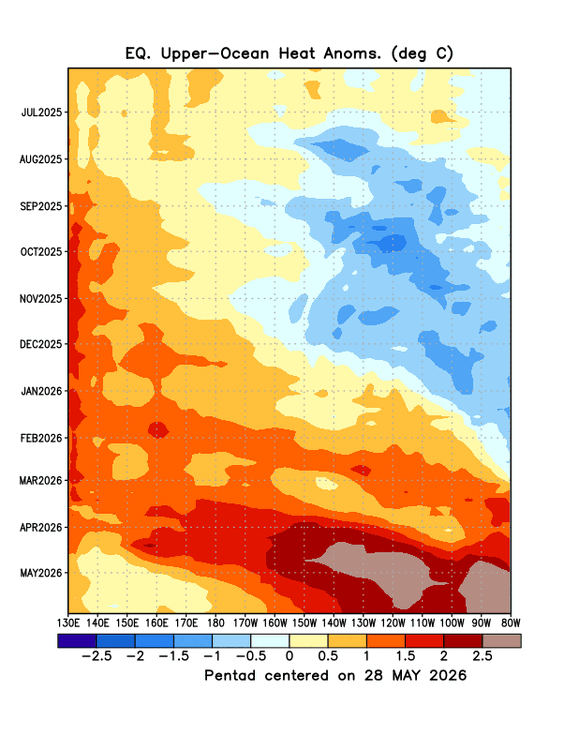
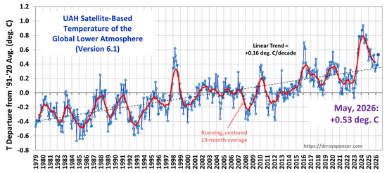
UAH6 spiked up in May. Matching the timing of the initial rise in other recent strong/super ninos (1997, 2015, 2023). The rise in UAH is a sign that tropical moist convection is increasing.
-
Still think storms on Saturday evening and then again Sunday aftn. Obviously not everyone sees them, but NAM has decent mid level lapse rates (700-500mb) moving in Saturday evening. Hopefully we have a decent Sunday until about 2p or so.
-
Still signs trough retros to GL and hopefully a more humid second half of the month.
-
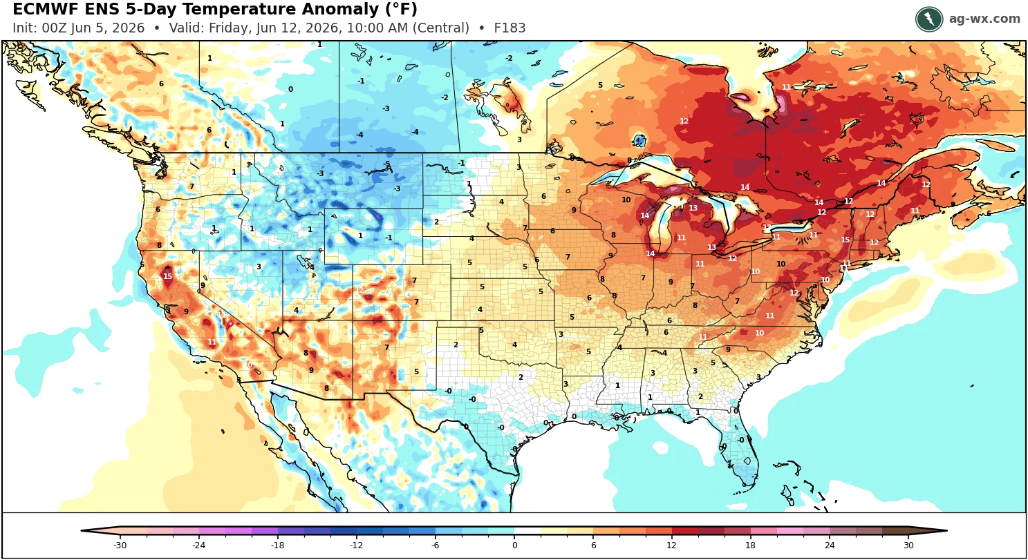
Bit of a heat wave signal later next week and then maybe a "normal" summer pattern for third week of June.
-
55/50 right now. I'll take 85-90 by day and 50-55 by night all summer! That would probably result in some moderate drought conditions tho'...
-

Central PA Summer 2026 Discussion/Obs Thread
TheDreamTraveler replied to Voyager's topic in Upstate New York/Pennsylvania
These models have been laughably bad. I've noticed the temp on Monday climbing up a degree or two literally every single day for days now. -
Yeah h5 heights are generally + to ++ throughout that 18z run. phantom stalling TC building lower heights along the SE Coast, so that may be some of it...right or not
-
-
Good
-
Is there a "magic" PDO range that we want for sustained cold and/or snow during an El Nino winter? Do we even have a large enough sample size for any statistical significance?
-
Promising squall line collapsed and dissipated over the western metro. Barely wet the sidewalk here.
-
Big differences between Winter 15-16 and 23-24, probably contributed to something along the lines of the PDO (15-16 was >+1, 23-24 was <-1).


.png.94a2930536ec80e92518f9046258a101.png)
.png.5ceb354da7a55677d27bb582d326dc7c.png)


.thumb.gif.f92b16c631a1d15d405ed77b33f0710d.gif)


