All Activity
- Past hour
-

First Winter Storm to kickoff 2025-26 Winter season
dendrite replied to Baroclinic Zone's topic in New England
NAM is still very amped. Nice model battle. Back to bed. -
Who remembers the huge ice storm we got the first week of December 1989? I was in Wilson Co.. Sleet was like 6 inches deep...ice cycles were a foot long but like 6 inches wide? No power...the WRAL tower collapsed! Man I miss those storms we used to get!!
- Today
-
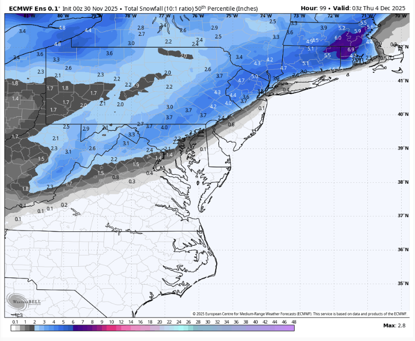
First NWS snowfall map - looks like the NBM, i.e., a compromise between most of the models showing little to no snow along/SE of 95 and the Euro/AIFS camp which are obviously more bullish on 95 snowfall.
-
Nov 28-30th Post Turkey Day Winter Storm
patrick05 replied to Chicago Storm's topic in Lakes/Ohio Valley
-

E PA/NJ/DE Winter 2025-26 Obs/Discussion
RedSky replied to LVblizzard's topic in Philadelphia Region
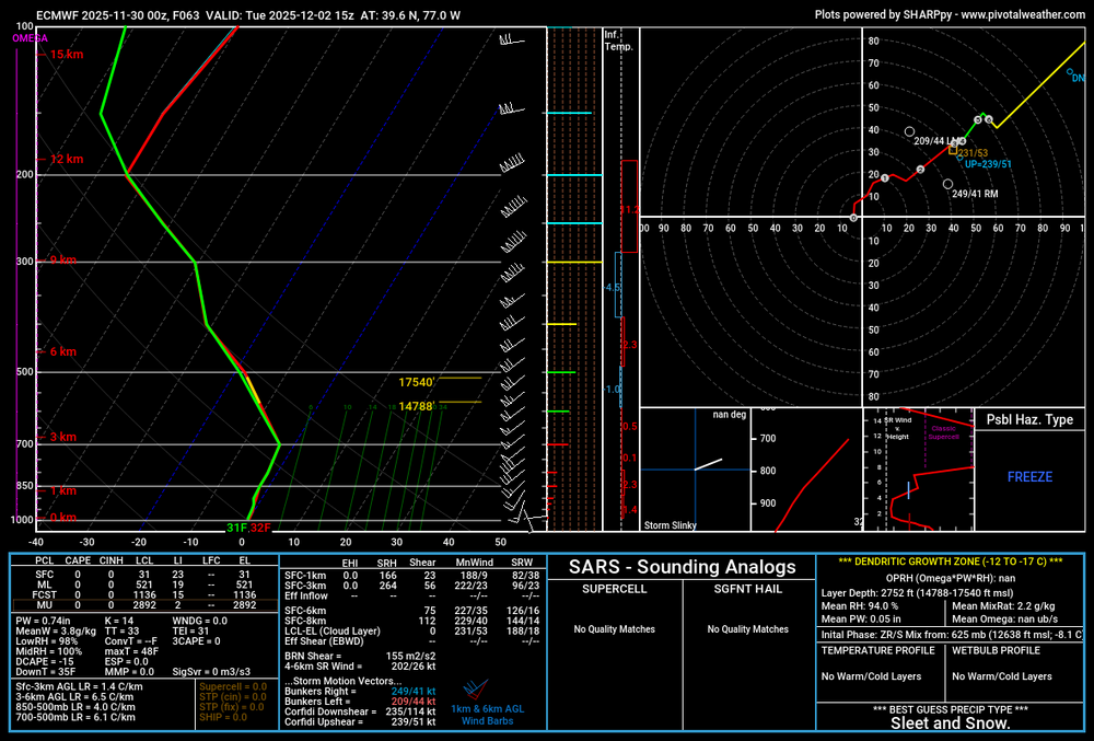
0z euro congrats Ralph lucky 7" Doylestown -
.thumb.png.4150b06c63a21f61052e47a612bf1818.png)
First Winter Storm to kickoff 2025-26 Winter season
HIPPYVALLEY replied to Baroclinic Zone's topic in New England
Man, NAM is out to lunch but I would take my chances riding those dynamics in Greenfield, despite my low elevation. -
.thumb.png.4150b06c63a21f61052e47a612bf1818.png)
December 2025 regional war/obs/disco thread
HIPPYVALLEY replied to Torch Tiger's topic in New England
You’re back! I wasn’t worried, just disappointed in your prolonged absence. I think it will be a fun winter for all in SNE. Especially inland. -
Nov 28-30th Post Turkey Day Winter Storm
TheNiño replied to Chicago Storm's topic in Lakes/Ohio Valley
Still going here in Kenosha at 1am. LES adding to the totals. Wind was ripping earlier and was actually kinda worried about my flag pole. My bird feeder isn’t doing well lol. But now it’s so peaceful. What a great fucking long duration storm this has been. -

First Winter Storm to kickoff 2025-26 Winter season
WinterWolf replied to Baroclinic Zone's topic in New England
I’m no MET, but that’s not a bad look at this juncture imo. Thank you for posting Will. -
Nov 28-30th Post Turkey Day Winter Storm
frostfern replied to Chicago Storm's topic in Lakes/Ohio Valley
Making up for the slow onset by avoiding the dry slot. Good night! -

First Winter Storm to kickoff 2025-26 Winter season
ORH_wxman replied to Baroclinic Zone's topic in New England
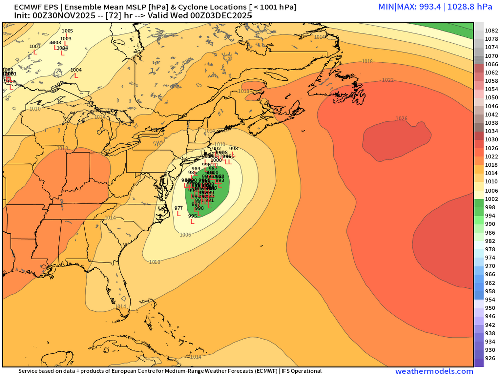
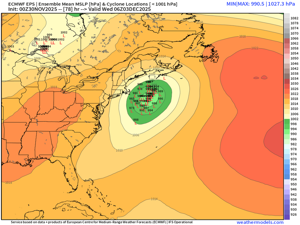
They look a bit juicier than the OP in terms of amplification but not by much. But that’s prob a good sign we’re gonna see model convergence. Betting OP is still a bit too flat -
35/24 here in the nw bronx. Might we see some flakes before dec?..it feels like snow outside rn.
-

First Winter Storm to kickoff 2025-26 Winter season
WinterWolf replied to Baroclinic Zone's topic in New England
How does the EPS look? -

First Winter Storm to kickoff 2025-26 Winter season
ORH_wxman replied to Baroclinic Zone's topic in New England
Euro AI itself is a massive hit for us in the moderate interior. But trusting any OP right now is asking for trouble. I think we’d take a model blend right now and run. -
-

Nov 28-30th Post Turkey Day Winter Storm
Chicago Storm replied to Chicago Storm's topic in Lakes/Ohio Valley
8.7" here at home as of midnight. -
I know man. So close but so far. Always the case. Hopefully things trend colder for us in future runs.
-
Nov 28-30th Post Turkey Day Winter Storm
thomp2mp replied to Chicago Storm's topic in Lakes/Ohio Valley
Flew into Bishop from Nashville this evening (pretty smooth flight given the circumstances). Probably under 2" on the ground at FNT when we landed around 9:45 but boy was it a slick drive home. Took an hour to get to Waterford from the airport via 75 and Dixie Hwy. Kept it around 40mph the whole way to Exit 93; two tracks at best on the interstate and snow-covered mainline roads. Still barfing snow out, NWS DTX reported 3.1" at 1AM in White Lake, I'll go out and measure in a bit after this titillating ND/Stanford game -

Nov 28-30th Post Turkey Day Winter Storm
HillsdaleMIWeather replied to Chicago Storm's topic in Lakes/Ohio Valley
Last little burst coming through here, what a lovely storm. -
First Winter Storm to kickoff 2025-26 Winter season
H2Otown_WX replied to Baroclinic Zone's topic in New England
Do we value them? Is AI doing better than the regular Euro? -
-

December 2025 regional war/obs/disco thread
H2Otown_WX replied to Torch Tiger's topic in New England
Man, that was one hell of a weenie run from the 00z Euro. Guess it can only get worse from here lol. I imagine December '95 was a bit similar to what it's showing. No KU but just a nickel 'n dime pattern with 3-6/4-8" type events every 5 days or so. -

Nov 28-30th Post Turkey Day Winter Storm
Chicago Storm replied to Chicago Storm's topic in Lakes/Ohio Valley
8.4" at ORD as of midnight. 8.0" at RFD. This snowstorm is now tied for the 5th largest on record in November for Chicago. -

First Winter Storm to kickoff 2025-26 Winter season
40/70 Benchmark replied to Baroclinic Zone's topic in New England
Man, EURO AI ens are enfuego. -

Central PA Fall Discussions and Obs
Superstorm replied to ChescoWx's topic in Upstate New York/Pennsylvania
Euro bumping things up. .


