All Activity
- Past hour
-
 Scooters boss @vortex95should really go wild overnight!
 -

Strong Nor'Easter/Hybrid Storm Late September 2026
donsutherland1 replied to Rjay's topic in New York City Metro
The 18z NBM: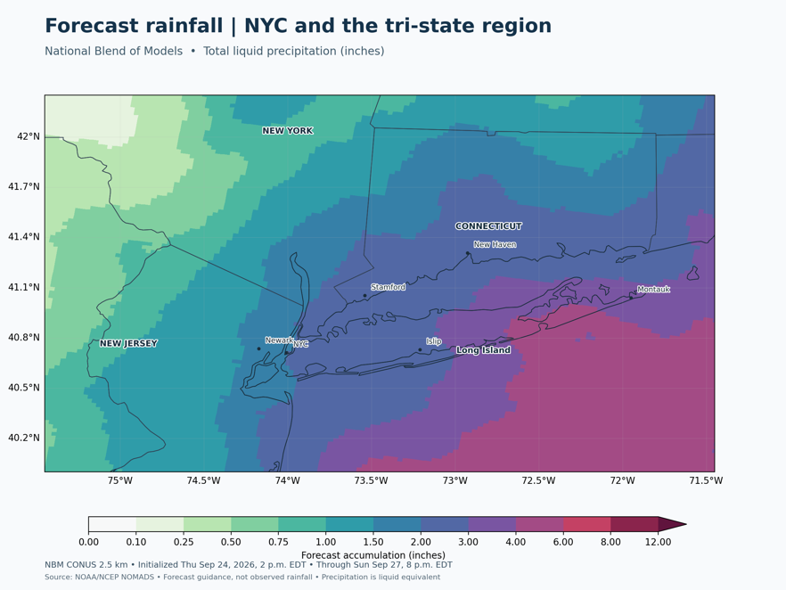
-

Strong Nor'Easter/Hybrid Storm Late September 2026
jconsor replied to Rjay's topic in New York City Metro
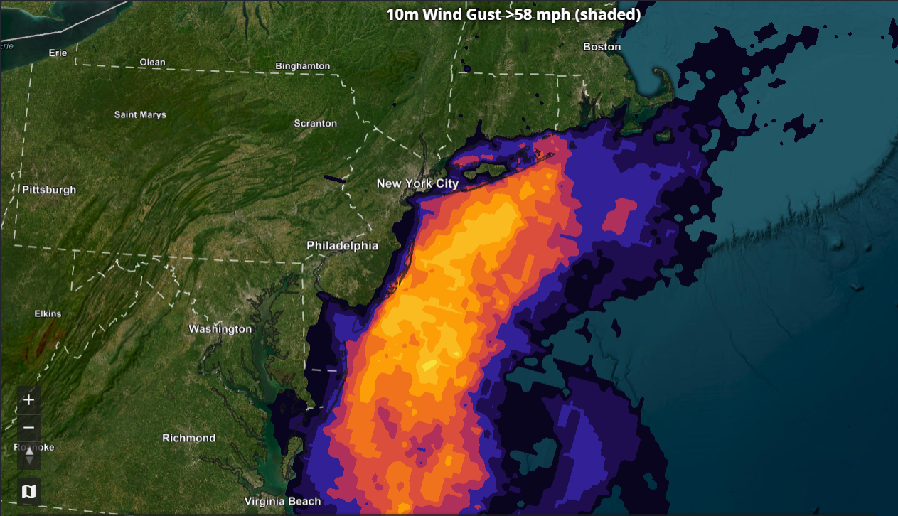
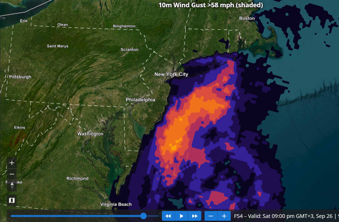
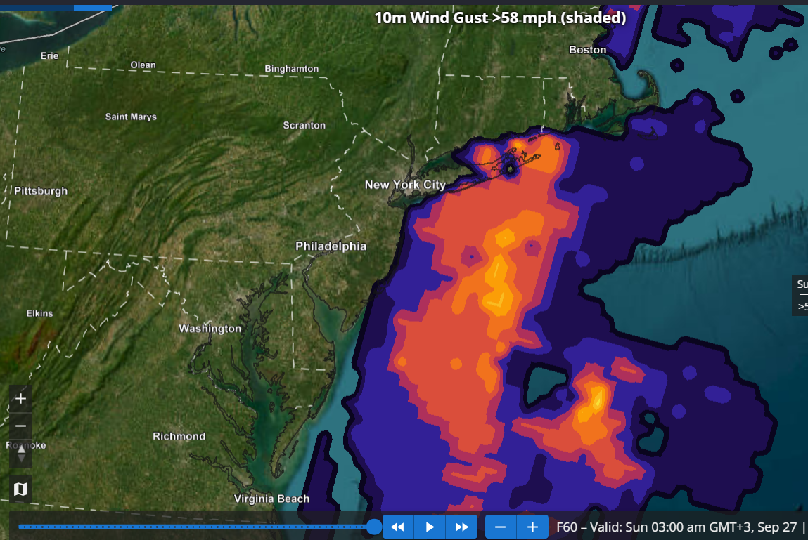
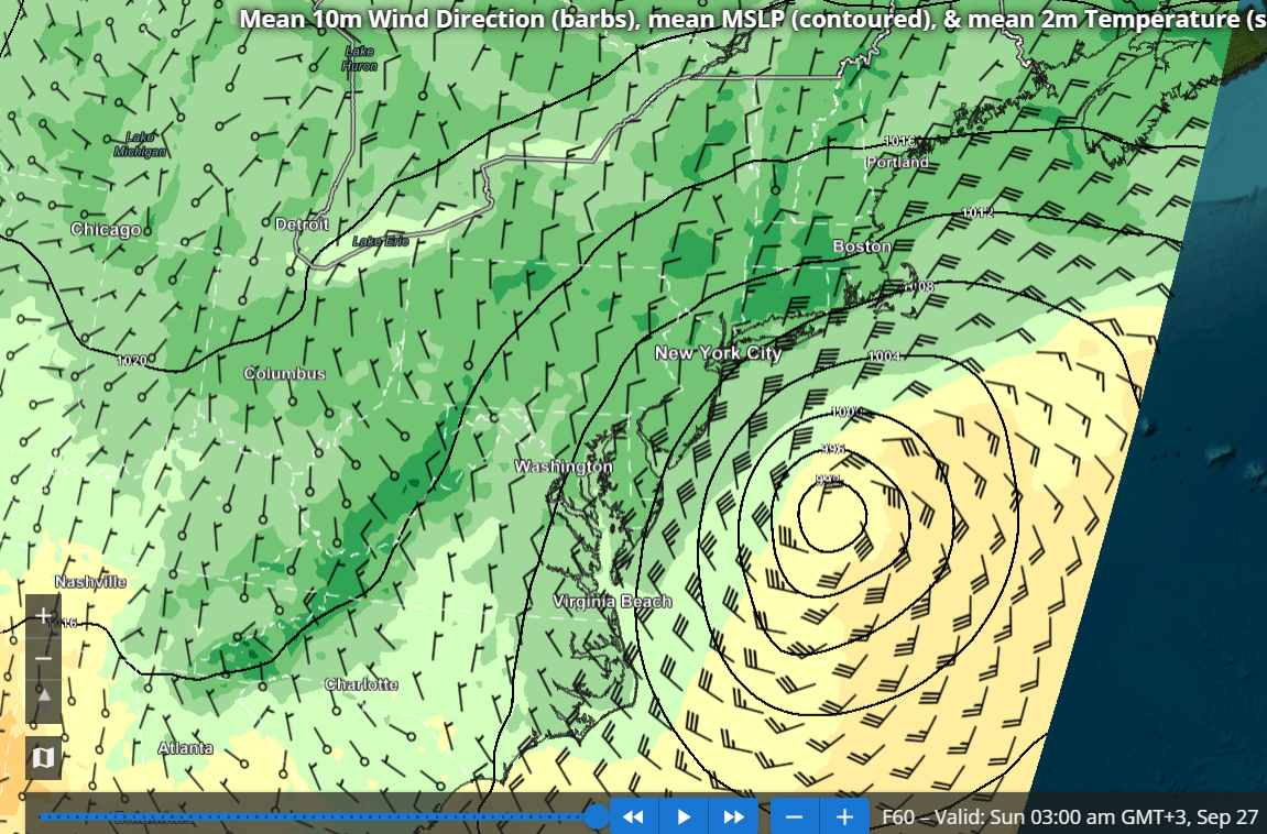
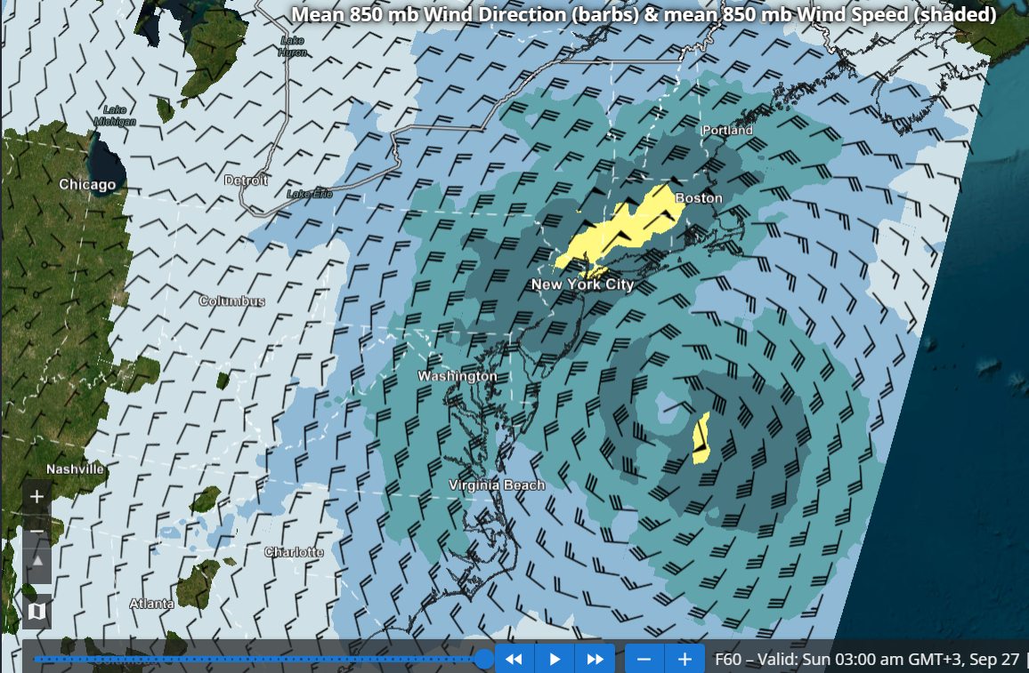
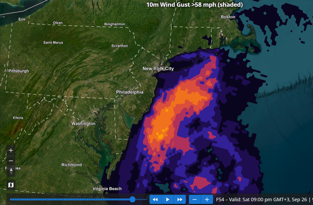
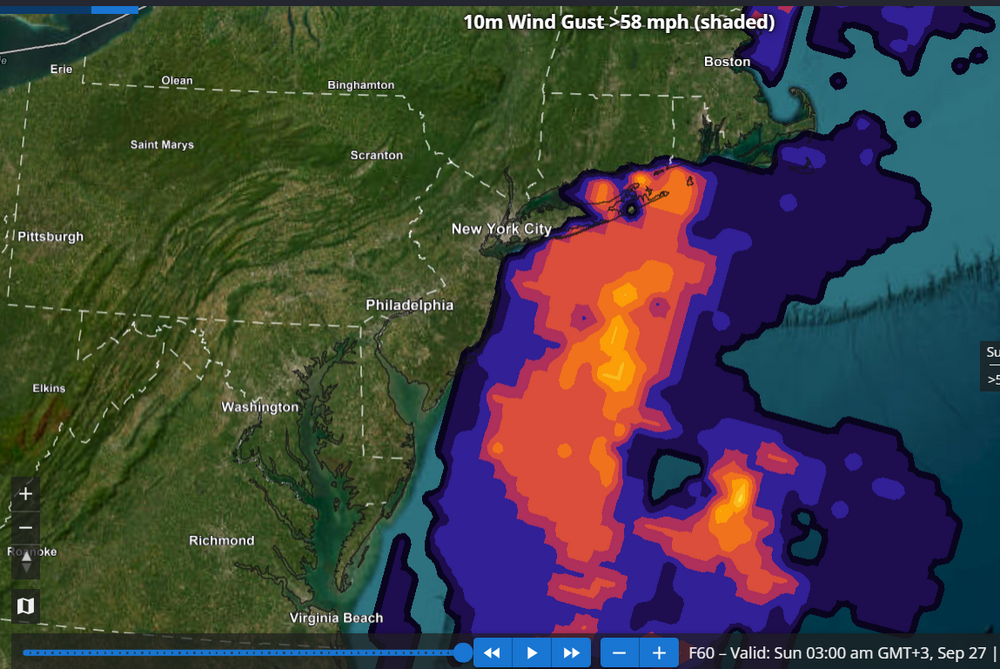
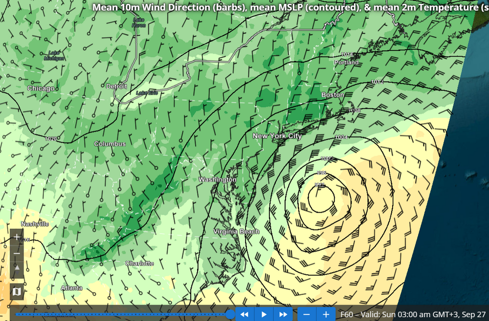
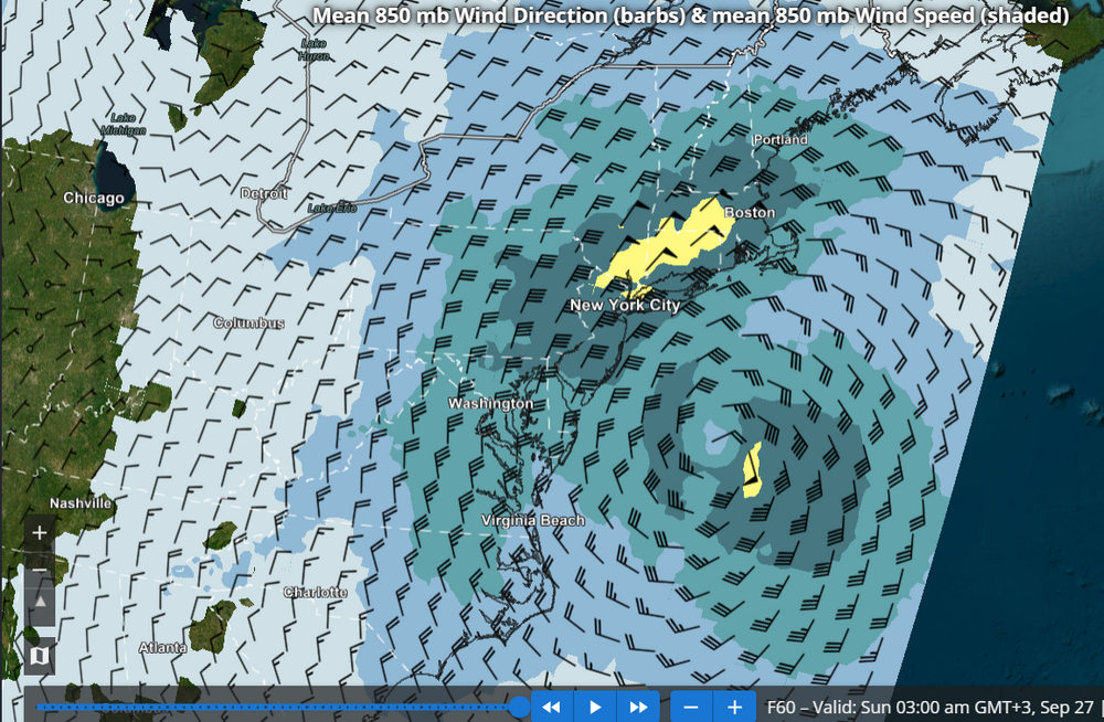
I agree the specific REFS scenario should be largely dismissed, though the idea of a westward turn occurring fairly far south near southern NJ and the Delmarva has merit IMHO. The REFS (RRFS ensemble) has a lot of value and so far I have barely seen anyone mentioning it. Probably because the site with REFS graphics seems to be a pretty well kept secret: https://sites.gsl.noaa.gov/desi/ The images I posted below show probability of 58 mph wind gusts (HWW criteria) at 42, 54 and 60 hours from the most recent REFS run (15z). Based on this I think a HWW would be well justified for the south shore of LI as well as eastern Suffolk, perhaps even into se CT. I also added the MSLP and 850 mb wind forecasts from the REFS at 60 hours, showing the mean places the storm well north of the RRFS operational.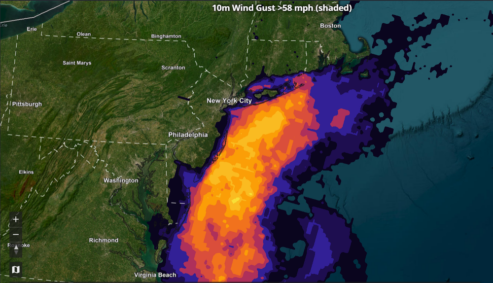
-

October Comes Early: Late September Multi-Hazard Hybrid Storm
WinterWolf replied to WxWatcher007's topic in New England
The exact evolution of this thing is still to be determined. And then the ultimate track is still up in the air. So ways to go on this thing. -

Strong Nor'Easter/Hybrid Storm Late September 2026
wthrmn654 replied to Rjay's topic in New York City Metro
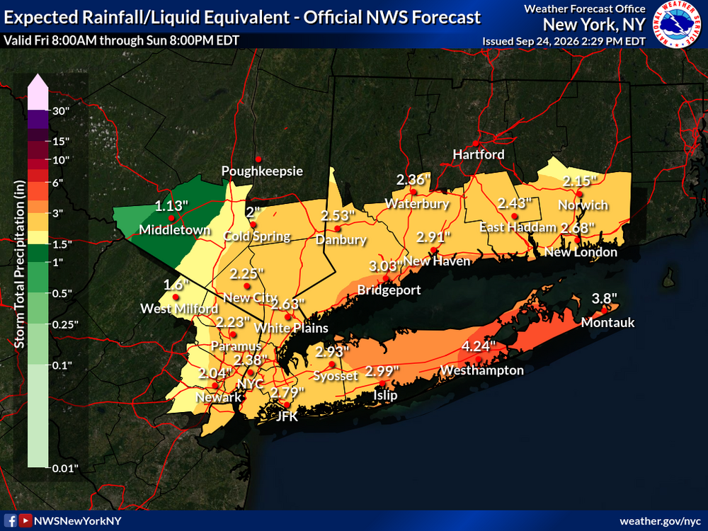
-
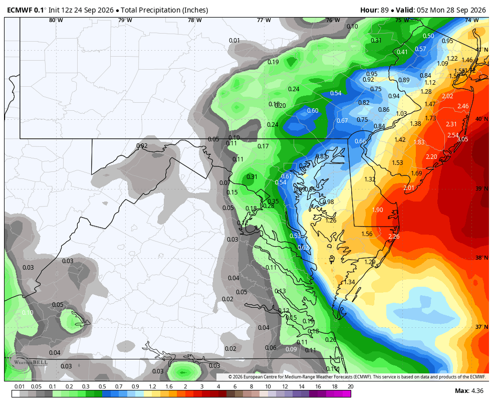
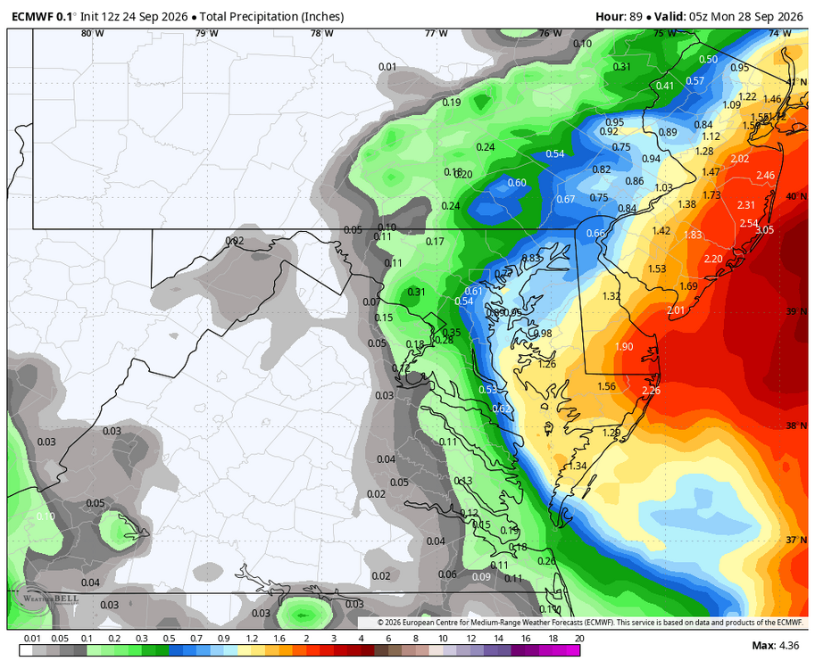
WB 12Z EURO
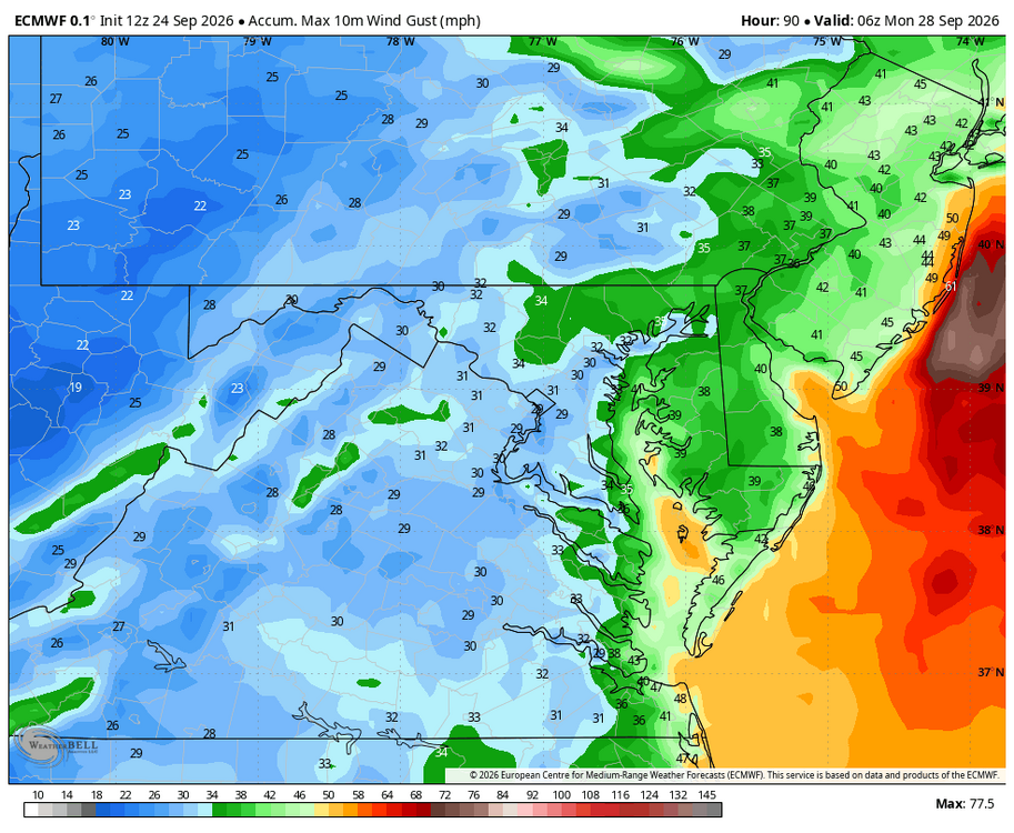
-
also shits out this at the end of the run
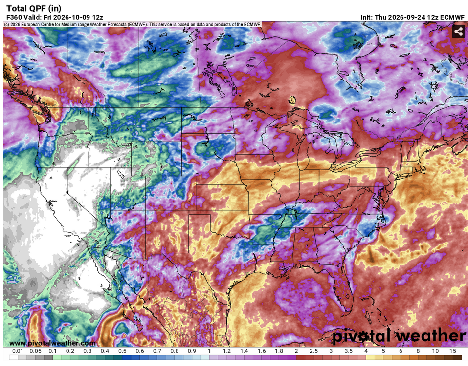
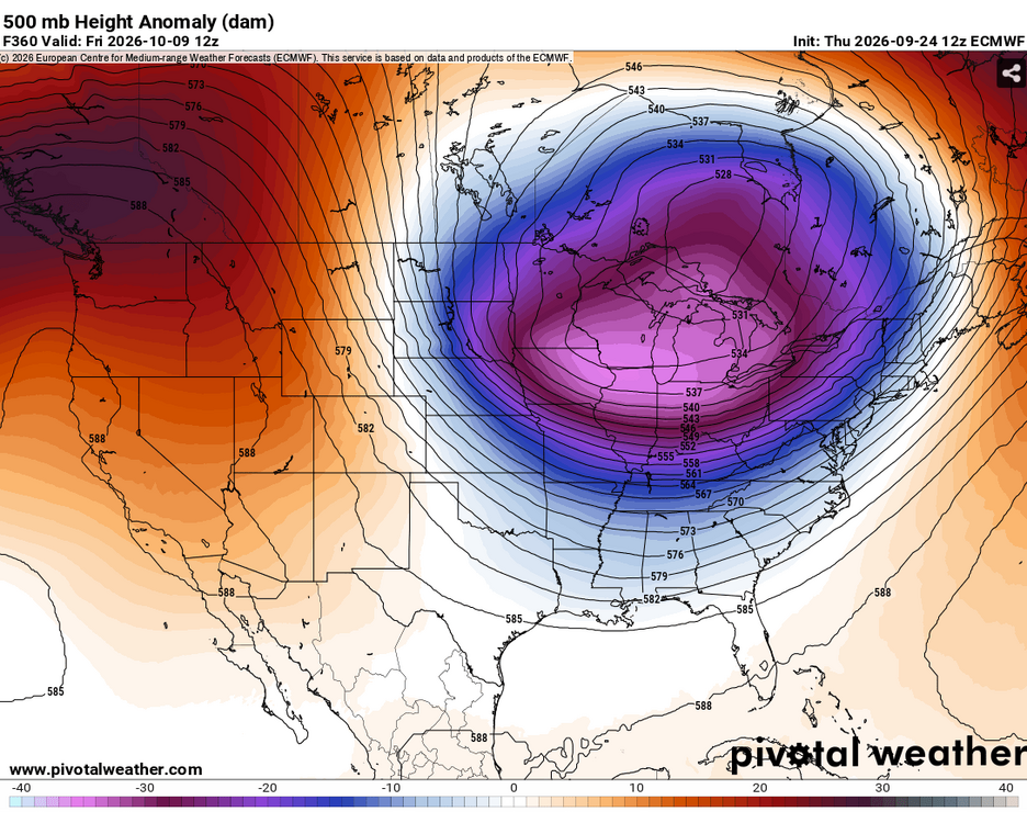
-
Sometimes I don't even know the joke when you respond ngl. Genuinely no clue how it relates to my post please enlighten me.
-

October Comes Early: Late September Multi-Hazard Hybrid Storm
Masswx replied to WxWatcher007's topic in New England
If the euro is right it’s a nor meh ster not interested if it’s not gonna give me much -

2026 Atlantic Hurricane Season
Windspeed replied to Stormchaserchuck1's topic in Tropical Headquarters
It's worth noting that the 12z HAFS suites get Fay down to 989 and 983 mb respectably by noon tomorrow before shear begins to increase again. Fay's vortex is embedded within a high background pressure regime of 1022+ hPa surface isobar with a 1030 hPa surface ridge centered to the north and 591dm heights. For it to drop 20 mb by tomorrow would require some rather significant intensification, and Fay would absolutely be a hurricane if this unfolds. Again, it's TC modeling, and HAFS may be overdone, but Fay has a real shot if it can continue mustering up convection and close off a core this evening. -

Strong Nor'Easter/Hybrid Storm Late September 2026
Rjay replied to Rjay's topic in New York City Metro
925mb winds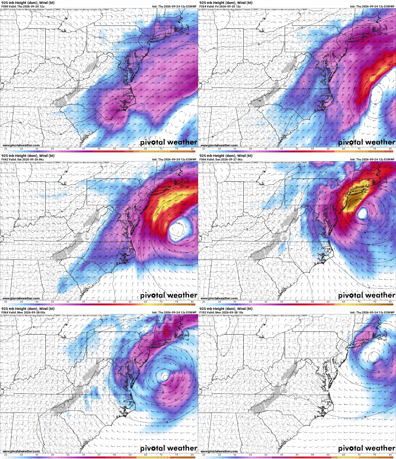
-

Strong Nor'Easter/Hybrid Storm Late September 2026
NJwx85 replied to Rjay's topic in New York City Metro
New run coming out now. This was 12z.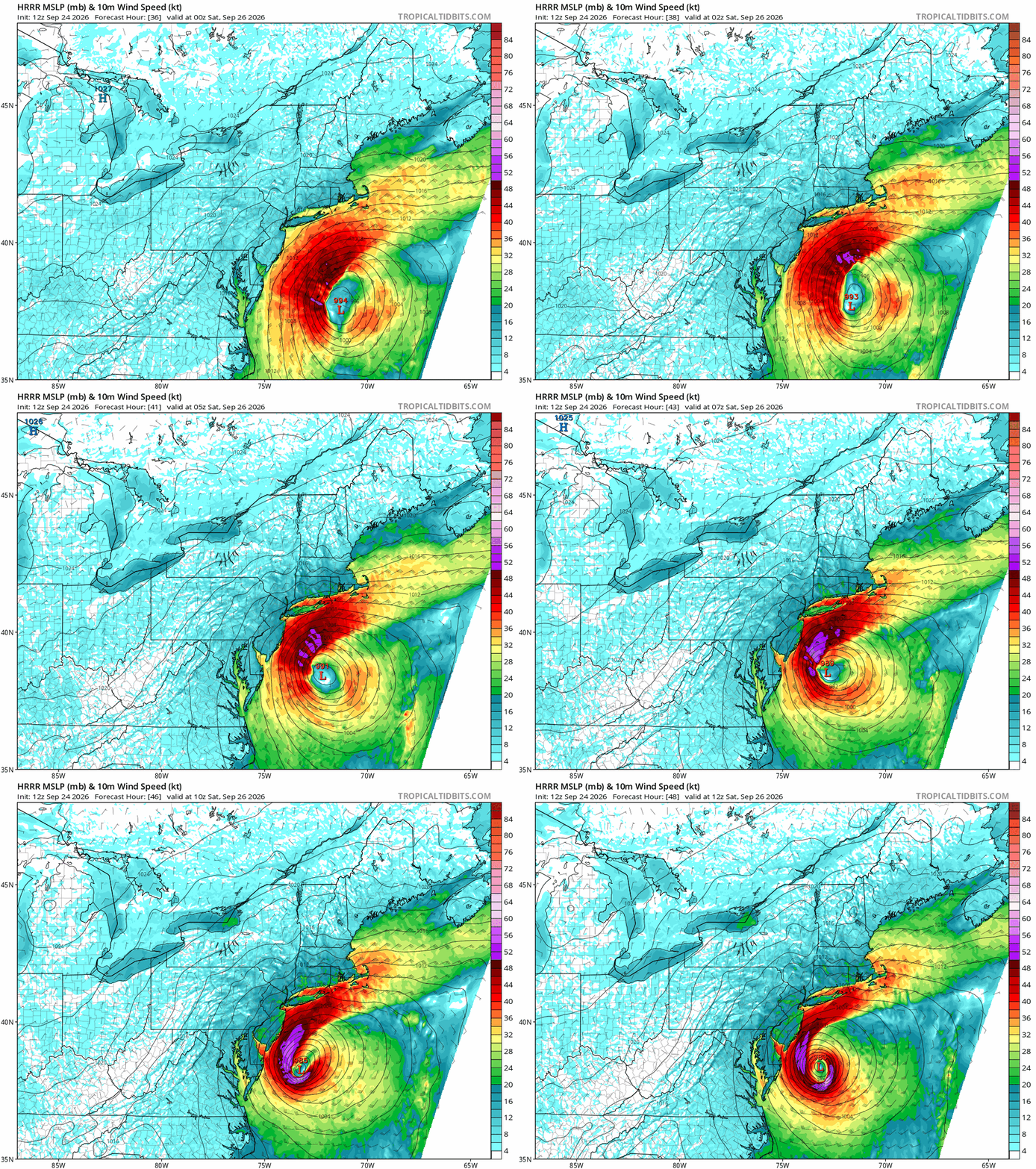
-

E PA/NJ/DE Autumn 2026 Obs/Discussion
Ralph Wiggum replied to PhiEaglesfan712's topic in Philadelphia Region
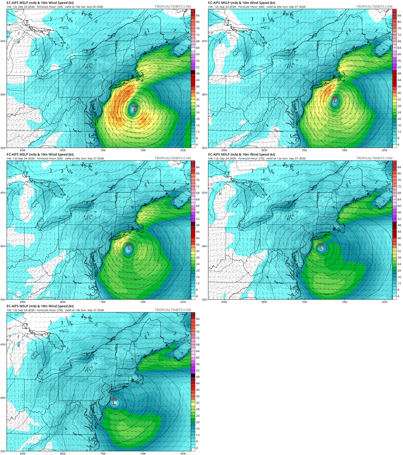
New euro ai track is sandy-esque with that hard left turn...N part of NJ in a bad spot, S NJ would probably get the saving grace of an offshore wind component.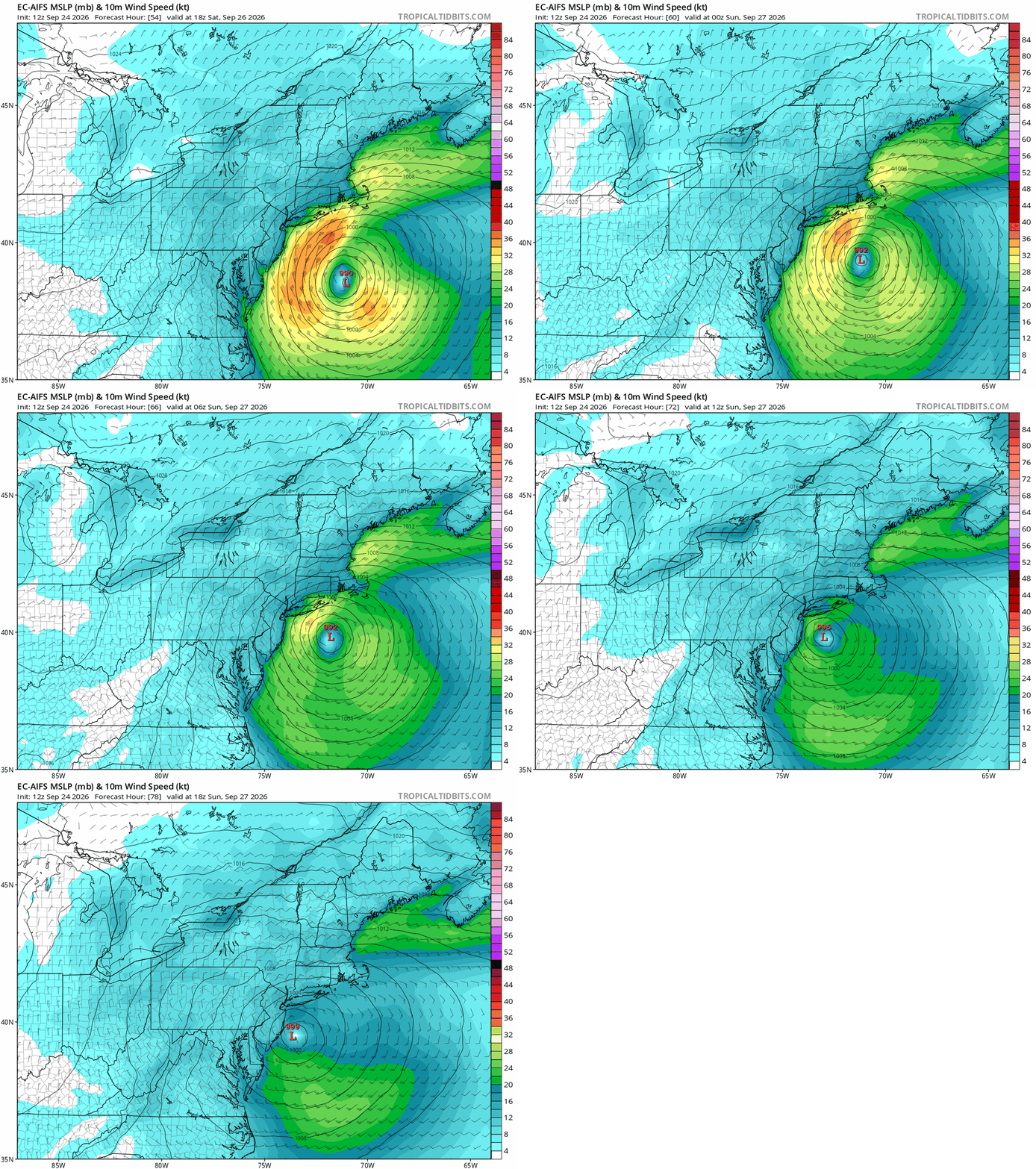
-
This is like a once-in-a-lifetime view of Pacific systems
-
Strong Nor'Easter/Hybrid Storm Late September 2026
Rjay replied to Rjay's topic in New York City Metro
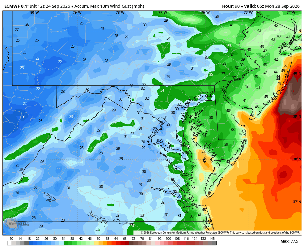
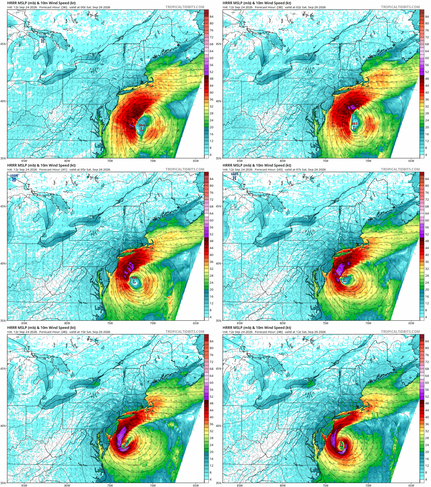
I kinda hate the 10m wind products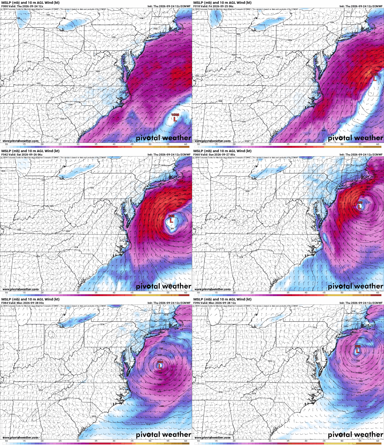
-
.thumb.gif.f92b16c631a1d15d405ed77b33f0710d.gif)
October Comes Early: Late September Multi-Hazard Hybrid Storm
Torch Tiger replied to WxWatcher007's topic in New England
Hopefully LBSW -

Strong Nor'Easter/Hybrid Storm Late September 2026
Brian5671 replied to Rjay's topic in New York City Metro
starting to see a consensus over all of a loop south of LI -

Strong Nor'Easter/Hybrid Storm Late September 2026
Nibor replied to Rjay's topic in New York City Metro
Can’t remember where I read it but the rrfs tends to over model the convective area by some crazy percentage like 50%. The rrfs-A is supposed to correct that excessive modeling. edit: https://journals.ametsoc.org/view/journals/wefo/39/1/WAF-D-23-0112.1.xml -

E PA/NJ/DE Autumn 2026 Obs/Discussion
Mikeymac5306 replied to PhiEaglesfan712's topic in Philadelphia Region
That 62 storm obliterated the Delmarva beaches (Rehoboth, Bethany, etc.) The pictures of the Henlopen Hotel falling into the Atlantic with the rest of the Boardwalk were insane! -
Strong Nor'Easter/Hybrid Storm Late September 2026
NJwx85 replied to Rjay's topic in New York City Metro
Can you do 10m winds? -
Nov. 28th
-

October Comes Early: Late September Multi-Hazard Hybrid Storm
ineedsnow replied to WxWatcher007's topic in New England
Hopefully the Euros trend north a bit before heading west.. on a side note Hawaii is having a great year.. some models at 12z hit the southern end then northern end now.. -
Check out the 12Z UKMET: gets her all the way to 23.7N, 56.4W and still moving WSW not too far N of the MDR: TROPICAL STORM FAY ANALYSED POSITION : 30.0N 41.2W ATCF IDENTIFIER : AL062026 LEAD CENTRAL MAXIMUM WIND VERIFYING TIME TIME POSITION PRESSURE (MB) SPEED (KNOTS) -------------- ---- -------- ------------- ------------- 1200UTC 24.09.2026 0 30.0N 41.2W 1014 28 0000UTC 25.09.2026 12 30.2N 42.1W 1015 25 1200UTC 25.09.2026 24 30.3N 43.1W 1015 27 0000UTC 26.09.2026 36 30.3N 43.7W 1015 25 1200UTC 26.09.2026 48 30.2N 44.4W 1014 26 0000UTC 27.09.2026 60 30.2N 44.8W 1016 21 1200UTC 27.09.2026 72 30.1N 44.8W 1015 22 0000UTC 28.09.2026 84 29.8N 44.6W 1016 20 1200UTC 28.09.2026 96 28.6N 44.9W 1016 22 0000UTC 29.09.2026 108 27.4N 46.0W 1014 23 1200UTC 29.09.2026 120 26.2N 47.6W 1013 24 0000UTC 30.09.2026 132 24.9N 49.6W 1012 26 1200UTC 30.09.2026 144 24.2N 52.0W 1011 29 0000UTC 01.10.2026 156 23.8N 54.3W 1011 27 1200UTC 01.10.2026 168 23.7N 56.4W 1012 27
-
October Comes Early: Late September Multi-Hazard Hybrid Storm
dryslot replied to WxWatcher007's topic in New England
Those will end up in the dining room ha ha. -
Strong Nor'Easter/Hybrid Storm Late September 2026
wthrmn654 replied to Rjay's topic in New York City Metro
12z First time the gefs ensembles are tightly clustered.