All Activity
- Past hour
-
EF2 from feederband, which was just ahead of a cold front, from remnants of Isaias in Duplin County, NC yesterday!
-
Big Breaking Bad fan, RJ Mite passed (Flynn/Walt Jr). No cause has been disclosed which makes me think drugs/mental/possible suicide. Seemed like he had a good head on his shoulders when interviewed...
-
Surveys done for 4 GA/SC Saturday 10/10/26 tornadoes: 3 EF-1 and 1 EF-0 -Fortunately no deaths or injuries -2 of 4 caused structural and/or automobile damage -All 4 caused notable tree damage https://www.weather.gov/chs/Tornadoes-October2026
-

2026-2027 Record-breaking El Nino
roardog replied to Stormchaserchuck1's topic in Weather Forecasting and Discussion
He’s back!!!! -
Wow! You're right over in Saranac Lake! I love the Adirondacks. When I was growing up my family went to the Lake Placid area a lot. I'm definitely heading your way for the winter festival this year. The ice castle is amazing. I plan on doing some serious blizzard chasing this season. Starting December 1 my focus will be hunting the big one. Extreme lake effect and powerful coastal storms on the New England coast. LFG! Sorry for banter. I get overly excited about this stuff lol
-

2026-2027 Record-breaking El Nino
snowman19 replied to Stormchaserchuck1's topic in Weather Forecasting and Discussion
We are seeing the strengthening +IOD state constructively interfering with the very strong El Niño low frequency forcing, which is overwhelming the MJO signal, something you’d expect to see with a super event. And also as expected, this Nino has become the most east-based event on record and we have hit +12C in the subsurface (courtesy of the record WWBs and DWKWs), something I have suspected for months, along with the 30C isotherm propagating to 140W -

E PA/NJ/DE Autumn 2026 Obs/Discussion
Psychguy replied to PhiEaglesfan712's topic in Philadelphia Region
Yes, I saw! By Saturday the high is only supposed to be 55 with a low 40 here in Philadelphia! -
2026-2027 Record-breaking El Nino
snowman19 replied to Stormchaserchuck1's topic in Weather Forecasting and Discussion
I actually did an update on the IOD early this morning….it strengthened rapidly to +0.88 in the last week. It likely peaks solidly over +1 next month - Today
-
Fall 2026 Medium/Long Range Pattern Thread
Daniel Boone replied to John1122's topic in Tennessee Valley
Short changed big time with this last Rain Event. Bands moving south to north eastern flank of system missed central Lee County for the most part. 0.52" Total here. Western Lee received 1-1.5". Eastern Lee 1-1.25". Wise and Scott Counties, 1.2 to 2.3 inches. Monthly Total here so far, 1.64". -
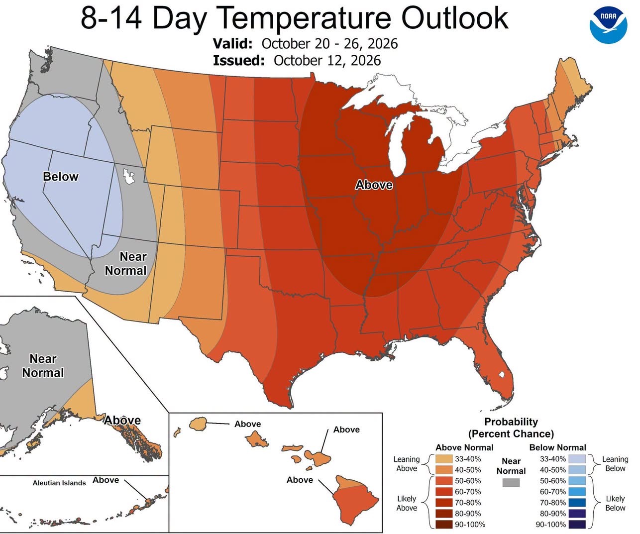
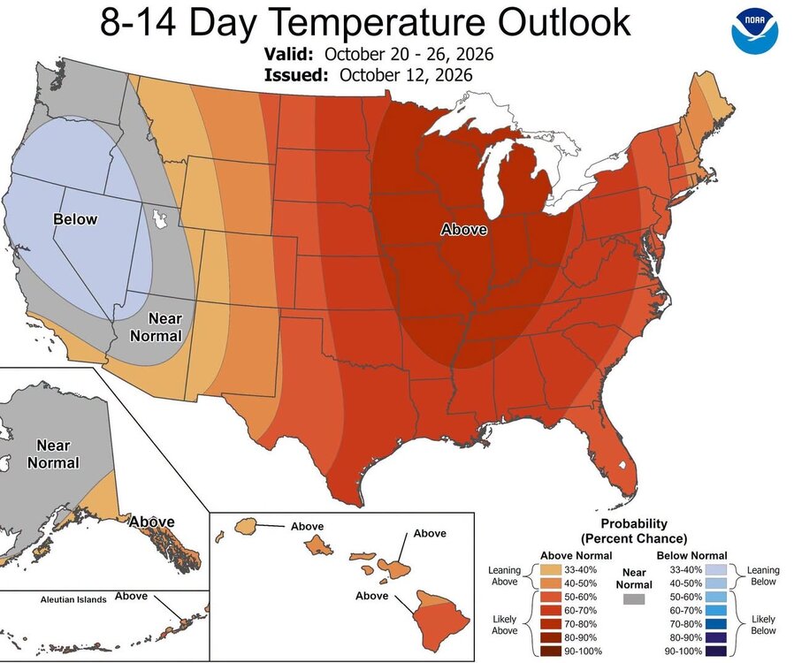
I don’t really care if we are above Normal in October here and there. BN and AN every few days…doesn’t really matter much. It’s a nice step down overall. It’s not meant to last any length in October.
-
I mean enjoy the 1-2 day cool down . Wish it would last but with west moving typhoons in the Pacific . this is what we get in the country . The color red will win in weather and in the upcoming elections .
-

E PA/NJ/DE Autumn 2026 Obs/Discussion
Birds~69 replied to PhiEaglesfan712's topic in Philadelphia Region
Heat will be short lived back to 60s for highs Thurs and 50s by the weekend... -
Upper 80s here. Bring on the first flakes.
-
ROFL
-
New daily record high at SBN today. 86 breaks the old record of 84 set in 2008.
-
We don’t need to get political….take it to another thread.
-
Well it was being forecast..and the possibility was there, and it was hinted at that the moisture could get up in here…but you did poo poo it, but it came up in here in a big way.
-
But it did develop...lol ALTERNATE REALITY...just like your political hero...lol
-
Tomorrow through Wednesday will be warmer than normal days. Highs should reach the upper 60s and lower 70s. Temperatures could peak in the middle to perhaps upper 70s on Wednesday ahead of a cold front. Newark could make a run at 80°. Cooler weather will then arrive for Thursday and Friday. There is increasing potential that a piece of an air mass that set a record low temperatures in parts of Canada during the weekend could move into the region for next weekend. The arrival of this air mass could trigger a few showers on Friday or Friday night. As a result, the weekend could see the coldest temperatures so far this season. The ENSO Region 1+2 anomaly was +5.2°C and the Region 3.4 anomaly was +3.3°C for the week centered around October 7. For the past six weeks, the ENSO Region 1+2 anomaly has averaged +4.73°C and the ENSO Region 3.4 anomaly has averaged +3.03°C. ENSO Region 3.4 has set a new all-time record. The ongoing strong El Niño, will continue to strengthen through the mid-fall. The SOI was -17.60 today. The preliminary Arctic Oscillation (AO) was +0.903 today. Based on sensitivity analysis applied to the latest guidance, there is an implied near 56% probability that New York City will have a warmer than normal October (1991-2020 normal). October will likely finish with a mean temperature near 58.3° (0.4° above normal). Supplemental Information: The projected mean would be 1.4° above the 1981-2010 normal monthly value.
-
Extreme hot air over the ocean supercharges evaporation leading to cloud cover and moisture downstream. Both of those would = wet and cooler weather for the south. I just don’t see an extreme EN leading to hot and dry conditions.
-
Pretty terrible that we've strung together three weekends in a row with a crappy Sunday. Especially during peak fall outdoor activity season. At least the streak will be over this weekend with Friday being the unsettled day instead.
-
Next two systems decent rains for NNE. I don't want hear it! And you should see your first flakes!
-
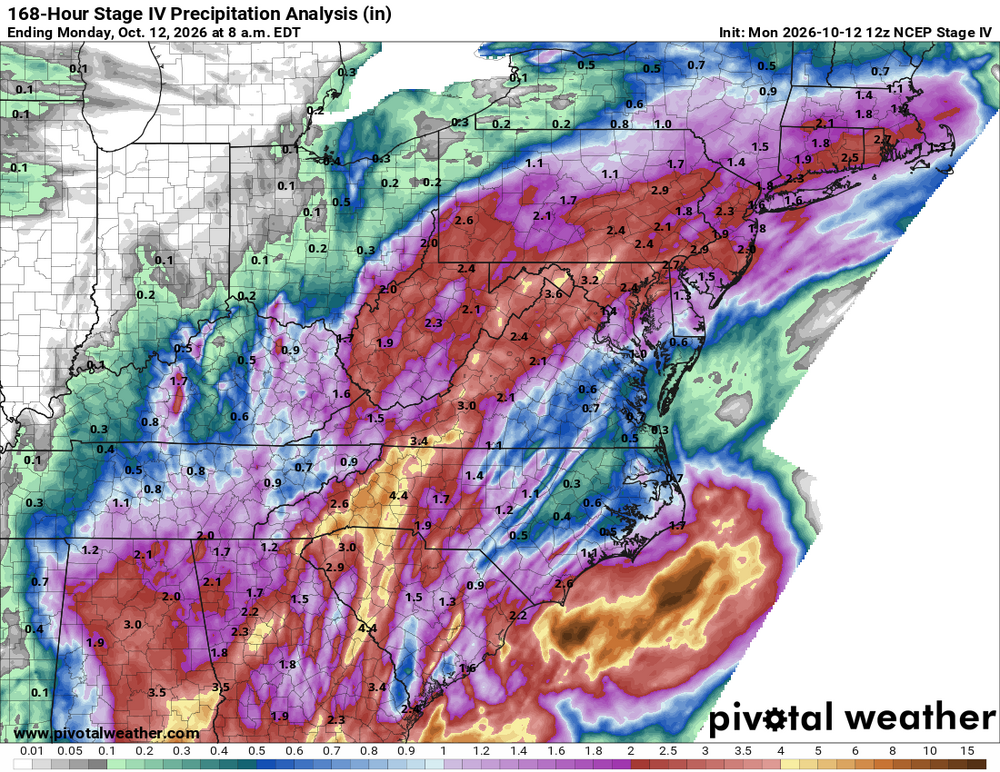
This one goes through the full event
-
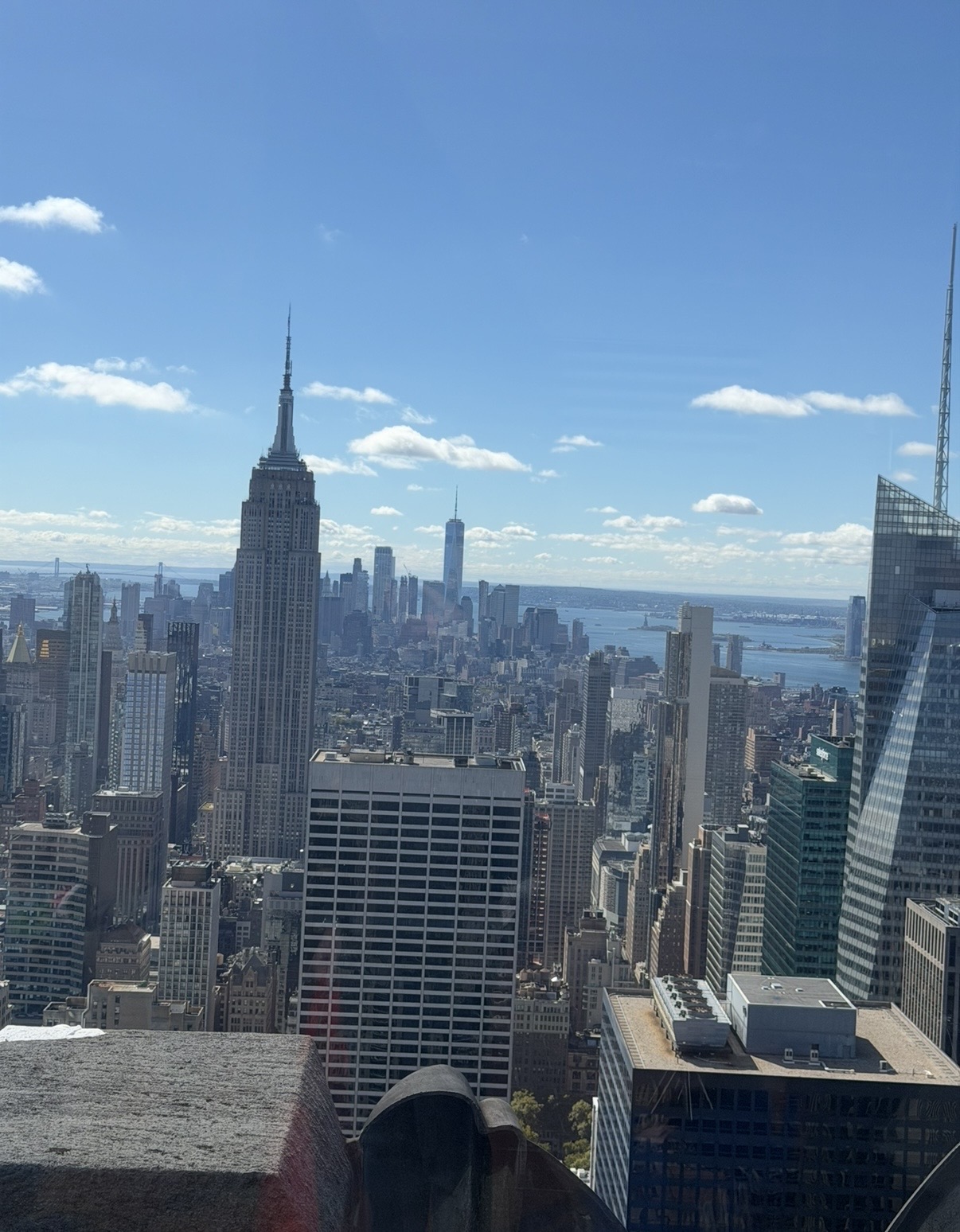
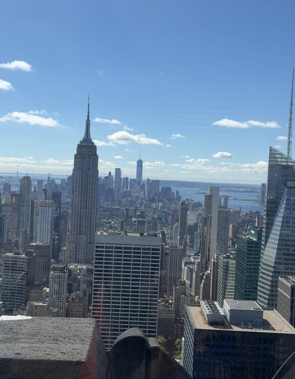
Couldn’t ask for a nicer day weather wise from top of the rock
-
E PA/NJ/DE Autumn 2026 Obs/Discussion
Psychguy replied to PhiEaglesfan712's topic in Philadelphia Region
Amazingly enough both Saturday and Sunday saw a high of 90 at MSP my old "stomping ground"... that place always amazed me! It could go from -30F in the winter to 100+ with beyond believable humidity in the summer. Guess the heat is migrating eastward.