All Activity
- Past hour
-
I miss my house up in Ashe County on days like today. I had good elevation in the area I was in and also cashed in being closer to VA sometimes. I might have to go land hunting soon and build another one.
-

December 2025 regional war/obs/disco thread
WinterWolf replied to Torch Tiger's topic in New England
Lol…she’s just a fool. But we laugh. Let’s get system in here, and join the party. Frieken cold out there today. -
Icon hoped on board with Friday/Saturday
.thumb.png.1ee3efca8c538f850f1b9db036a20e66.png)
-

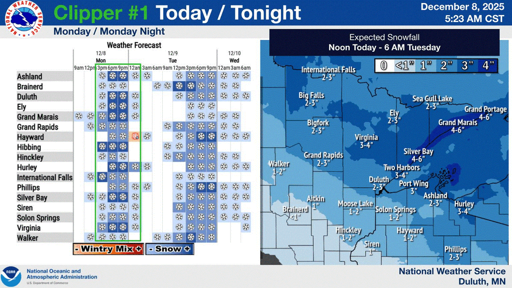
The Monday wintry event potential (12/8/25)
PackGrad05 replied to GaWx's topic in Southeastern States
41 in Willow Springs on my Tempest. Latest HRRR looks better. -
Traffic cams show it really coming down on I-64 northwest of Richmond, just past Gum Springs. As you get closer to Richmond, some flakes are starting to show on the cams in places like Short Pump.
-

The Monday wintry event potential (12/8/25)
NorthHillsWx replied to GaWx's topic in Southeastern States
Front has come through. Getting some strong N gusts. Temp has risen to nearly 40 though -

The Monday wintry event potential (12/8/25)
kvegas-wx replied to GaWx's topic in Southeastern States
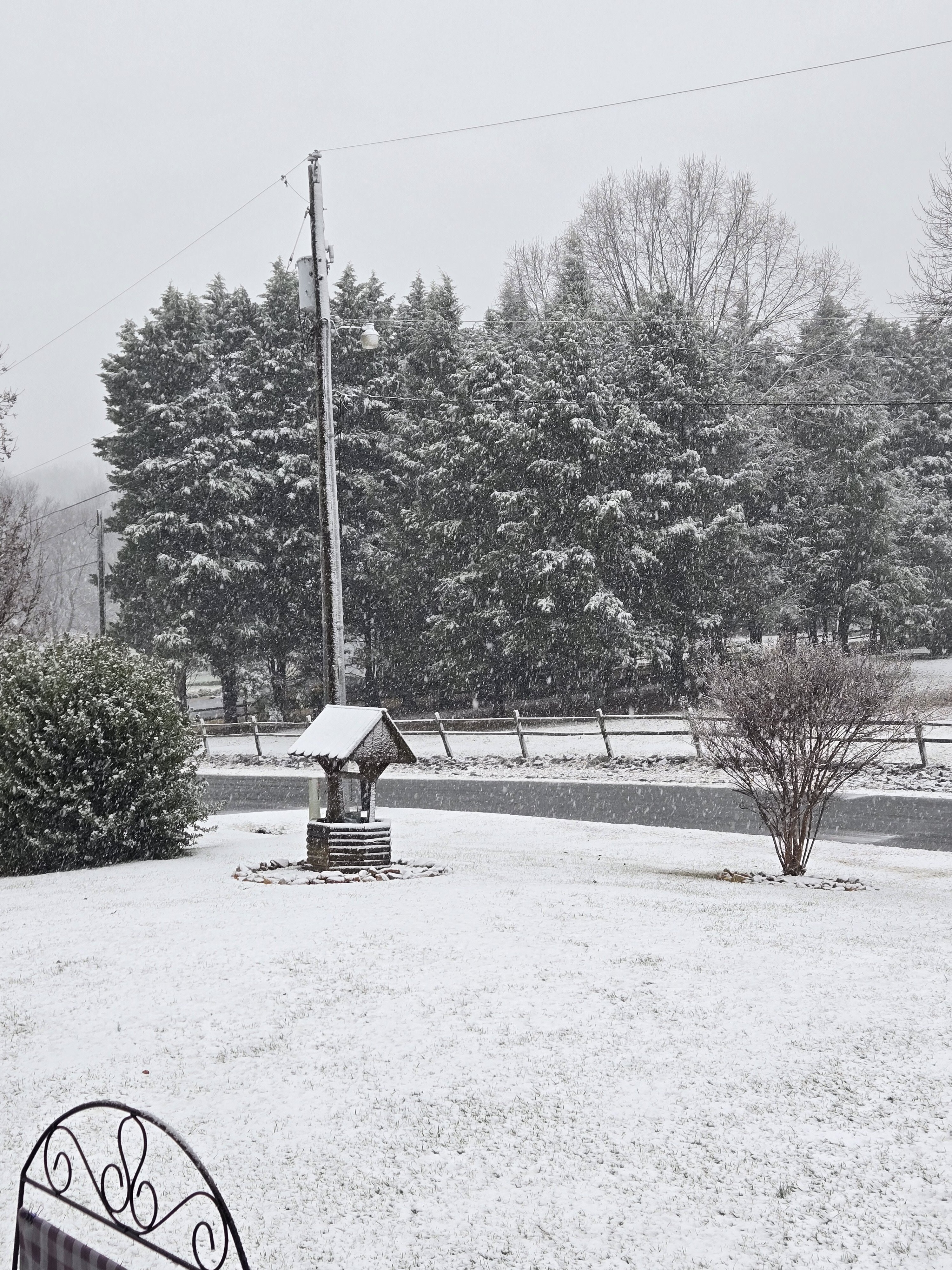
Ground covered in Stuart VA at the farm and now snowing nicely in Kernersville. No more mix. -
Currently 22 here (10:30 a.m.) with some scattered flurries between 8 and 8:30. Currently mid to upper teens NW Sussex County ice box spots as cold air continues to spill in behind the front.
-

December 2025 regional war/obs/disco thread
RUNNAWAYICEBERG replied to Torch Tiger's topic in New England
Mention her name and the resident predator goes wild. -
Is this because we stopped getting smaller storms or because some of the same storms got bigger? More of a rhetorical question because I have no idea how one could answer it. Is there a way to look at annual snowfall totals net of NESIS storms?
-
Congratulations, get all you can, love snow
-
The Monday wintry event potential (12/8/25)
NorthHillsWx replied to GaWx's topic in Southeastern States
Snow globe -
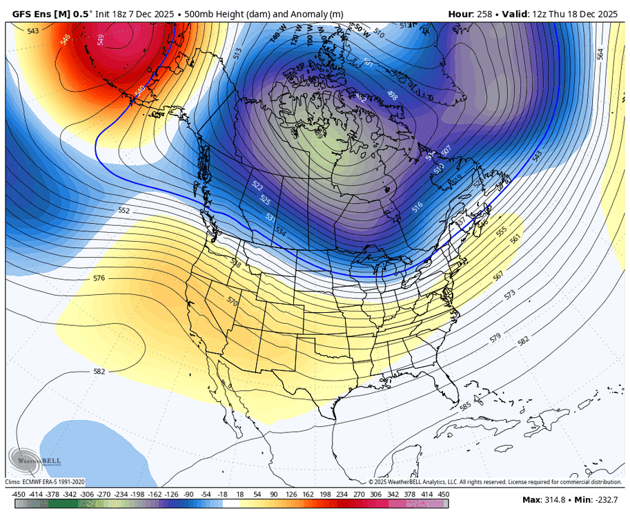
Indeed, and look at the trend of just the last 3 GEFS for 12Z on 12/18: E trough deepening/W ridge strengthening. It’s important to keep watching these trends as the models in general have been much too warm since the runs starting 3 weeks ago:
-

Richmond Metro/Hampton Roads Area Discussion
iherebyresign replied to RIC Airport's topic in Mid Atlantic
Stuck at 33.9 in Mechanicsville with no sticking to any surfaces. Probably already wasted a good half an inch -
End of the HRRR run looks like it gets the coastal cranking earlier which enhances precip back towards Richmond later today. Maybe a trend to watch.
-
Your generalizations are a figment of your imagination. You need to supply proof.
-
-sd's/10's this morning with sd's along the shore. Looks like 24-36hrs of light/mod snow my way. 6-8" total accum forecasted for TH.
-

December 2025 regional war/obs/disco thread
Cyclone-68 replied to Torch Tiger's topic in New England
Instead of the “I had to walk to school barefoot in 4 feet of snow” you’ll be saying “back in my day we had bare ground walking to school in my sneakers and we liked it!” -

The Monday wintry event potential (12/8/25)
BornAgain13 replied to GaWx's topic in Southeastern States
-
latest HRRR - still a bit more for RIC and east at this point:
-

Richmond Metro/Hampton Roads Area Discussion
rbrewbaker replied to RIC Airport's topic in Mid Atlantic
Been snowing moderately for at least an hour near Carytown but only slight hint of sticking on high roof of house - nothing any where else since still showing 36 as temp - don't think folks though temps were going to be an issue but sure are at this point -
way too early to nail down xmas week-if you remember 3 weeks ago some said Thanksgiving week/first week of December would be mild-complete and total bust.
-

December 2025 regional war/obs/disco thread
Boston Bulldog replied to Torch Tiger's topic in New England
Little ocean effect out by Chatham right now? -
December 2025 regional war/obs/disco thread
WinterWolf replied to Torch Tiger's topic in New England
Yup…we got that this go around. -

Richmond Metro/Hampton Roads Area Discussion
mikeeng92 replied to RIC Airport's topic in Mid Atlantic
Yep. 2 pm- 8 pm will determine how this storm does (for Richmond). HRRR brings in .2-.3" QPF with temps dropping into the twenties and sun going down.


.png.380792e11681274313736a621adcec07.png)