All Activity
- Past hour
-

White Christmas Miracle? December 23-24th
moneypitmike replied to Baroclinic Zone's topic in New England
RRFS also likes Jeff. -
If it wasn’t for the strong -NAO, the record ridge across the Southern Plains would have expanded closer to our area.
-
They are not the only ones trending colder so is Noaa
-

White Christmas Miracle? December 23-24th
Damage In Tolland replied to Baroclinic Zone's topic in New England
After the last month of frigid temps and 3” of snow .. I’m admittedly nervous . I expected a low snow year again. But thought we’d at least reach double digits -
An interesting storm. I ended up with 3.2 inches here about half that fell in the hour and a quarter I got into the heavy band. I measured 3.2 inches at 10 o'clock. At noon it had settled and compressed and probably melted a bit down to 2.6. One last good band came through and at 1 o'clock I was back to 3.2. Under old methods that would be recorded as 3.8 inches but now it's a 3.2, maximum depth at any point during the day. At least until they change the rules again. Personally I preferred the clearing of the snowboard every six hours, or when precip has stopped on changed. To me that gave the most accurate measurement.
-
Just want to say congrats to all who live and or are visiting in NNE on just an idyllic Bing Crosby Christmas scene. I have so many Christmas memories up there. Nothing better
-

White Christmas Miracle? December 23-24th
Sey-Mour Snow replied to Baroclinic Zone's topic in New England
18z NAM/12z GFS is what I'm thinking for Friday.. -
Because the models were wrong with the warmth. Snow is coming.
-
But what will they say next run? The variability is crazy this year.
-
Very blocky
-
White Christmas Miracle? December 23-24th
Damage In Tolland replied to Baroclinic Zone's topic in New England
Im Thinkng 2-4/3-6. Should trend north. We’ll see -
Sketchy drive? Maybe. The GFS has 850 at -8C for State College and +8C for Morgantown. Don't forget ur umbrella.
-
a low is showing up near hatteras ????
-

2025-2026 ENSO
PhiEaglesfan712 replied to 40/70 Benchmark's topic in Weather Forecasting and Discussion
Yes, but I'm very skeptical of this snowstorm. They were predicting 50s on Friday until of a sudden yesterday morning, now they're predicting 30s and snow. -
Started here about the same time as you. 31.6. Expecting more than the 0.2" Dover has been locally forecast to get.
-

White Christmas Miracle? December 23-24th
Boston Bulldog replied to Baroclinic Zone's topic in New England
Raindrops and 36 in Canton, MA -
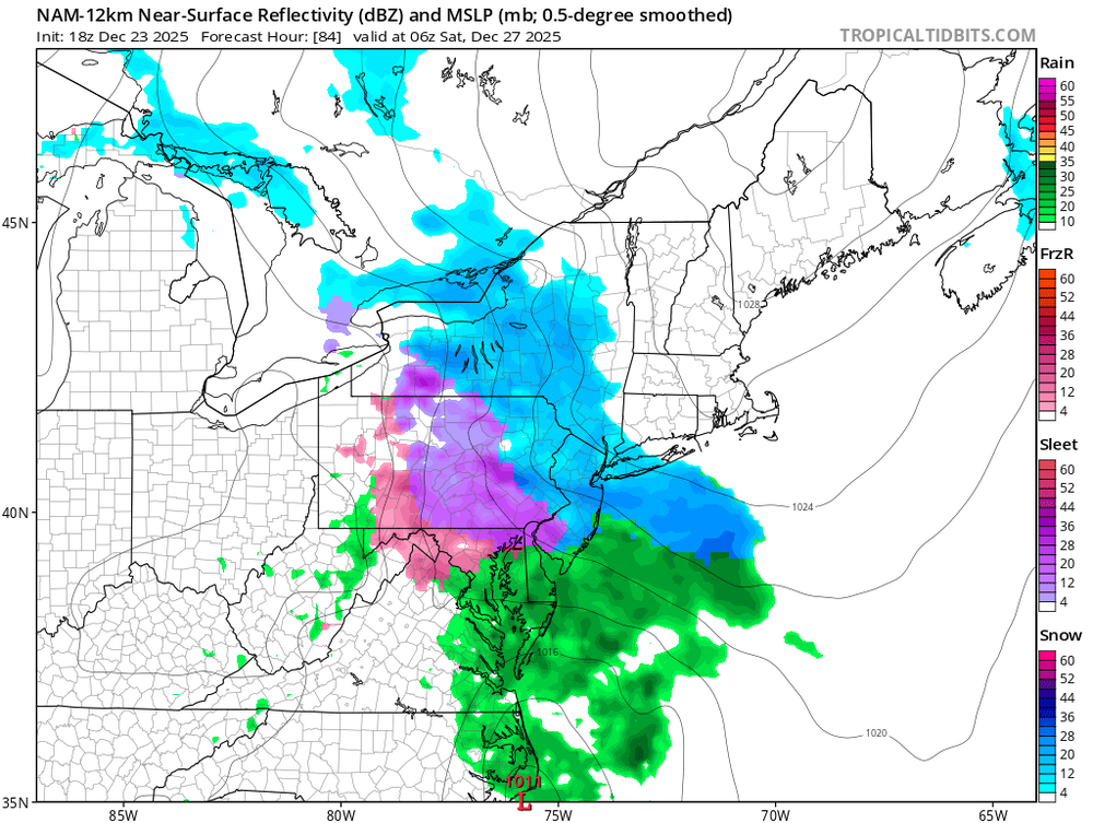
Nam looks decent still going strong 84 hours a bit too south if you ask me
-

White Christmas Miracle? December 23-24th
CoastalWx replied to Baroclinic Zone's topic in New England
Kind of a rain mangled flake mix. -
I don’t think that it’s an exaggeration to say that today’s Euro Weeklies colder changes in the aggregate for the E US are at least near the largest I can recall this entire season with 4 of the 5 weeks notably colder and only the other (Jan 5th-11th) staying about the same (pretty mild). If you want to look specifically at the big changes in the ecmwf in-house maps, themselves, vs yesterday, you can go here to the main ENSO thread:
-
What's up with Upton - the forecast says little or no snow accumulation for NYC BUT the discussion says chances of accumulating snow are increasing ? ZFP from KOKX
-

Pittsburgh/Western PA WINTER ‘25/‘26
colonel717 replied to Burghblizz's topic in Upstate New York/Pennsylvania
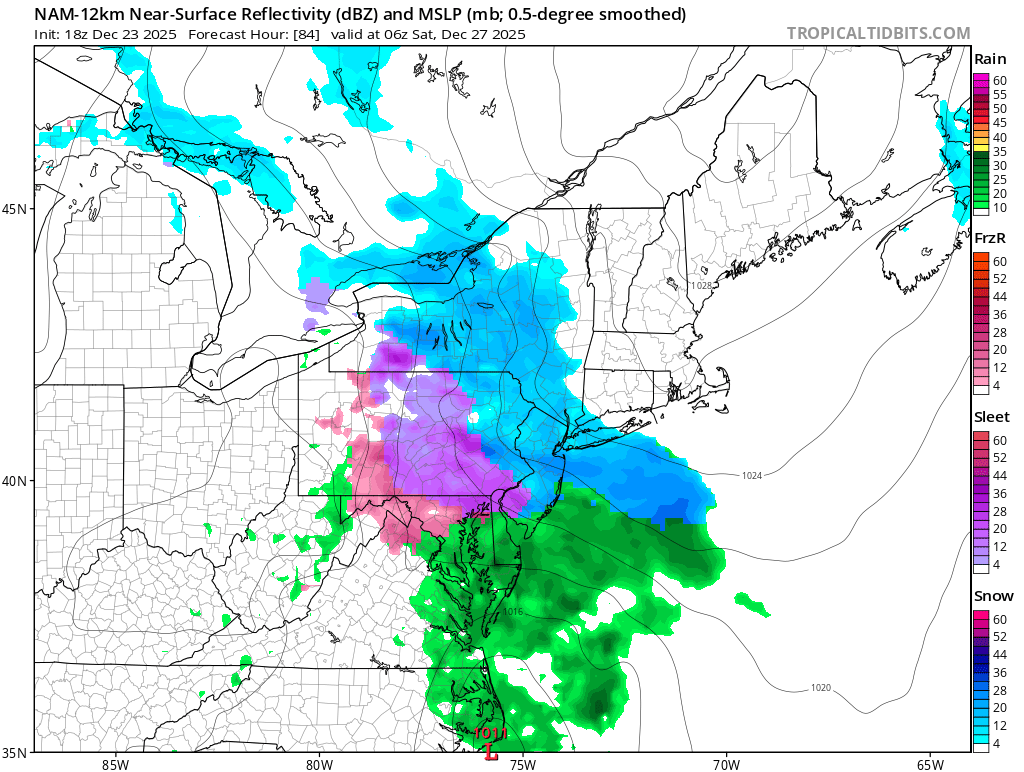
Fri/Sat has trended much colder and now the NAM has us with severe icing. Still long ways to go for that s to play out, but something to watch.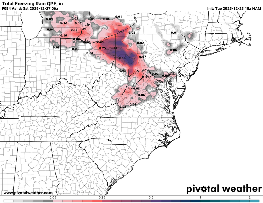
-
White Christmas Miracle? December 23-24th
moneypitmike replied to Baroclinic Zone's topic in New England
Still (barely) above freezing. Hopefully we'll avoid stickiness and manage fluff. 32.4* -

December 2025 Short/Medium Range Forecast Thread
GaWx replied to John1122's topic in Tennessee Valley
I don’t think that it’s an exaggeration to say that today’s Euro Weeklies colder changes in the aggregate for the E US are at least near the largest I can recall this entire season with 4 of the 5 weeks notably colder and only the other (Jan 5th-11th) staying about the same (pretty mild). I’ll leave it to @Carvers Gapto post more about them as he normally is thorough communicating about them here. But if you want to look specifically at the big changes in the ecmwf in-house maps, themselves, vs yesterday, you can go here to the main ENSO thread: -

Central PA Winter 25/26 Discussion and Obs
Ruin replied to MAG5035's topic in Upstate New York/Pennsylvania
These days they pretty much do model watching. Some may do legwork 80%dont -

White Christmas Miracle? December 23-24th
Lava Rock replied to Baroclinic Zone's topic in New England
I'll take the under and be happy with 5"