All Activity
- Past hour
-

November 2025 general discussions and probable topic derailings ...
alex replied to Typhoon Tip's topic in New England
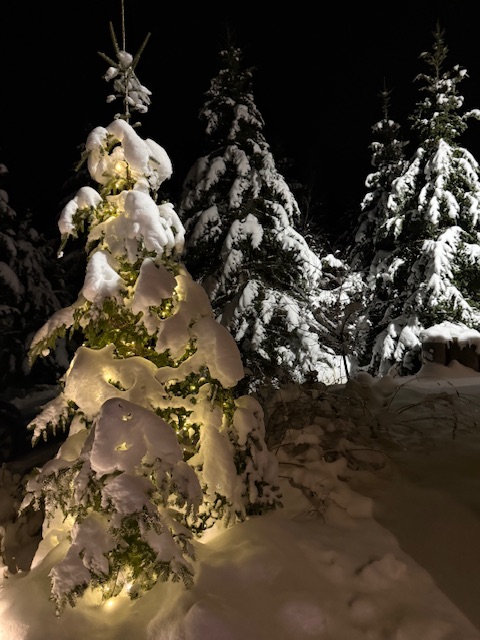
A week straight of caked trees. My kind of November. My son today told me “our house is really like a winter wonderland.” I think there’s a weenie in the making… -

November 2025 general discussions and probable topic derailings ...
WinterWolf replied to Typhoon Tip's topic in New England
Kevin, it does snow in November and December, but not all the time. Some years it does. Some years it doesn’t. In the 80’s it was rare. The last 25 yrs it has a lot. But that’s no given. It can and certainly does, but if it doesn’t it’s not unusual. That’s just a fact. -
Ratios will save us!
-
This weird idea that it doesn’t or isn’t supposed to snow in Nov and Dec is absurd . Cold weather months typically snow in SNE and it used to be a lot sometimes. There was always a November snowfall .. even in NJ where I I lived until age 7. And Dec was and should be snowy. This nonsense of waiting until January is ludicrous . There’s then 2 months of winter left before Morch .
-

November 2025 general discussions and probable topic derailings ...
CoastalWx replied to Typhoon Tip's topic in New England
Nuke em all. -
Cloudy 34.1/21
-

November 2025 general discussions and probable topic derailings ...
WinterWolf replied to Typhoon Tip's topic in New England
Different world down there right by the water. But here we have done real well in November and December storms many times over the last 25 years especially. Some years nothing. Some years it can and has been hefty. So again…it goes both ways. I will say, When I was a teenager during the 80’s…it seemed it didn’t want to snow here until January most years. But eventually that changed too when we got into the early and mid 90’s. -
E PA/NJ/DE Autumn 2025 Obs/Discussion
Kevin Reilly replied to PhiEaglesfan712's topic in Philadelphia Region
Interesting system coming in from the west needless to say. Those are some pretty good thunderstorms there in West Virginia. Currently precipitation to the south is hitting a brick wall and heading southeast away. Here is my interesting observation at the airport currently it is 47f with a 25f dewpoint. Here in Media just 13 miles west southwest it is 38 with a dewpoint of 23f Pretty wild to have an almost 10-degree difference in a short distance with a lower dewpoint. Looks like a pretty vigorous low coming in from the west and energy transfer southeast from the Great Lakes. I also too didn't have sleet on my bingo card today. I wonder if there are any more surprises coming tonight. wind here west at 7 mph. -
As of right now looks like another southern special.
-
Mid level dry air for the win. If this were winter, people would be screaming.
-
Remains to be seen if we can achieve phase 8. Still a little bit too far in the future for guidance, but this year... maybe? There's been somewhat of a notable trend on the EPS over the last couple of days now with the mjo. Incrementally amplifying the phase 7 transit through several runs. With today's 12z run the most amplified thus far. I bring up the EPS since it's been the one piece of guidance that has been the most reluctant with this event throughout. Here are yesterday's 00z run followed by the latest 12z EPS 200mb velocity potential (the ones in between follow the same trend). 00z yesterday: 12z today: Taking a global view of this now, in the 10-15 day mean. It's a fairly clear phase 7 signature being shown now on the 5 day mean. With the suppressed phase pushing into the MC and the enhanced phase pushing into South America. Again, this signal has been growing. Not fading away, much like we are all accustomed to in recent times, as verification time approaches. Consistent with the slower moving mjo events, as mentioned earlier in this thread. There should be a response reflected in the 500mb pattern. Or at least more likely. So I like to check the model output against the mjo composites in times like these. Since that is most certainly not always the case. In this instance though, there do seem to be at least several similarities between the phase 7 December La Nina composite. When compared with the 12z EPS forecast at day 15. Which, to me, suggests it is indeed being effective. At least in the model. What happens from here? I'm beginning to think it might be interesting to find out.
-

November 2025 general discussions and probable topic derailings ...
OrangeCTWX replied to Typhoon Tip's topic in New England
I don’t even bother looking for snow until January. November/December are such useless months especially down here lol -

November 2025 general discussions and probable topic derailings ...
WinterWolf replied to Typhoon Tip's topic in New England
14-15 had a 70 plus degree Xmas eve day. That doesn’t bode well for wire to wire imo. And while the 6 week blitz was epic out east…it’s still not a wire to wire deal for me. 95-96 melted out completely down to the grass here with a huge warm rain event after the Jan Blizzard. So did 93-94. So as good as those winters were..And they were awesome, they still melted out here before reloading and going gangbusters. As has been said, that’s about as good as it gets here. I guess there’s different ideas, and that’s cool. So all good. - Yesterday
-
November 2025 general discussions and probable topic derailings ...
dryslot replied to Typhoon Tip's topic in New England
Maybe it does well in micro climates, But i find its way to generous with the qpf here in the coastal plain. -

November 2025 general discussions and probable topic derailings ...
ORH_wxman replied to Typhoon Tip's topic in New England
Yeah every month had major events....'02-'03 and '95-'96 both seasons (not October in 1995, lol...but still November to April) 2014-15 had a dud December here which kind of ruined the wire to wire vibe....too bad because we slammed over the interior on T-day eve that year with a nice warning event. '17-'18 was very solid Dec-Mar, but not much in April or November that season. -
We normally do not do well with West to East moving systems in the Fall/Winter.
-
The companion maps, Eps weekly snow anomalies, from Pivotal have it likely falling the last 2 full weeks of December ending on the 29th fwiw.
-
fall weather been so boring last few years in the northeast while california enjoys wild weather..
-

November 2025 general discussions and probable topic derailings ...
ORH_wxman replied to Typhoon Tip's topic in New England
Thanksgiving Eve into T-day morning has been trending colder too. Not expecting much winter precip here but interior CNE northward might grab something. If we somehow tick it another nudge colder, then maybe it gets interesting down into interior pike region. OF course, maybe it's not much at all like the Euro had.... -

November 2025 general discussions and probable topic derailings ...
CoastalWx replied to Typhoon Tip's topic in New England
Gfs is nice. Feet of snow otg for freak and roses still growing on the CT Shore. -
.thumb.png.4150b06c63a21f61052e47a612bf1818.png)
November 2025 general discussions and probable topic derailings ...
HIPPYVALLEY replied to Typhoon Tip's topic in New England
*240hr OP run. -
A weak system could bring a few scattered rain and/or snow showers tonight into tomorrow. No measurable snowfall is likely in New York City. Since daily snowfall and temperature records were kept, just 1 out of 55 (1.8%) systems with minimum temperatures of 38° or above had measurable snowfall in Central Park. Afterward, tomorrow will be another cool day with highs topping out in the 40s. Below normal temperatures will prevail through at least Thursday. Highs will be mainly in the middle and upper 40s in New York City with lows in the middle and upper 30s. A milder pattern will likely develop during the latter part of the week. Some rain or rain showers are possible. Once in place, the milder pattern could continue for a week or longer. Meanwhile, today will be Central Park's 1,389th consecutive day without daily snowfall of 4" or more. The record of 1,394 days was set during February 22, 1929 through December 16, 1932. That stretch ended with 6.7" daily snowfall on December 17, 1932. The ENSO Region 1+2 anomaly was -0.7°C and the Region 3.4 anomaly was -0.7°C for the week centered around November 12. For the past six weeks, the ENSO Region 1+2 anomaly has averaged -0.16°C and the ENSO Region 3.4 anomaly has averaged -0.65°C. La Niña conditions will likely continue through at least mid-winter. The SOI was +27.87 today. The preliminary Arctic Oscillation (AO) was -1.686 today. Based on sensitivity analysis applied to the latest guidance, there is an implied 61% probability that New York City will have a cooler than normal November (1991-2020 normal). November will likely finish with a mean temperature near 47.4° (0.6° below normal). Supplemental Information: The projected mean would be 0.3° below the 1981-2010 normal monthly value.
-

November 2025 general discussions and probable topic derailings ...
Torch Tiger replied to Typhoon Tip's topic in New England
That pack was impressive, like 30" or so in attleboro






.thumb.png.f570bb3eedbdd6a354379864d7c70c1b.png)
.thumb.png.c634859e406fcb9a1973bc8cc188f2d5.png)
