All Activity
- Past hour
-

E PA/NJ/DE Summer 2026 Obs/Discussion
LVblizzard replied to PhiEaglesfan712's topic in Philadelphia Region
A lot less smoky out there today. I can even see some blue in the sky. Looking forward to this crap being gone by tomorrow afternoon. -
We got "upgraded" to Code Purple AQI fwiw
-
Double hits rarely occur but there is enough forcing tomorrow even with the 1st round early afternoon I like the chances of seeing a 2nd round later in the evening.
-
July 17 2001: Lightning struck a Minnesota National Guard field training site located in Camp Ripley. Nearly two dozen Marine Corps reservists were sent to hospitals. Most were released after treatment. 1952: 5.20 inches of rain falls in 3 1/2 hours at Moose Lake. Numerous basements flood, and Highway 61 becomes impassable at Willow River. 1934: Frost damages crops across the north with lows of 34 in Baudette and Roseau. For Friday, July 17, 2026 1934 - One of the worst heat waves in the history of the nation commenced. During the last two weeks of the month extreme heat claimed 679 lives in Michigan, including 300 in Detroit alone. (The Weather Channel) 1941 - A prolonged heat wave over Washington State finally came to an end. Lightning from untimely thunderstorms was responsible for 598 forest fires. (David Ludlum) 1952 - Thunderstorms helped the temperature at Key West, FL, to dip to 69 degrees, to equal their July record established on the first of July in 1923. (The Weather Channel) 1957 - On a warm and sunny day at Wilmington, DE, with a high of 86 degrees, a dust devil suddenly appeared. It tore most the roof off one house, and stripped shingles from a neighboring house. A TV aerial was toppled, and clothes were blown off clothes lines. (The Weather Channel) 1987 - Slow moving thunderstorms caused flooding on the Guadalupe River in Texas resulting in tragic loss of life. A bus and van leaving a summer youth camp stalled near the rapidly rising river, just west of the town of Comfort, and a powerful surge of water swept away 43 persons, mostly teenagers. Ten drowned in the floodwaters. Most of the others were rescued from tree tops by helicopter. (The National Weather Summary) (Storm Data) 1988 - A dozen cities in the eastern U.S., and six others in California, reported record high temperatures for the date. Downtown San Francisco, CA, with a high of 103 degrees, obliterated their previous record high of 82 degrees. Philadelphia, PA, reported a record five straight days of 100 degree heat, and Baltimore, MD, reported a record eight days of 100 degree weather for the year. Afternoon and evening thunderstorms produced severe weather along the Middle Atlantic Coast, and over southern New England. (The National Weather Summary) 1989 - Thunderstorms produced severe weather from South Dakota to Louisiana, with 126 reports of large hail and damaging winds during the day and night. Thunderstorms in Nebraska produced hail four inches in diameter in Frontier County, and at North Platte, causing millions of dollars damage to crops in Frontier County. Thunderstorms in Oklahoma produced wind gusts to 90 mph at Peggs. Tahlequah OK was drenched with 5.25 inches of rain. (Storm Data) (The National Weather Summary) Observances: 17 Fri National Lottery Day 17 Fri World Emoji Day 17 Fri National Peach Ice Cream Day 17 Fri National Tattoo Day 17 Fri World Day for International Justice 17 Fri Yellow Pig Day 17 Fri Wrong Way Corrigan Day
-
Does the GOES outage impact weather modeling? Hopefully that gets resolved sooner than later. Thankfully not expecting many tropical systems this season with it being out.
-
 Since eastern Canada seems to regularly get plenty of convection, wouldn’t the smoke act as a deterrent there as well?
 -
Good thing you are at home and not back at college, its been hell up in MP.
-
Good thing the O's are in Houston this weekend.
-
looks like we'll get lucky enough to avoid most of it in the cincy metro, aqi around 110 here. just north in middletown, dayton, columbus, seeing readings in the 500-600 range, though.
-

2026 Atlantic Hurricane Season
dbullsfan replied to Stormchaserchuck1's topic in Tropical Headquarters
any hope for this thing to make some noise in the gulf? -

2026-2027 Super El Nino
snowman19 replied to Stormchaserchuck1's topic in Weather Forecasting and Discussion
As suspected, given the super El Niño/++PMM, the EPAC tropical cyclone season is shaping up to be a blockbuster In other news, even the notoriously too cool CDAS daily has region 1+2 at almost +3.5C now And it has region 3.4 on the verge of +2.0C -
Much better here than yesterday, but still higher AQI in the 500's around DLH. Rains heaviest up on the border where they really need it with some passing showers here in town. Not quite out of the woods yet.
-
I recall a string of Virginia forest fires while attending Virginia Tech in the 90s. It was so bad that the back of my throat was irritated. I don't even think they canceled classes though. lol
-
 Pretty clearly a circulation formulating west of Sarasota
 -
Its awful here still, we are at 1 1/4SM with the smoke and the AQI is around 400 still.
-
Similar upper level air flow looks possible next week. Wonder if it comes in over us again.
-
Forky please keep SPF 100 handy in case of unexpected clearing. As always …..

-
Would have loved that over my house.
-

-
I agree. I think we will be also having a lot more "mixed" or snow to rain events east of the i81 corridor/mountain regions this winter. I'd like to think if we can time it right with the cold air - as I believe we will see numerous moisture laden SLPs - we could luck our way into a decent winter.
-
My son had a tennis match today. The tennis club canceled all programming. Good thing I chose not to practice outside yesterday as well. He has mild asthma. We saw the haze on the way to his camp this morning.
-
Satellite shows the smoke has pushed south but it’s deceiving, still lots of lingering ground level smoke easily seen when outside.
-
I suppose we were due for this. Over the past 50 or 60 years precipitation has increased quite a bit. That 46 inches in 2024 would have been above normal some 50 years ago.
-

Central PA Summer 2026 Discussion/Obs Thread
Jns2183 replied to Voyager's topic in Upstate New York/Pennsylvania
My air quality monitor finally paid of. I have it upstairs in my daughter's room. The 4.0 has been a bit worse than 2.5 and 1.0. regardless they have peaked in the aqi range of 104-115 inside Sent from my SM-S731U using Tapatalk -
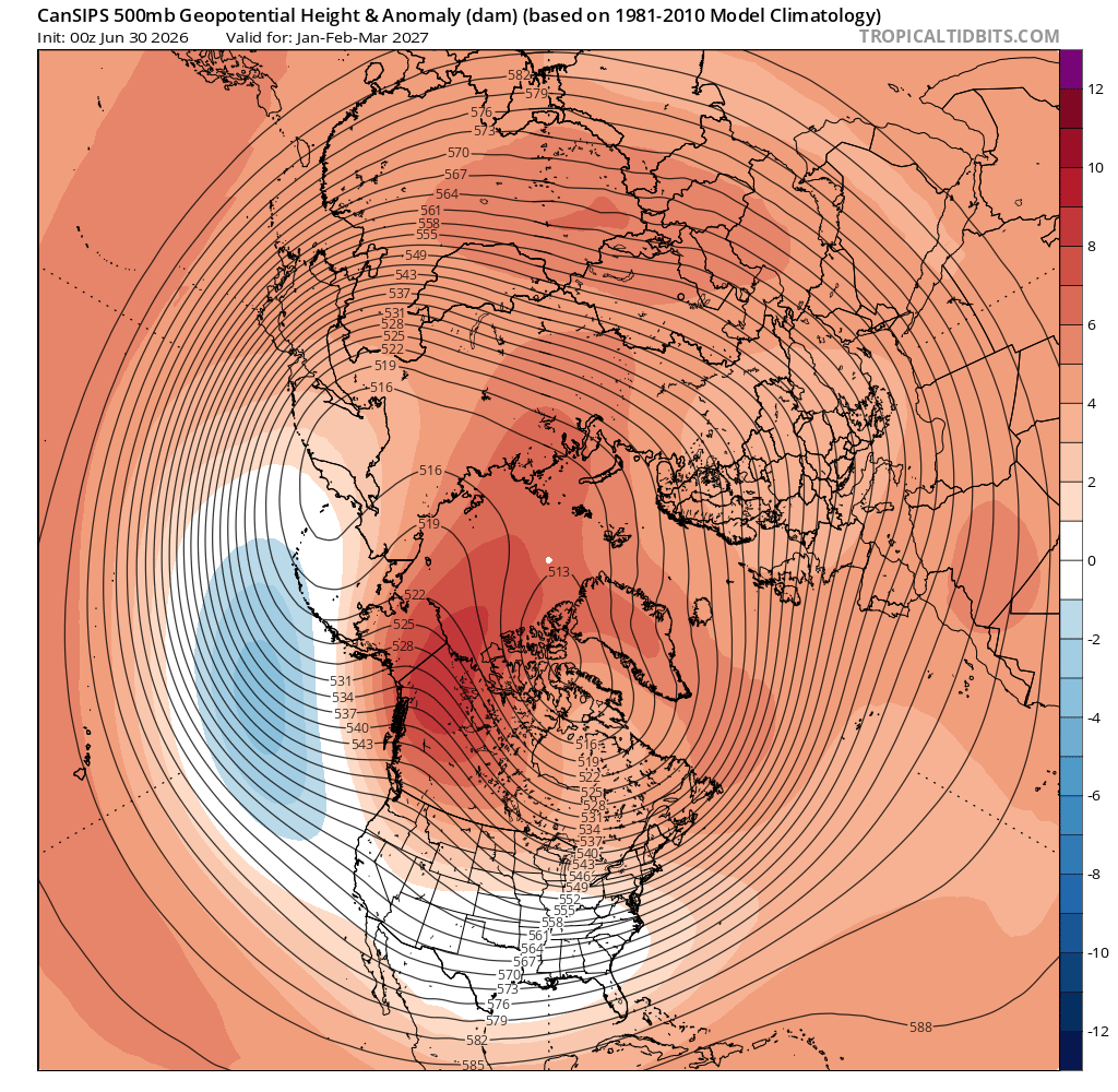
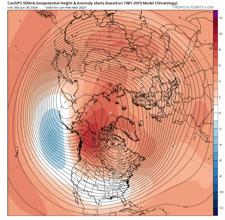
The CanSIPS advertised h5 pattern for latter part of winter certainly implies cold enough at times. Love the look out west with the Aleutian low placement and the amped EPO ridge. Has the TPV in a favorable spot and suggests a -NAO.






.thumb.jpg.ad3a2e31d30aff035044689b311a0540.jpg)