All Activity
- Past hour
-

October Comes Early: Late September Multi-Hazard Hybrid Storm
Hoth replied to WxWatcher007's topic in New England
The BOX radar presentation is pretty cool. In the absence of any other storm information, I would think there was a 'cane off shore just by looking at the radar. -

Strong Nor'Easter/Hybrid Storm Late September 2026
Michael05192016 replied to Rjay's topic in New York City Metro
It sure feels like a lot of coastal storms will be a threat from Pumpkin spice season till the Bunny hops by in March. Busy...busy...busy -
More morning low
-

October Comes Early: Late September Multi-Hazard Hybrid Storm
WinterWolf replied to WxWatcher007's topic in New England
Gotta be able to mix it down from 950mb…if we can’t then it’s nothing to exciting. -
 Infrastructure gone
 -
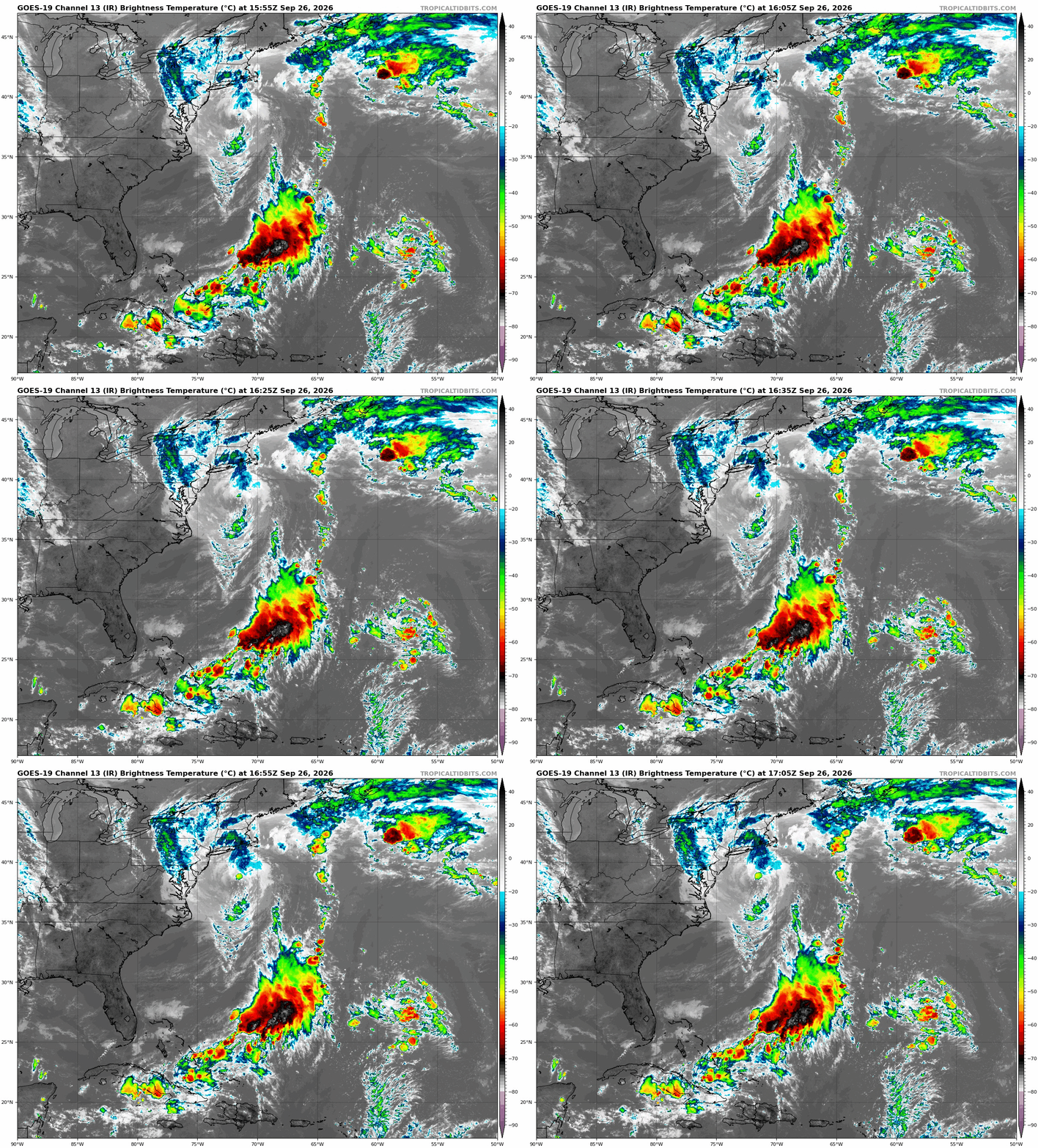
It's not tropical, but it sure looks like it. Quite the eye our there. So far .35" here in the Skook.
-
yikes - yeah we were supposed to take the train to NYC last night, cancelled that trip.
-

Strong Nor'Easter/Hybrid Storm Late September 2026
psv88 replied to Rjay's topic in New York City Metro
At the boat and winds are gusting about 33 knots per the boats instruments. Huntington harbor about 2 feet above normal but not really flooding -

October Comes Early: Late September Multi-Hazard Hybrid Storm
Typhoon Tip replied to WxWatcher007's topic in New England
what are the sounding/profiles like compared to the near coastal SSTs -

October Comes Early: Late September Multi-Hazard Hybrid Storm
ineedsnow replied to WxWatcher007's topic in New England
Just got home.. winds are ripping.. i saw a tree down that took out some wires.. templeton light and power were there @Damage In Tolland would be excited -
still haven't forgiven them for leaving the ACC (largely because of the football team lol)
-

October Comes Early: Late September Multi-Hazard Hybrid Storm
weatherwiz replied to WxWatcher007's topic in New England
16z HRRR is widespread 40-50+ knots at 950mb from eastern MA back through much of CT overnight and 55 knots towards the coast -

Strong Nor'Easter/Hybrid Storm Late September 2026
TriPol replied to Rjay's topic in New York City Metro
Definitely a hybrid. Pressure isn't dropping or rising that much. If it were warm core, the pressure would be rising because the waters are colder the further north it goes. -

Strong Nor'Easter/Hybrid Storm Late September 2026
nycsnow replied to Rjay's topic in New York City Metro
Maybe it’ll be more fun here tonight -
October Comes Early: Late September Multi-Hazard Hybrid Storm
tavwtby replied to WxWatcher007's topic in New England
beautiful sight -
First burr fell. None of the nuts were fertilized (as expected)


-

Strong Nor'Easter/Hybrid Storm Late September 2026
weathermedic replied to Rjay's topic in New York City Metro
Will once again open up the topic of whether this is now a warm core or a hybrid storm -
Strong Nor'Easter/Hybrid Storm Late September 2026
weathermedic replied to Rjay's topic in New York City Metro
Nice update from NYC EM via X (Twitter) NYC Emergency Management @nycemergencymgt · 22m NYC Emergency Management just wrapped a coordination call with the National Weather Service and City agencies. Here's where things stand and what's ahead. What's happened so far About half an inch to an inch of rain has fallen across the city. Gusts have reached 45 mph citywide and up to 55 mph at JFK. NYC Parks has received about 640 requests for downed or damaged trees since Friday, most in Queens and Brooklyn. Jamaica Bay reached major flood levels with this morning's high tide, and parts of Long Island Sound reached moderate flooding. What's ahead Tonight, about 8 p.m. through mid-morning Sunday: The heaviest rain arrives in bands falling at up to 1 inch per hour. Some areas could see 2 inches overnight, with localized amounts up to 3 inches. Isolated flash flooding is possible. Tonight into Sunday morning: Gusts of 45 to 55 mph continue, with an isolated gust to 60 mph possible. More downed trees and power outages are likely. Tonight's high tide: Around 8:15 to 9 p.m. on the south shore and near midnight along Long Island Sound. Moderate flooding is expected in Jamaica Bay and the Rockaways. Sunday's high tides: Around 8:30 to 9:15 a.m. on the south shore and around noon along the Sound. Moderate flooding is expected in Jamaica Bay and the Rockaways. The midday tide could bring more widespread moderate flooding to the coastal Bronx and northern Queens, including parts of Flushing and Astoria. Staten Island and Lower Manhattan should see minor flooding. Sunday afternoon: Winds drop off to gusts around 35 mph. Scattered heavy showers are possible into the evening, and showers linger into Monday. City beaches are closed to swimming and lifeguards are not on duty. Life-threatening rip currents are expected, so stay out of the water. Tonight through late Sunday morning is the worst time to travel. City crews are clearing downed trees, responding to flooding, and keeping rescue teams staged along the coast. If you live in a basement, be ready to move to a higher floor. Never walk or drive through floodwater, and stay away from downed lines. Report fallen trees to 311. Report damage to your home or business at http://reportdamage.nyc.gov. Text NOTIFYNYC to 692-692 for alerts. Basement apartment residents can sign up at http://nyc.gov/notify and select the basement apartment option to get automated phone calls during flooding. -

October Comes Early: Late September Multi-Hazard Hybrid Storm
Modfan2 replied to WxWatcher007's topic in New England
Too bad this was wasn’t during winter; nice feeder band set up from E Mass into CT -

Strong Nor'Easter/Hybrid Storm Late September 2026
NJwx85 replied to Rjay's topic in New York City Metro
Ummm, there’s convection firing near the center and quite a bit of lightning now.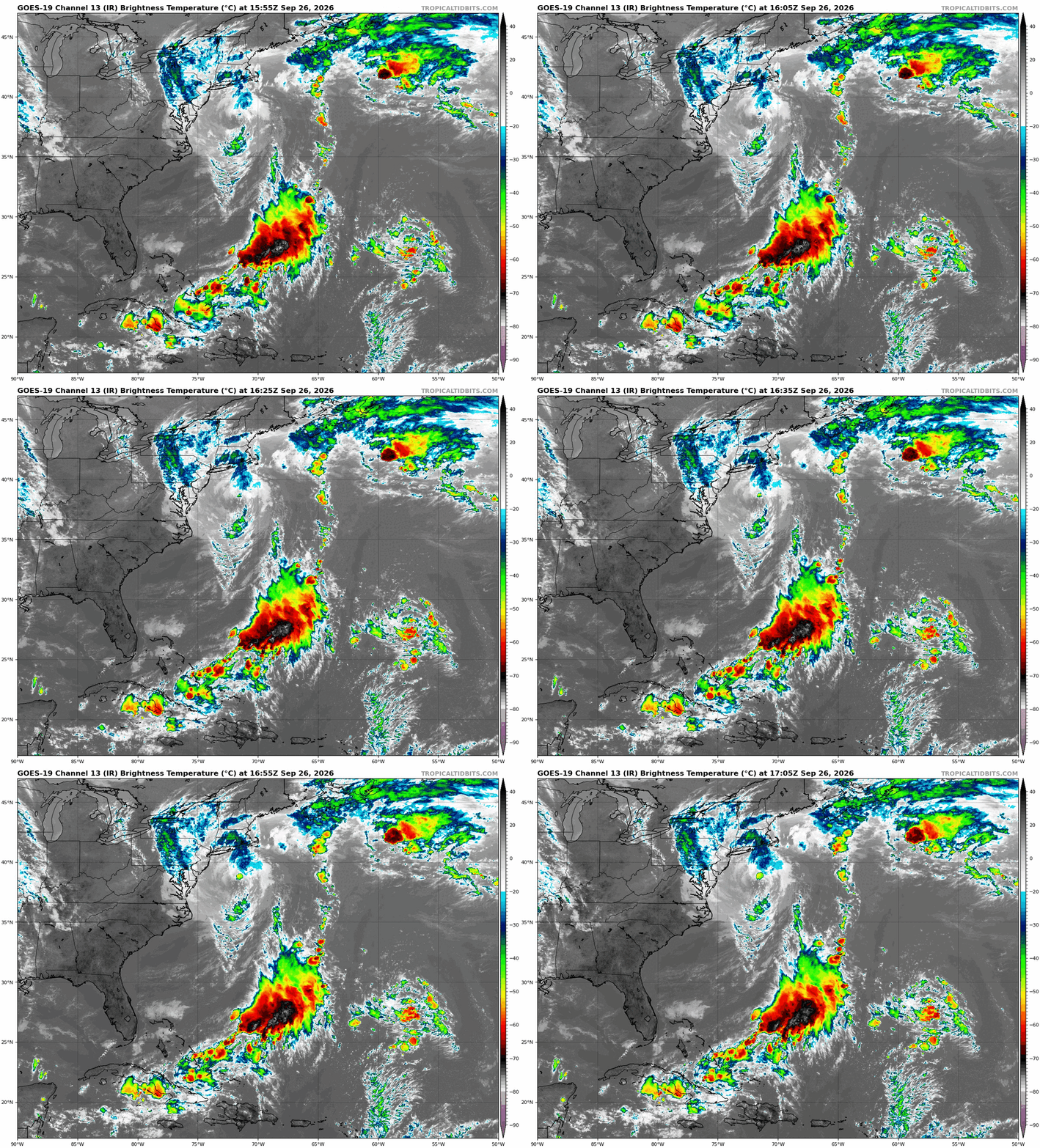
-
October Comes Early: Late September Multi-Hazard Hybrid Storm
Typhoon Tip replied to WxWatcher007's topic in New England
I don't even observe much of a digging trough... This was weakly fed really. The heights just cored out from internal processes more so - though 'some 'thing of a trigger aided. But it seemed to go disproportionately deeper relative to what it started out with, after the fact, giving it an allusion of some spontaneity to it. I suggested the other day there's a transitive/non-linear forcing coming from the large scale - by definition ..that's not always exposed to convention observation techniques. Think 'rogue wave' phenomenon as an analogy. Anyway, it may be too early to claim failure on coverage. The guidance blend really has this maximizing tonight, with 988 -ish mb low approaching from the S; with 1030mb high pivoting E over top while that happens... likely lays in a pretty significant llv jet axis and given that low gets to ISP it's probably going to be pretty nasty over E CT/RI/E Mass per the course. -

E PA/NJ/DE Autumn 2026 Obs/Discussion
JTA66 replied to PhiEaglesfan712's topic in Philadelphia Region
Only 0.20” so far, but this was never supposed to be a big rain maker back this way. I’ve set the bar at 1” for mby. We now have more night than day! 57F/DP 54F -

E PA/NJ/DE Autumn 2026 Obs/Discussion
Ralph Wiggum replied to PhiEaglesfan712's topic in Philadelphia Region
Phillies need a rain out tonight desperately....Luzardo and Wheeler both unavailable tonight but available tomorrow. Cmon rain...never needed you so badly!! -

October Comes Early: Late September Multi-Hazard Hybrid Storm
kdxken replied to WxWatcher007's topic in New England
I like a good bust as well as the next guy. But the amount of football spiking is over the top. Just beginning . The national weather service isn't backing down. -

October Comes Early: Late September Multi-Hazard Hybrid Storm
DomNH replied to WxWatcher007's topic in New England
I know this isn’t going to be that exciting inland but the mehing at 17z Saturday is kind of funny. Overnight and into tomorrow AM was always going to be the worst of it up this way.