All Activity
- Past hour
-

September 2025 OBS-Discussion centered NYC subforum
MANDA replied to wdrag's topic in New York City Metro
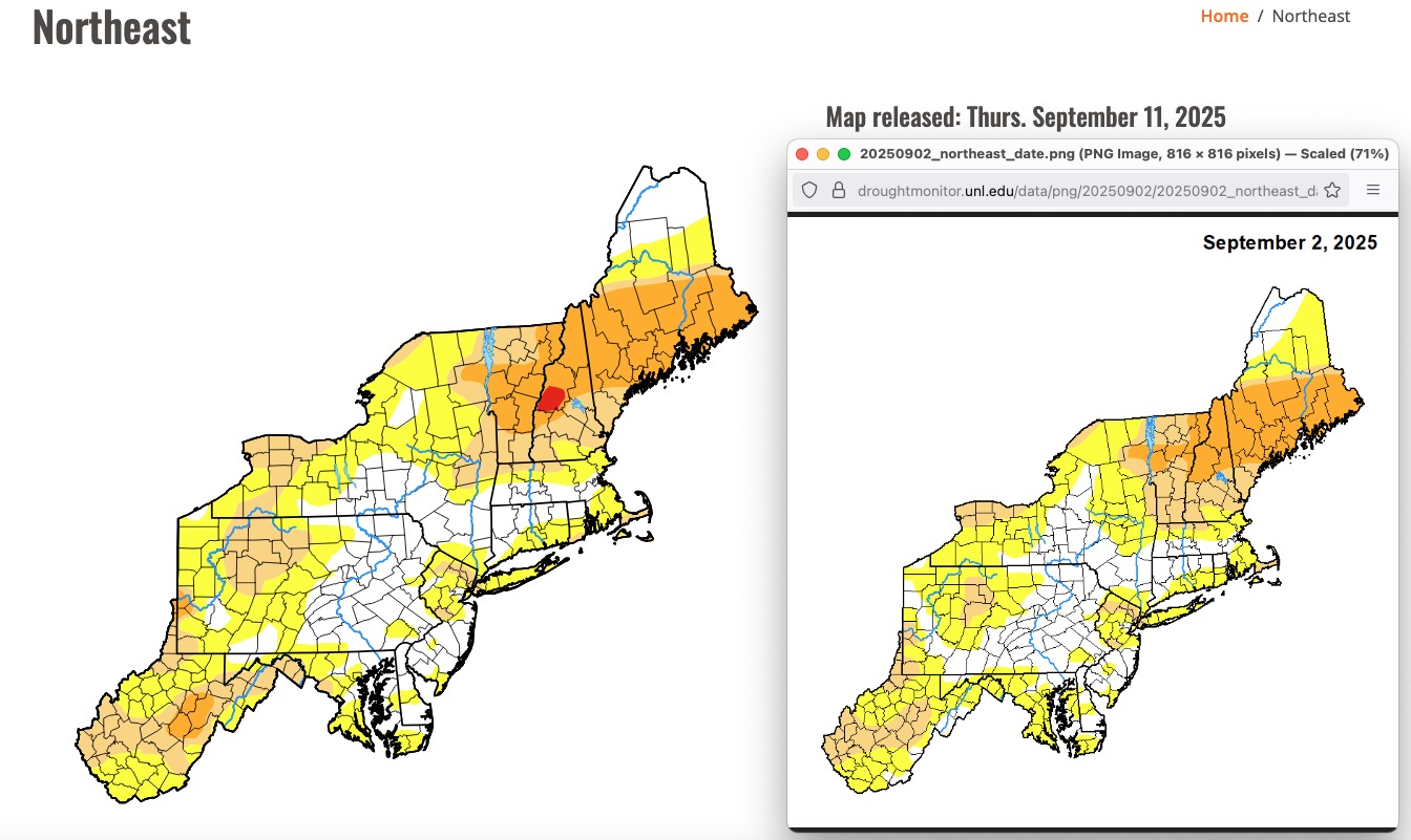
No changes to the Drought Monitor this sub forum. With the rain last week, cool temperatures and lowering sun angle not as critical as it would have been back in July and August. Drought intensified / expanded over New England.
-
September 2025 OBS-Discussion centered NYC subforum
MANDA replied to wdrag's topic in New York City Metro
Not my favorite but manageable. This cool run has been great though. -

Occasional Thoughts on Climate Change
donsutherland1 replied to donsutherland1's topic in Climate Change
China is making the turn toward cleaner energy, as are some of the other countries cited. Better sources of energy exist. The problem is not technological. It's political. Unfortunately, because fossil fuel interests are so entrenched in U.S. society, the United States has chosen to double down on outdated fossil fuel energy. The U.S. will wind up falling behind in terms of energy and possibly a much wider range of fields that utilize energy due to its decision to stick with higher cost, dirtier energy sources. It won't be the first society to bet big on yesterday's technology. During the 15th Century, as the printing press started spreading throughout Europe, Russia chose to reject it. As a result, Russia fell behind in terms of literacy and the creation/dissemination of scientific knowledge for centuries. The end result was slow modernization. Even contemporary Russia is far from a truly modern state. Its economy is largely based on natural resources and little more. It maintains an imperial world view. In short, bad choices have bad consequences. -
75/50. CoC, that is all.
-
I wonder if the clouds will burn off today
-

September 2025 OBS-Discussion centered NYC subforum
winterwarlock replied to wdrag's topic in New York City Metro
Looks summery weekend and next week...all forecasts low 80s at least -
We need a terrestrial theory of everything
-

2025-2026 ENSO
PhiEaglesfan712 replied to 40/70 Benchmark's topic in Weather Forecasting and Discussion
What about 57-58 and 09-10 (the two very snowy el ninos)? Were the 500mb height anomalies similar when adjusted for climate? -

2025 Atlantic Hurricane Season
Wannabehippie replied to BarryStantonGBP's topic in Tropical Headquarters
That very large wave just coming off the coast of Africa might have a little gap to develop IMHO, before it runs in to the SAL. -
Radar showing rain but all stations on LWX site under those returns are reporting fair skies. Is it raining anywhere or is my RadarScope just in ultra high sensitivity mode?
-

September 2025 OBS-Discussion centered NYC subforum
winterwx21 replied to wdrag's topic in New York City Metro
Looks like nice extended summer next week. Still no real heat coming, but highs probably in the low 80s here all next week. -
Yeah if winter is going to be warm, might as well tee up a severe wx buffet line! The monthly charts are hideous for snow. SER might be overdone. Surface cold might do better than progged. However the precip charts (AN Mid South) scream cutters.. and severe! for Snow I prefer AN precip to my south (the rain). low Liquid content snow should be near normal north of the rain. Even BN qpf can work for snow in colder regimes. AN qpf is almost always rain. Should I move that last paragraph to winter topic? Nah, because I don't think it'll actually be that bad. North Pac is warm. Here I'm just jawboning severe.
-
In the end, the 500mb height anomalies in 72-73 were very similar to 23-24 when you adjust for the current climate.
- Today
-
LFG
-

Mountain West Discussion
mayjawintastawm replied to mayjawintastawm's topic in Central/Western States
Yes, I feel like since we moved to the Denver Metro in 2010, September and even October have shifted from real transition months to "warm, dry and dark" (the length of daylight is one thing that hasn't changed!) while April-May have just become more variable. -
Locally it should be.
-
Early data for Aug showing an avg month. A warmer summer again driven by the warmth of June, and July. 5 & 10 yr trend charts shown respectively.


-
Very dense fog this AM. Airport has had visibility around a quarter mile.
-

September 2025 OBS-Discussion centered NYC subforum
psv88 replied to wdrag's topic in New York City Metro
Upton has a dry weekend east of the city. -

2025-2026 ENSO
40/70 Benchmark replied to 40/70 Benchmark's topic in Weather Forecasting and Discussion
I think it's one of the more helpful teleconnectors in terms of individual storms, but I would take the -EPO for starters during a given season....getting a vortex over AK is the kiss of death for any season. -
Looks hot the next two weeks through maybe Wed. Sept. 25 but mercifully humidity should be low to moderate. Only drawback with low RH is the drought will get worse in the Mid-South and western half of our region. Drought might even spread east. Not as hot east, but still dry. -GLAAM favors the warm pattern. While the ECMWF weekly is warm forever (what's new?) the CFS drops a Great Lakes trough at the end of the month, somewhat helped by a slight +PNA. Even with the GLAAM situation even a slightly +PNA can allow the said trough. CFS makes sense to get our region's temps back to normal. Euro weekly has a similar 500 mb pattern with a Midwest trough. It's west of the CFS trough axis; so, the Euro keeps the Southeast warm. Gonna have to disagree though. With normal heights, surface cool fronts should make it. Sure it'll be a day later than progged, but FROPA will happen. Bottom line: I have to go with the CFS milder late Sept. Hard spot: I figure drought could expand east more than CPC shows. We'll see. Little NW flow surprises like today might mitigate such a thing.
-

September 2025 OBS-Discussion centered NYC subforum
wdrag replied to wdrag's topic in New York City Metro
I agree with you but overall, the EC AI did not buy into the initial Sunday-Monday EC EPS closed low aloft scenario...admittedly as we mentioned... highly unusual pattern evolution. I am curious as to the multiple ensembles with sct showers Saturday (FOUS has LGA 90% RH at 60 hours 00z Sun) and it still looks like sct or widespread showers ahead of the seed moving short wave Sunday. Middle of next week might also have closed low feature in mid ATLC. For now will monitor what might transpire. -
And the best late summer/early fall rolls on.
-
Agree...


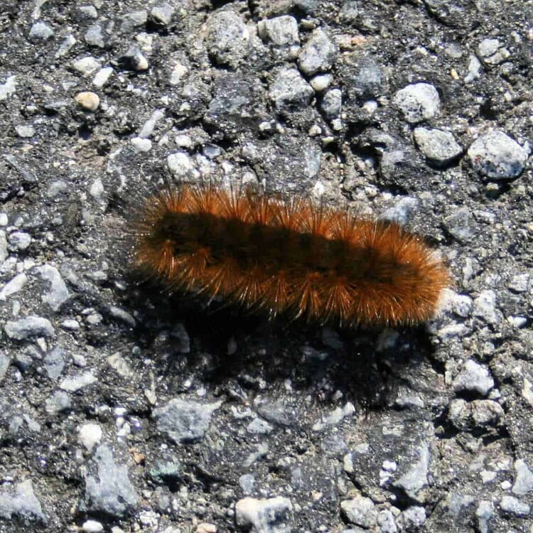
.thumb.jpeg.406ecda2eec9e267302c22b9f128fe3c.jpeg)