All Activity
- Past hour
-
 Generic Tadalafil 20mg price [url=https://menon36.shop/#]MenOn36[/url] Buy Cialis online
 -

2026-2027 Fall/Winter Mountain Thread
Met1985 replied to BlueRidgeFolklore's topic in Southeastern States
Euro looks really nice in the extended range but we've seen this before. -
https://www.severe-weather.eu/long-range-2/new-polar-vortex-emerging-winter-2026-2027-disruption-forecast-stratospheric-warming-trend-united-states-canada-europe-fa/
-

Septorcher 2026 Discussion - Endless Summer
ineedsnow replied to Damage In Tolland's topic in New England
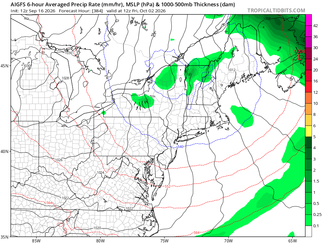
Its a start
-
If the AO is persistently negative, it seems to correlate to at least some -NAO episodes, esp in a Nino. Just going on memory/intuition. They do seem to jibe more times than not. Ofc 2009-10 is the benchmark, but this Nino is not going to be that. Just need a 2 week period where everything aligns like Jan 2016.
-
I recently pulled the seasonal stats for Chicago during past strong and super El Niño episodes. Dating back to 1950, there have been seven seasons that have featured an El Niño of strong to super magnitude. To shed a full light on the situation, I pulled stats both met winter (DJF) and the full October–April snowfall season. The clearest signal is snowfall. Every one of the seven strong/super El Niño seasons featured below normal snowfall during both the DJF and October–April periods. In several of those seasons, snowfall was significantly below average. When it comes to precip, it's more of a mixed signal. Both the DJF and October–April periods feature a mix of very wet, near-average and dry seasons. Temps lean warmer, particularly during met winter. DJF temps ranged from slightly below normal to well above normal, with warmer outcomes more common. During the longer span October–April periods there is more variability, with most seasons within +/- 1° of average, while a couple were well above average. ...Chicago Strong/Super El Nino Seasons... October-April Average Temp: 38.4° October-April Average Snowfall: 38.4" October-April Average Precipitation: 18.12" Met Winter (DJF) Average Temperature: 28.2° Met Winter (DJF) Average Snowfall: 29.6" Met Winter (DJF) Average Precipitation: 6.07" ............................................................. 2015-16 Season (Super El Nino) Oct-April Avg Temp: 40.6° (+2.2°) Oct-April Snowfall: 31.2" (-7.2") Oct-April Precip: 19.80" (+1.68") DJF Avg Temp: 31.4° (+3.2°) DJF Snowfall: 16.3" (-13.3") DJF Precip: 6.94" (+0.87") 1997-98 Season (Super El Nino) Oct-April Avg Temp: 39.7° (+1.3°) Oct-April Snowfall: 10.4" (-28.0") Oct-April Precip: 17.93" (-0.19") DJF Avg Temp: 33.2° (+5.0°) DJF Snowfall: 7.1" (-22.5") DJF Precip: 5.87" (-0.20") 1991-92 Season (Super El Nino) Oct-April Avg Temp: 37.6° (-0.8°) Oct-April Snowfall: 28.4" (-10.0") Oct-April Precip: 19.80" (+1.68") DJF Avg Temp: 30.5° (+2.3°) DJF Snowfall: 14.5" (-15.1") DJF Precip: 3.97" (-2.10") 1982-83 Season (Record Super El Nino) Oct-April Avg Temp: 38.0° (-0.4°) Oct-April Snowfall: 26.6" (-11.8") Oct-April Precip: 31.36" (+13.24") DJF Avg Temp: 30.9° (+2.7°) DJF Snowfall: 16.0" (-13.6") DJF Precip: 11.28" (+5.21") 1972-73 Season (Strong El Nino) Oct-April Avg Temp: 37.9° (-0.5°) Oct-April Snowfall: 32.9" (-5.5") Oct-April Precip: 24.38" (+6.26") DJF Avg Temp: 28.0° (-0.2°) DJF Snowfall: 20.0" (-9.6") DJF Precip: 7.52" (+1.45") 1965-66 Season (Strong El Nino) Oct-April Avg Temp: 38.1° (-0.3°) Oct-April Snowfall: 24.7" (-13.7") Oct-April Precip: 17.19" (-0.93") DJF Avg Temp: 27.5° (-0.7°) DJF Snowfall: 20.9" (-8.7") DJF Precip: 7.32" (+1.25") 1957-58 Season (Strong El Nino) Oct-April Avg Temp: 37.2° (-1.2°) Oct-April Snowfall: 20.0" (-18.4") Oct-April Precip: 11.24" (-6.88") DJF Avg Temp: 26.9° (+1.3°) DJF Snowfall: 16.2" (-13.4") DJF Precip: 3.40" (-2.67")
-

2026-2027 Record-breaking El Nino
michsnowfreak replied to Stormchaserchuck1's topic in Weather Forecasting and Discussion
Any idea the strength of the 1925-26 Nino? -
Im noticing the usual early color popping here. Im going to Traverse City Oct 20-22. Hoping its perfect up there then. They usually change later on the lakeshore than inland, so their color peak is usually around ours as opposed to more inland places like Gaylord which peak at least 2 weeks earlier.
-
On the extended pattern: I had someone ask me if it wasn’t a bit early to be putting out fall decorations with it being this hot. My response: “If you’re waiting on fall weather to do fall things, it’ll be time to decorate for Christmas.” Next week is looking a little better at least. Not quite as stifling hot and maybe some rain to help.
- Today
-
Sunday looking like a washout but next week drier overall
-
Yeah...the threads that don't have COC vs torch in them **Spoiler Alert**
-
I vaguely remember seeing that somewhere too
-
I'm heading west to Yosemite tomorrow through Tuesday coming home to 8" of rain could be fun. GFS is probably right though
-
Basically. I actually saw some post recently saying GGEM now has highest verification scores!? But I think it’s gonna rain…
-
The largest/highest heat dome on the entire planet is centered over Tennessee according to Ryan Hall. We edged out the one over the Sahara Desert. I see forecasts calling for a cool down after next Tuesday. The 12z Euro came on board after the 0z was wall to wall warmth.
-
http://menon36.com/# Cialis 20mg price
-
things are so hot in the central USA that it's never cool. My place keeps getting 70 dew points. Go away. We want weather that's cooler. Less sweaty. The +6 degrees F in Amarillo Texas might be like the warmest 90 days ever.
-
I mean when it comes to which models I want on my side that’s basically a list from “hell no” to “great to have”
-
12z gfs does have a frost risk for far NW zones at day 12…
-
It has @EastCoast NPZ in the heavy rain totals... so we have to toss it
-

2026-2027 Record-breaking El Nino
GaWx replied to Stormchaserchuck1's topic in Weather Forecasting and Discussion
The E US heat of Sept 2026 is somewhat similar to the intense E US heat of another El Niño Sept, that of record breaking 1925. -
This looks nice:
-
Cialis 20mg price: Men On 36 - Cialis 20mg price in USA
-

Septorcher 2026 Discussion - Endless Summer
Typhoon Tip replied to Damage In Tolland's topic in New England
Joke ( or not ) aside ... something like 'weather modification' may be down the road of Quantum Computing. If and when the QC cores start actually understanding all the quantum states of a system simultaneously - largely purported to be how they 'quantum compute' - it doesn't intuitively seem like sending spin instructions/communicating to the matrix ( so to speak ) is a very big leap beyond that. We had a course work in 'chaos' in nature vs weather modeling in FAST II back in the headier university days up at UML. ...Jesus the dinosaurs were big back then... The principle idea was that weather modeling would one day hit a limit ... the speculation back then in the 1990s was that it would probably be between 5 and 7... beyond that, the permutation horizon was not readable, because it was based up emergence' that were yet to occur. That may still be true, yet ... won't matter. Because we don't have to know the future any longer. Philosophically, there's no need for the preparation if were programming the winds. In other words, conventional model become a thing of the past. What a weird state that would be. For those that are born in such an era, not so much. But if one remembers a time when "pita-flops" were required to multi-modal processing of navier-stokes at grid points... and the trillions in tech and satellite that went into it all ... paper weights. -
Buy Cialis online: MenOn 36 - Tadalafil price