All Activity
- Past hour
-

Junorch obs and discussion 2026
CT Valley Snowman replied to Damage In Tolland's topic in New England
Warning now heading towards Wiz/ Wolfie. -
Start dragging out the sprinklers before it gets dark. Looks pretty sunny tomorrow.
-
Junorch obs and discussion 2026
CT Valley Snowman replied to Damage In Tolland's topic in New England
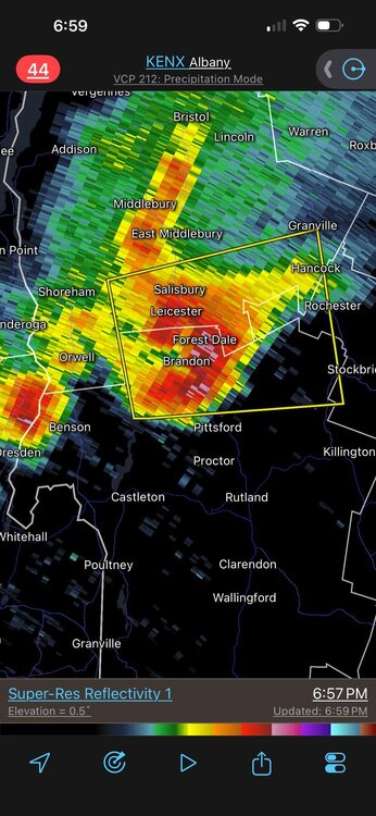
Storm is weakening just WNW of here. Meh -
Line of severe storms pushed through here (Deep Creek) around 4p - T&L, strong winds, and heavy, heavy rain. Currently sunny, breezy, and 67 degrees - gorgeous weather sitting on the deck. Looks like more severe storms to the west crossing into WV/PA.
-

Junorch obs and discussion 2026
Damage In Tolland replied to Damage In Tolland's topic in New England
I’m so angry I could spit -

- 430 replies
-
- 1
-

-
- severe
- thunderstorms
- (and 7 more)
-
Storms back in OH are moving more SErly... I'm assuming those wont make it here at all? I see a new watchbox out there
-
Come to your daddy

-
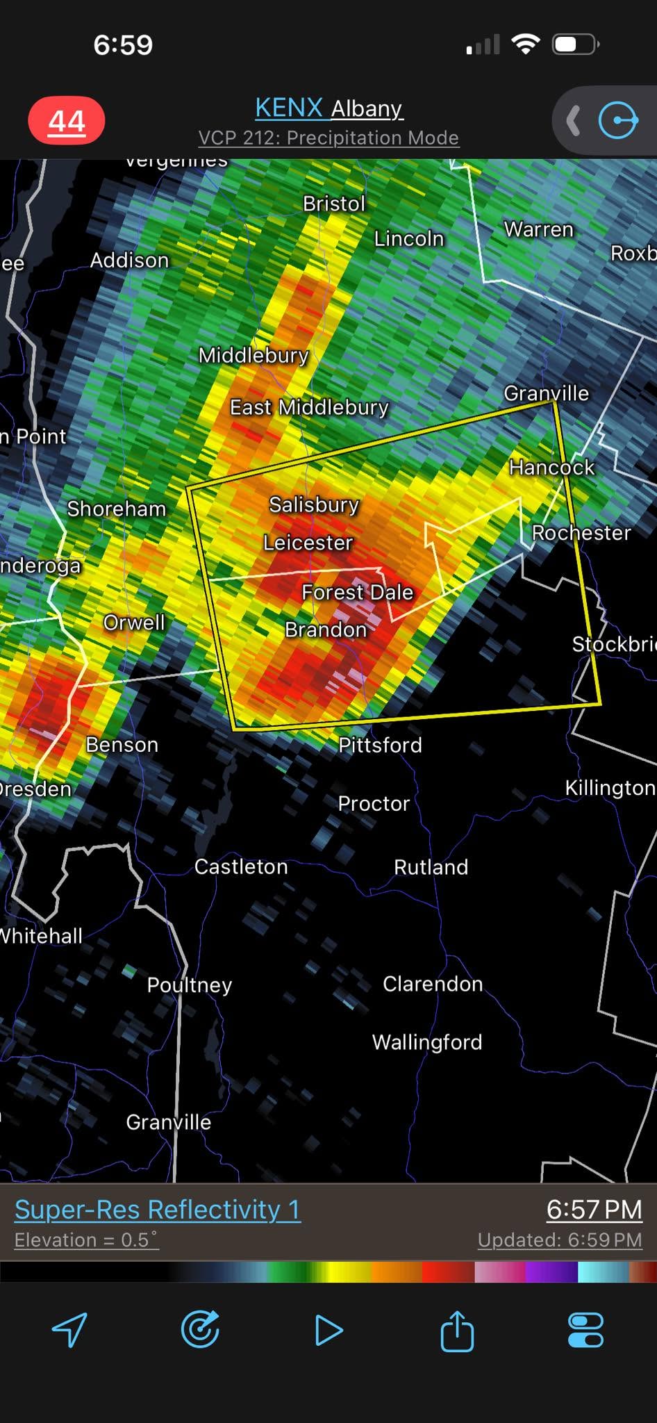
Should of stayed in VT!!! RRFS was correct w/ discrete cell near RUT.
-
Welcome! I live here in Hamblen Co. as well. We have a good group here but not many posters from Hamblen Co. Great to have you on here. I see the red tag, are you a met at MRX?
-
I put it down in early May (maybe late April) Not much I can do at this point but hope it recovers someday. Not losing sleep over it. At some point I will have to order truckloads of soil and start over. Not this year.
-
Junorch obs and discussion 2026
CT Valley Snowman replied to Damage In Tolland's topic in New England
Storm riding the CT/MA border may slip N towards Agawam. Could be a hair too S here. -

E PA/NJ/DE Summer 2026 Obs/Discussion
JTA66 replied to PhiEaglesfan712's topic in Philadelphia Region
Dark as night, hearing thunder, first drops are here, temp down to 72F. -
Junorch obs and discussion 2026
Damage In Tolland replied to Damage In Tolland's topic in New England
Yeah it looks bleak as of now. Hoping something congeals but already having nervous stomach diarrhea -
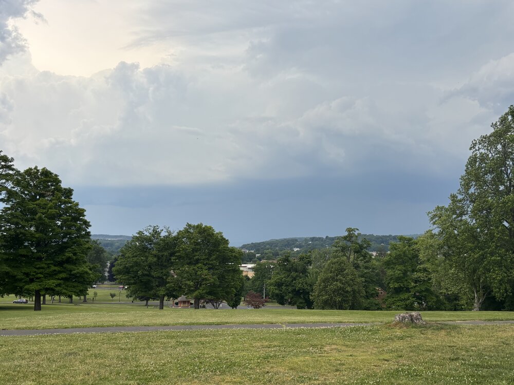
Can hear boomers in the distance, but radar looks lame. No hay cut here, so if we miss out on any significant rain, it’s all on you!
-
Beautiful! Getting very dark by me in little ferry.
-
Southern portion of the line appears to be weakening.
-
-
Junorch obs and discussion 2026
Damage In Tolland replied to Damage In Tolland's topic in New England
At least Mitch is getting crushed in VT. The downed trees will cover up limbs and body parts that surfaced after the snow melted. -

Spring 2026 Pattern Discussion Thread
KakashiHatake2000 replied to Carvers Gap's topic in Tennessee Valley
Hi welcome to Tennessee . -

E PA/NJ/DE Summer 2026 Obs/Discussion
Birds~69 replied to PhiEaglesfan712's topic in Philadelphia Region
Stuff...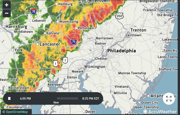
-
Just straw. Next week looks good enough for some hay.
-

2026-2027 Super El Nino
raindancewx replied to Stormchaserchuck1's topic in Weather Forecasting and Discussion
The very cold Western US + MX heatwave in June 2023 are nowhere to be found so far. It's been quite warm in the West so far this June, and the monsoon in Mexico has been in full swing at normal timing. Much of the West was 5F below average in June 2023. Nino 4 was already about 30.0C in May - record warmth. Nino 3.4 finished below May 2015. The precip pattern depicted on the June run for DJF looks like a blend of 1997-98, 2009-10, 2012-13, 2015-16. Looks to me like an MJO 6-7 blend with major +IOD contributions by East Africa. The Canadian Update in June did move the greatest precipitation area v. means much further east in the tropics, which is a good sign for canonical El Nino impacts. -
Junorch obs and discussion 2026
Damage In Tolland replied to Damage In Tolland's topic in New England
Translated.. “Kev.. you FOC’d” -
Lightening to the north, lightning to the south. Sprinkles overhead. Par for the course.