All Activity
- Past hour
-

Strong Nor'Easter/Hybrid Storm Late September 2026
uofmiami replied to Rjay's topic in New York City Metro
They only updated aviation section this afternoon. Updated forecast discussion hasn't been put online yet. -
based purely historical stats, nov 5th.
-

Strong Nor'Easter/Hybrid Storm Late September 2026
Rjay replied to Rjay's topic in New York City Metro
.png.0f576f88a63b85faf2757a202c437953.png)
-

Strong Nor'Easter/Hybrid Storm Late September 2026
Brian5671 replied to Rjay's topic in New York City Metro
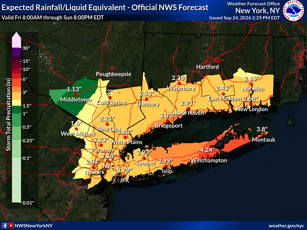
they have an advisory up for all of LI and CT shoreline and NYC -
Oh, snap. Dogfish released their WWS! (photo from FB)

-

E PA/NJ/DE Autumn 2026 Obs/Discussion
Ralph Wiggum replied to PhiEaglesfan712's topic in Philadelphia Region
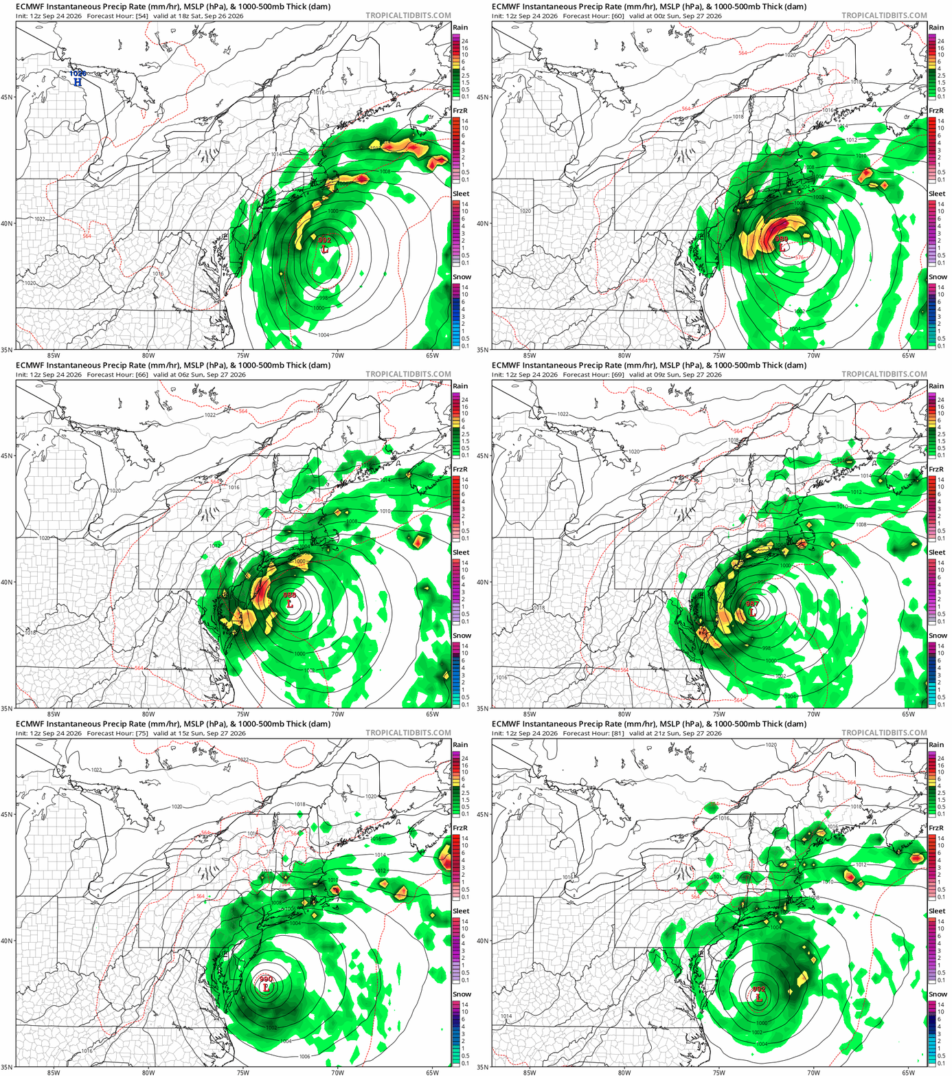
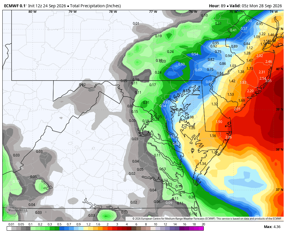
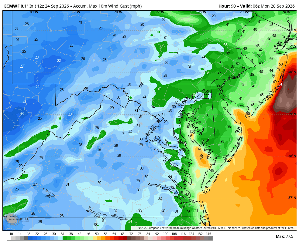
Euro Op doubles down...holy smokes! Thats worst case scenario for S NJ right there with the prolonged onshore flow, full moon, and system retrograding to the West.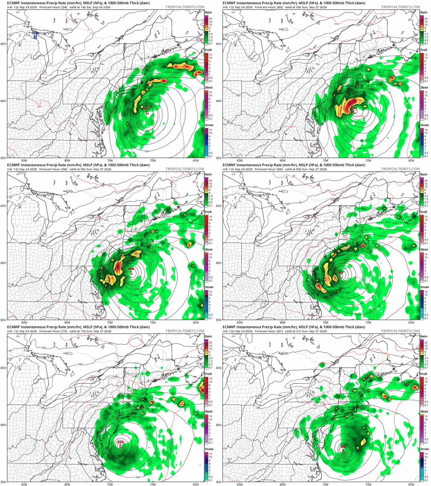
-

Strong Nor'Easter/Hybrid Storm Late September 2026
Prue11 replied to Rjay's topic in New York City Metro
Okx forecast discussion still not buying into warnings for winds outside of possibly the twin forks -

October Comes Early: Late September Multi-Hazard Hybrid Storm
amarshall replied to WxWatcher007's topic in New England
[emoji2357][emoji15] . -
Taking a look at fall during higher-amplitude El Niño episodes... October temps have generally finished near to slightly below average, although there have been a few instances of well below average temperatures. Precip tends to finish near to below average, with one notably wet outlier. Snowfall also generally ends up near average, although average October snowfall is minimal to begin with. November has shown a stronger tendency toward cool conditions, with temps generally finishing a bit below to well below average. There is, however, one notable well above average outlier. Precip becomes much more variable in November, with outcomes ranging from below normal to well above normal precipitation. Snowfall follows a similarly mixed pattern, with a fairly wide range of outcomes, from below average to well above average. ...Normal/Average... Oct Temp: 54.0° Oct Precip: 3.43" Oct Snow: 0.2" Nov Temp: 41.3° Nov Precip: 2.42" Nov Snow: 1.8" ...2015... (Fall - Strong/Super El Nino) Oct Temp: 54.7° (+0.7°) Oct Precip: 2.23" (-1.02") Oct Snow: 0.0" (-0.2") Nov Temp: 44.6° (+3.3°) Nov Precip: 4.49" (+2.07") Nov Snow: 11.2" (+9.4") ...1997... (Fall - Super El Nino) Oct Temp: 53.1° (-0.9°) Oct Precip: 2.75" (-0.68") Oct Snow: 0.0" (-0.2") Nov Temp: 36.4° (-4.9°) Nov Precip: 1.46" (-0.96") Nov Snow: 3.3" (Missing Data) (+1.5") ...1991... (Fall - Moderate/Strong El Nino) Oct Temp: 53.2° (-0.8°) Oct Precip: 7.36" (+3.93") Oct Snow: 0.0" (-0.2") Nov Temp: 35.1° (-6.2°) Nov Precip: 3.59" (+1.17") Nov Snow: 1.2" (-0.6") ...1982... (Fall - Strong/Super El Nino) Oct Temp: 53.2° (-0.8°) Oct Precip: 1.88" (-1.55") Oct Snow: 0.0" (-0.2") Nov Temp: 39.1° (-2.2°) Nov Precip: 6.95" (+4.53") Nov Snow: 0.4" (-1.4") ...1972... (Fall - Strong El Nino) Oct Temp: 50.2° (-3.8°) Oct Precip: 3.62" (+0.19") Oct Snow: 0.8" (+0.6") Nov Temp: 37.5° (-3.8°) Nov Precip: 3.18" (+0.76") Nov Snow: 5.5" (+3.7") ...1965... (Fall -Strong El Nino) Oct Temp: 54.0° (0.0) Oct Precip: 1.06" (-2.37") Oct Snow: 0.0" (-0.2") Nov Temp: 42.0° (+0.7°) Nov Precip: 1.10" (-1.32") Nov Snow: 0.0" (-1.8") ...1957... (Fall - Moderate/Strong El Nino) Oct Temp: 52.0° (-2.0°) Oct Precip: 3.15" (-0.28") Oct Snow: 1.9" (+1.7") Nov Temp: 40.2° (-1.1°) Nov Precip: 2.72" (+0.30") Nov Snow: 0.5" (-1.3")
-

October Comes Early: Late September Multi-Hazard Hybrid Storm
TalcottWx replied to WxWatcher007's topic in New England
"Storm planning & prep meeting today- With our Emergency Management Director, DPW Director and Asst Director. Special thanks to Eversource CT Tolland Liaison Ryan McKenna and Tolland Weather Advisor Kevin Wood for attending." -

October Comes Early: Late September Multi-Hazard Hybrid Storm
ineedsnow replied to WxWatcher007's topic in New England
fwiw the 18z HRRR and 15z SREFS are pretty far south with the westward turn -

October Comes Early: Late September Multi-Hazard Hybrid Storm
CoastalWx replied to WxWatcher007's topic in New England
I’ll slap some sense into him. -
.thumb.jpg.6a4895b2a43f87359e4e7d04a6fa0d14.jpg)
Central PA Autumn 2026
Yardstickgozinya replied to canderson's topic in Upstate New York/Pennsylvania
Yardstickgozinya Yardstickgozinya Posted Monday at 12:42 PM What a beautiful coastal setup being advertised today. Too bad, it's not January or February. Hopefully, this is a premonition to how we may possibly see some systems set up this winter. I wasn't sure how to move this post to a new thread. This feels pretty typical watching an anomalous storm, not far away, as we sit under bluebird, skies. That said this storm is forecast to do some things that I don't think we've seen in a very long time . I'm fired up and ready for winter. I can't wait another day so I'm watching the old tuck rule game tonight to help motivate me to get into snowsuit physique. Lol -
 http://canamcrosscare.com/# canadian pharmacy website
 -
 Scooters boss @vortex95should really go wild overnight!
 -

Strong Nor'Easter/Hybrid Storm Late September 2026
donsutherland1 replied to Rjay's topic in New York City Metro
The 18z NBM: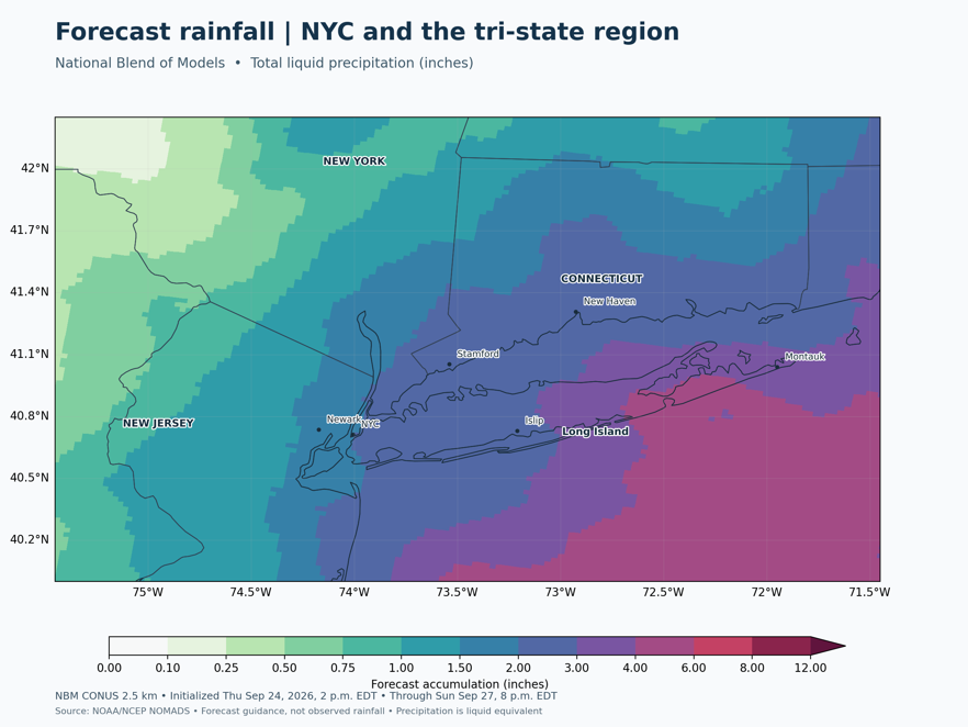
-

Strong Nor'Easter/Hybrid Storm Late September 2026
jconsor replied to Rjay's topic in New York City Metro
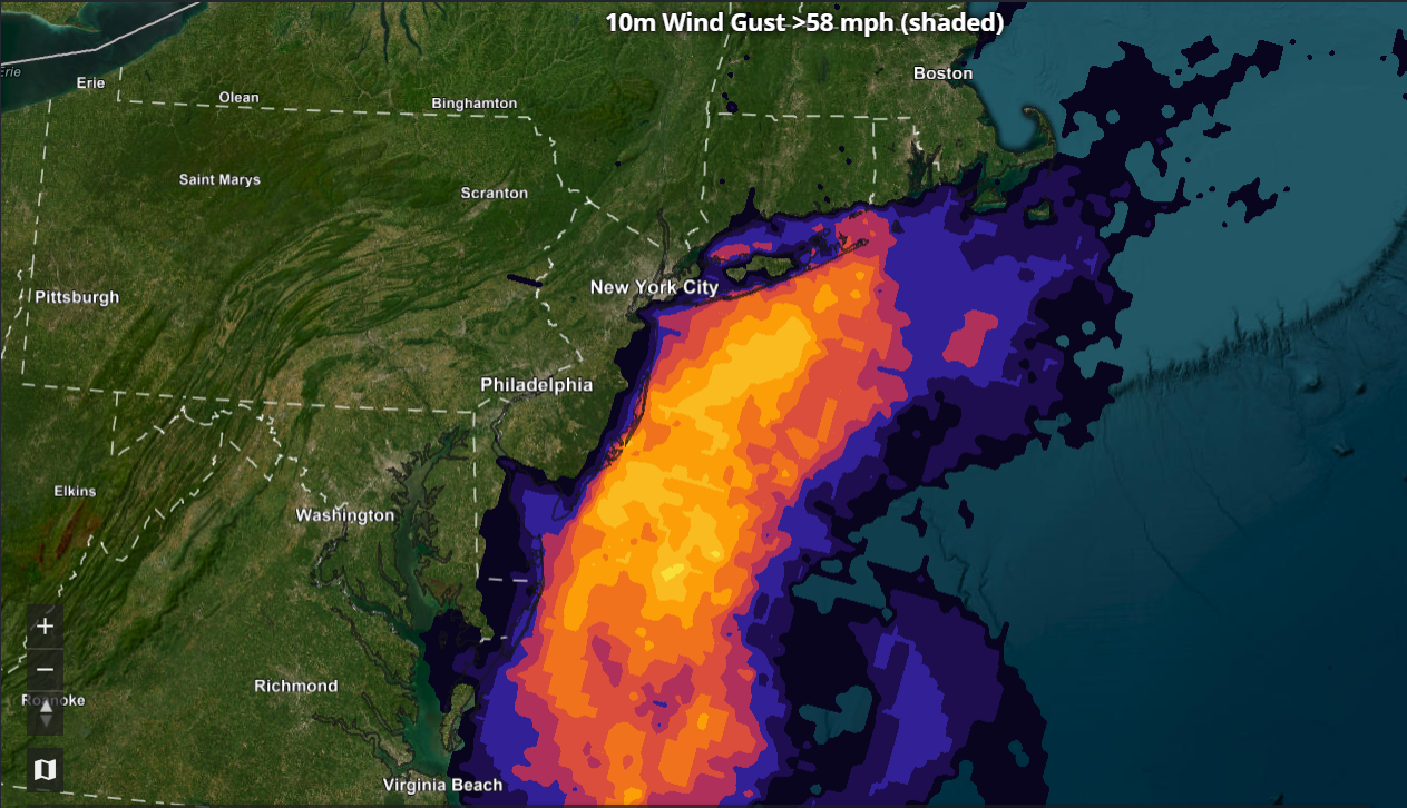
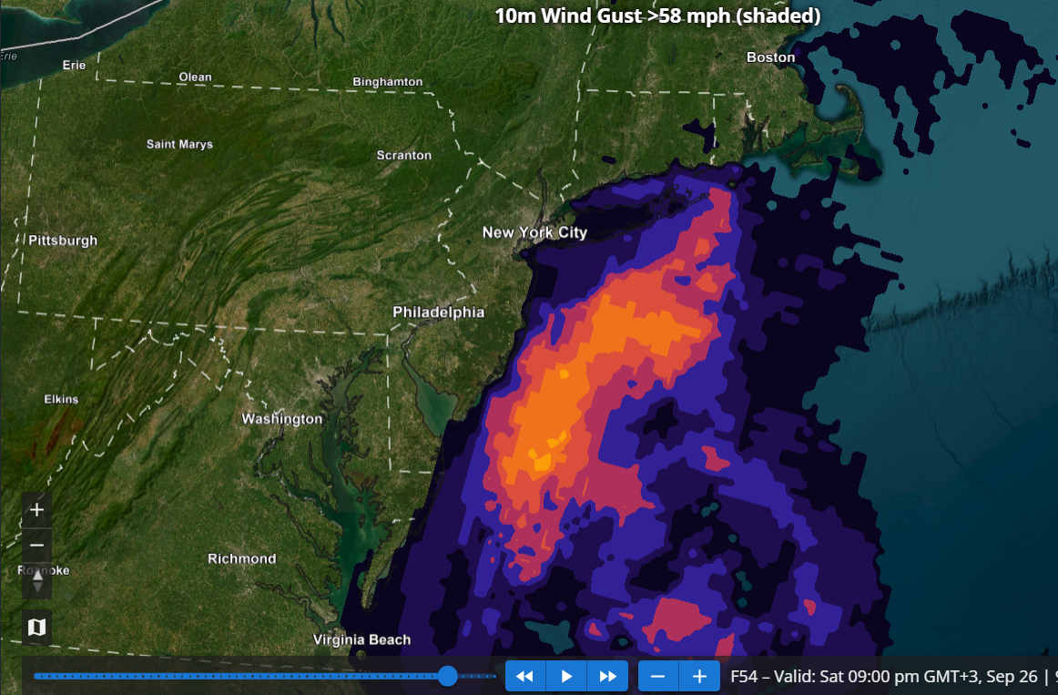
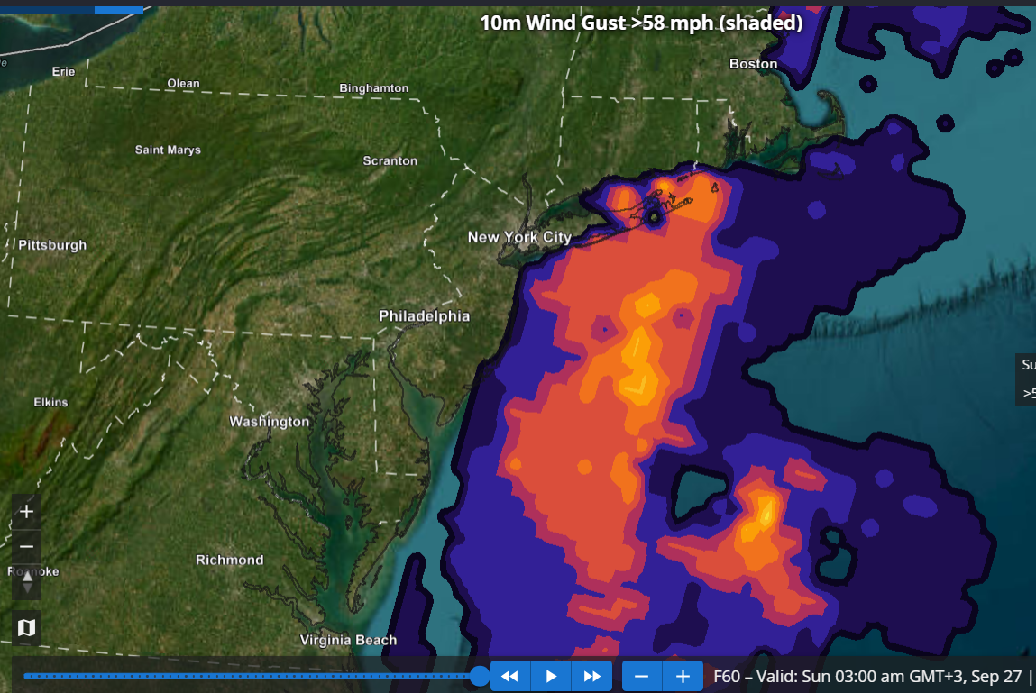
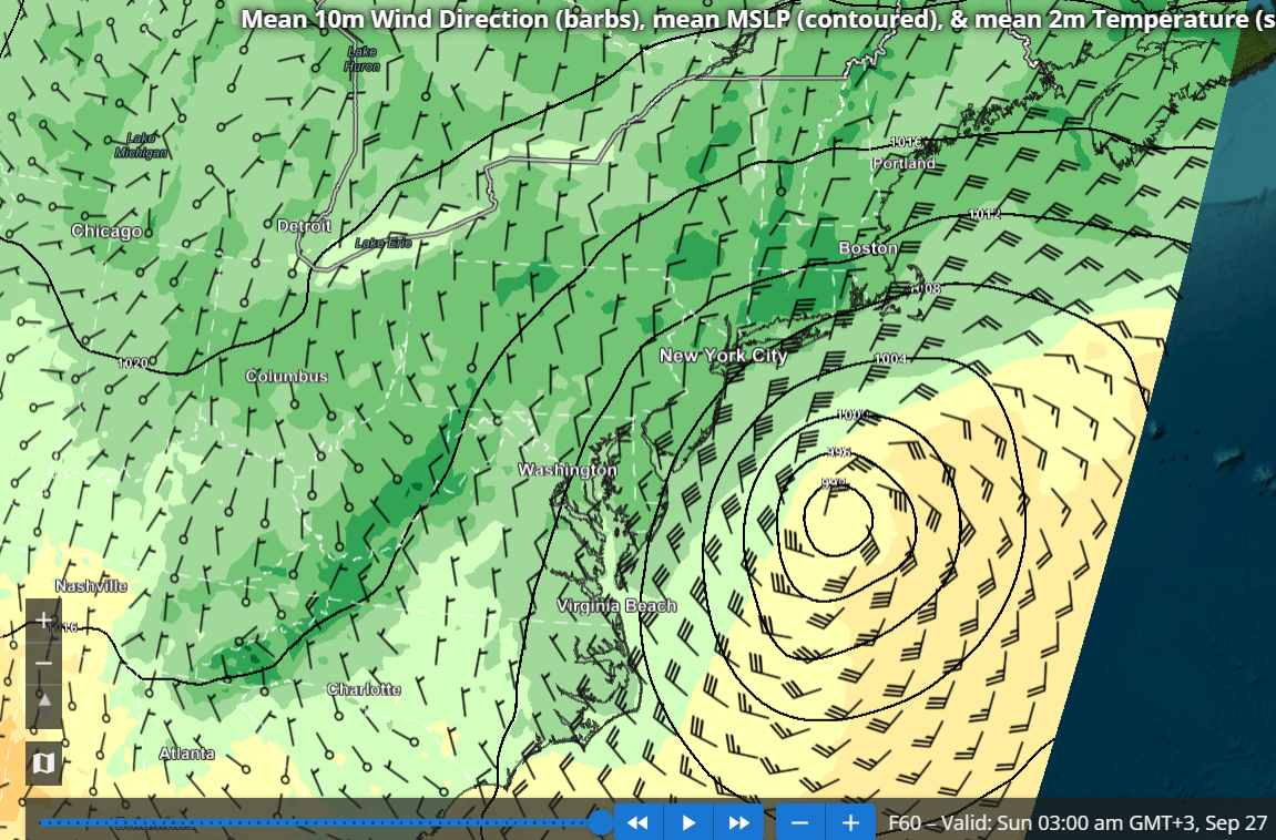
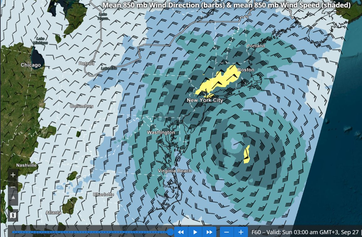
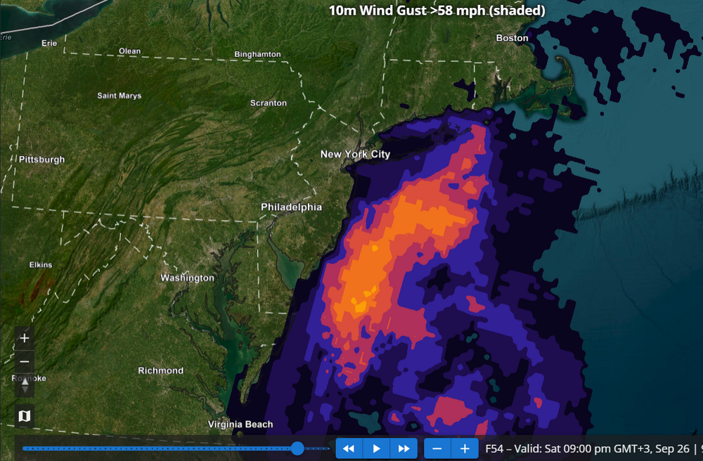
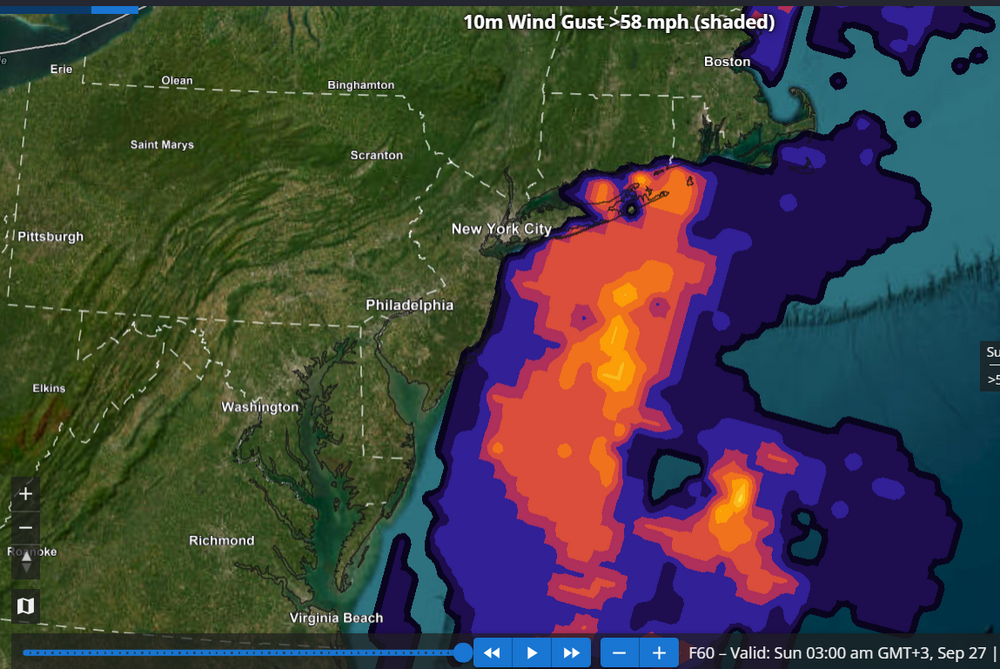
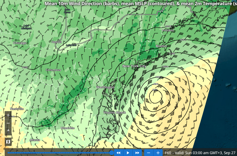
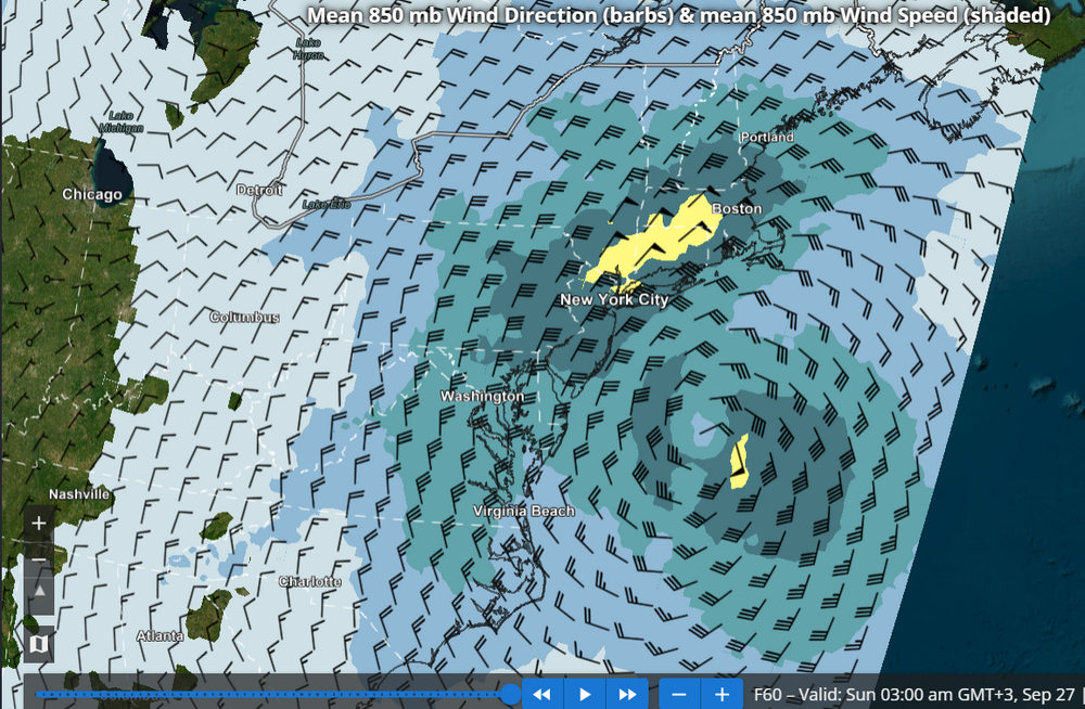
I agree the specific REFS scenario should be largely dismissed, though the idea of a westward turn occurring fairly far south near southern NJ and the Delmarva has merit IMHO. The REFS (RRFS ensemble) has a lot of value and so far I have barely seen anyone mentioning it. Probably because the site with REFS graphics seems to be a pretty well kept secret: https://sites.gsl.noaa.gov/desi/ The images I posted below show probability of 58 mph wind gusts (HWW criteria) at 42, 54 and 60 hours from the most recent REFS run (15z). Based on this I think a HWW would be well justified for the south shore of LI as well as eastern Suffolk, perhaps even into se CT. I also added the MSLP and 850 mb wind forecasts from the REFS at 60 hours, showing the mean places the storm well north of the RRFS operational.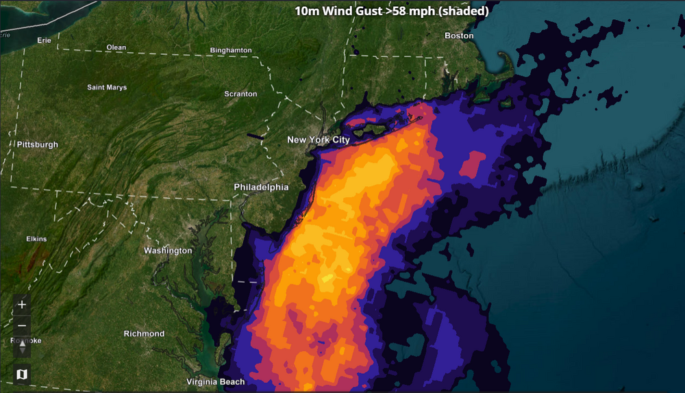
-

October Comes Early: Late September Multi-Hazard Hybrid Storm
WinterWolf replied to WxWatcher007's topic in New England
The exact evolution of this thing is still to be determined. And then the ultimate track is still up in the air. So ways to go on this thing. -

Strong Nor'Easter/Hybrid Storm Late September 2026
wthrmn654 replied to Rjay's topic in New York City Metro
-
WB 12Z EURO
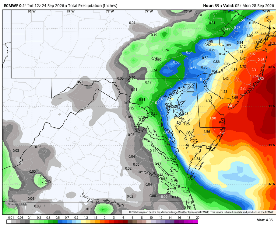
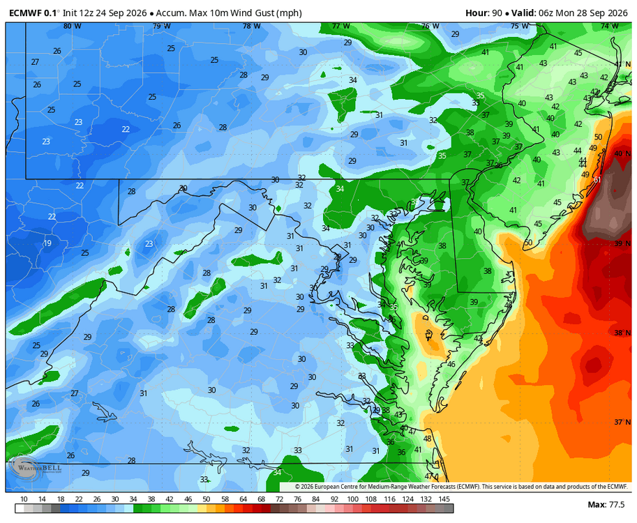
-
also shits out this at the end of the run
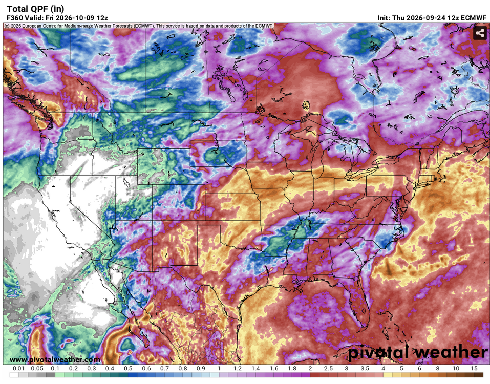
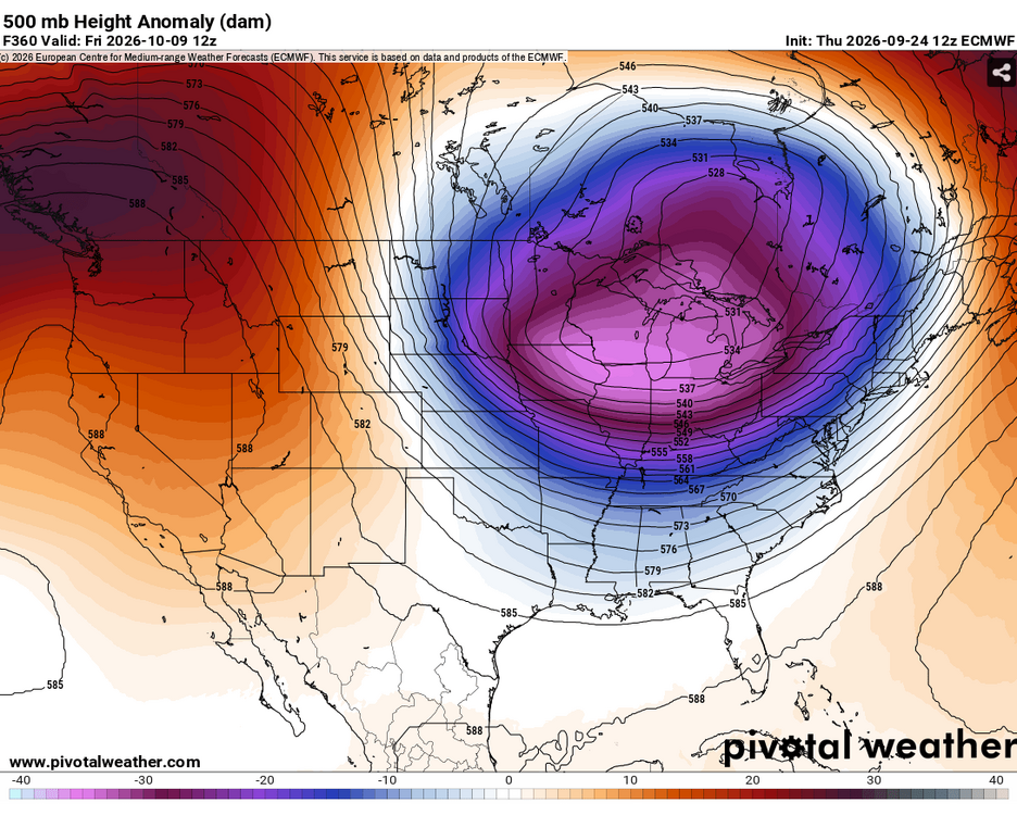
-
Sometimes I don't even know the joke when you respond ngl. Genuinely no clue how it relates to my post please enlighten me.
-

October Comes Early: Late September Multi-Hazard Hybrid Storm
Masswx replied to WxWatcher007's topic in New England
If the euro is right it’s a nor meh ster not interested if it’s not gonna give me much -

2026 Atlantic Hurricane Season
Windspeed replied to Stormchaserchuck1's topic in Tropical Headquarters
It's worth noting that the 12z HAFS suites get Fay down to 989 and 983 mb respectably by noon tomorrow before shear begins to increase again. Fay's vortex is embedded within a high background pressure regime of 1022+ hPa surface isobar with a 1030 hPa surface ridge centered to the north and 591dm heights. For it to drop 20 mb by tomorrow would require some rather significant intensification, and Fay would absolutely be a hurricane if this unfolds. Again, it's TC modeling, and HAFS may be overdone, but Fay has a real shot if it can continue mustering up convection and close off a core this evening. -
Strong Nor'Easter/Hybrid Storm Late September 2026
Rjay replied to Rjay's topic in New York City Metro
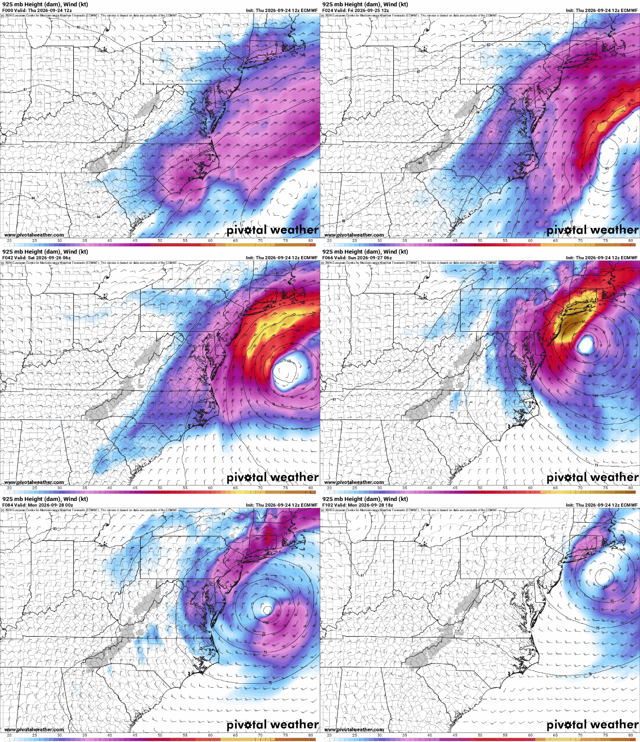
925mb winds