
All Activity
- Past hour
-
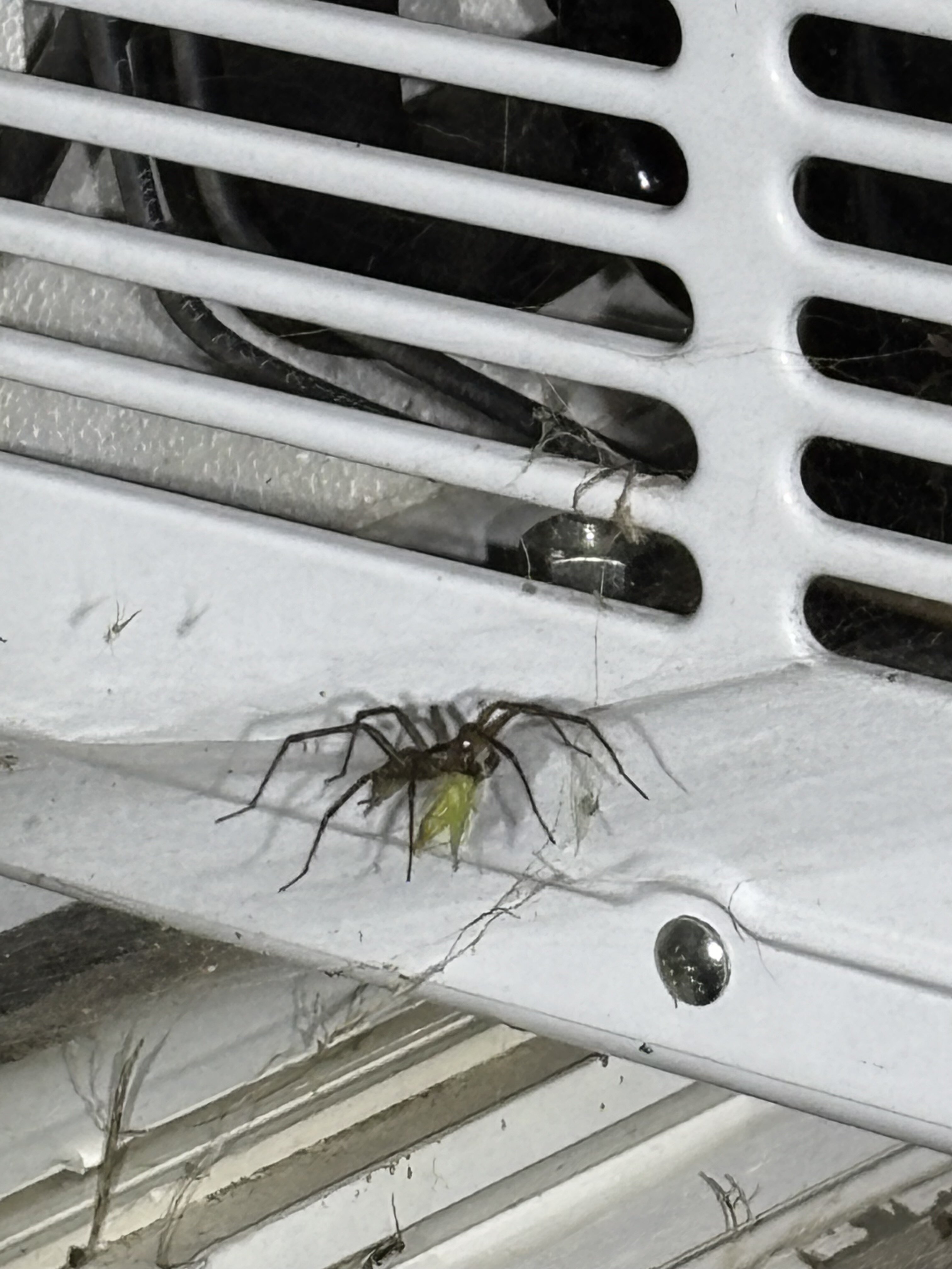
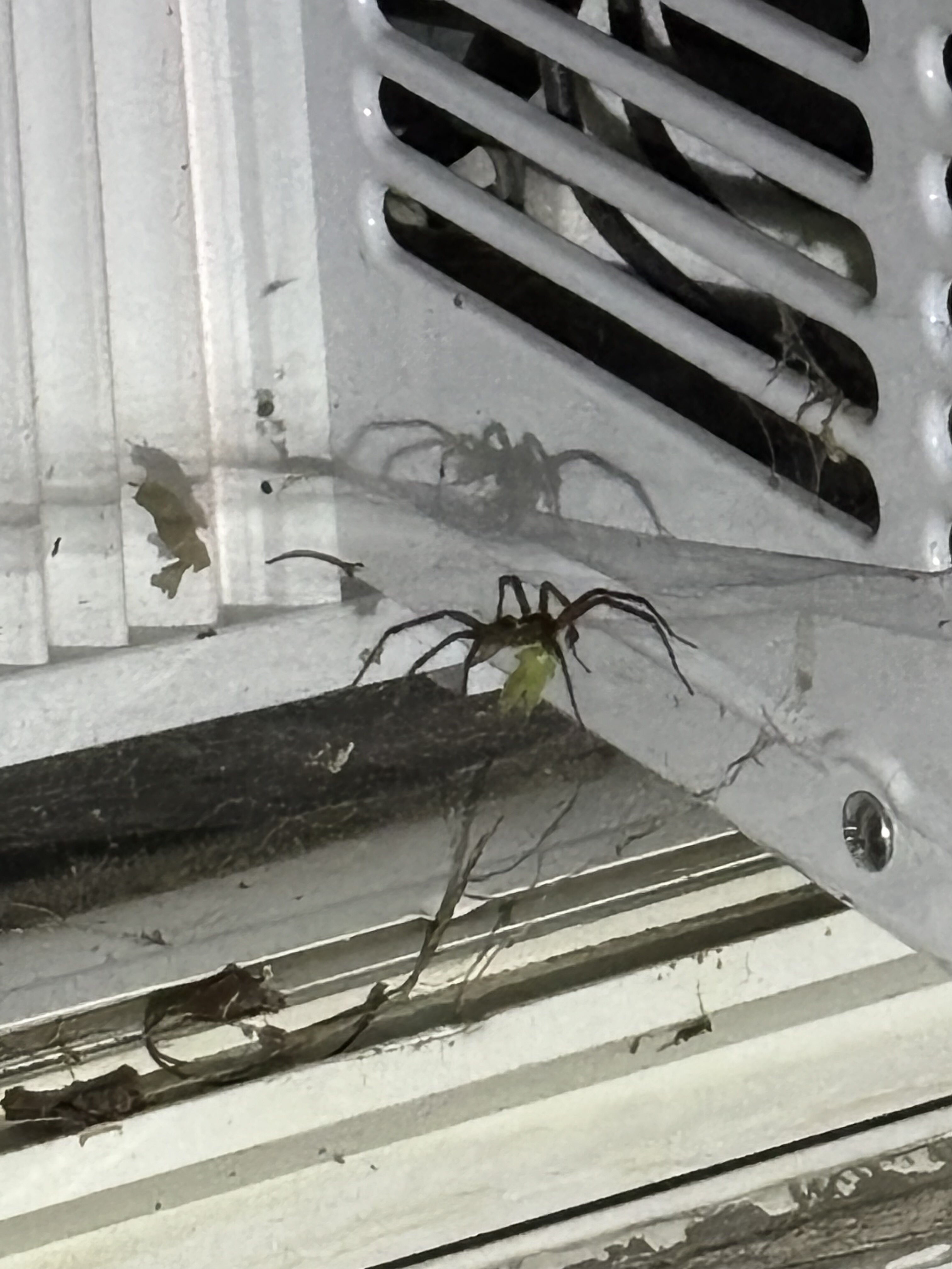
Looks like a Airaconda. They breed in air conditioners. Give the unit a kick. I wouldn't mess around.
-

Augdewst 2026: Summer's Last Stand
ineedsnow replied to Prismshine Productions's topic in New England
its a pauldid.. they sense when people are scared of them.. then they find them during the night and bite -

Augdewst 2026: Summer's Last Stand
HIPPYVALLEY replied to Prismshine Productions's topic in New England
Touch it, see if it bites. -
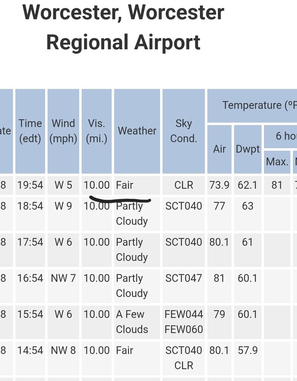
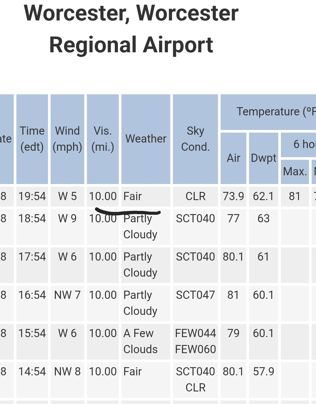
Absolute perfection weather. Been a nice stretch. When are we getting that torch you were talking about? Did manage 81 today I hope you found a cooling station.
-

Augdewst 2026: Summer's Last Stand
weatherwiz replied to Prismshine Productions's topic in New England
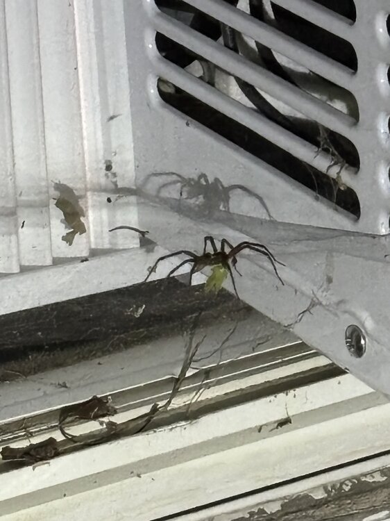
What in the hell kind of spider is this? It’s freaking massive. Too scared to get any closer for a pic. I’m afraid he will lunge at me. He was watching my every move as is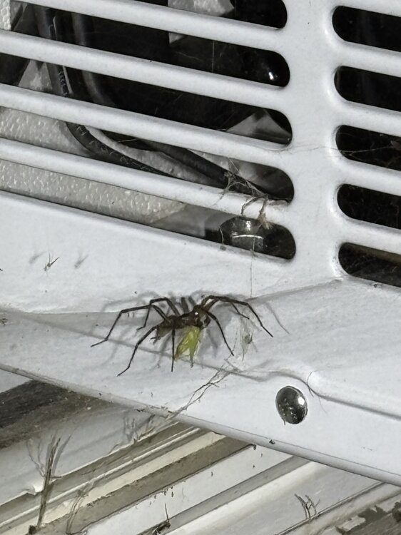
-
seems like the moisture part of the equation won't be an issue. Just need a well-timed airmass.
-

Augdewst 2026: Summer's Last Stand
Damage In Tolland replied to Prismshine Productions's topic in New England
Turning into a very dewy week other than Friday -

Augdewst 2026: Summer's Last Stand
vortex95 replied to Prismshine Productions's topic in New England
TPA last year?, it seems that where the ASOS in relation to the runway, and the location of jets that taxi on the runway at the time from flight plots (turn point/wait point is in direct line of ASOS), that could have nudged it to 100. In the large picture, this obsession w/ 100 F. 100 is base 10, first number to go from 2 to 3 digits, and psychologically satisfying number, so somehow that makes it more significant from a wx/climate POV? It's a U.S., and more specifically, E Coast-centric mindset, as 100 is not that common. Well, there is a world outside of the East Coast! And we just happen to use the F scale. In C, benchmark numbers for hot temps are 30 and 40 C, so 100 is not some magical number here from a wx/climate POV universally. And we have the K temp scale as well --- oh wait, I just realized how we can hype the heat more! Use the K scale instead, it is *so* much hotter sounding (100 F = 311 K)!!!! -
Today's Highs: New Brnswck: 88 PHL: 88 EWR: 86 TEB: 86 NYC: 86 ISP: 85 JFK: 85 LGA: 85 TTN: 85 ACY: 84 BLM: 82
- Yesterday
-
https://www.nytimes.com/2026/08/18/climate/trump-ends-roadless-rule-forests.html?unlocked_article_code=1.6VA.m1Sl.hpiH3V8wmXUd&smid=url-share “After the proposal is published in the Federal Register, which is expected later this week, the Forest Service will accept public comments before making the rule final.” I’d implore everyone to let their voice be known as our administration plans to divide and then cut down our oldest forests; despite the fact that currently existing national forest roads are hemorrhaging money and resources.
-

2026-2027 Record-breaking El Nino
Jebman replied to Stormchaserchuck1's topic in Weather Forecasting and Discussion
The DC Region has it coming, and has had it coming for a very long time. Juiced up, roided out STJ, meet an abnormally frigid airmass over the DC Region Sub. That's how they could end up with a super deep snow blizzard to rival many of the biggest snowstorms since records began. Might be in February. Models have been hinting at it being colder then normal then. Frigid air plus record nino stj could go full-on George BM blizzard. -
Augdewst 2026: Summer's Last Stand
vortex95 replied to Prismshine Productions's topic in New England
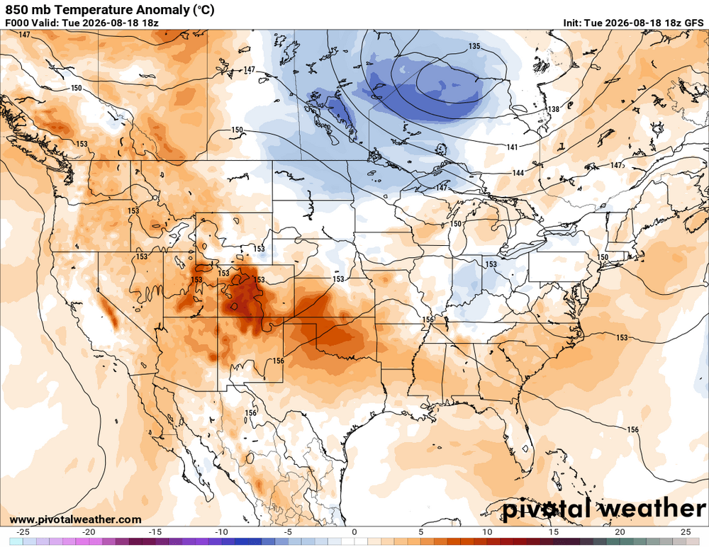
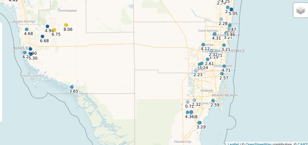
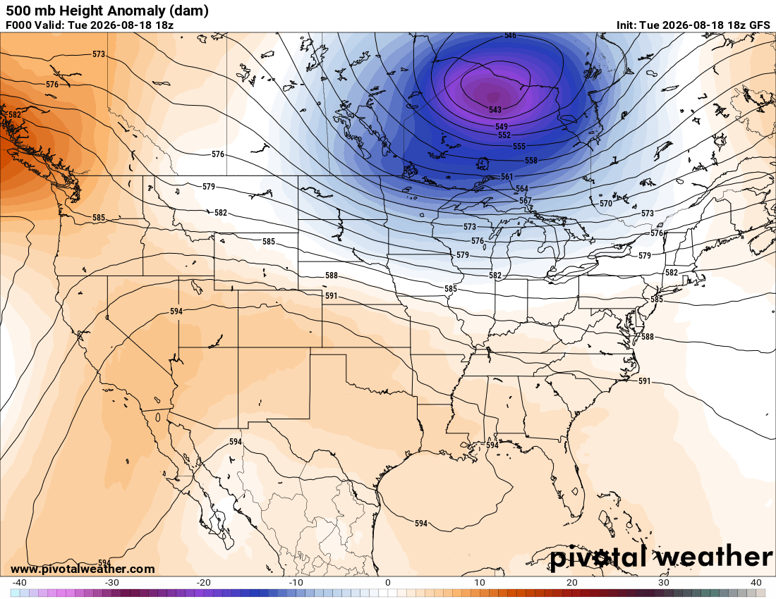
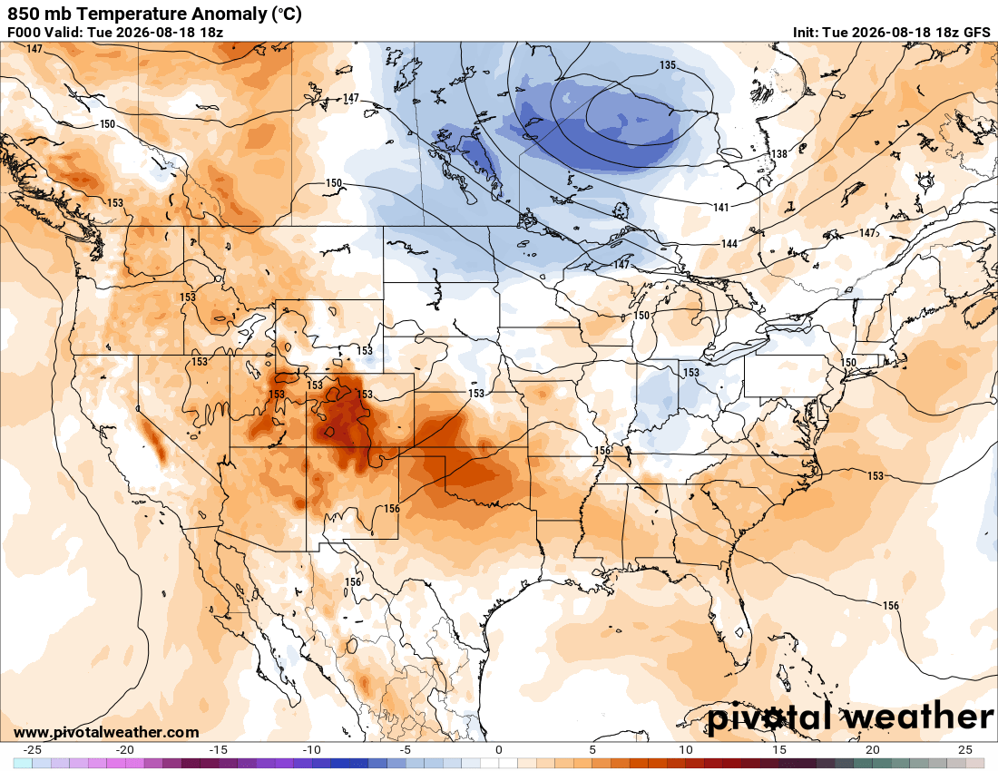
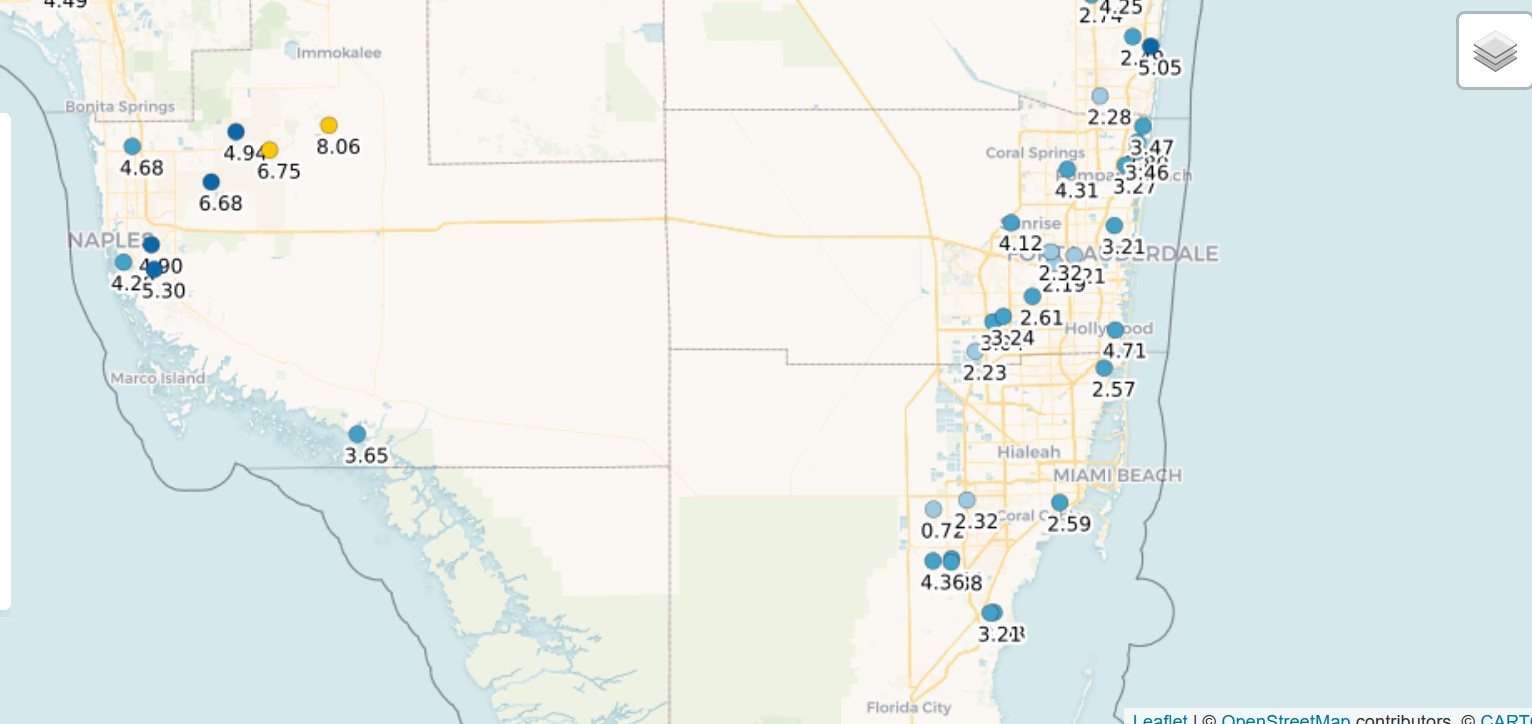
Dew point briefly dropped to 67 which is practically unheard of this time of year. Wind flipped SE and now dew point is 78. Even more amazing HST dew point dropped to 60! Must have been a localized dry pool of air. No RW/TRW in the area in the last 24 hr. It was not b/c anything atypical was going on in the pattern synoptically. GFS 500 and 850 anomalies show nothing of significance. This was a localized phenomena. 925 and 850 winds across much of FL today light NW. If you look at climo for the area, the wind, outside of convection, is rarely out of the NW at any appreciable speed in the afternoon this time of year. But not long before the 100 reading today, it was 33011G16KT. But never such details get in the way of a good story or proper perspective. The MSM will act like the wx is extreme and a big heat wave/AGW caused it. MIA is +2.0 F for the month, nothing that unusual. And yes, there are mdt-high drought conditions in S FL, but it is long-term drought. So far in August, it has been near to above normal for rainfall, so you can't say the topsoil is widespread parched that caused the low dew points (M-T-D rainfall attached). MIA also hit 100 on July 21, 1942. I'd like to see what was going on that day for comparison. And of course, the population of Miami-Dade Co. was ~350,000 in 1942. It was 2.7M in 2020. So not a level playing field for proper comparison due to UHI.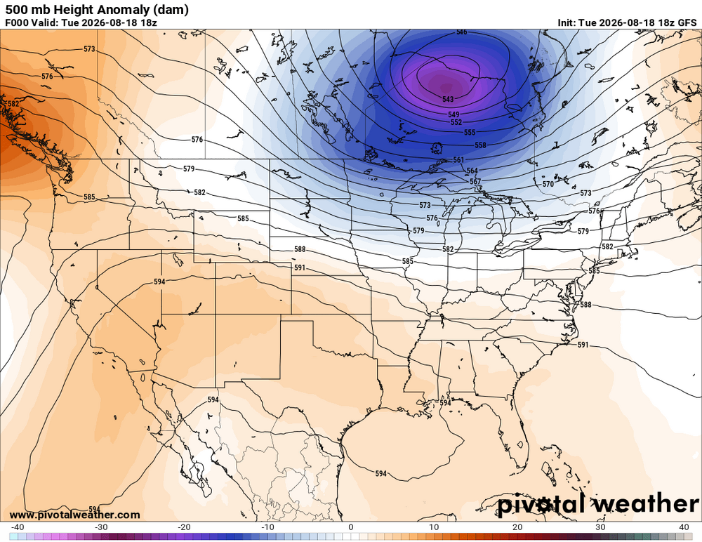
-
Reading the Neven Sea Ice Board there has been a low entrenched over the pole most of the sun keeping warmth and sun at bay.
-
Another free bar beer bites the dust. "What's the hottest it's ever been in Miami?" Tampa went down last July.
-
You've pointed out something that I've had a question about for a long time. We all know that the NPac is way warmer than normal. But, does that matter (wrt our weather around here)? If the average ocean temp is say, 45, and we're now seeing 50-52, is that enough of a jolt to alter the Nino climactic expectations? I know there are other variables out there, but focusing specifically on ocean warmth, is the 'blob' warm enough (NOT just comparing to average, but total warmth) to cause what we expect (warm northern tier, cooler southern tier, dry Ohio Valley, juiced STJ etc.) to be materially altered? This may be too simplistic but if I go from 17 degrees to 24, that doesn't alter much. If I go from 28 degrees to 35, we have a whole different world.
-

2026-2027 Record-breaking El Nino
michsnowfreak replied to Stormchaserchuck1's topic in Weather Forecasting and Discussion
If December is as mild as early thoughts, im hoping we get a Thanksiving wintry blast. 4 of the 5 past Thanksgiving weekends have been snowy in the Lakes, and the last 2 years there's been snow on the ground when cutting down the Christmas tree black Friday. It really helps to get that early jolt if Decembers gonna suck. -
2026 Atlantic Hurricane Season
vortex95 replied to Stormchaserchuck1's topic in Tropical Headquarters
Several days after Andrew, Typhoon Omar made a direct hit on Guam. taking out the operation of JTWC (which was based on Guam at the time). NHC was almost taken out by Andrew, and the following month, CPHC in Honolulu narrowly adverted Iniki. The E/CPAC had 27 NS in 1992, the record for this basin. Quite a year! -
Miami hit 100° today for only the second time ever wow
-

2026-2027 Record-breaking El Nino
mitchnick replied to Stormchaserchuck1's topic in Weather Forecasting and Discussion
Big, early departures may result in an ugly monthly + anomaly, but once it flips and gets cold enough for snowfall, who cares!!! February will be knocking on the door. -
Tomorrow should mainly fair and very warm. Highs will likely reach the middle 80s to perhaps upper 80s across the region. Another cold front could bring some showers or thundershowers to the region Wednesday night or Thursday. The frontal passage will be followed by a reinforcing shot of cooler air. Thursday and Friday could see highs in the lower 80s. The weekend could feature cool and perhaps unsettled weather. The ENSO Region 1+2 anomaly was +4.0°C and the Region 3.4 anomaly was +2.7°C for the week centered around August 12. For the past six weeks, the ENSO Region 1+2 anomaly has averaged +3.80°C and the ENSO Region 3.4 anomaly has averaged +2.32°C. The ongoing strong El Niño, which has reached super El Niño threshold, will continue to strengthen through the summer. The SOI was -22.21 today. The preliminary Arctic Oscillation (AO) was +0.388 today. Based on sensitivity analysis applied to the latest guidance, there is an implied near 50% probability that New York City will have a warmer than normal August (1991-2020 normal). August will likely finish with a mean temperature near 76.1° (near normal). Supplemental Information: The projected mean would be 0.9° above the 1981-2010 normal monthly value.
-
Agree, and think there is decent multi modeling suggestions that we will see several periods when +PNA / - AO will work in tandem with a juiced up El Nino to present us with some big potential. Wall to wall snow cover? NO! Above normal Temp? YES... But solid opportunities for disruptive snow periods.
-

2026-2027 Record-breaking El Nino
LakePaste25 replied to Stormchaserchuck1's topic in Weather Forecasting and Discussion
Preliminarily this is where I’m leaning (locally): December +7 to +10 January +5 to +8 February -1 to +2 I will revise this later on. This is for the lower Great Lakes (Erie, Cleveland, Buffalo, Rochester). Of the 3 months, there’s little chance I’ll revise December. Might even go higher. -
2026-2027 Record-breaking El Nino
michsnowfreak replied to Stormchaserchuck1's topic in Weather Forecasting and Discussion
Possible. Just hope youre wrong lol. January being the coldest month is still very workable with temps solidly above avg here. But want to avoid the +10 nonsense. -

2026 Atlantic Hurricane Season
Kevin Reilly replied to Stormchaserchuck1's topic in Tropical Headquarters
1992 was also a time where the tropics in the Pacific was very active. Iniki hit the northwest Hawaiian Islands that year not too much different than this year so far. However, looks like even more hurricane activity could affect the Hawaiian Islands in the coming two weeks. -

Augdewst 2026: Summer's Last Stand
dendrite replied to Prismshine Productions's topic in New England
Close at FLL and HST too. Really interesting setup for a mid summer afternoon down there. NNW flow and dews somewhat mixed out.










.thumb.JPG.418e8a9a2902ae687ec35ff4bc0e038e.JPG)


