All Activity
- Past hour
-
 https://hydropressdirect.com/# online pharmacies
 -

2026-2027 Fall/Winter Mountain Thread
Maggie Valley Steve replied to BlueRidgeFolklore's topic in Southeastern States
GSP put out a nicely done informative discussion late this afternoon to their credit. It offered a lot of details regarding their reasoning and is worth the read. -
Good to hear! Take it easy, Sunday will be rain throughout the day enjoy some Football.
-
Conditions are rapidly deteriorating in Wright Fl as the northern eyewall bears down. TS sustained with gusts over 50 ATM. .
-
Starting to see multiple tornados around the Nature Coast https://radar.weather.gov/station/KTLH/standard
-
Pensacola Naval Air Station gust to 51mph
-
https://hydropressdirect.com/# online pharmacies
-
Expected. I have Atlanta in the survivor pool this week.
-
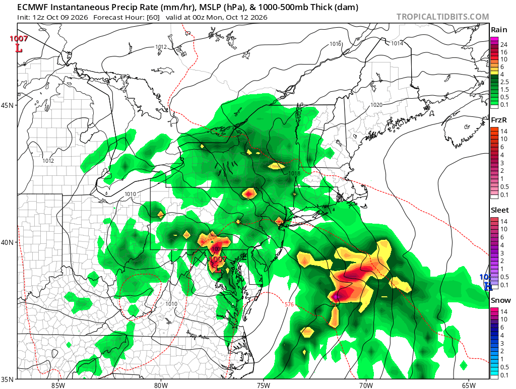
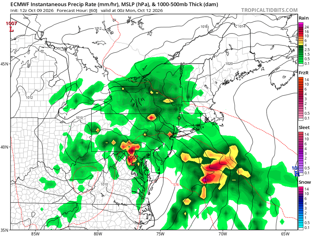
Sunday’s going to be wet. Pretty much 1-2 inches region wide
-
Temps near coast in upper 60s. That's pretty stable for hurricane. Cool and much drier air. May see quite a bit of weakening before it fully comes on shore
-
To 75 before the high clouds moved in
-
If it rains Sunday, it will be 35 out of 41 weekends with measurable rain/snow/hail/ash/apocalypse since January at the EWR reporting station.
-
While he didn't predict this storm, per se, about a week ago, Greg Postel on TWC had a great discussion about how the huge frontal system that was progged to sweep through the SE US last weekend would stall over the very warm GOM and that pressures and low shear looked favorable for tropical development this week.
-
CWOP KFLPENSA690 Summary High Low Average Total Temperature 78.2°F 69.8°F 73.9°F — Dew Point 73.1°F 67.7°F 70.8°F — Humidity 98% 82% 90.1% — Precipitation Rate 0.14in/hr — 0.08in/hr — Precipitation Accumulation — — — 0.39in* Wind Speed 68.5mph 5.6mph 25mph — Wind Gust 79mph 7.4mph 29.1mph — Wind Direction — — ENE — Pressure 29.38in 29.1in — As for timing... ahead of scheduled LF
-
What does total rainfall look like.on the 12z euro?
-
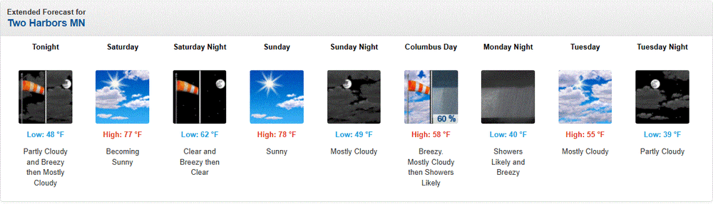
Same here. Nice n mild then crashing to avg.
-
Link to pier camera on Perdido Key https://www.earthcam.com/usa/florida/pensacola/pier/ .
-
Going to be an interesting Sunday evening for someone.
-
Thanks Jason! .
-
I enjoyed sharing snowstorms. This, not so much. I hope all will be well.
-
This could be indicative of what is to come in the right quadrent as this comes inland later on and into the overnight. Tornado threat and inland wind damage to trees and power lines likely to be extensive well into Alabama and western GA.
-
This buoy will get close to the eye
-
This will go down as warmest october for CONUS and its not even really close right @bluewave?
-
I think the GFS had a low pressure in a Gulf about a week ago, but there was nothing on the NHC outlook, and then.. nothing, and then.. this.