All Activity
- Past hour
-
MBY got split with that developing band. Nothing measurable. Kinda looks like that was my only shot too…
-

E PA/NJ/DE Spring 2025 Obs/Discussion
LVblizzard replied to PhiEaglesfan712's topic in Philadelphia Region
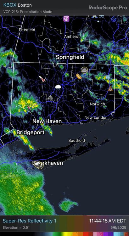
That's a really nice looking cell near West Chester. Even has somewhat of the classic supercell shape on radar. It's headed right towards me, ETA just over an hour...might go and chase it if it perks up again. -
Apparently it's pouring at home...I'm in Florida for a Publix meeting it's 94 freaking degrees here yuck
-
Wouldn't count on it. Models hinting another cutoff low for next week. 12z GFS: 12z Canadian: It gets worse on the 12z GFS run that it keeps us pretty much in Cutoff Land for a good portion of the month, especially about a week after next.
-
When i was sick, i hardly slept because of this exact thing. PSU cardiology has been amazing for me.
-
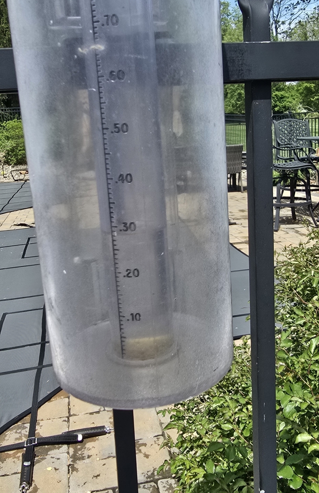
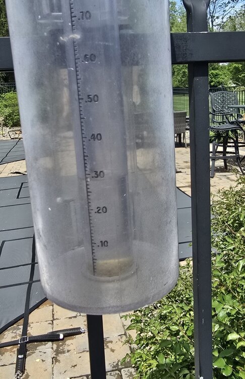
From my weather station in Ballenger Creek (Frederick) just west of 15/340 and just south of I-70" 2.44' for the month 1.26" on 5/5 0.26" so far for the day. The heaviest stuff fell to my south and west yesterday.
-
LFG
-
https://mesonet.agron.iastate.edu/p.php?pid=202505061730-KLWX-FPUS71-NOWLWX Little short term statement about the cell producing hail. Woo my report did something good!
-
taking a trip to Liberty NY on Friday leaving around 7Pm hope the rain is outta here by than!
-
Yeah, let's get those soil temps up!
-
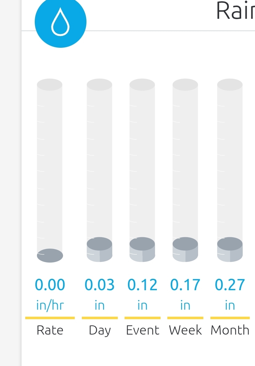
Wow, what, maybe 3 miles away or so! .27" on station, .28" in gauge

-

New England Winter 2024-25 Bantering, Whining, and Sobbing Thread
tamarack replied to klw's topic in New England
It's 9 years since our Japan trip to see our son and DIL. United works with ANA but the service quality between the 2 airlines was enormously different - the Japanese attendants were far more polite and helpful. -
Better be just a blip 12z GFS regarding May 18th, highs stuck in the 40s:
-
Big slug of precip heading up from the south
-
Thats crazy, i'm at just under 1" since Saturday.
-
-
Pea size hail is falling. I called it in to LWX
-
What we've got going on here in the east. Fogelville/Allentown to be exact. Broken clouds and sunshine and quite muggy...
-

E PA/NJ/DE Spring 2025 Obs/Discussion
Hurricane Agnes replied to PhiEaglesfan712's topic in Philadelphia Region
Watches are up. Have been getting on and off popcorn type little cells and streamers this morning and have 0.03" in the bucket from a couple. The sun did come out a couple hours ago so things are destabilizing. There has been a series of bands basically training, N->S, over portions of Lancaster and York Counties for hours. I know it has to be flooding there. I bottomed out at 60 this morning and have been bopping around 75/76 as a high so far. Currently 76 and partly sunny (but with some serious-looking angry cumulostratus off to the east) and a dp of 67. -
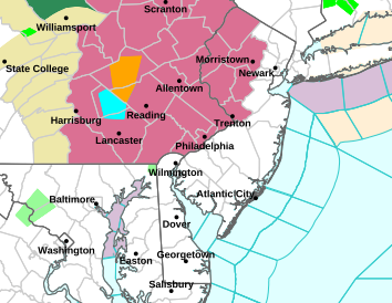
Watch issued for somerset county on north and west
-
It was remarkably dark before here in SW Nassua but has since really lightened up. Missed the rain to the east. Most likely the dry zone today as the convection to the west will have trouble making it into the marine layer.
-
Oh look, deluge in Fredrick county
-
12z CMC also will make some jump
-
HBG east (and from S border to N border) to the border put into a severe tstorm watch until 8 pm
-
Partly sunny, 73