All Activity
- Past hour
-
well going to make a move towards Ringe. That may be a bit too far north but it seems like that area (especially just south towards fitchburg) will have the best aerial coverage of storms.
-
No doubt man! .
-
Summer has arrived. Hang on tight, because you’re not allowed to get off the ride until at least Oct 31 for the most part.
-
Someone is going to get nailed with widespread 90° temps and dews in the 60s, no doubt. Figuring out where these MCS’s go is always such a crap shoot though. It’s been fun to watch the HRRR swing entire regions every few runs. if anyone wants some chuckles, the NAM has cape about 4,000 for a chunk of the Carolina’s tomorrow.
-
that's pretty wild holy crap
-
hey so ... we incurred a severe verification in my local township between 7 and 7:40 this morning. I bore witness to tree calving.. heh Anyway, estimating a 60 mph gusting and I had hail up to between nickle and quarter sized. I was wondering if that may have been EML loaded. This cell was bit of an over-achiever in an ongoing small cluster that came down Rt 2 in N Mass, and then sat showed a rather intense anvil radial expansion right over us, then all hell broke loose for 5 minutes - this was very wet microburst in appearance.
-
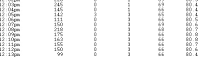
 Must have kicked on earlier today - temp not fluctuating much during today's noon hour - sorry Forky!!
-
Got a disappointing 0.10 yesterday. Hoping for more over the next 5 days.
-
normal June is still very warm, they're drunk
-
It’s crawling. I think the mountain takes a bite out of it for us before it rebounds eastward.
-
Wow there were 3” hail reports in NY state yesterday.
-
Looks like scattered downpours tomorrow with some spots getting significant rain while others get very little. We had the much-needed drying out period, but now the ground is back to being a little dry again. I watered the vegetable garden for the first time in quite awhile yesterday. I'd like to see a downpour tomorrow.
-
Storms developing in Dover De and moving slowly NW, yet forecast for my grid is mostly sunny, hmm. Meanwhile storms to the West near ( Thurmont ) moving East, but progress may be limited
-
Reminds me of yesterday's post by @MillvilleWx very muggy, moisture in the air and everything wet.
-
Showers on the shore...
-
There are a few stables around the area
-
One of our techs is there now, but I'm not hopeful for recovering it.
-
@OceanStWx Do you guys have the official high for CON from yesterday? I know the 93° was before the outage. If I had to put odds on the high estimate I think I’d go… 95° 50% 94° 40% 96° 10%
-
FWIW - HRRR has been awful at initializing the storms to the west.
-
Such is life in the rugged foothills of the The Highlands
-
Mesoscale Discussion 1145 NWS Storm Prediction Center Norman OK 1101 AM CDT Fri Jun 06 2025 Areas affected...Southern New England Concerning...Severe potential...Watch possible Valid 061601Z - 061800Z Probability of Watch Issuance...40 percent SUMMARY...Isolated wind damage and marginally severe hail will be possible with multicell storms after 18-19z (2-3p EDT) this afternoon. The need for a watch is uncertain. DISCUSSION...Strong surface heating is ongoing across southern New England along and south of a diffuse baroclinic/differential heating zone. As surface temperatures warm through the mid-upper 80s with mid-upper 60s dewpoints, MLCAPE will increase to near 2000 J/kg with minimal convective inhibition. By early-mid afternoon, widely scattered thunderstorm development will become probable along the diffuse baroclinic zone/buoyancy gradient. Steep low-level lapse rates, DCAPE of 750-1000 J/kg and precipitation loading could favor isolated wind damage with downbursts, while the moderately large buoyancy will be sufficient for marginally severe hail. Vertical shear will remain relatively weak and the storms are currently expected to remain only loosely organized, so the need for a watch this afternoon is uncertain. ..Thompson/Smith.. 06/06/2025
-
Wobbling a bit!! No drop yet but fingers crossed...cmon fan aspiration!!!
- Today
-
Without CC all ridges were perfect and we never missed storms. Obviously joking, but that is the way it reads all the time.
-
I was riding a horse that was bucking. 87 here.
-
Here it comes... https://weather.cod.edu/satrad/nexrad/?parms=LWX-N0B-1-24-100-usa-rad


