All Activity
- Past hour
-
-

Central PA Spring 2026 Discussion/Obs Thread
NepaJames8602 replied to Voyager's topic in Upstate New York/Pennsylvania
1.30" event total here. Nice soaking! Never did see flakes, but it was in the low 30s. Still sitting at 37. -
65-70? Maybe WOR. 55-60 here.
-
I saw that story this am and came here to post it lol.
-
Nov 2026 - March 2027.
-
Or maybe with record strong El Niño they don’t change color or fall and just stay on , green all winter?
-
They may just emerge in September immediately into fall color.
-

Potential Sever Weather Outbreak 4/27/2026
TheNiño replied to pen_artist's topic in Lakes/Ohio Valley
No moderate risk on the day 2 so I’ll probably be wrong. But I still see high risk potential in the Springfield area tomorrow. I’m willing to take the weenie penalty if I’m wrong but at the very least there should be a moderate there. I don’t know I’m just some fucking guy. -

Central PA Spring 2026 Discussion/Obs Thread
Mount Joy Snowman replied to Voyager's topic in Upstate New York/Pennsylvania
Low of 41 with .54” of rain. -

Central PA Spring 2026 Discussion/Obs Thread
mahantango#1 replied to Voyager's topic in Upstate New York/Pennsylvania
.50 rain from the event, was expecting more. -
Man that’s brutal . Maybe late May?
-
This weather sucks azz
-
Not close. Forsythia just bloomed though.
-
Sunny and 65-70 this afternoon abc Monday/ Tuesday . Couple of great fays coming
-
Have you leafed out yet?
- Today
-
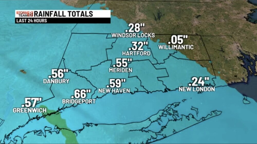
Fri 4/24 0.47” Sat 4/25 0.39” April, 2026 thru 4/25: 1.62”
-

E PA/NJ/DE Spring 2026 Obs/Discussion
MGorse replied to PhiEaglesfan712's topic in Philadelphia Region
0.81 inches of rain. Some drizzle ongoing. -

Central PA Spring 2026 Discussion/Obs Thread
pawatch replied to Voyager's topic in Upstate New York/Pennsylvania
42 degrees this morning. .52” of rain, about half of what they was calling for. -
Ummm... wasn't it susposed to rain lol. I got a few sprinkles that didn't even wet the driveway. I saw model runs for up to an inch lol
-
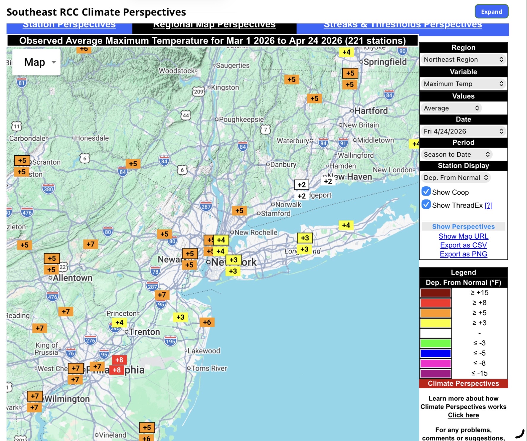
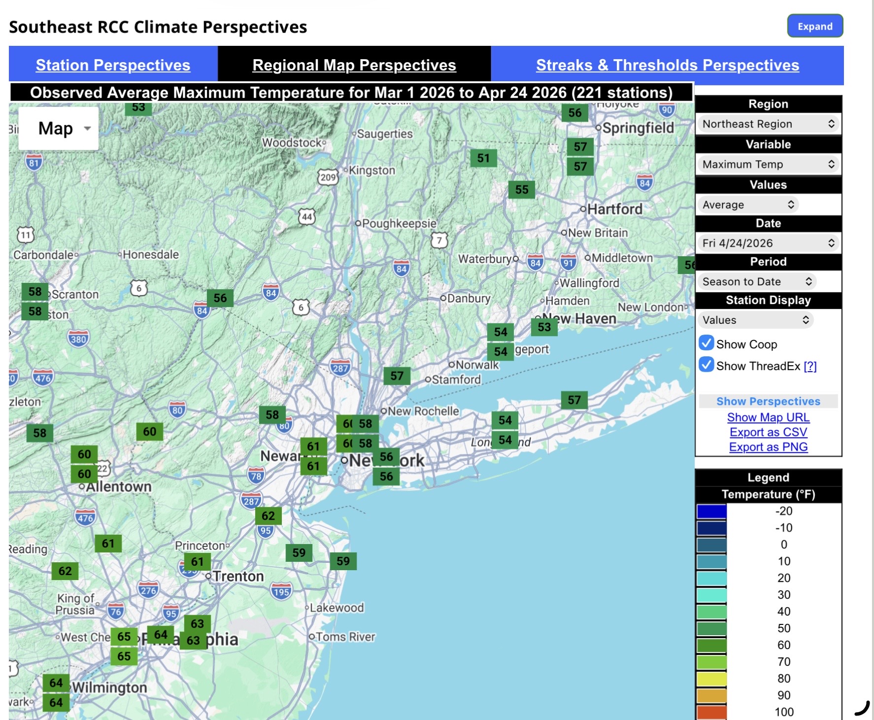
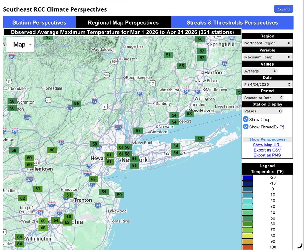
It mostly comes down to the warmest high temperatures staying closer to the interior rather than the coast. So even though Long Island is still having warmer highs than normal for this time of year, It’s around 10° cooler than the Philly to interior NJ corridor. Very strong onshore flow influence with the SSTs still cooler during the spring.

-
Jesus I’m coming back to hell.
-

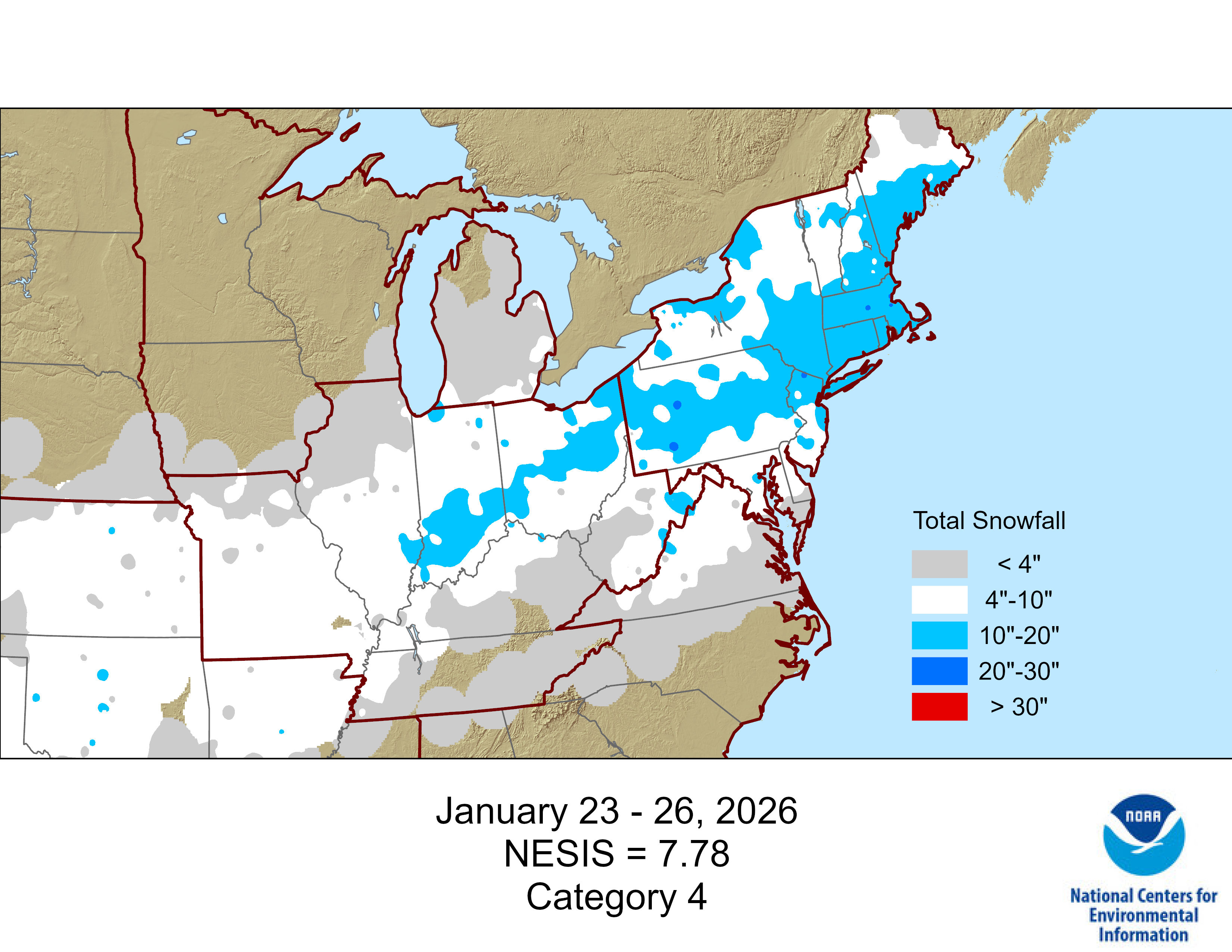
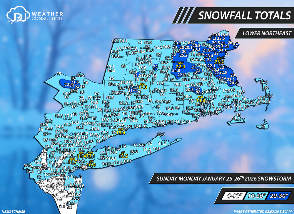
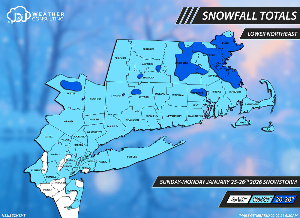
January 25-26th, 2026 Final Storm Totals
The 4 Seasons replied to The 4 Seasons's topic in New England
We finally have a NESIS map and ranking for this major storm. #5 all time on NESIS https://www.jdjweatherconsulting.com/jan-25-26-2026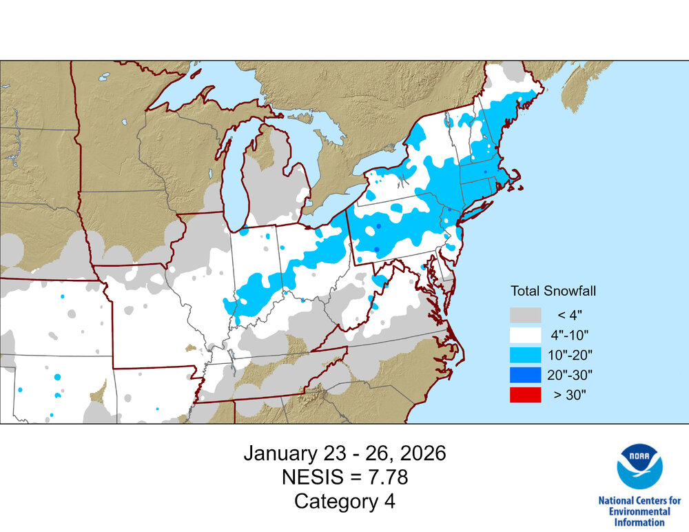
-
Finally! I knew it would likely be a 3, not surprised its actually a 4. That Dec 2022 is strange on that list but if you look at RSI for Northeast it's only a 1 and Mar 1960 is only a 3. https://www.ncei.noaa.gov/maps/rsi/ So weird it took so long and they got the Feb blizzard out in just a couple days. https://www.ncei.noaa.gov/access/monitoring/rsi/nesis No surprise its a bit conservative, especially in MA where there was a large area of 20+ from ORH to BOS. Here's one of the maps i did on top of the regular ones with NESIS color scheme and ranges. https://www.jdjweatherconsulting.com/jan-25-26-2026
-
Sure….we trolled with those images, but the dry models failed too. Anyway…looks decent the next couple of days.
-
0.33” overnight and 1.63” for April. I think we all need the midweek system to work out.