All Activity
- Past hour
-

Hurricane Erin: 125 MPH - 946mb - WNW @ 13
Wannabehippie replied to BarryStantonGBP's topic in Tropical Headquarters
2:00 PM AST Sun Aug 17 Location: 21.3°N 68.0°W Moving: WNW at 13 mph Min pressure: 946 mb Max sustained: 125 mph -
 Down at the nautical mile for the first time in many years. Almost a perfect day just a bit cloudy
 -
yup!
-
Too many Vito’s in mine. My mom bucked the tradition 78+ years ago. The contentious fallout, sadly, lasted for decades. As always ….
-
Muggy

-
86/72 steambath
-
We had some muggy days last week but yeah now an Augdewest. But a great month so far and a steamer today.
-

Hurricane Erin: 125 MPH - 946mb - WNW @ 13
canderson replied to BarryStantonGBP's topic in Tropical Headquarters
The continuous S/E track makes me think Erin has eyes wanting to split the upright and run head first into Newfoundland. -
Ineedsnow still tracking?
-
Pretty similar. I'm barely at .75" since July 16. Truly remarkable how we struggle to rain given the heat and humidity we've experienced.
-
Due to Steim
-
Interesting storm...surprised to read this from Ars... "With a central pressure of 917 mb on Saturday, Erin ranks as the second-most intense Atlantic in the last 50 years prior to today's date, behind only Hurricane Allen in 1980."
-
Surfs up is the only thing that matters
-
Nice Eric
-
One of the reasons I like the SW Atlantic as a hot spot is the thermal environment. Erin is likely a blip, especially with it being mid August.
-
 I think we are underway with a significant dry pattern, much like last year. We'll see how long it persists but sure looks like the rest of this month is going to be dry. Expect upgrades (D1 or even D2) to the Drought Monitor in the coming weeks. Not expecting much today in terms of widespread coverage. If you get something consider yourself lucky.
 - Today
-
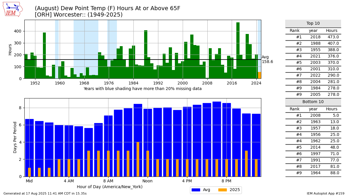
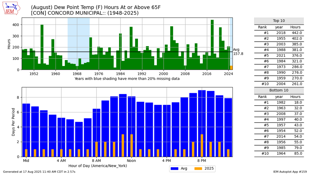
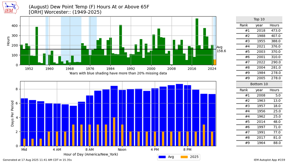
August dews have been way down.
-
 I think we get hit later. It is brutal out. Conditions ripe
 -
Oh heck yeah! Was not expecting this today (was thinking they would wait until September! This is the Orioles saying the equivalent of "HERE! Dang " to everyone screaming for him and Beavers, lol
-
I didn't know that. I haven't flown into ORH lately.
-
Radiation. They’re on a hill top
-
Are you referring to the cool stretch, or the dry ground? ORH has amassed a drenching .35" in August.
-
It's whatever Joe Bastardi says it is! @snowman19
-
Ill take last year with more snow
-
Water will be churned up pretty good though?