All Activity
- Past hour
-
 http://mexgetrx.com/# pharmacy in mexico online
 -
http://indigetrx.com/# prescription medication from india
-
A definite 'hole' over here, and much of the guidance had it. Still, an inch or so of rain is fine with me in October. Not like it hasn't rained for 3 straight weekends or something..
-
Good AFD from BTV… A cold front will sweep through the area Friday night sharply lowering temperatures 10 to 15 degrees from Friday evening to Saturday morning. Temperatures will likely dip below freezing for most if not all locations across the area with only those near Lake Champlain and immediately near the St. Lawrence River staying above freezing. As temperatures fall, snow levels during the day Saturday will also lower to 500-1000ft agl, with a transition to snow above 1500ft agl, and a rain, wet snow mix, in elevations between 1000- 1500ft agl. A few mixed in flurries cannot be ruled our even in the Champlain Valley, though temperatures will be marginal in the mid to upper 30s. Some snowliage appears likely with ensembles denoting nearly 100% chances for purely snowfall in the Adirondacks and Northeast Kingdom. Rain and snow showers will taper off Saturday evening as the system pulls away to the northeast. 850 mb temperatures Saturday night will be remarkably cold for this time of year in the -9 to -11C range Saturday night supporting temperatures in the 20s for most of the area, including the entire Champlain Valley. Pockets of teens will be possible in the coldest hollows of the Adirondacks and Northeast Kingdom as surface temperatures anomalies will be 10 degrees below normal. Temperatures will slowly moderate back towards seasonable normals to start next week.
-
mexico pharmacy: Mex Get Rx - top 10 online pharmacies in mexico
-

2026-2027 Record-breaking El Nino
GaWx replied to Stormchaserchuck1's topic in Weather Forecasting and Discussion
Following up on my last post (QBO): Based on my expectation of each of DJF being at +8+ QBO and also within a mature +QBO phase as opposed to near the start of it, here are the best QBO/ENSO analogs in order of quality taking into account the timing within the +QBO phase, the QBO amp, and the Nino strength: -2015-6 strongest analog: ~identical QBO timing, super-Nino -1982-3 super-Nino and similar QBO amp but QBO 3 month later start of + phase -1957-8 not quite super-Nino, QBO 2 month earlier start of + phase and weaker JF amp -1987-8 Nino only mod & 2nd year and QBO 3 month later start of + phase -2006-7 easily weakest of these analogs because only weak Nino and QBO 2 month earlier start of + phase along with only +1 Feb QBO -

E PA/NJ/DE Autumn 2026 Obs/Discussion
Birds~69 replied to PhiEaglesfan712's topic in Philadelphia Region
Almost 80F tomorrow and 80F+ Wednesday? Say it isn't so... 73F/DP 62F -
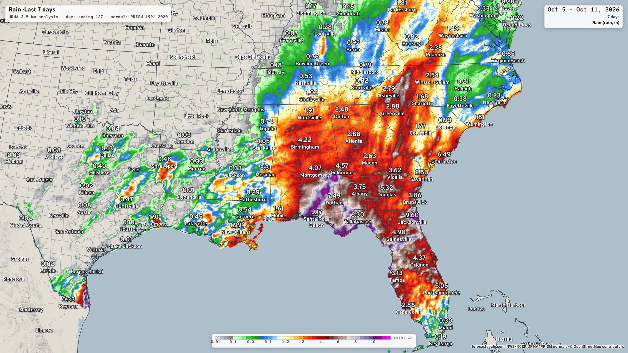
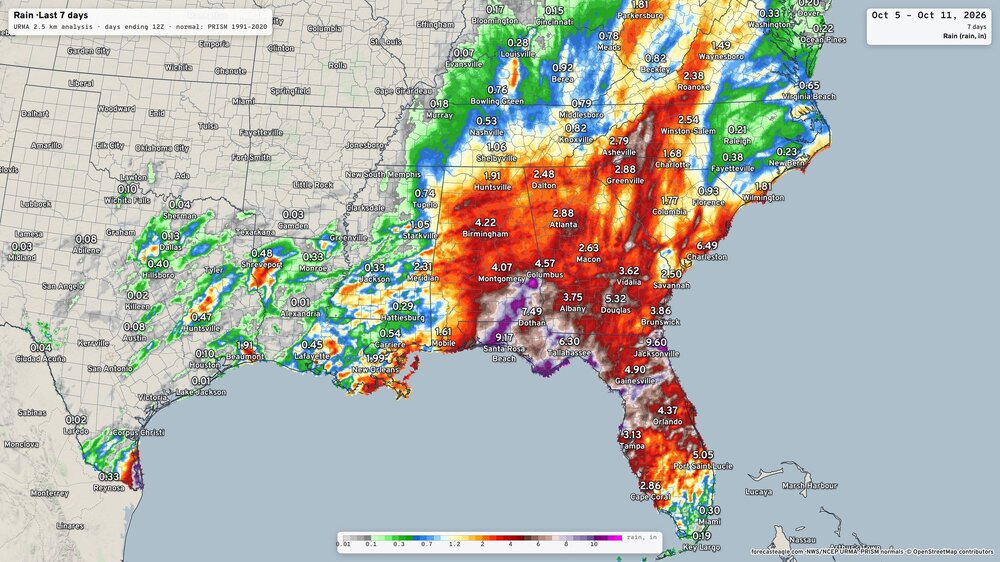
I'm confused: RDU reported over 1.25" just yesterday. Maybe that 0.21 is supposed to be somewhere downtown, but even the color scale doesn't come close around the airport. Oh wait, that graphic ended at 12Z, which was before that crazy band came through.
-
2.4” final here
-
Yep, 90 here too.
-
Extreme record breaking El Nino. Everything is on the table. There just may be too much hot air from the ocean that floods the continent except for the northern part of the country.
-
I'll have to start visiting the New England page starting in Dec. These fokes here will get sick of me reporting from up there. I'd be Jebman of the snowbelt
-

2026-2027 Record-breaking El Nino
EasternLI replied to Stormchaserchuck1's topic in Weather Forecasting and Discussion
Here are the main points from the CPC MJO update posted today. No surprises, el nino is the main event. With a notable mention of the +IOD potentially beginning to show itself now as of late. -

October 2026 General Discussion
BeastFromTheEast replied to SchaumburgStormer's topic in Lakes/Ohio Valley
Strong SW winds too! Leaves flying everywhere! - Today
-
best indian pharmacy website [url=https://indigetrx.shop/#]indian pharmacy shipping to usa[/url] pharmacy website
-
That would be a shocker but you never know around these parts. The next 2 weeks are a welcome drying out if El Nino really kicks up the STJ. Average first frost used to be between October 1-15 r here until about 2000. Since then its closer to October 24.
-
Raleigh was squarely in the screw zone this time around
-
what a day. 73 no wind tolerable RH and at least some feeble warmth value still to the sun. top 10er actually -
-
After the cool down later this week warmth returns over a rather large area of North America.
-
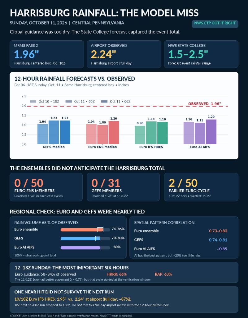
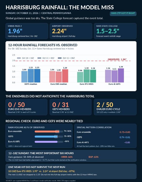
shall we discuss the total and complete collapse of every single model and ensemble model for this past system. The HRRR literally had a negative skill score at 3 hours that's how bad it was. and it wasn't just the American the euro is just as bad I don't know what that hints for this winter time but that was the most epic and total failure I have seen by models in a long long time Sent from my SM-S731U using Tapatalk
-
90 in the paign, with a chance again tomorrow. Unbelievable for October 12th.
-

2026-2027 Record-breaking El Nino
bncho replied to Stormchaserchuck1's topic in Weather Forecasting and Discussion
we talk about snow autism in here but the guy looks like he has real autism if u look at his other videos -
At the time there was no hurricane. Had that not developed it would have been Stein
-
E PA/NJ/DE Autumn 2026 Obs/Discussion
KamuSnow replied to PhiEaglesfan712's topic in Philadelphia Region
We call days like yesterday "rainout theater", lol. -
Ah yes, even better haha. Euro has snow through much of NNE Saturday with daytime highs in the 30s up my way.