All Activity
- Past hour
-
6z GFS gone wild here
-
Ceres has updated through September. Net radiation continues to increase off the enso bottom and the 12-month average is getting close to peak levels in La Ninas before 2020.

-

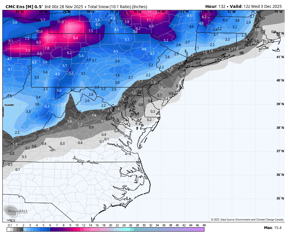
December 2025 regional war/obs/disco thread
moneypitmike replied to Torch Tiger's topic in New England
Just reading the words makes me happy. Monday Night Mostly cloudy, with a low around 18. Tuesday A 40 percent chance of snow after 1pm. Cloudy, with a high near 35. Tuesday Night A 50 percent chance of snow. Mostly cloudy, with a low around 21. -
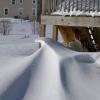
Have had 3 inches of snow here past two days, not a big storm but looks like long-lasting snow cover with colder temperatures developing. Around 28 F now as the snow pulls away to southeast.
- Today
-

November 2025 general discussions and probable topic derailings ...
ineedsnow replied to Typhoon Tip's topic in New England
Driving to cumberland farms this morning and realized they pre treated roads.. they must have been on the board -

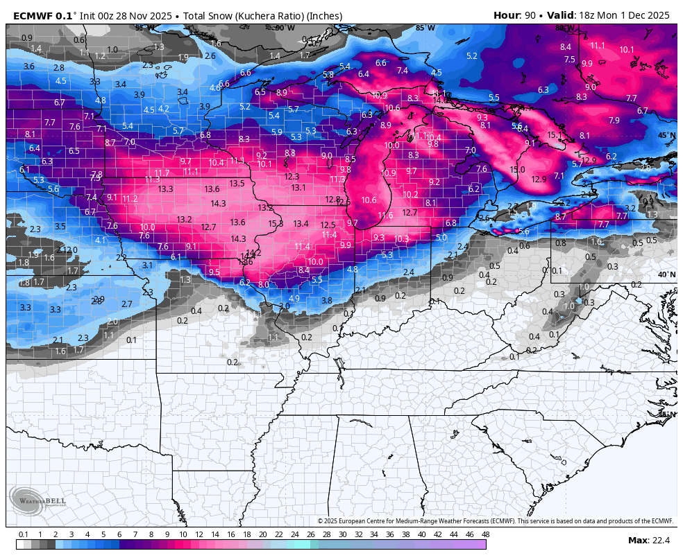
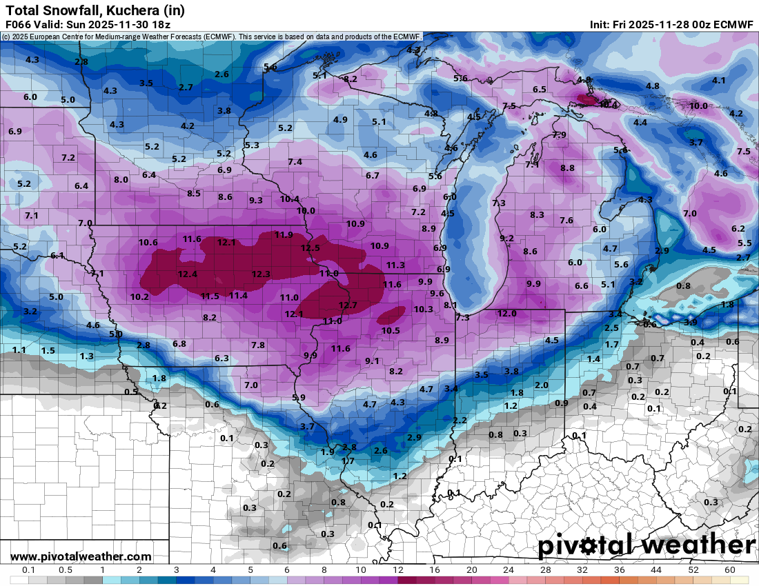
Nov 28-30th Post Turkey Day Wintry Potential
jlauderdal replied to Chicago Storm's topic in Lakes/Ohio Valley
Upping my 7.5 Downers Grove prediction to 9 just for Baum who is right down the road. We got this Baum, 9 and a decent possibility of overachieving. Just have to watch the euro, its not giving up on the more northerly route of the low and Euro AI has the low a tick farther north than the Euro OP. -

Nov 28-30th Post Turkey Day Wintry Potential
Mogget replied to Chicago Storm's topic in Lakes/Ohio Valley
Winter Storm Warnings in southern Wisconsin. Once it gets light, better go check on the snow blower, which makes a nice change from the last couple of years. -

Nov 28-30th Post Turkey Day Wintry Potential
wegoweather replied to Chicago Storm's topic in Lakes/Ohio Valley
Winter Storm Warning up for LOT, MKX, ILX. -

December 2025 regional war/obs/disco thread
Snowlover11 replied to Torch Tiger's topic in New England
Half a flake. -
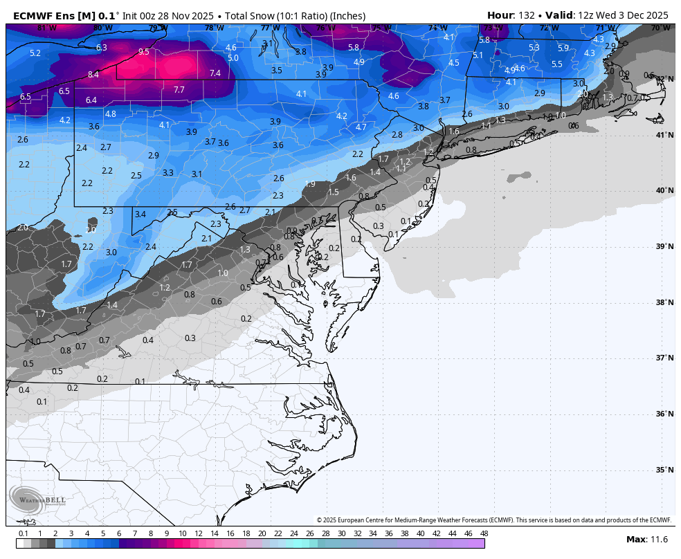
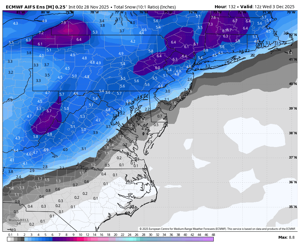
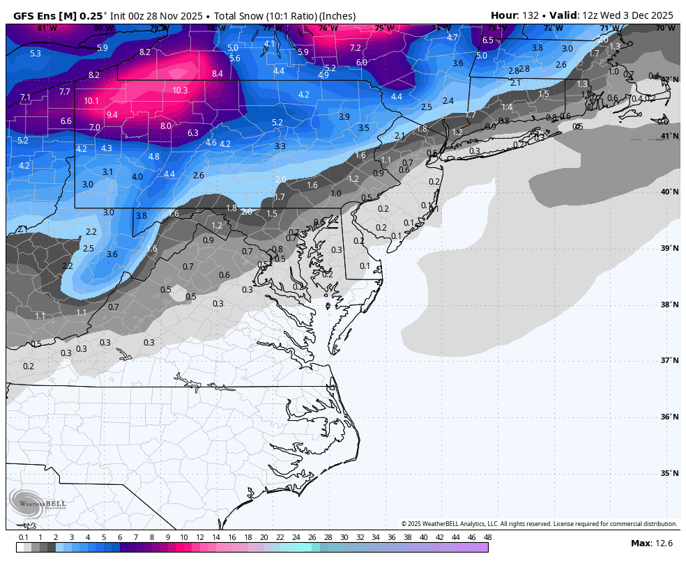
WB 0Z ensembles for early next week:

-
*fewer
-

Nov 28-30th Post Turkey Day Wintry Potential
KeenerWx replied to Chicago Storm's topic in Lakes/Ohio Valley
Not much has changed from my thoughts locally over the past 24 hours. Hoping we hold steady, even as that dry slot influenced “custom screw zone” (cyclone, 2025) gets way too close for comfort. For a final call would expand the upper range and go 3-7”. Aside from total failure, I don’t see going below 3”. But imo would take a lot of things going right to get to 7”. Moving chips up a bit to 5.7” -

December 2025 regional war/obs/disco thread
40/70 Benchmark replied to Torch Tiger's topic in New England
Told ya the EURO was full of $hit. Looks just like some of the other guidance with a classic rt 128 deal. -
Heavy snow and freezing fog at KSLK. First time seeing the SN+ ob at that station.
-

December 2025 regional war/obs/disco thread
WxWatcher007 replied to Torch Tiger's topic in New England
Very much so. Really want to see how it can handle synoptic events and long range patterns. Good early season test with next week. -

December 2025 Short/Medium Range Forecast Thread
John1122 replied to John1122's topic in Tennessee Valley
Ironically, the GFS ensembles agree more closely at 500 than the Euro in general, and not with it's OP which is a massive WC trough/EC ridge. -
December 2025 Short/Medium Range Forecast Thread
John1122 replied to John1122's topic in Tennessee Valley
It would be hard to be more different than the GFS is vs the Euro in the long range. The GFS is full torch, the Euro is full freezer. -

Nov 28-30th Post Turkey Day Wintry Potential
homedis replied to Chicago Storm's topic in Lakes/Ohio Valley
Looking good. Curious to see how the lake will affect snow ratios in lakeside areas with the slightly onshore SSE flow, but thinking 1:10 average is reasonable. Final call 7.5” Lake Forest, I’ll be stationed here for duration of the storm. They got around 6” from the LES event a few weeks back so that would be over a foot total for Nov — quite impressive. -
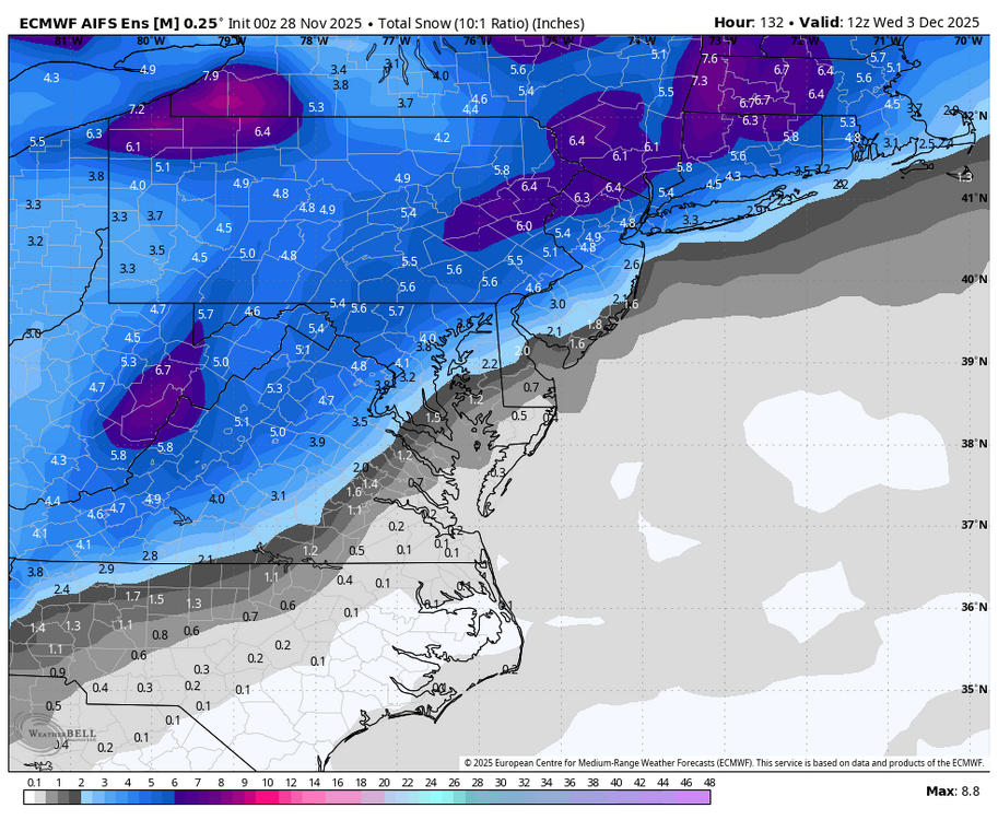
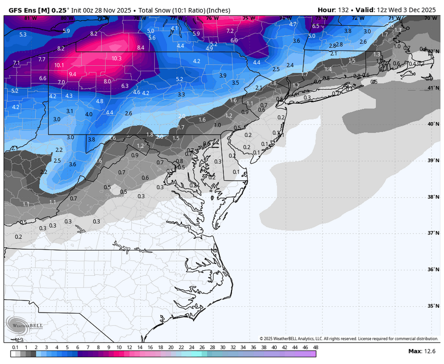
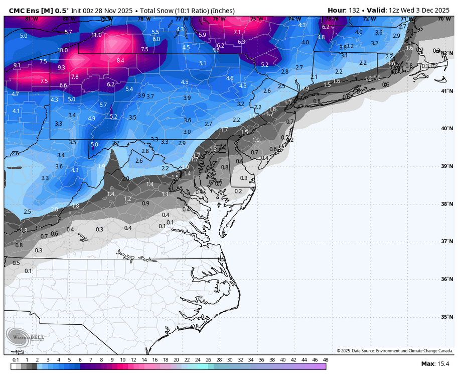
Euro is a N&W event similar to map above.
-

Nov 28-30th Post Turkey Day Wintry Potential
migratingwx replied to Chicago Storm's topic in Lakes/Ohio Valley
-
Nov 28-30th Post Turkey Day Wintry Potential
michaelmantis replied to Chicago Storm's topic in Lakes/Ohio Valley
For the first storm of the season, coming out of a bad 2024-2025, all the signs seem to be good for IA, S WI, and N IL. -

Nov 28-30th Post Turkey Day Wintry Potential
hawkeye_wx replied to Chicago Storm's topic in Lakes/Ohio Valley
00z Euro... This is about as locked into 8+" as my area ever gets.
-

Nov 28-30th Post Turkey Day Wintry Potential
Radtechwxman replied to Chicago Storm's topic in Lakes/Ohio Valley
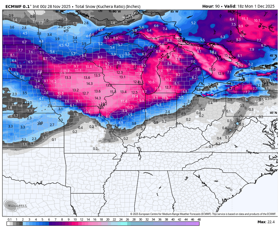
Something that should probably be used for this event in a lot of areas is snow depth to see a more realistic depiction of what you may measure on ground. Kuchera and 10:1 maps aren't accounting for the compaction and melting from this very wet snow that will likely occur and are probably overinflated. Yes 8-10in may fall but may not reflect on ground after melting and compaction. -
.thumb.png.ec4a32b8d2c4423ed890799cbdf9af95.png)
-
That high running off Maine just as it starts is no good for 12/2. Further west by 350 miles is needed


.png.925d9e550832cdcd5566898281816b64.png)
