-
Posts
1,267 -
Joined
-
Last visited
Content Type
Profiles
Blogs
Forums
American Weather
Media Demo
Store
Gallery
Everything posted by fountainguy97
-
I've seen ALOT of different sources point to a classic Miller A swath of + snowfall anomalies across the SE and Mid Atlantic recently. looks like back loaded winter is heavily favored as well. sources: trackersacker twitter Brian Brettschneider twitter ben noll twitter
-
Looks like this cold front mid-week next week and Lee will hook up and bring fall crashing our way. This will be a permanent step down in temps and our first big taste of fall.
-
Looks like a warm week in the 80s and a few touches of 90 here and there but I see a lot of greens (50s) on the gfs on tidbits going forward!
-
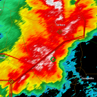
Spring/Summer Mid-Long Term Discussion
fountainguy97 replied to John1122's topic in Tennessee Valley
Paying for our mild summer with an endless summer. After the brief relief thanks to this tropical system gfs goes torch again. Of course it's wildly too hot normally.- 295 replies
-
- 2
-

-
- severe weather
- frosts
-
(and 5 more)
Tagged with:
-

Spring/Summer Mid-Long Term Discussion
fountainguy97 replied to John1122's topic in Tennessee Valley
Yeah GFS brings that tropical storm through which would certainly help us out. It's on the extreme western edge of guidance though so not very likely at the moment.- 295 replies
-
- 1
-

-
- severe weather
- frosts
-
(and 5 more)
Tagged with:
-

Spring/Summer Mid-Long Term Discussion
fountainguy97 replied to John1122's topic in Tennessee Valley
Man the gfs really wants to keep the heat around for another 10-14 days. I'm not surprised but I was hoping to see some fall mornings.- 295 replies
-
- severe weather
- frosts
-
(and 5 more)
Tagged with:
-
Yeah these decadal sequences are tough to really apply just because of the sheer length of time between pattern changes. The current massive -PDO has surely been stubborn and may not flip at all. AMO is such a long pattern sequence it's tough to really get a grasp on. I haven't been alive in a -AMO regime. And I think it's not irrelevant to consider in this climate IF we will get a -AMO signal in the near future. Or maybe decades. I don't think we struggle with precip this winter. I'm more worried about too much of a good thing with the El Niño. Especially if we don't transition to more of a 3.4 focused Nino. We may blow right through any blocking we manage to get. there has been some cooling going on in the PDO region. Maybe we see it transport across the Pacific this fall.
-

Spring/Summer Mid-Long Term Discussion
fountainguy97 replied to John1122's topic in Tennessee Valley
78/62 here today. Absolutely perfect. Enjoying it before this heat wave of death hits.- 295 replies
-
- 3
-

-

-
- severe weather
- frosts
-
(and 5 more)
Tagged with:
-
Seeing my friends back in Eastern NC hit 90 at 9am sure has me thankful for the mountains today.
-
With a descending QBO and solar activity rising toward peak the chances of blocking and a disrupted PV are increased. along with the active southern jet with the El Niño I'll take those chances any day. The only fly in the ointment is we need the El Niño to shift toward a more basin wide event vs eastern based. Models are predicting that so let's hope they are correct. Definitely some good signs heading into fall!
-

Spring/Summer Mid-Long Term Discussion
fountainguy97 replied to John1122's topic in Tennessee Valley
4.52" here on the day. Easily the highest 24hr total here going back to July 2019 on my records. 5 hrs after rain we still have creeks flooding. I've never really seen the ditch along my property carry much water but it sounds like a river tonight.- 295 replies
-
- 6
-

-

-
- severe weather
- frosts
-
(and 5 more)
Tagged with:
-

Spring/Summer Mid-Long Term Discussion
fountainguy97 replied to John1122's topic in Tennessee Valley
Over 2" already today. Easily heading to the largest single day total I've had here in the last 4 years.- 295 replies
-
- 3
-

-
- severe weather
- frosts
-
(and 5 more)
Tagged with:
-

Spring/Summer Mid-Long Term Discussion
fountainguy97 replied to John1122's topic in Tennessee Valley
Man going to be an unusual day tomorrow for the middle of summer. Won't feel like it tomorrow. PWATs approaching 2". Probably going to be some flooding in the mountains of TN and NC if the 2-3+ inches materialize. The firehouse is already lined up.- 295 replies
-
- 3
-

-
- severe weather
- frosts
-
(and 5 more)
Tagged with:
-

Spring/Summer Mid-Long Term Discussion
fountainguy97 replied to John1122's topic in Tennessee Valley
Peaked at 89.1 so far today. Have yet to hit 90 this year but I think we will do it this week. I won't be surprised if this week is the "peak" of our summers heat. Can't complain at all about the year we have had so far. A welcome relief compared to the last few Niña springs and summers. The gears of fall are slowly beginning to turn up north. August will be hot but my favorite time of year is just around the corner! This time of year is when I always start rummaging through old winter event threads and wishing for colder days.- 295 replies
-
- 1
-

-
- severe weather
- frosts
-
(and 5 more)
Tagged with:
-

Spring/Summer Mid-Long Term Discussion
fountainguy97 replied to John1122's topic in Tennessee Valley
Checking in. It's hot. Is it December yet?- 295 replies
-
- 3
-

-
- severe weather
- frosts
-
(and 5 more)
Tagged with:
-

March 2023 Mid-Long Range Discussion thread
fountainguy97 replied to Holston_River_Rambler's topic in Tennessee Valley
Well with winter behind us here is my summary. 4 events behind normal. 11" behind average of the last 4 winters. (2019-2023 average) -

March 2023 Mid-Long Range Discussion thread
fountainguy97 replied to Holston_River_Rambler's topic in Tennessee Valley
Honestly I don't think many anyone East of I-85 have much hope. Even the runs that favor them it's all a cold rain. Your'e going to want to have atleast a bit of elevation for this one. I'm indifferent abt it. It's one of the best looks of the winter for snow for the SE. But it's March and not early March. Temps will be a problem if we even get the precip. This setup in January would be mouthwatering. -

March 2023 Mid-Long Range Discussion thread
fountainguy97 replied to Holston_River_Rambler's topic in Tennessee Valley
Models have flattened out the wave associated with next weeks storm. Probably right where we want it at this range. It would be fitting for the last threat to be suppressed though lol -

March 2023 Mid-Long Range Discussion thread
fountainguy97 replied to Holston_River_Rambler's topic in Tennessee Valley
Significant uptick in GEFS members with this system.. CMC is close. This one is getting interesting. Sitting on the NW edge of this is exactly where we want to be. -

March 2023 Mid-Long Range Discussion thread
fountainguy97 replied to Holston_River_Rambler's topic in Tennessee Valley
This is a beautiful setup for the spine of the Apps. Big dog potential. Probably one of the best looks of the winter inside 180. Would like to see some more ensemble support though at this range. -

March 2023 Mid-Long Range Discussion thread
fountainguy97 replied to Holston_River_Rambler's topic in Tennessee Valley
To be fair to the GFS the EURO is very similar at 00z. It just isnt as dynamic of a system so the cold isn't there. This weekend is 100% cold chasing moisture with no other model support. Early next week could be a legit threat but support is low right now which is actually how we want it at this range. I'd rather be missed to the south at this stage. That is something we haven't been able to say any this year. -

March 2023 Mid-Long Range Discussion thread
fountainguy97 replied to Holston_River_Rambler's topic in Tennessee Valley
I am highly skeptical of this weekend and next week. Gfs has almost no support and we know how that has gone this winter. -

March 3 High Wind and Severe potential
fountainguy97 replied to Holston_River_Rambler's topic in Tennessee Valley
Wind shear is necessary for long lived storms because it tilts the updrafts and downdrafts away from each other. Allowing them to be independent. Without shear the updraft and downdraft overlap and smother each other. Too much shear (wind) can just rip them apart from each other. Basically decapitating any storm. here is a brief NWS article about it. https://www.weather.gov/ilx/swop-springtopics The hrrr doesn't have any signs of issues with shear for the main line today. Doesn't mean there won't be limiting factors though. -
Definitely looking like a "legit" severe weather event for TN this Friday. The usual low cape, high shear event as typical for early season. But with temps in the 70s and DPs in the 60s we should get some decent afternoon development.

