-
Posts
1,267 -
Joined
-
Last visited
Content Type
Profiles
Blogs
Forums
American Weather
Media Demo
Store
Gallery
Everything posted by fountainguy97
-
January 12-13 Severe and NWFS Event
fountainguy97 replied to fountainguy97's topic in Tennessee Valley
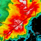
Radar looks GREAT right as night falls. Let's see who can rack up. -

January 12-13 Severe and NWFS Event
fountainguy97 replied to fountainguy97's topic in Tennessee Valley
Man just can't get to 32 for anything here. Back to 33.1. Grrrr -

January 12-13 Severe and NWFS Event
fountainguy97 replied to fountainguy97's topic in Tennessee Valley
Getting absolutely blasted by graupel. Roads covered instantly -

January 12-13 Severe and NWFS Event
fountainguy97 replied to fountainguy97's topic in Tennessee Valley
Full on graupel squall last 30 min. Daytime and temp above 32 limiting accum. But as soon as we get toward evening this will stack quickly if there is any left -

January 12-13 Severe and NWFS Event
fountainguy97 replied to fountainguy97's topic in Tennessee Valley
Daytime, temps above 32, warmer ground, and spotty nature of snowfall doesn't bode well for much accumulation throughout the day. Hopefully we have plenty of moisture tonight! 37 and rain here currently. -

January 12-13 Severe and NWFS Event
fountainguy97 replied to fountainguy97's topic in Tennessee Valley
Hard for me to get onboard with the hrrr being so dry. I feel like this one may slip through our hands even for NW areas. Of course the tip top peaks will score but hrrr keeps most areas with a dusting at best. -

January 12-13 Severe and NWFS Event
fountainguy97 replied to fountainguy97's topic in Tennessee Valley
Wind picking up here slowly. hrrr is extremely unimpressed for Unicoi county. Barely gives me a dusting.. it's not the best on qpf outside 12hrs or so. But it's got me very conservative this afternoon. -

January 2023 Medium/Long Range Pattern Discussion Thread
fountainguy97 replied to Carvers Gap's topic in Tennessee Valley
- 923 replies
-
- 5
-

-
- warm start
- cold
- (and 4 more)
-

January 12-13 Severe and NWFS Event
fountainguy97 replied to fountainguy97's topic in Tennessee Valley
Models holding steady this morning. For my back yard NAM and HRRR both advertise an extreme cutoff with about an inch for me. Hoping to squeeze that out! -

January 12-13 Severe and NWFS Event
fountainguy97 replied to fountainguy97's topic in Tennessee Valley
RGEM follows suite with a cutoff trough just like NAM. -

January 12-13 Severe and NWFS Event
fountainguy97 replied to fountainguy97's topic in Tennessee Valley
Let's keep this trend going. The more neutral and cutoff we can get the more moisture we will have to work with. -

2022-2023 Fall/Winter Mountains Thread
fountainguy97 replied to BlueRidgeFolklore's topic in Southeastern States
Great trends at 500mb. -

January 12-13 Severe and NWFS Event
fountainguy97 replied to fountainguy97's topic in Tennessee Valley
-

January 12-13 Severe and NWFS Event
fountainguy97 replied to fountainguy97's topic in Tennessee Valley
Wow NAM even better at 500mb. This is a doozy. man closed off ULL at hr 51. This thing is cranking big time on NAM. Going to be some big totals. -

January 2023 Medium/Long Range Pattern Discussion Thread
fountainguy97 replied to Carvers Gap's topic in Tennessee Valley
I'm hungry for flakes- 923 replies
-
- 3
-

-
- warm start
- cold
- (and 4 more)
-
Figured we can keep the main topic clean and talk about the weekend here. 18Z NAM tilted our trough much more neutral vs positive which is really helping to stack up significant qpf across the NW prone regions. Every tick more neutral will add to totals quietly. Even a good bit of moisture up to 700mb now. RGEM is on board as well. High mountains should see 6+ easily in a setup like this. Should see some thunder as well with temps in the upper 60s, DPs in the upper 50s, and Cape into the 500 range. Exciting weekend ahead!
-

January 2023 Medium/Long Range Pattern Discussion Thread
fountainguy97 replied to Carvers Gap's topic in Tennessee Valley
12z NAM family looks great. 24-36hrs of NWSF. Some streamers across the valley too.- 923 replies
-
- 5
-

-
- warm start
- cold
- (and 4 more)
-

2022-2023 Fall/Winter Mountains Thread
fountainguy97 replied to BlueRidgeFolklore's topic in Southeastern States
Very true lol. NAM was stacking it on and had several hours to go. Maybe we squeeze out something noteworthy this weekend. -

2022-2023 Fall/Winter Mountains Thread
fountainguy97 replied to BlueRidgeFolklore's topic in Southeastern States
While not prolific by any means the 18z NAM is a good sign for this weekend. Plenty of backside moisture up to 700mb thanks to the large UL trough pivoting through. Should be a good 24hr window for NW flow. -

January 2023 Medium/Long Range Pattern Discussion Thread
fountainguy97 replied to Carvers Gap's topic in Tennessee Valley
Can't complain with this look- 923 replies
-
- 8
-

-
- warm start
- cold
- (and 4 more)
-

January 2023 Medium/Long Range Pattern Discussion Thread
fountainguy97 replied to Carvers Gap's topic in Tennessee Valley
Long range NAM is almost always too dry. In my experience at least. It used to be too wet but they over corrected it the other way.- 923 replies
-
- 6
-

-
- warm start
- cold
- (and 4 more)
-

January 2023 Medium/Long Range Pattern Discussion Thread
fountainguy97 replied to Carvers Gap's topic in Tennessee Valley
Models have really taken a step back tonight. Oh well. Looks like a minor NW event. This has been a rough one so far. Hoping we can atleast get one decent event before spring.- 923 replies
-
- 3
-

-
- warm start
- cold
- (and 4 more)
-

January 2023 Medium/Long Range Pattern Discussion Thread
fountainguy97 replied to Carvers Gap's topic in Tennessee Valley
Doesn't turn negative in time but much better euro run. Northern energy becomes the dominant piece like cmc.- 923 replies
-
- 1
-

-
- warm start
- cold
- (and 4 more)
-

January 2023 Medium/Long Range Pattern Discussion Thread
fountainguy97 replied to Carvers Gap's topic in Tennessee Valley
Euro with a lot more energy with our northern stream. Let's see where it goes- 923 replies
-
- 1
-

-
- warm start
- cold
- (and 4 more)
-

January 2023 Medium/Long Range Pattern Discussion Thread
fountainguy97 replied to Carvers Gap's topic in Tennessee Valley
For those of you who have not been tracking this weekends storm. The EPS/GEFS have had some hints of this but the CMC is the first global to confirm this solution. The Northern stream energy has been trending stronger and slower over the top of our bowling ball. This has allowed that piece to rotate around the trough and become the main player over the Eastern seaboard. We would like to see this trend continue a bit more so our storm goes negative tilt sooner and can throw more precip back our way.- 923 replies
-
- 4
-

-
- warm start
- cold
- (and 4 more)


