Kmlwx
-
Posts
13,431 -
Joined
-
Last visited
Content Type
Profiles
Blogs
Forums
American Weather
Media Demo
Store
Gallery
Everything posted by Kmlwx
-
 Surprised at how hard it's coming down here. No stickage though.
 -
Flakes in Colesville, MD. Pretty! Hopefully the first of many until April!
-
Significant power blips in Colesville, MD. Generator has kicked on and off three times now. The blips are long enough to trigger it but it's happened quite a few times now. May just cut the house over to generator power until the weather passes to keep it from flipping back and forth.
-
Using my same method as last year - wild stab in the dark. BWI: 11.5" DCA: 8.5" IAD: 17.5" RIC: 2.5" Tiebreaker (SBY): 0.5"
-
I also use Pivotal. I like it for the most part.
-
Problem is - it seems like a different voodoo trick works each year. It's entirely possible the thread trick won't work in 2024-2025. We'll have to sacrifice the first few opportunities to figure out the magic trick that works for this specific year.
-
I thought there was an ENH day or two. I might be wrong though.
-
32.2 and being stubborn!
-
The 18z has not run yet. Do you mean the 12z?
-
Hearing it could be just the tail (or nothing at all!)
-
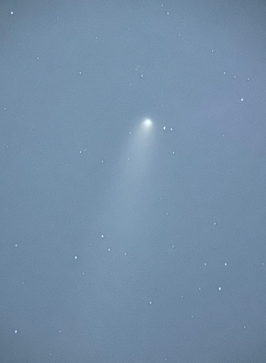
And got it with the telescope tonight!
-
At least on even the warm days the temp can fall pretty fast (unlike during peak sun angle summer). 82 for the high here but already dropped back to 70.
-
Euro AIFS seems to hint at development down in the Caribbean as well but shunts it out to sea. We'll have to see how any deep digging trough out in that day 13-16 range transpires. If there really IS a strong system coming north out of the Caribbean and a "capture-worthy" trough...they might be in trouble. Long way away, of course. Wake me in 5 or 6 days if it's still showing
-
It is almost guaranteed to be wrong of course. Though wacky things can happen this time of year I suppose.
-
Sandy further south.
-
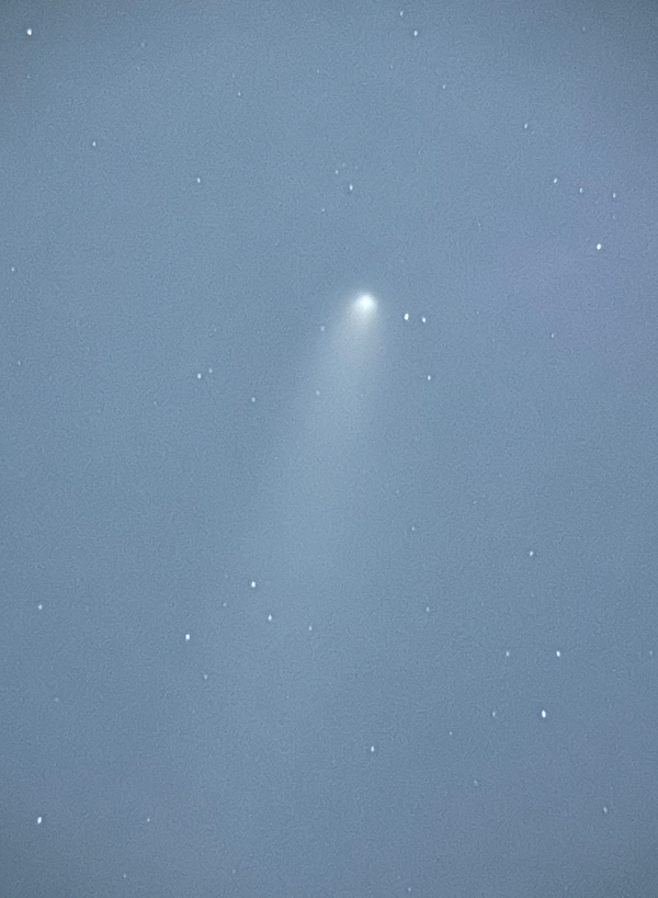
Late to the party but I finally snapped a shot of the comet.

-
Awesome weather. Love being able to sleep under blankets without being in a swamp.
-
Low of 35.6 here. House got down to 63ish inside...not switching to heat just yet.
-
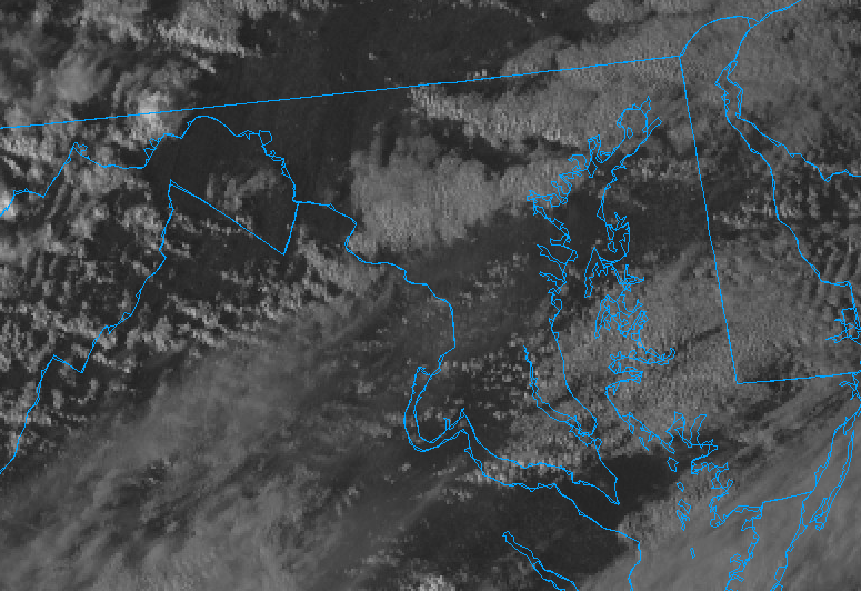
Watching that western sky. Might be just a touch too bright still.
-
Latest - Pesky band of clouds has formed just to my north. They might scoot out before primetime though.
-
Could be far worse...cautiously optimistic. HRRR the past few runs looks solid for a chance.
-
Clouds may be an issue this evening - seems models have reductions in clouds from NW to SE in the 0z to 3z timeframe. That may not be good enough - but with it being west to east - if the western sky can clear earlier we may still have a shot.
-
West
-
Thanks! Sounds like a similar "night mode" setting/exposure that I used for the aurora might work here...providing I can actually locate it tonight. Fingers crossed!
-
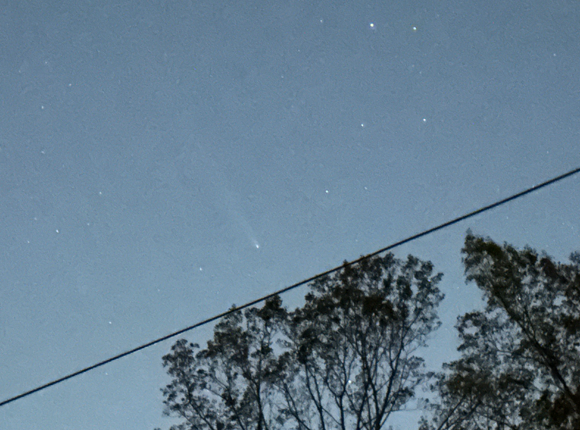
How did it look naked eye? Was that with a few seconds exposure? I think it was behind trees for me last night. Going to try again this evening!