purduewx80
-
Posts
1,705 -
Joined
Content Type
Profiles
Blogs
Forums
American Weather
Media Demo
Store
Gallery
Everything posted by purduewx80
-
That dirt was ruined when modern ag took over.
-
Occasional Thoughts on Climate Change
purduewx80 replied to donsutherland1's topic in Climate Change
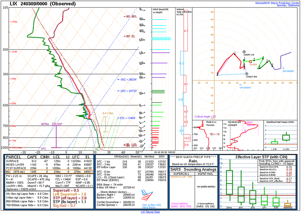
This is the exact type of thing you'd expect to see in a warming planet with warming oceans. Record precipitable water on the Slidell, LA sounding last night, for March, April and early May.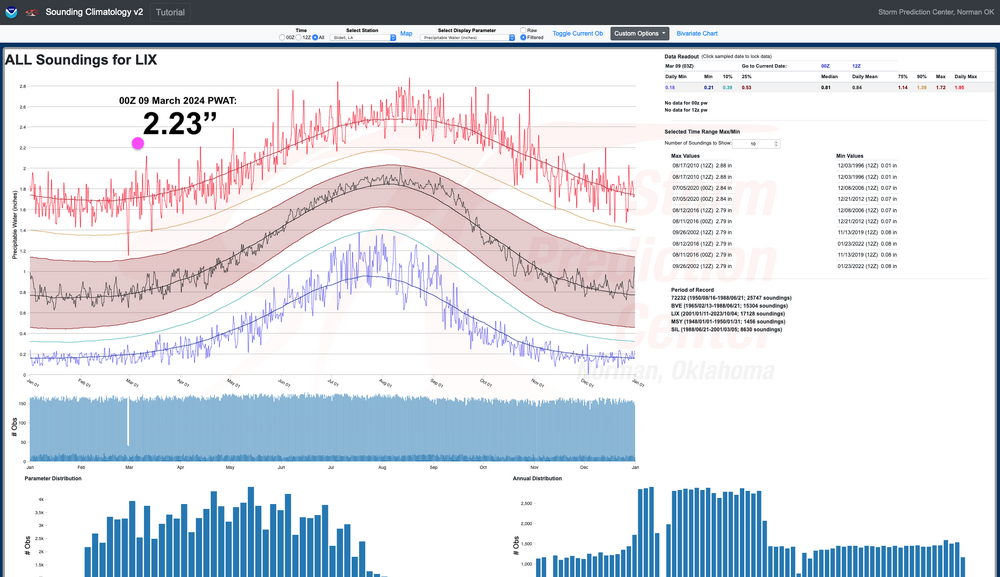
-
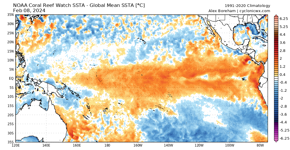
Not sure why I find this so funny, but NOAA issued a La Niña Watch. It's pretty clear that sub-surface cooling is impacting the surface in the EPAC now.
-
MO/KS/AR/OK 2023-2024 Winter Discussion
purduewx80 replied to JoMo's topic in Central/Western States
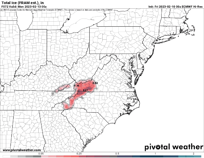
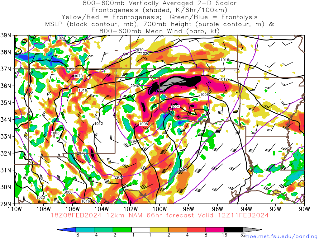
This most likely will change between now and then, but the frontogenesis progged on today's NAM runs in OK and adjacent areas is sick. There's upright and slantwise instability feeding into it, which makes sense with the intensifying and closed-off 500 mb feature. That's a good 2"+/hr TSSN signal if these amped up scenarios verify.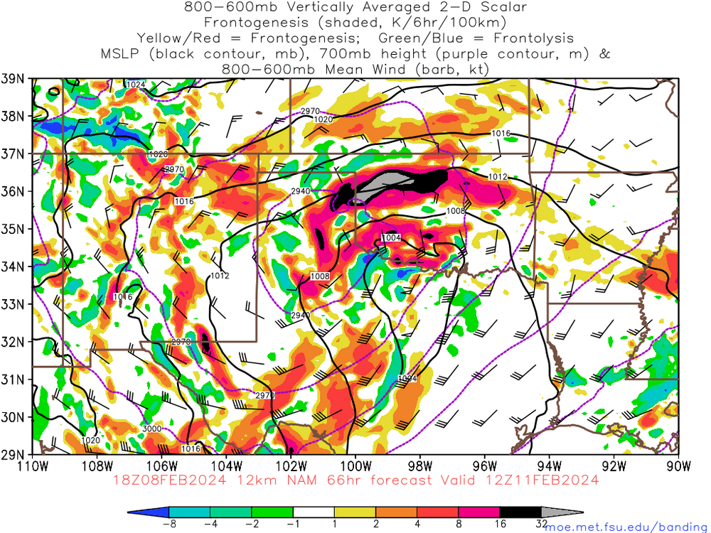
-
The moisture-laden warm sector looks fairly narrow on Friday, which may be limiting, while warming mid-level temperatures as the potent low moves north actually act to decrease instability compared to what is progged north of the warm front earlier in the day. I think elevated supercells may actually be likely in the warm air advection pattern midday into the southern Appalachians and Piedmont, which should present a very large hail risk given the extreme shear. Perhaps some of these will interact with the warm front in the afternoon. Shear vectors are more perpendicular to the pre-frontal trough/pseudo-dryline as compared to yesterday, so perhaps a few tornadic supercells can get going later in the day, as well. There certainly may be a better risk for surface-based storms closer to the Gulf Coast and eventually the East Coast given the proximity to better instability.
-
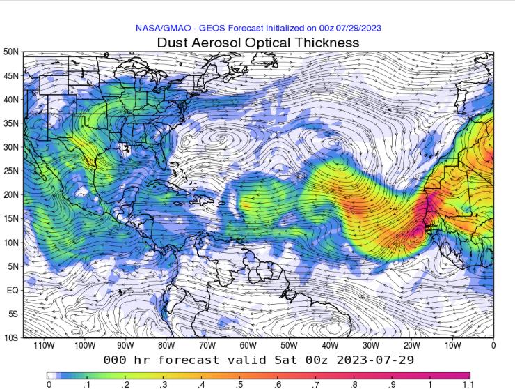
The excess lightning y'all reported may be at least partially due to aerosols from the Saharan Air Layer that streamed into the region yesterday. There is some evidence from this study and master's thesis to support that potential.
- 214 replies
-
- 10
-

-

-
Mid to Long Range Discussion ~ 2023
purduewx80 replied to buckeyefan1's topic in Southeastern States
A cooler-than-normal warm season is not at all surprising, especially if we do end up going into a Super Nino this year. Still, they won't be perfect analogs given the climatology this map uses and major differences in SST patterns elsewhere.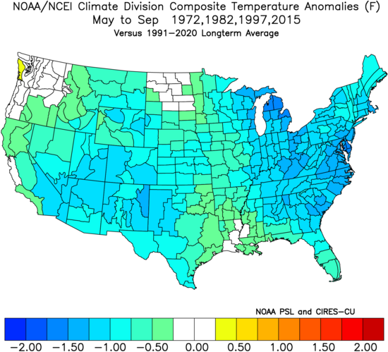
-
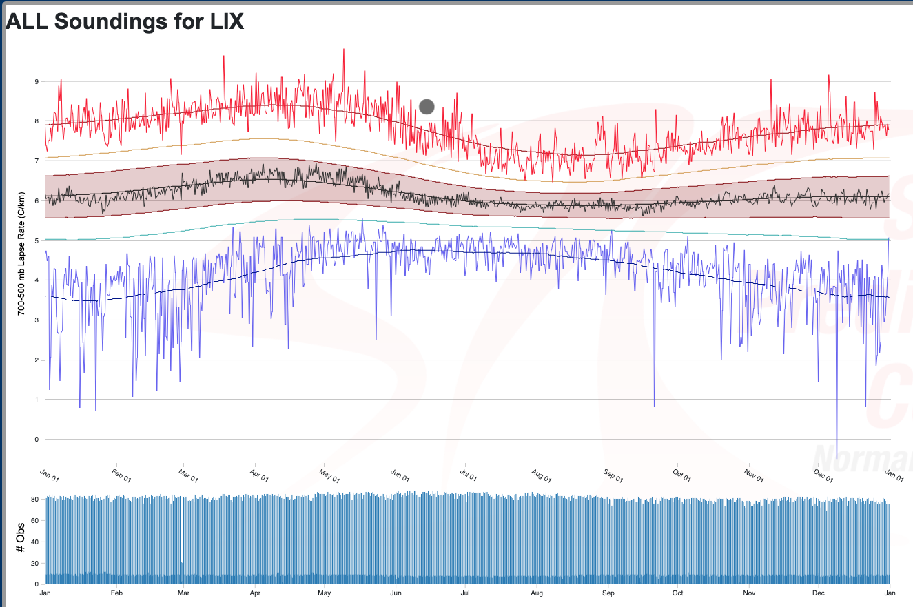
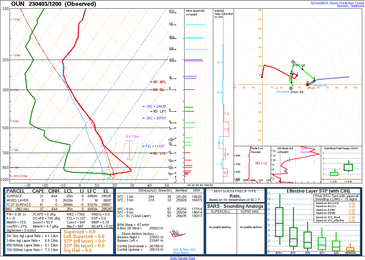
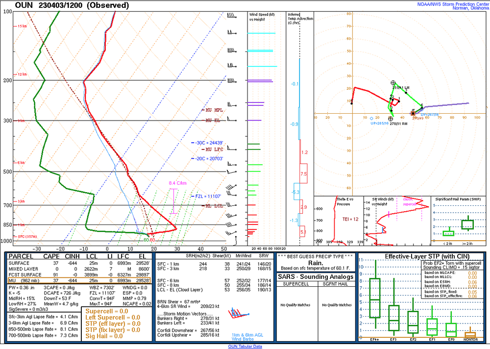
8.4C/km at New Orleans this morning:
-
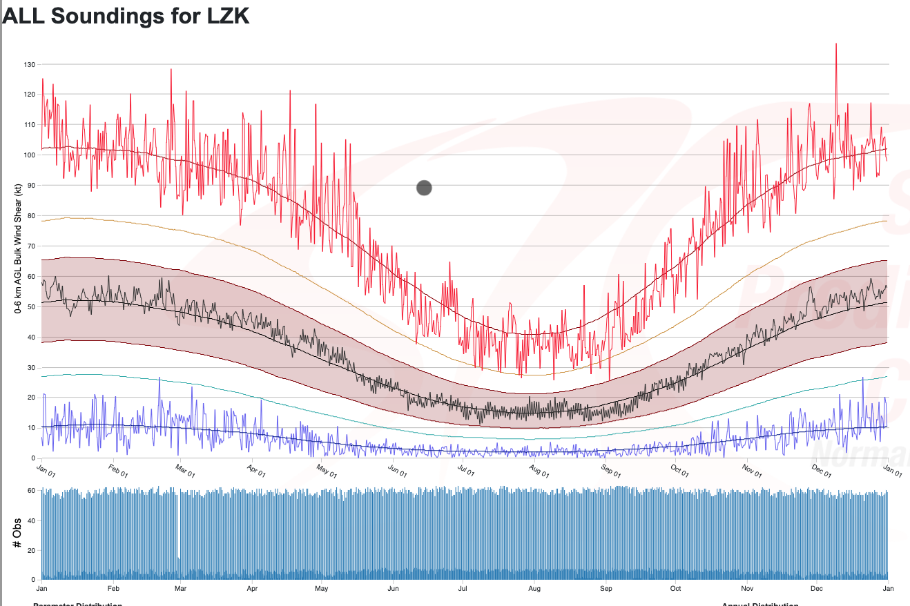
Loving the new SPC sounding climo page. Check out how anomalous the observed shear was at Little Rock this morning:

-
The deep layer of dry air that may cause LCL/capping/moisture issues is clearly evident on 12Z soundings over the Plains this morning, where Gulf return moisture looks great at first glance.
-
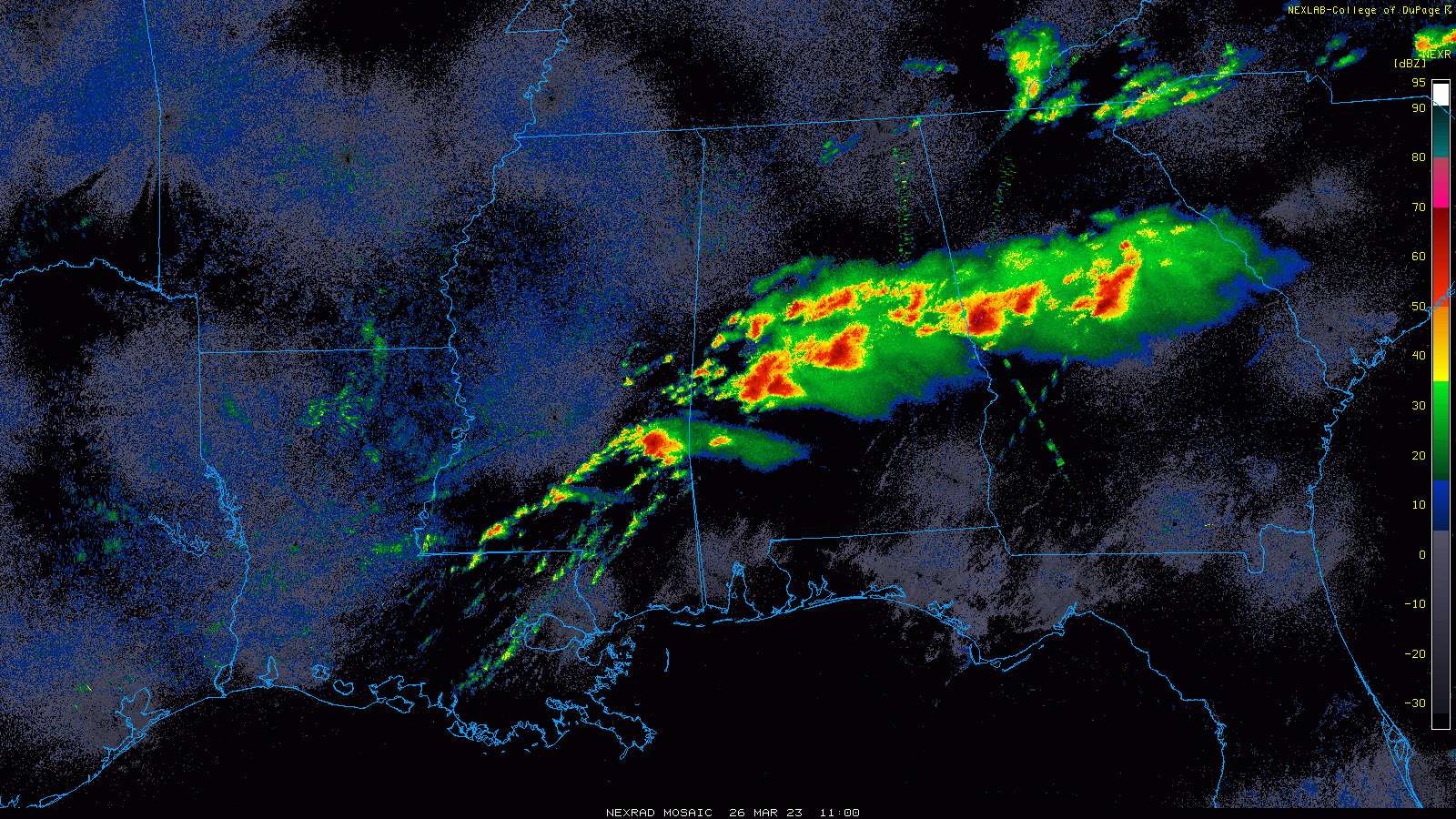
Severe Weather 3-30-23 and 3-31-23
purduewx80 replied to cheese007's topic in Central/Western States
Fire weather is severe weather, too. OK and southern KS seeing dozens of wildfires in the past 15-20 minutes.
-
Oh no. How will excess capitalism ever recover? Good luck, y’all. Will miss being in Chicago for this.
-
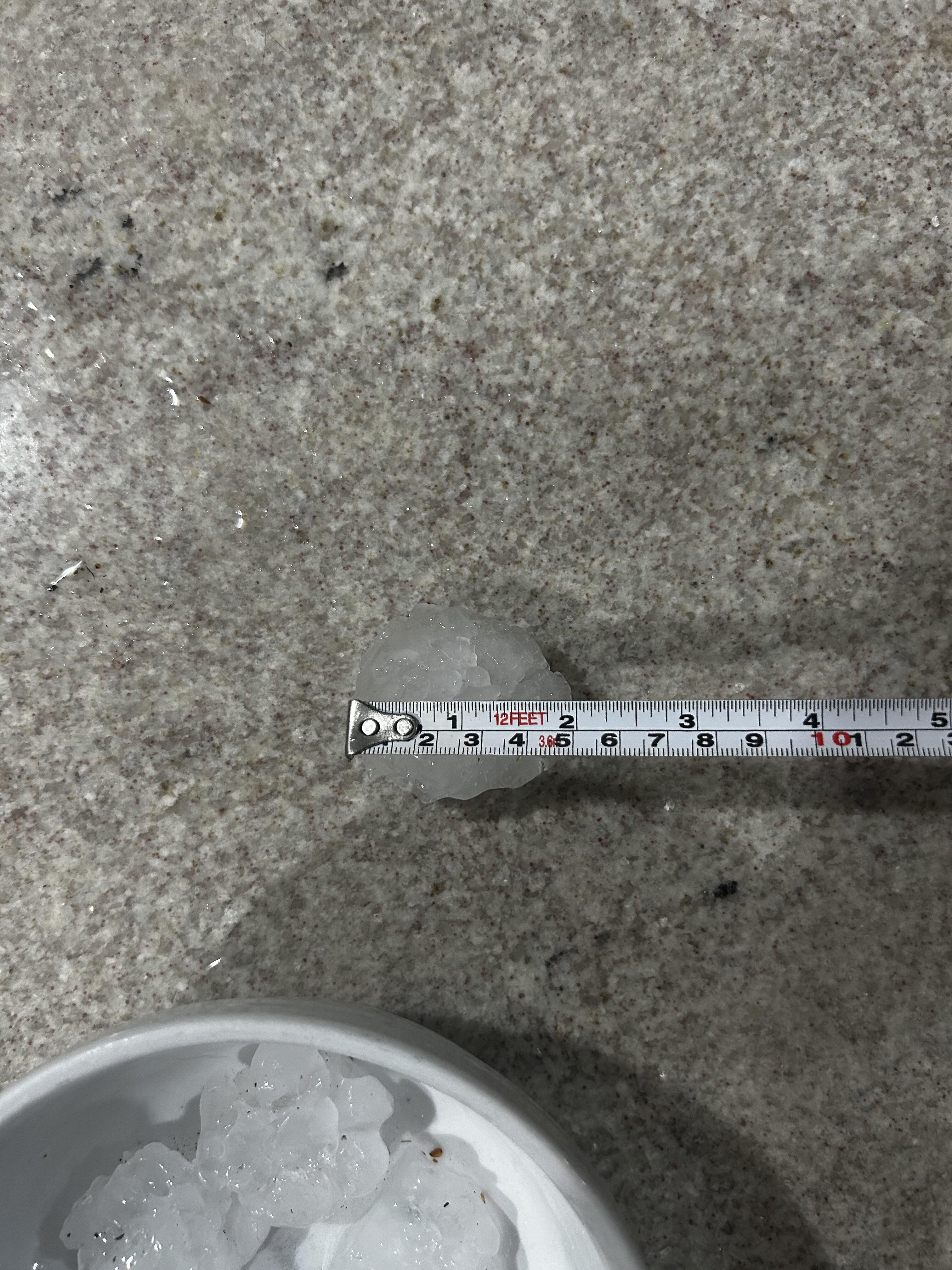
Huge hail for a couple minutes in ATL just now. Biggest stone I found is 2.1”.

-
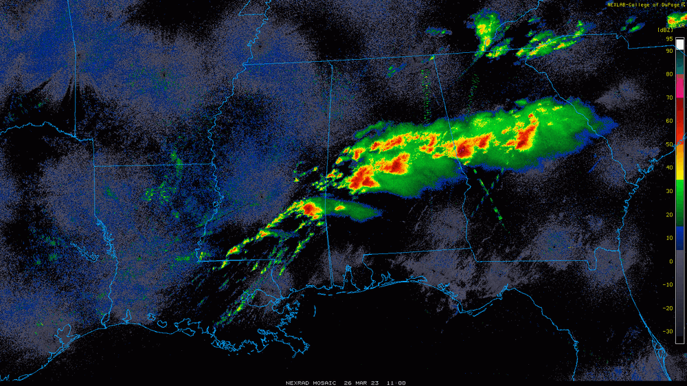
That's quite the early morning string of pearls across AL and GA. Two radar-confirmed tornadoes have occurred in GA over the past hour.
-
Mid to Long Range Discussion ~ 2023
purduewx80 replied to buckeyefan1's topic in Southeastern States
It’s weird or perhaps to be expected that the SPC didn’t go with higher probabilities Friday over AL/GA/TN. The low is still deepening and wind fields overall are stronger than Thursday, with more than enough instability progged. Still some timing differences with the front but it’s slowed down a bit, pretty much like every other cut off low. A lot of the point fcst soundings highlight PDS tornado potential. -
Mid to Long Range Discussion ~ 2023
purduewx80 replied to buckeyefan1's topic in Southeastern States
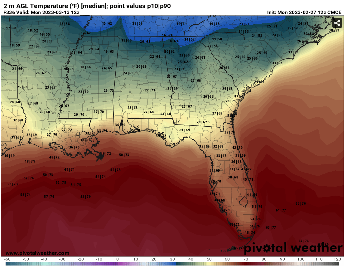
Although it's definitely going to be difficult to get snow or ice without a threat-the-needle situation or elevation on your side, I think one of the higher confidence impacts in the SSW- and MJO-forced cool down is going to be to agriculture in the South. Personally, I have strawberries and blueberries blooming currently, the asparagus is up and all the cool-season veggies are thriving. It'll be easy for me to cover but not so simple for all the commercial farms to mitigate a potential hard freeze. The GEPS ensembles are showing the reasonable worst-case scenario with widespread 20s to the coast and some teens to the Piedmont. The 10th percentile is the number on the left, so the extreme outliers are even colder. EPS is not quite as cold as the Canadian. Obviously, there's a lot of spread, but that whole period is increasingly ripe for at least a couple of anomalously cold days/nights.
-
Mid to Long Range Discussion ~ 2023
purduewx80 replied to buckeyefan1's topic in Southeastern States
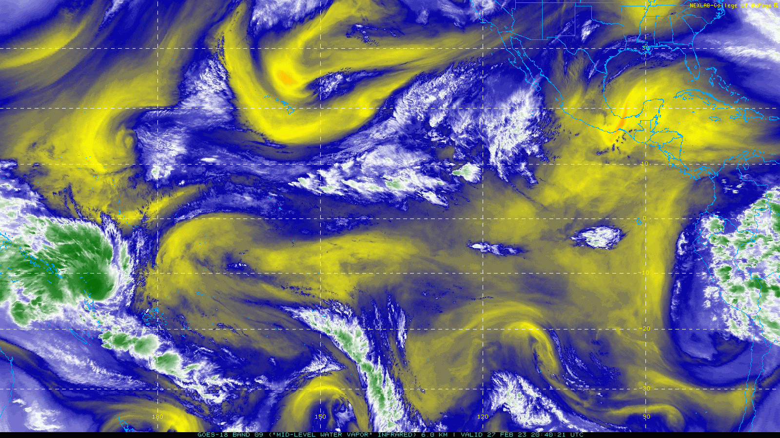
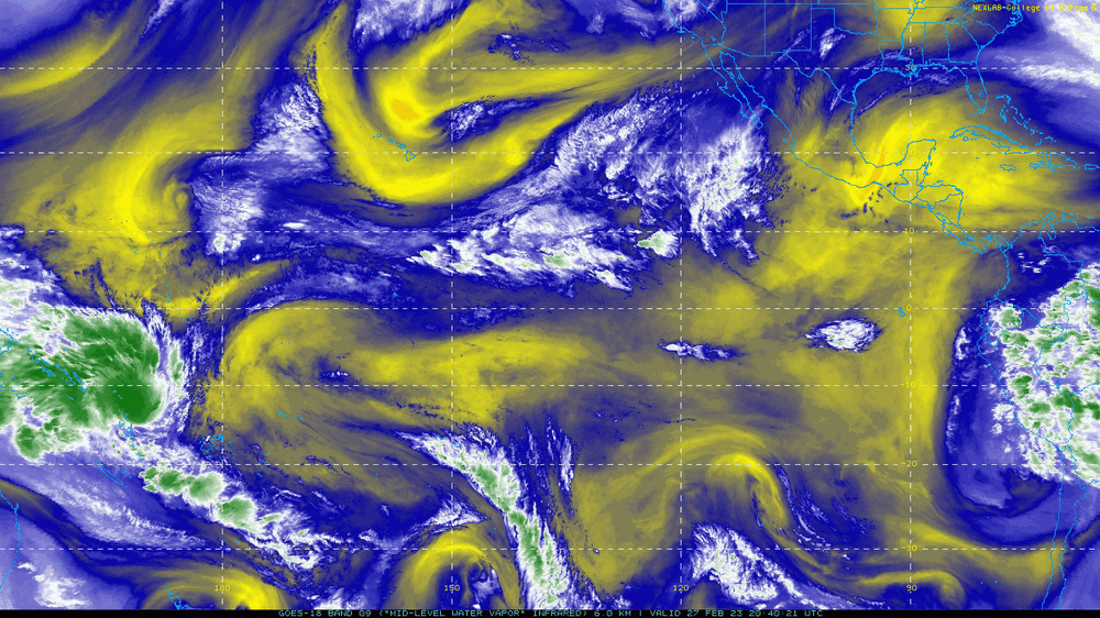
Was just looking at GOES-18 this afternoon and noticed how different it looks out there. Sub-tropical jet showing up and all. The SST anomaly animation shows the warming to neutral nicely.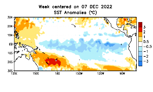
-
Mid to Long Range Discussion ~ 2023
purduewx80 replied to buckeyefan1's topic in Southeastern States
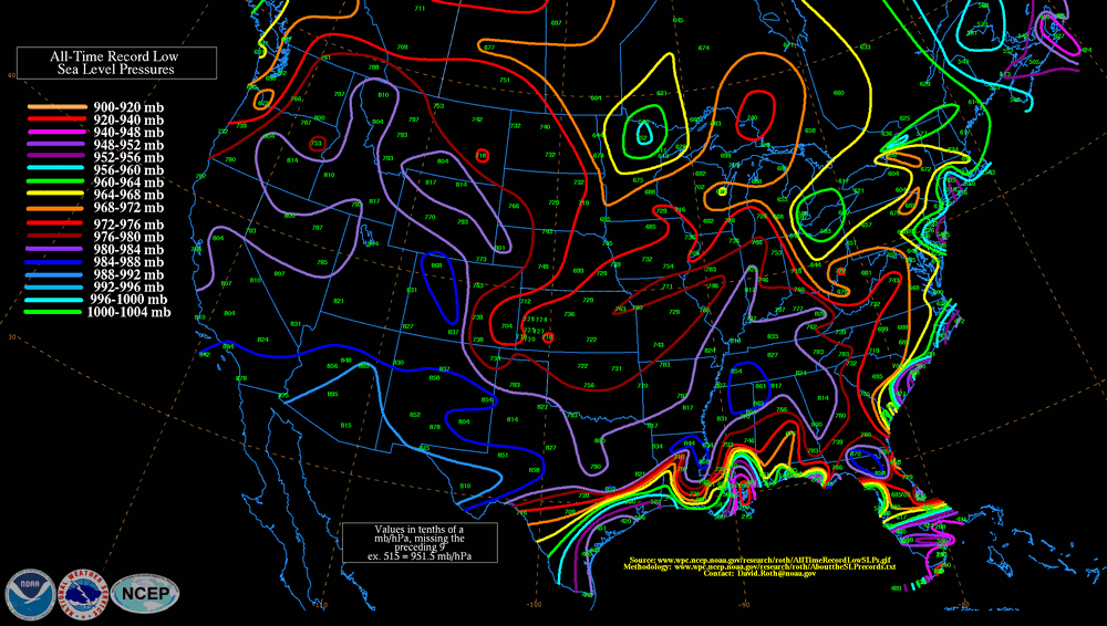
They're definitely coming into better agreement the past 24 hours or so, closer to the more persistent GFS and what most of the other guidance was showing last week. The stronger solutions are very close to setting low pressure records across the Mid-Miss./Tenn./Ohio Valleys and have super outbreak written all over them. 12Z EPS and low pressure records below: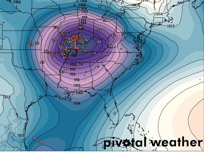
-
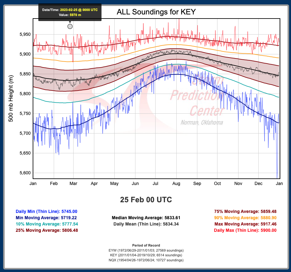
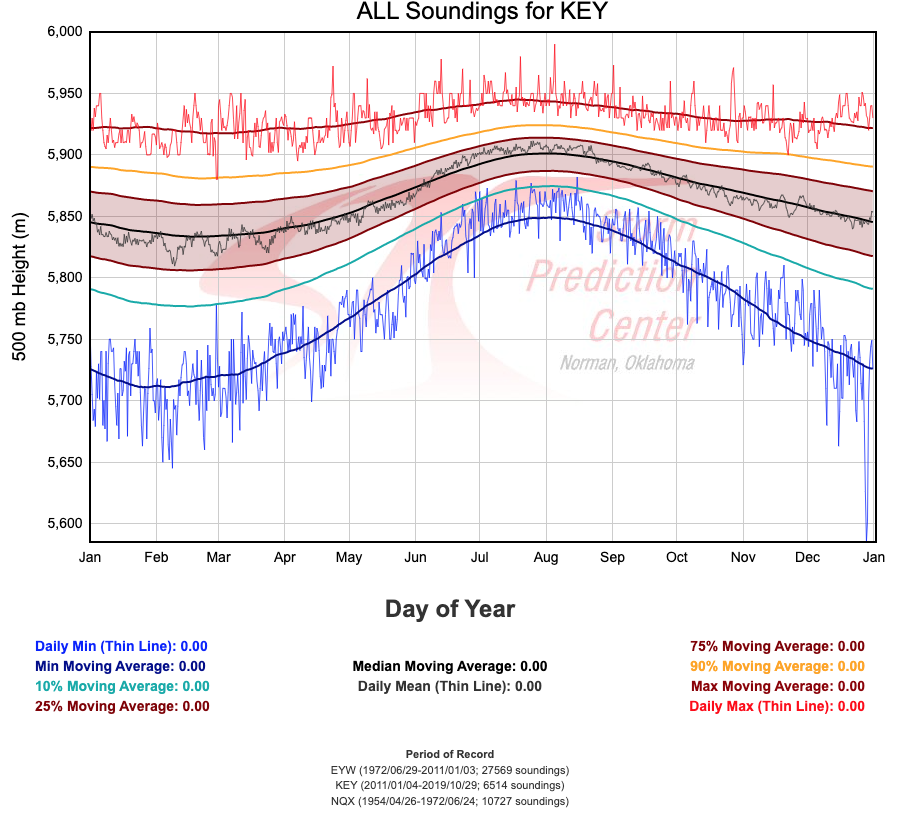
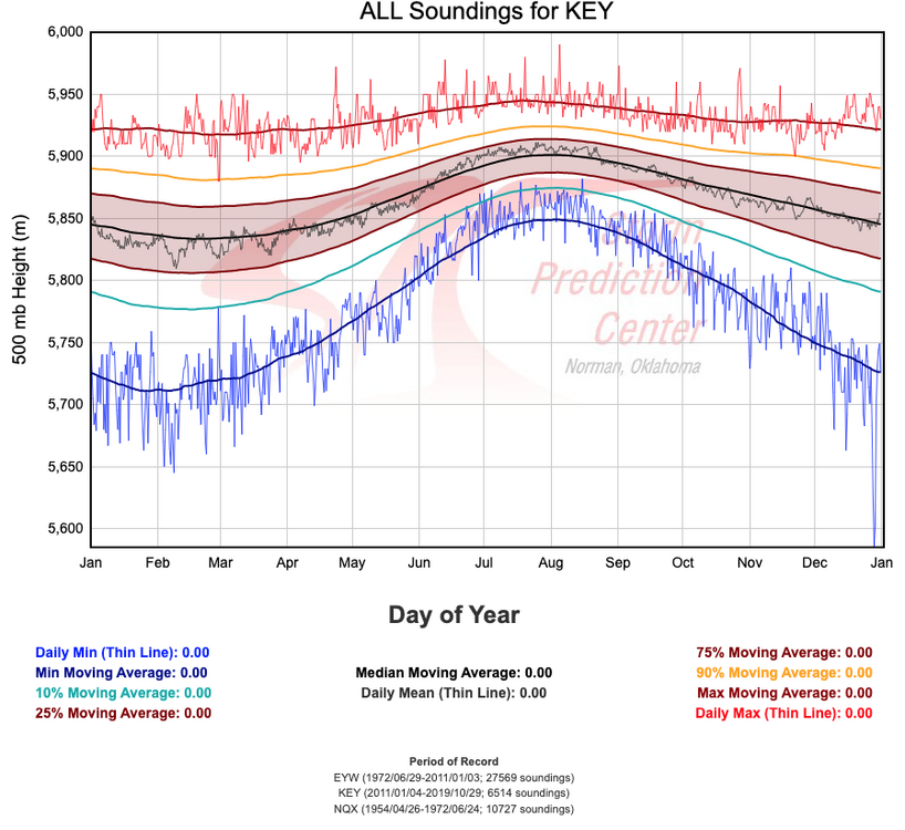
Key West finally scored that 597 dm ridge on Friday evening's sounding.

-
Mid to Long Range Discussion ~ 2023
purduewx80 replied to buckeyefan1's topic in Southeastern States
That's some eerily good agreement on the 00Z runs late next week. Conceptually, the amped up pattern across the CONUS this week and next should lead to some kind of major severe wx outbreak eventually. Ensembles are also supportive of a bombing low, but I'm a little hesitant to trust anything this far out with the looming -NAO/SSW impacts.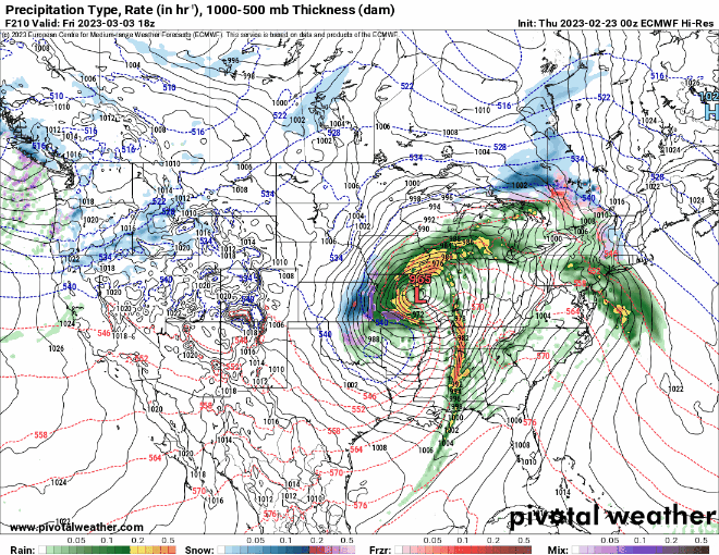
-
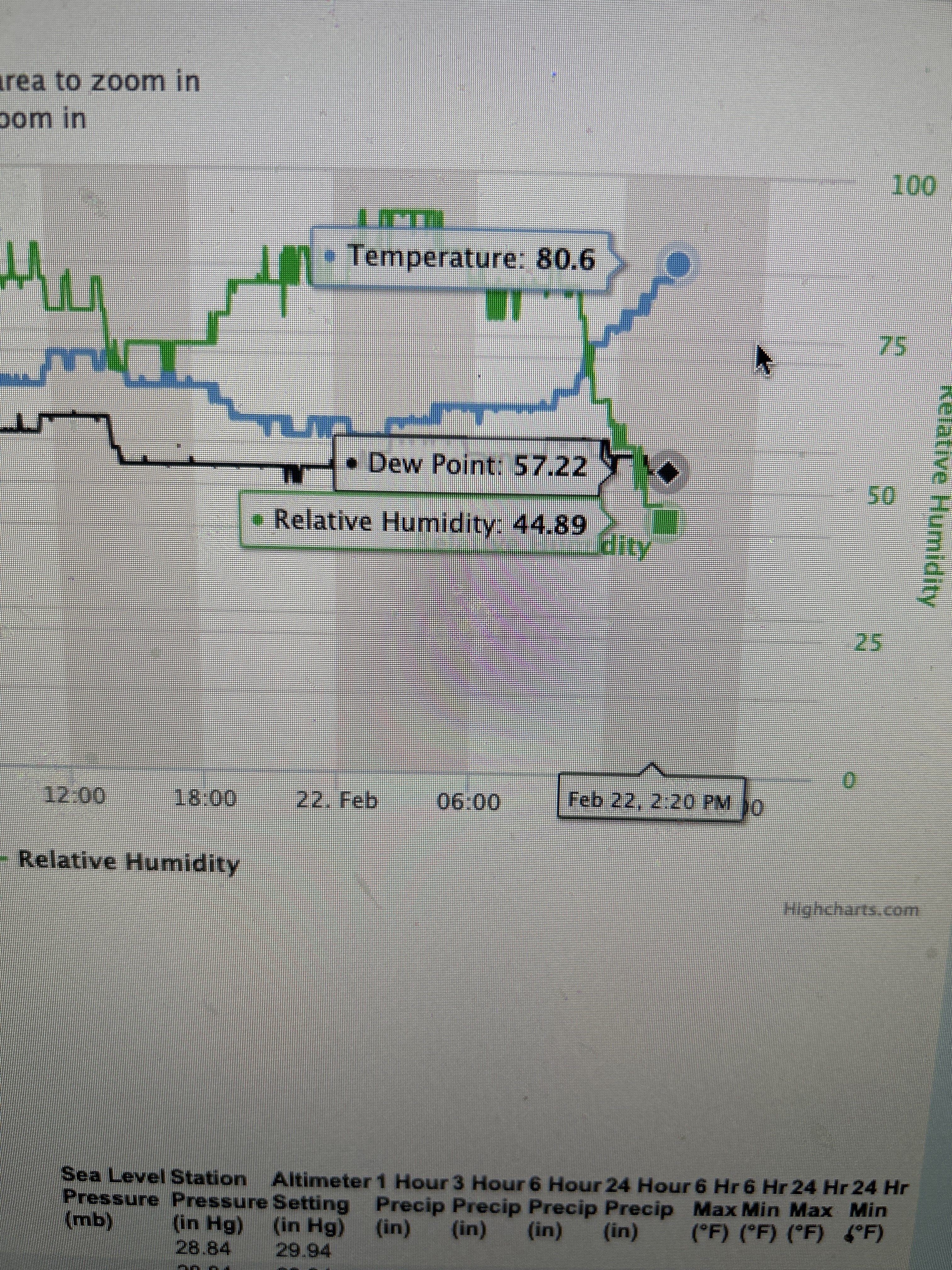
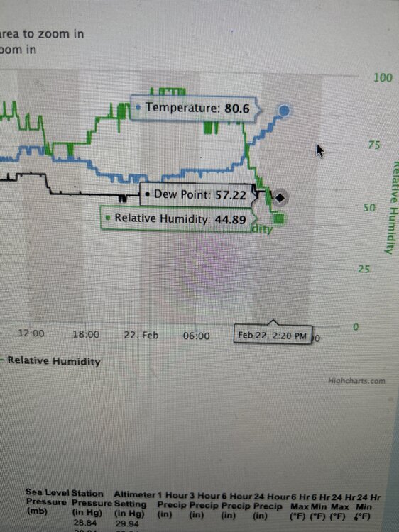
It’s unofficially the warmest Feb day on record in Atlanta.
-
Mid to Long Range Discussion ~ 2023
purduewx80 replied to buckeyefan1's topic in Southeastern States
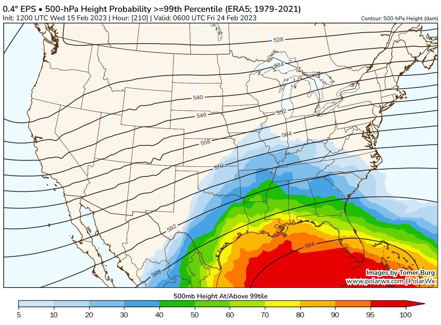
Gotta love the absurd ridge forecast next week by the EPS. The 12Z op run even had 5970+ meter 500 mb heights over the Gulf, which is impressive for any time of year. Should be a lot of record highs next week south of wherever that strong front sets up.
-
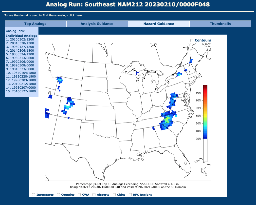
Nah, I've only lived in ATL a year. CIPS analogs are below. The shading is probs for >4" of snow based on the 00Z NAM. CIPS doesn't have FZRA as far as I can tell, but you can see the top 15 analogs in that drop down.

-
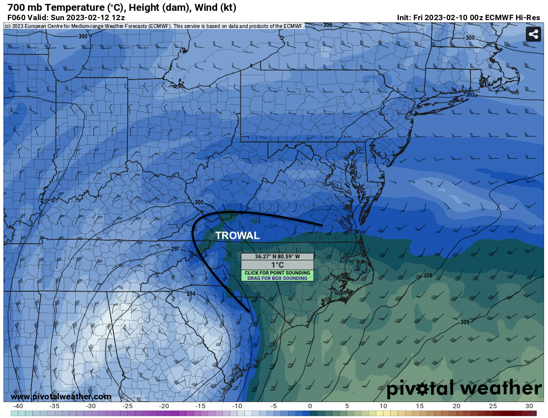
There is almost better agreement on the freezing rain potential than for snow. A surface high over the Mid-Atlantic could maintain just enough dry air to wet bulb surface temps down to or below freezing near the Blue Ridge (esp. sheltered valleys and some ridge tops) as the heaviest precip moves through. The TROWAL (trough of warm air aloft) provides the melting aloft for that and also contributes to the upright instability that will be crucial for flipping rain over to snow despite marginal boundary layer temps for elevations below ~1500'. The favored zone for heavy snow will be just northwest of the core of the closed 700/500mb circulations, but predicting where and when convection occurs this far out, even on hi-res guidance, is next to impossible. That's why ensembles are still a good tool for a marginal situation like this.