purduewx80
-
Posts
1,705 -
Joined
Content Type
Profiles
Blogs
Forums
American Weather
Media Demo
Store
Gallery
Everything posted by purduewx80
-
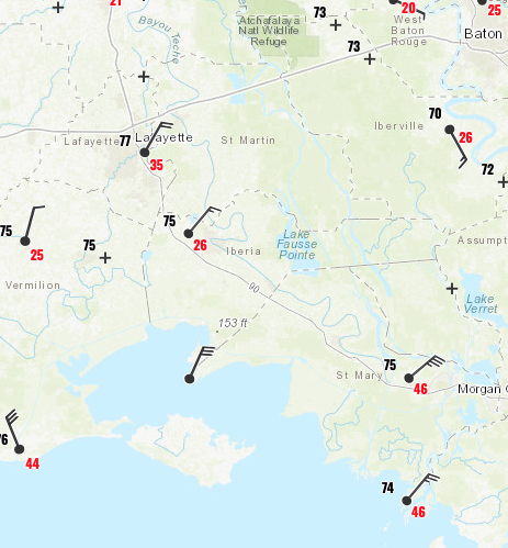
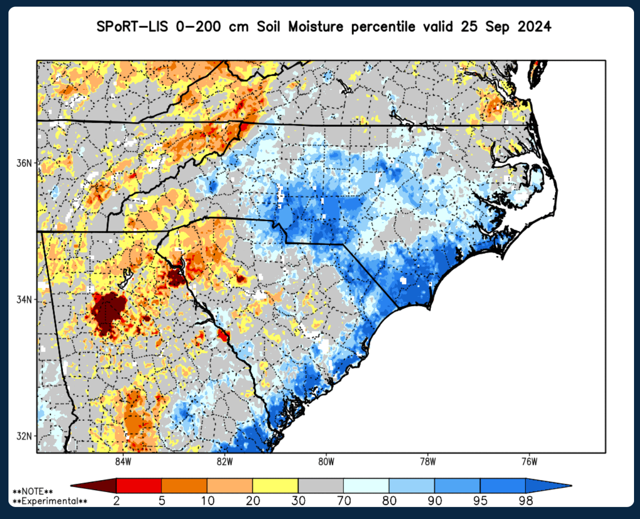
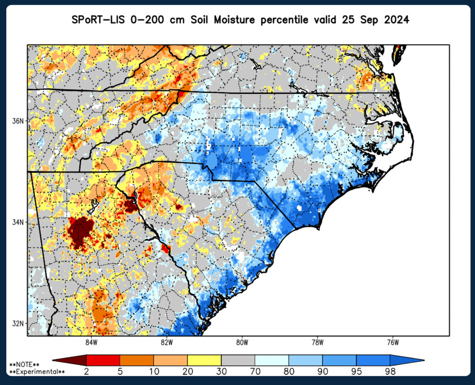
Very noticeable drought here in Atlanta and most of the Apps. NC is still wet from PTC8. Soil moisture percentiles below. Not sure it will matter much, but at least it’s dry to start.
-
2024 Atlantic Hurricane Season
purduewx80 replied to Stormchaserchuck1's topic in Tropical Headquarters
Its ensembles are all over it, but the GFS and Canadian suite is a bit less clear. I'm also watching this wave about to enter the Caribbean. It'll initially be sheared by Helene but may encounter more favorable conditions as it interacts with the CAG early next week. Not as much model support for anything intense, but its worth tracking.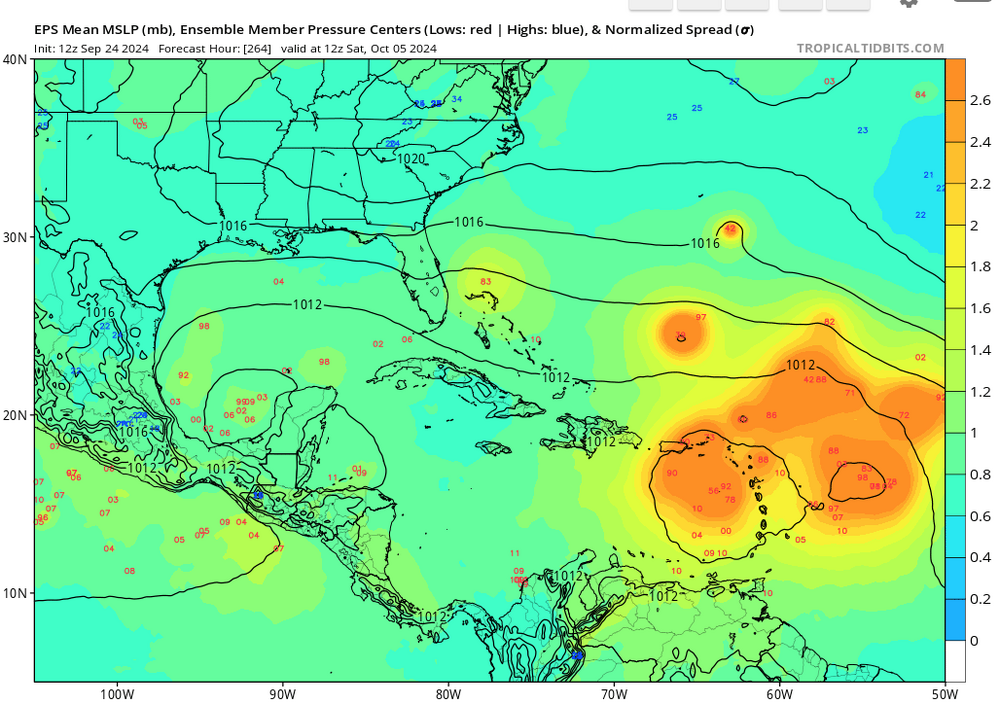
-
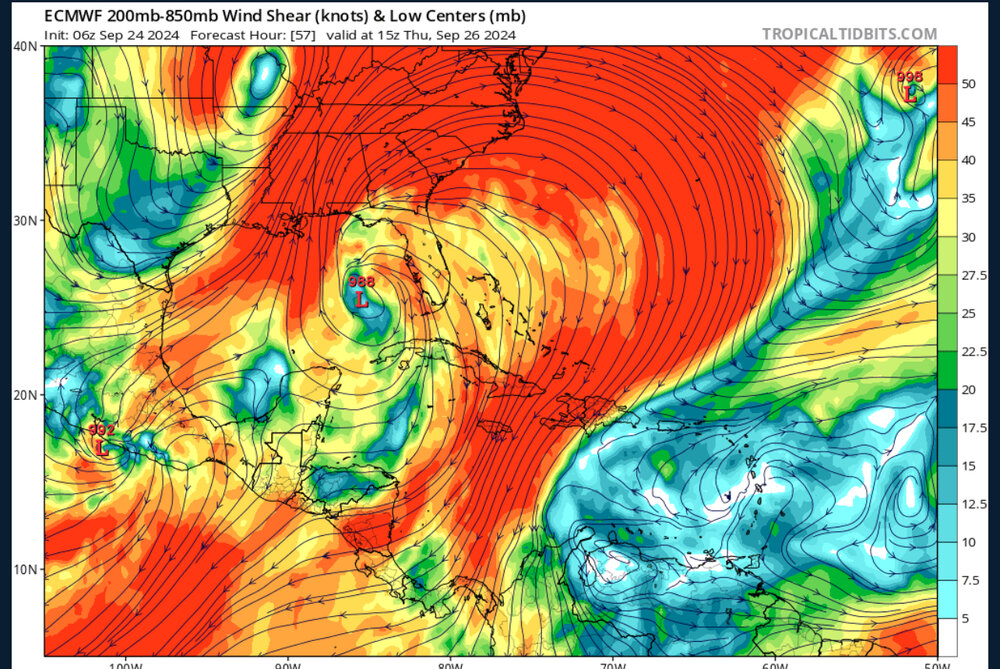
Is that shear in the room with us? This is an ideal setup for ventilation and expansive outflow in at least three quadrants.
-
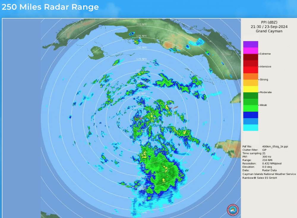
Should have a good view from the Cayman Islands radar the next day or so, and then Cuba's after that. https://www.weather.gov.ky/radar
-
2024 Atlantic Hurricane Season
purduewx80 replied to Stormchaserchuck1's topic in Tropical Headquarters
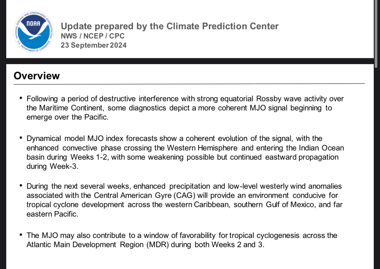
Some good tidbits in today’s CPC MJO discussion:
-
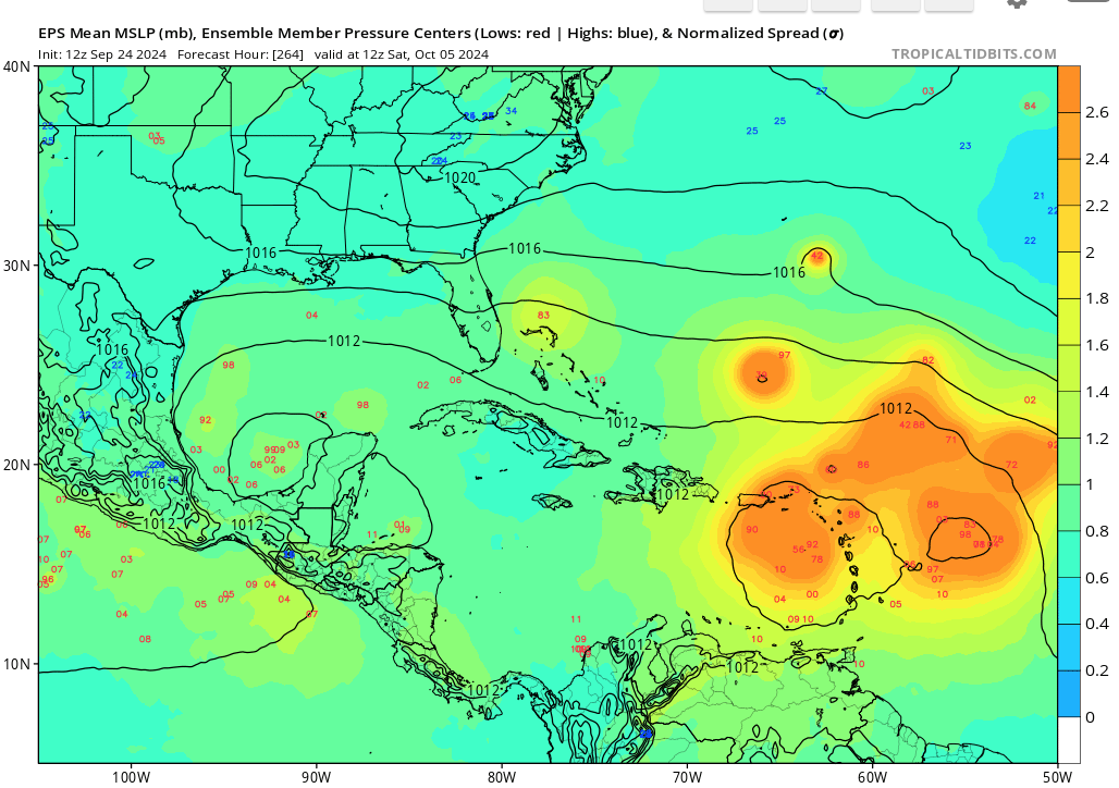
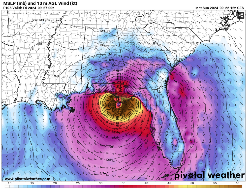
This is the reasonable worst case scenario. Note the asterisked fine print at the bottom.
-
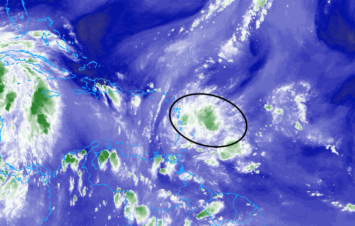
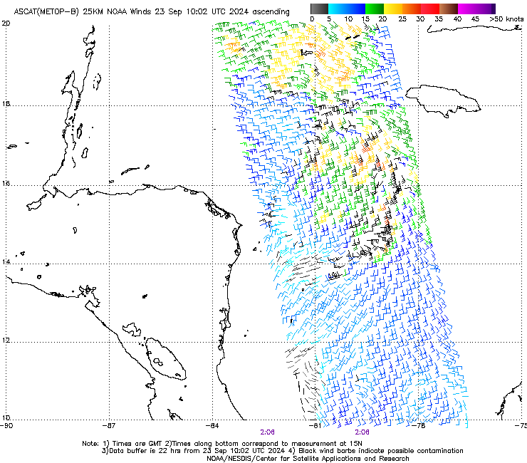
Still a mess at the surface, with multiple areas of convergence. Convection is firing over the southern piece but most models key in on the area west-southwest of Jamaica. Seeing scattered areas of 25-30KT winds in there. Hopefully NHC goes the PTC route later today if the low hasn’t consolidated yet.
-
Its interaction with the upper low will cause severe flooding.
-
That's a good bit east of Panama City.
-
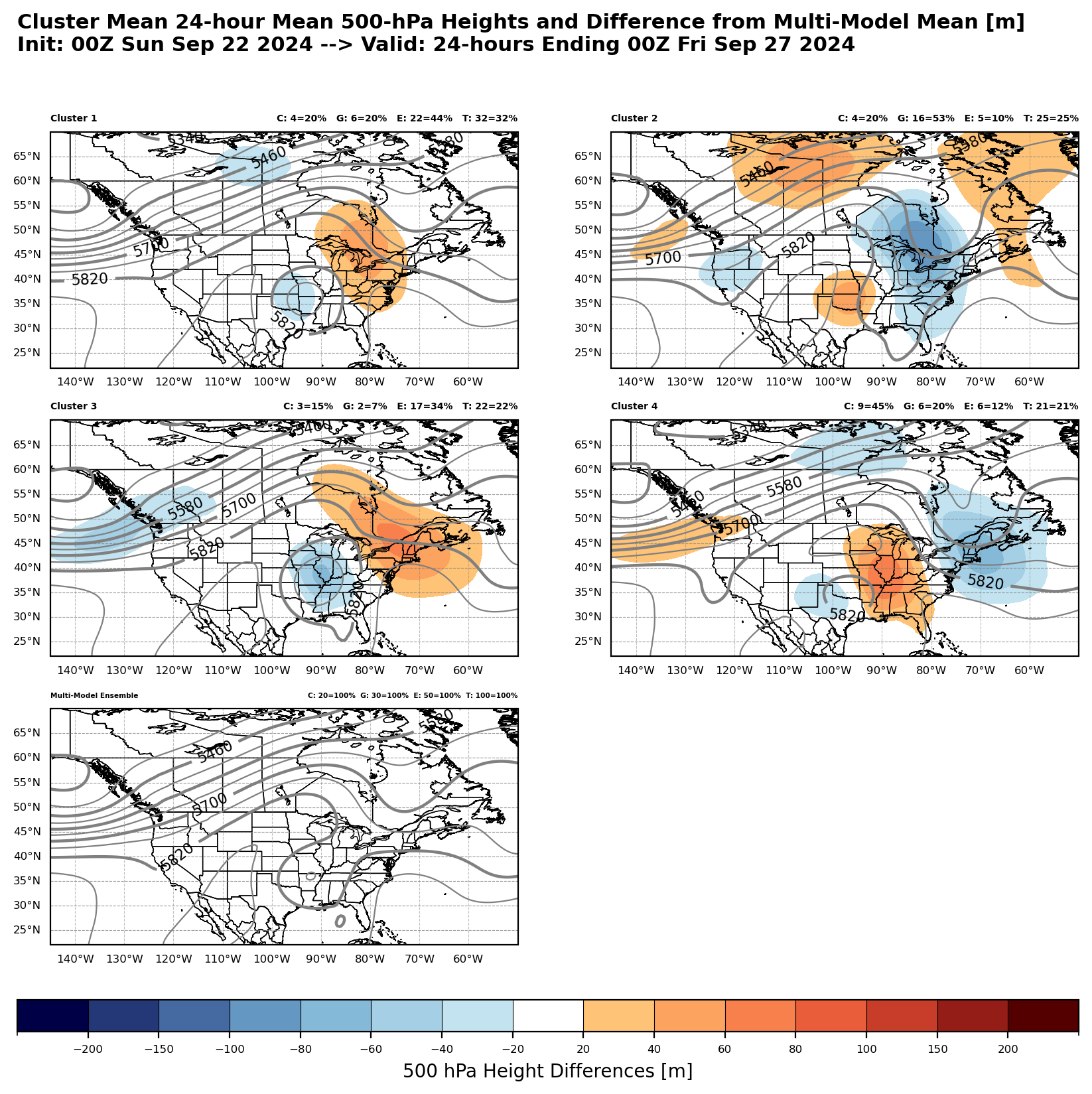
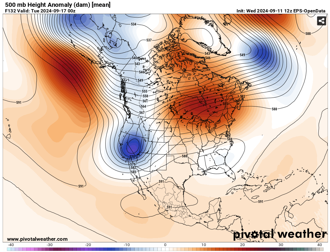
This cluster product valid on Thursday evening shows huge differences in where the cut-off is, which is unfortunate but to be expected in the blocking regime we're in now. It takes the Canadian, GFS and Euro ensembles, groups their 500 mb depictions into four similar patterns (the main 4 panel with colors) and also displays the ensemble mean on the lower left (upper low over northern AR). No one cluster is more likely than the others at this point, but watching trends in where the mean is will be important. The shading is just where the cluster has higher or lower heights than the mean. The upper low is predicted to be anywhere from the Ozarks to St. Louis to central OK, with cluster 2 showing something more akin to the EC-AIFS, with a more progressive cut-off and ridging in the Plains. There are really big differences with troughing over New England, too. Lots to sort out here still. These are the parts that will have some influence on the extent of rainfall to the west, its track/speed in the northeastern Gulf and especially the jet configuration for either shear or ventilation.

-
2024 Atlantic Hurricane Season
purduewx80 replied to Stormchaserchuck1's topic in Tropical Headquarters
That convective burst is impressive. Winds aren’t too supportive quite yet.
-
Than what? The spread in the full ensemble suite is wildly different in terms of intensity, timing and placement. Anything from a tropical storm to a major hurricane is on the table. The blocking pattern over North America is adding to the uncertainty, unfortunately. Need to watch the thunderstorm cluster south of Jamaica tonight and the potential competition in the east Pac, too. The highest ocean heat content surrounding Central America is squarely on the Atlantic side, so it will be interesting to see if that is where convection ends up being favored the next few days. Bottom line, it’s complicated. Operational runs will continue to have wild swings, perhaps into Monday.
-
It organized more quickly in the Caribbean, had better ridging overhead and the position of the cut off over the Miss. Valley changed slightly, resulting in excellent ventilation. Tells us the cut off position and where/when a low organizes are probably the main reasons for the uncertainty.
-
2024 Atlantic Hurricane Season
purduewx80 replied to Stormchaserchuck1's topic in Tropical Headquarters
Certainly seeing the beginning stages here, but it will probably take several more days for something to consolidate.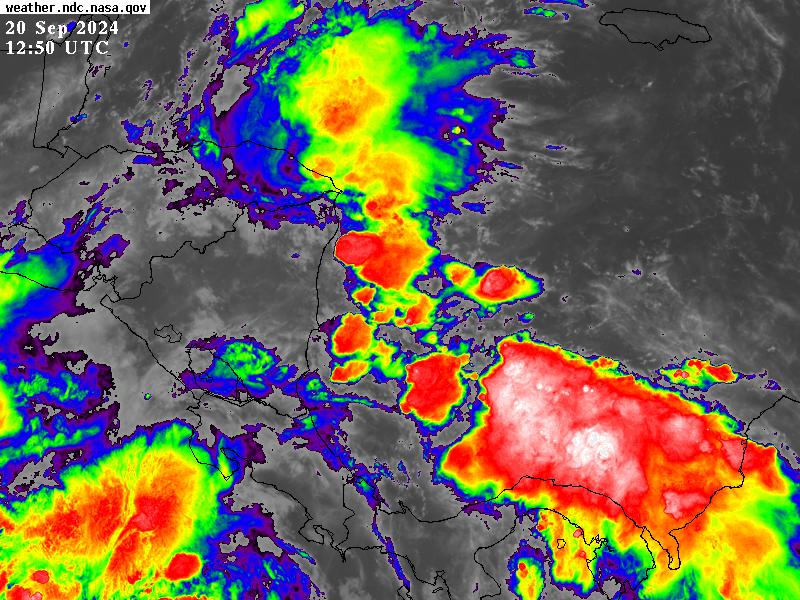
-
2024 Atlantic Hurricane Season
purduewx80 replied to Stormchaserchuck1's topic in Tropical Headquarters
It appears that way when you focus on operational runs, but the ensembles have been showing two camps for days, with other solutions somewhere in between. The Euro ensembles have had the most support for a slower/more westward track. As usual it comes down to where and when a surface low consolidates. There is also a lot of work to do with the upper pattern near the Gulf Coast, which is highly variable due to energy potentially undercutting the Upper Midwest ridging next week. -
2024 Atlantic Hurricane Season
purduewx80 replied to Stormchaserchuck1's topic in Tropical Headquarters
A track like that is entirely possible with the high latitude blocking in Canada/Greenland and wave breaking underneath. Plenty of Euro ensembles are showing something similar. It’s a thread the need situation no matter what. -
2024 Atlantic Hurricane Season
purduewx80 replied to Stormchaserchuck1's topic in Tropical Headquarters
Eh, Wilma intensified to an historic Cat 5 in the Caribbean. Current ensemble suite doesn’t suggest anything like a repeat, but in general the analogs are showing how we get a potential major hurricane to come north out of the Caribbean. Somewhere in the eastern half of the Gulf is most likely at this point, but there’s a huge amount of spread in timing and location, such that anywhere in the Gulf is probably fair game. This one will have off-the-charts OHC to work with and will probably be able to take advantage of the loop current farther north, too.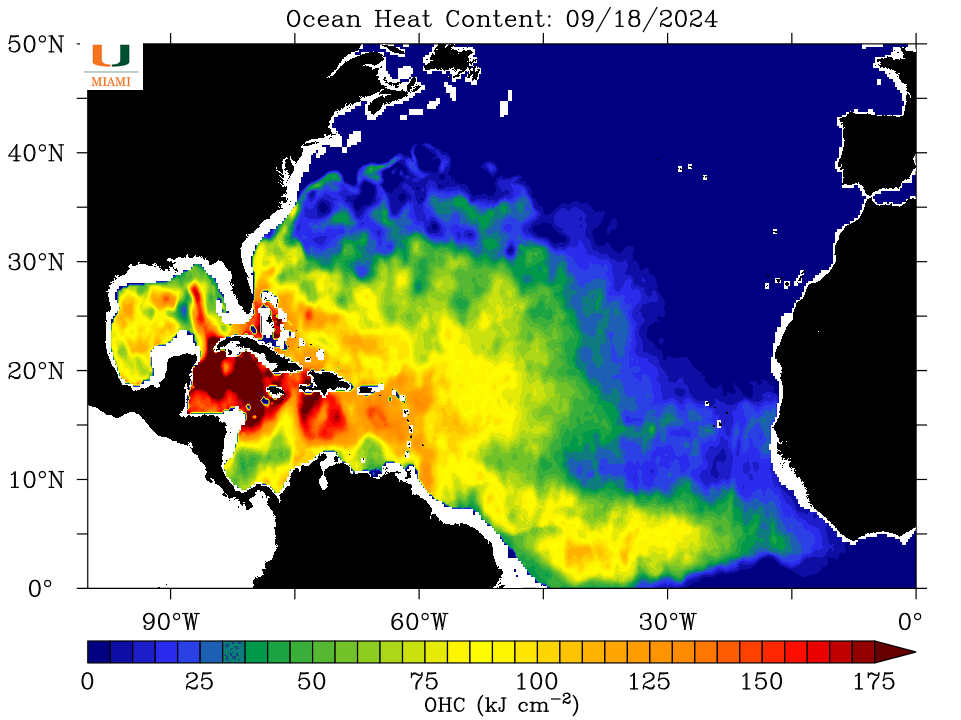
-
2024 Atlantic Hurricane Season
purduewx80 replied to Stormchaserchuck1's topic in Tropical Headquarters
The pattern that produced Wilma in ‘05 just moved to the top analog in the 6-10 day.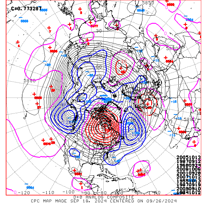
-
2024 Atlantic Hurricane Season
purduewx80 replied to Stormchaserchuck1's topic in Tropical Headquarters
NHC should be adding it to their 7-day outlook any day now. At least CPC is on it with today's update. There’s a lot of uncertainty with the troughs and ridge placement next week, so I guess we can’t rule out a Euro-like solution under a Gulf ridge into Central America. Certainly more of a consensus in the ensembles for a track north or northeast across Cuba and Florida for now.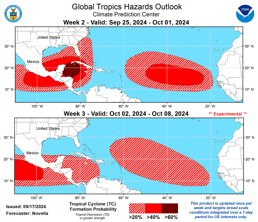
-
Potential Tropical Cyclone Eight—50mph/1006mb
purduewx80 replied to WxWatcher007's topic in Tropical Headquarters
Definitely what the 12z GFS shows and why it’s so much earlier with landfall. -
Potential Tropical Cyclone Eight—50mph/1006mb
purduewx80 replied to WxWatcher007's topic in Tropical Headquarters
There's hints of another binary interaction on some of the guidance, both CAMs and globals, not unlike what occurred with Francine. The MCV off the coast and another broad wave on the east side of the loop are trackable now and could be the two players these models are seeing. The difference this time is that they're both frontal waves initially. Hopefully, if this occurs and a consolidated low develops, it happens close enough in that it runs out of time to intensify significantly due to the improved organization and improving jet dynamics. This seems to be the consensus, but there's also indications a weird hybrid mess with multiple centers could head up the coast, in which case a named system would be less likely, despite similar impacts.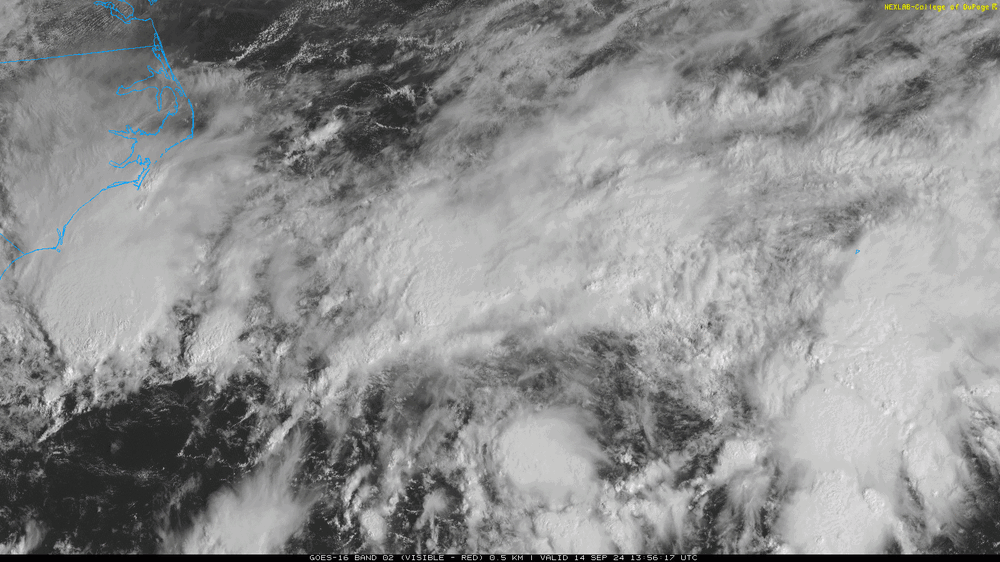
-
2024 Atlantic Hurricane Season
purduewx80 replied to Stormchaserchuck1's topic in Tropical Headquarters
The ensembles are also all over the place in terms of location, timing and intensity. This is likely due to the Rex Block developing over eastern North America, with Francine's remnants and a few other shortwaves meandering/possibly merging under the ridge making it more difficult to model. Even the offshore tracks could be fairly impactful to the Outer Banks due to the long-duration onshore winds that should precede its development. That said, there is a naked surface low out there that could reform under any persistent convection over/near the Gulf Stream this weekend.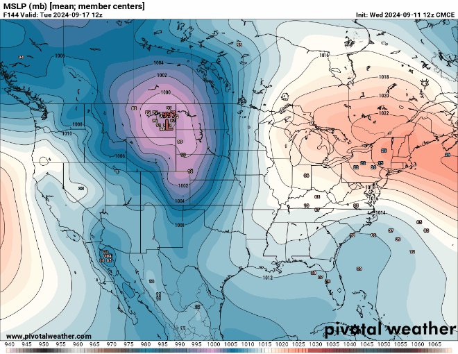


-
Wild that LIX hasn't upgraded their Hurricane Watches.
-
Agreed. Wish this was closer to the radar, but there are mesovortices evident in the northern eyewall that are almost certainly enhancing winds on the meso-beta scale.

-
This area has offshore flow, pulling the water out. It's also close to low tide now. Next high tide isn't until 3-4AM.