purduewx80
-
Posts
1,705 -
Joined
Content Type
Profiles
Blogs
Forums
American Weather
Media Demo
Store
Gallery
Everything posted by purduewx80
-
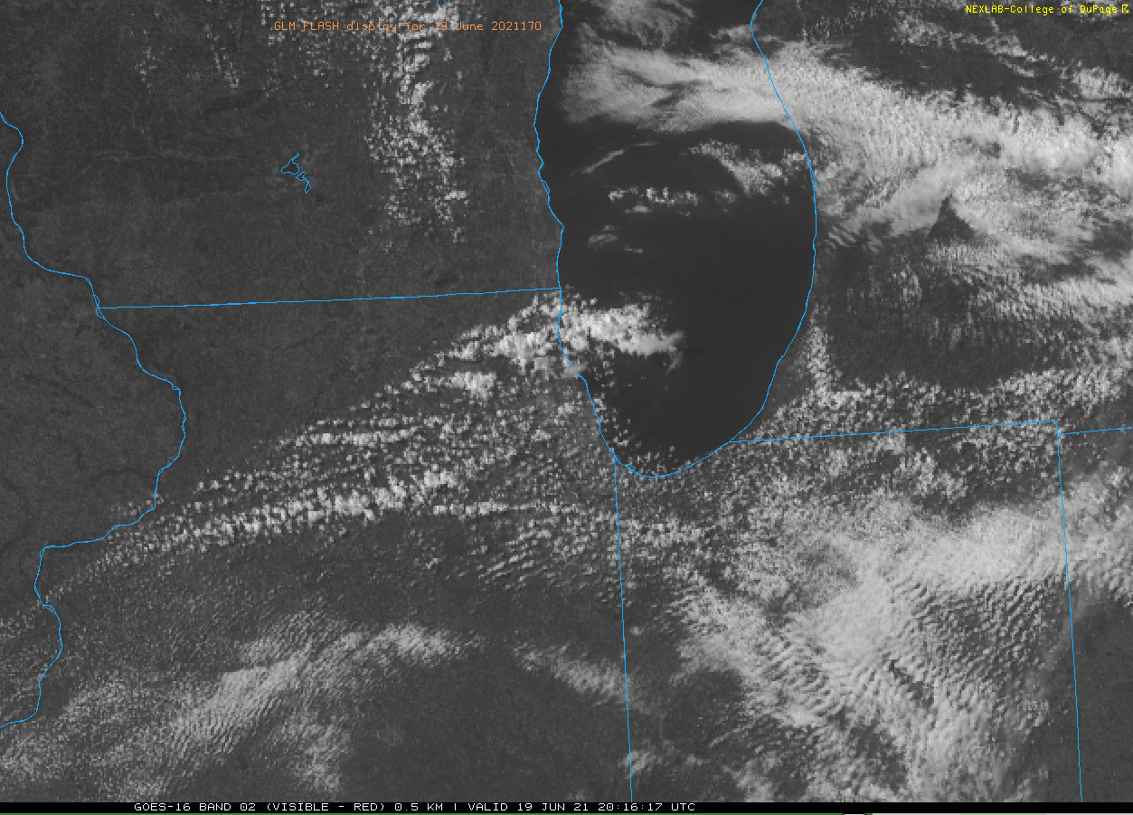
Differential heating caused by the thicker smoke moving into northern Lower Michigan has helped focus thunderstorms over the cleaner air ahead of it. Had the smoke not been there, the lake breeze would likely have been the focus a little farther NW.
-
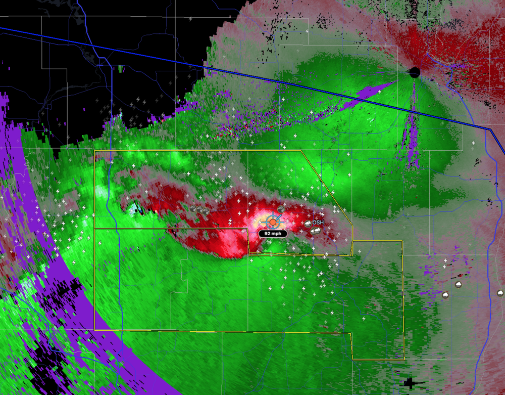
The supercell that's been NW of OSH has evolved into a classic book-end vortex over the past 30 min or so. GRB is sampling 90+ mph outbound winds around 3000'. This feature looks to directly affect the Milwaukee metro area and may at least clip portions of Chicagoland. It has yet to encounter the most favorable instability, unfortunately. Likely to be a threat for rain-wrapped tornadoes with it off and on, as well.
-
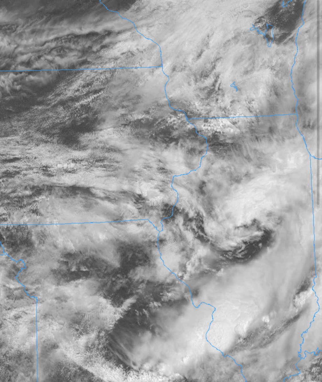
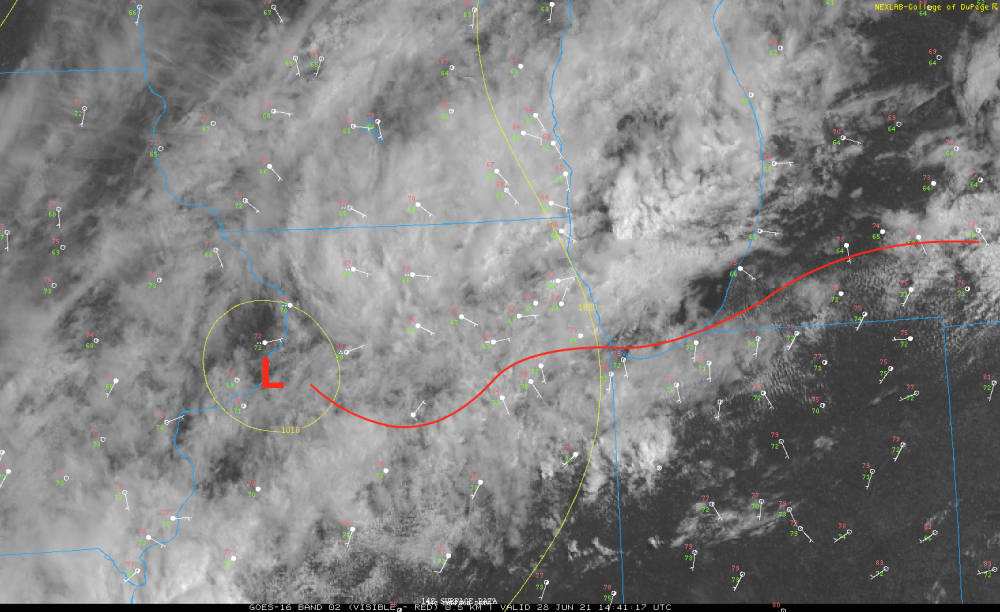
The overnight MCV is being sheared apart due to the strong winds aloft - def can see those remnants aloft w/ the feature over IA. The only implication I can see related to that is the min in instability caused by the warm front being driven S/W by an outflow boundary. Recovery can happen quickly in this setup during the late PM hours, but it's not totally clear where the instability gradient will be as TS ride the ridge SE and then S tonight. The latest HRRR does capture current instability fields relatively well. Hate to say this, but the 12Z GFS actually looks more reasonable than a lot of the CAMs from what I'm seeing so far. First warning up by Lake of the Woods now. Will be very interesting to see if that's the start of the main show (probably so).
-
somewhere inland from duluth will probably have the relatively higher discreet sup potential, but north woods is def not chaser country. don't recommend chasing qlcs tornadoes at night, especially given the terrain and how fast these'll be moving.
-
Toss most of the overnight CAMs that have little to none of the ongoing WAA activity captured. Orientation of the severe threat looks more N-S oriented than the initial day 1 outlook and may end up father W given the instability axis will have trouble building east as long as the MN TS continue.
-
Eh, what happens here is conditional on the AM MCS and whether things recover over IA/MN. If those areas don’t recover, we are likely to be in the enhanced risk for winds tomorrow night, along with a pretty sig risk for flash flooding given the lingering boundaries that may be nearby.
-
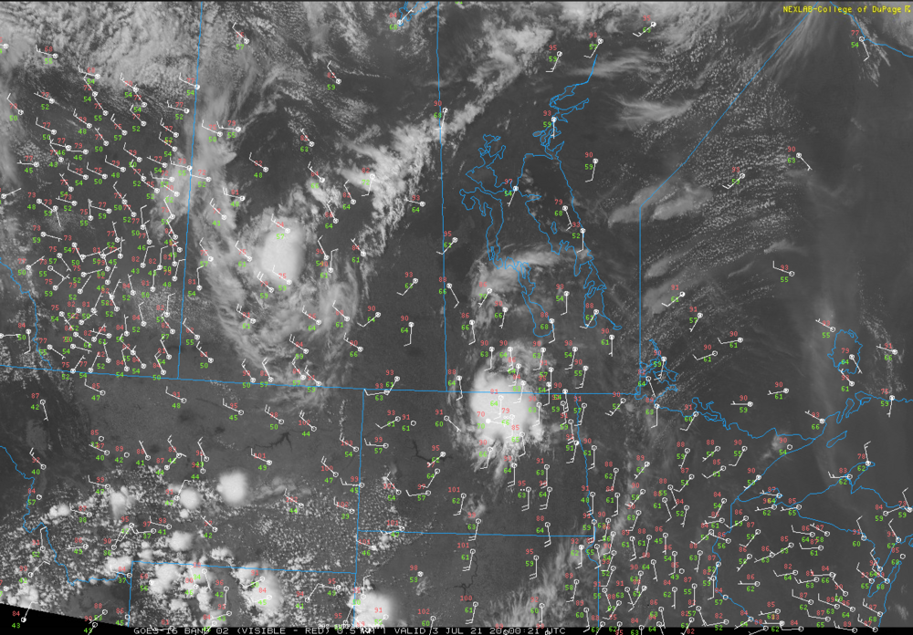
Our neighbors to the north are getting in on the PacNW heat dome, MCV action and wildfires. We have that telltale milky blue sky in Chicago today - pretty wild to see the highly amped pattern via smoke plumes emanating from Ontario and Manitoba.
-
Lake breeze gonna pop today? Stay tuned.
-
Just realized I posted in the wrong thread. Probably setting up for some 1-3" totals across the metro, especially near/south of 88/290. Starting to get initiation ahead of the central IL MCV now. There are a couple of boundaries to focus on, the lake-enhanced front which is now stalling in southern Cook through Lake Co, IN, and another more elevated boundary across northern Cook left behind by the AM showers.
-
Shear is relatively weaker today, but with the surface front draped across Chicago, couldn't rule out a brief spin-up this afternoon. That weak low near the MS River should help the front lift a little farther north tho lakeshore areas will keep the marine influence. Flash flooding will be the much greater threat as the 850 jet focuses across the area through the afternoon and evening. Training convection seems like a good bet given mean steering flow that is once again parallel to some of the boundaries out there. There are several weak MCVs/disturbances in the SW'rly flow extending from west-central IL back into OK to help kick things off with a little more heating. Some of the businesses in my neighborhood are still closed after their basements flooded on Saturday.
-
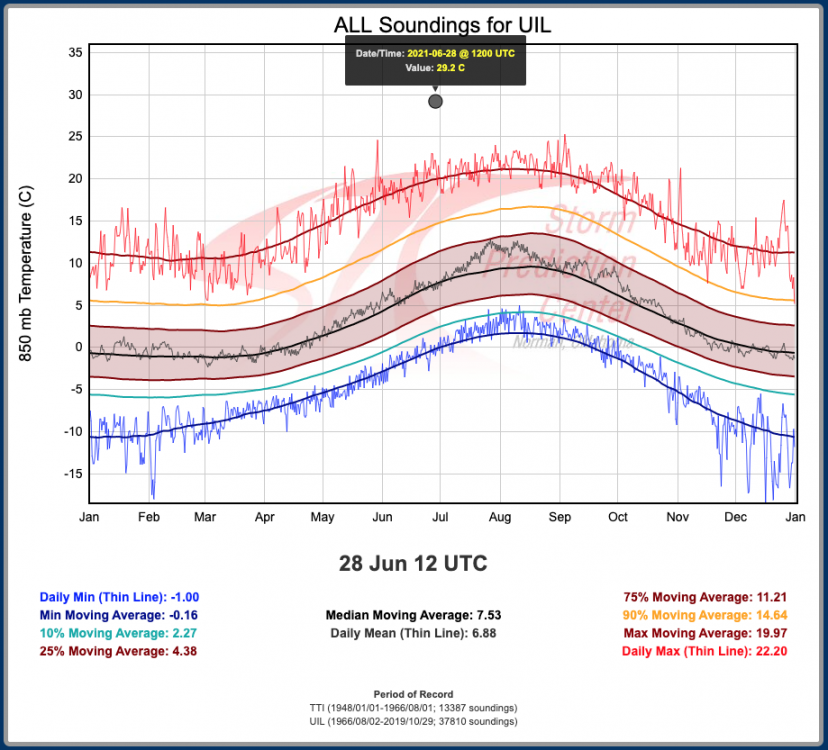
Some downsloping comes into play for the extremity of the surface temperatures in Cascadia. Today should be Seattle's hottest day of the heat wave and will smash yesterday's all-time high temp record. The 12Z Quillayute, WA ballon launch captured historically warm temperatures aloft. 850mb temp below. 500mb heights were also about 20m higher than the previous record (Aug-Oct is typically when they reach a maxima there).
-
Quality flash flooding disco from WPC.
-
Yeah looks like it’ll go quick.
-
The new day 1 sums it up nicely. I could foresee an enhanced/higher probs scenario across the southern Chi metro into far NW IN and SW MI. These festering shows could limit the heating over the rest of the Chicago area, but there is the potential for some last-minute destabilization given the fast flow at 925mb. There is quite a bit of clearing ahead of the main disturbance over SW Missouri now, and the 12Z ILX sounding has a convective temp in the mid-80s. Watching the stalling outflow boundary just west of STL to east of PIA closely.
-
Plenty of evidence for Chicagoland to get in on things tomorrow. AM convection should lay out the effective warm front. Shear looks decent on a lot of guidance, especially ahead of a weak surface low that tracks towards the area from the southwest during peak heating. Winds could locally back under fast, ~unidirectional flow aloft. That flow may also be parallel to some of the boundaries around which enhances the heavy rain potential. Gonna take a good amount of sun with temps well into the 80s to get decent convection, given the poor mid level lapse rates. If all that happens, a wet microburst setup and isol tornado threat is there. Perhaps some supercells mixed in initially given the 50KT of bulk shear.
-
Should add a few more patches today to the areas that have seen less (but not around Madison until tomorrow probably). HRRR is picking up on that area of clearing across N IL back into IA where a surface trough is also co-located. Storm motions will be 5-10KT so any spotty storms that form could dump some local 2-3” amounts.

-
June 20th, 2021 Severe Weather Event
purduewx80 replied to MazooWeather's topic in Lakes/Ohio Valley
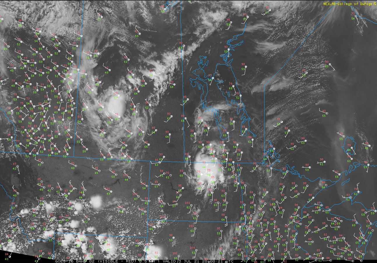
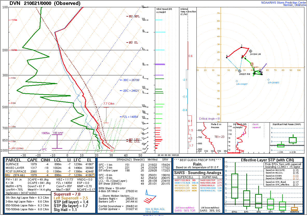
Shear rapidly increase either side of the MS River now (even more since the DVN sounding below). May be looking at overnight QLCS tornadoes, but there are some supercells developing ahead of the front in the strong WAA regime, too. Could be some training across N IL into the overnight. 18Z NAM (low res) and some of the older CAMs hinted at that this evening.
-
June 20th, 2021 Severe Weather Event
purduewx80 replied to MazooWeather's topic in Lakes/Ohio Valley
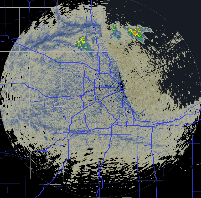
Area just W/SW of RFD is one to watch for initiation. Warm front is through ORD and will stall w the lake breeze. Low level flow is strongest near RFD ahead of a weak surface meso low. It’s a pretty small area but there is just enough overlay of instability and low-mid level is enhanced flow from the MCVs to get it going. Shame it’s so cloud my but that will also keep LCLs lower. -
June 20th, 2021 Severe Weather Event
purduewx80 replied to MazooWeather's topic in Lakes/Ohio Valley
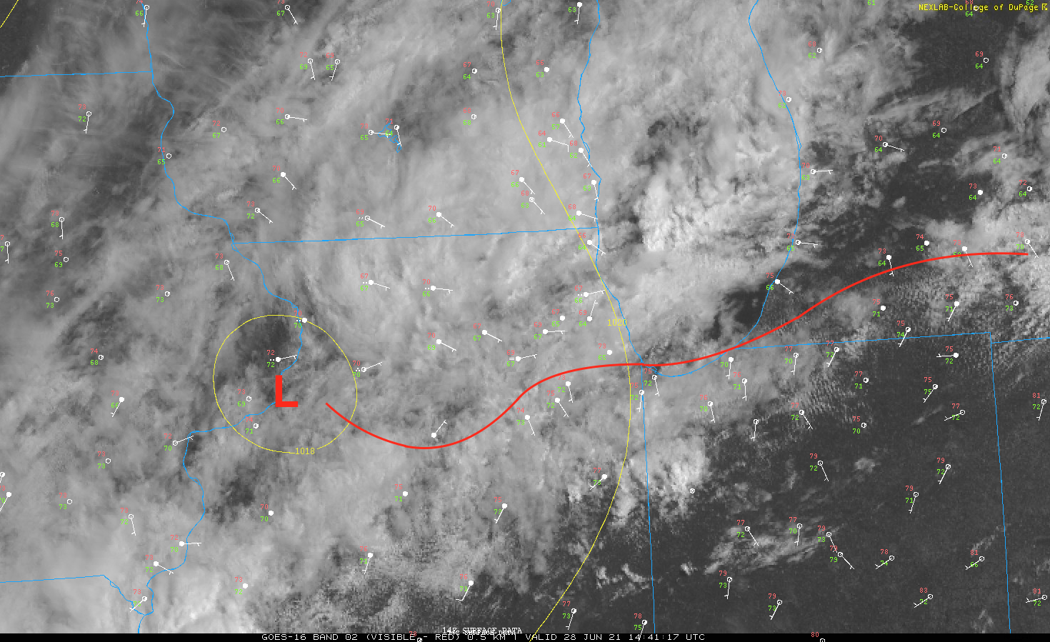
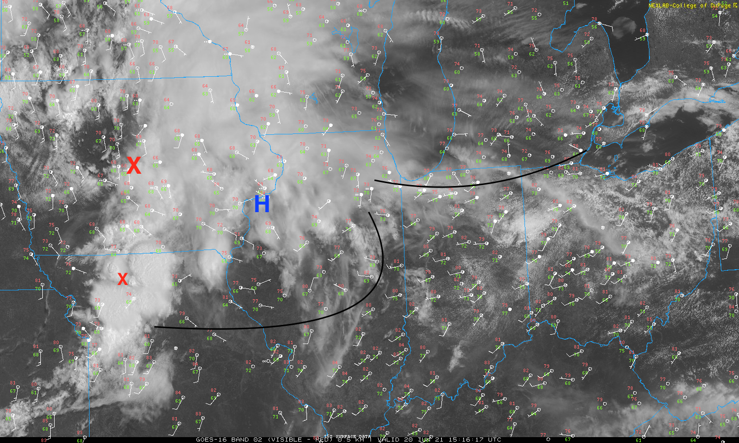
There are several boundaries out there that will mark the northern extent of the severe threat w/ the 2 MCVs, but the eastern-most boundary/front will likely lift a bit north of where it is now as long as clearing continues. The smaller/secondary MCV over MO is probably what will drive the wind/tornado threat across the southern Chicago metro (initiation of sfc-based TS near intersection of an outflow boundary and the lake breeze) into the Detroit area, likely reaching a peak either side of the IN/OH/MI borders. A good chunk of IA is definitely in play, with hail too, especially where the outflows intersect the low/front later on.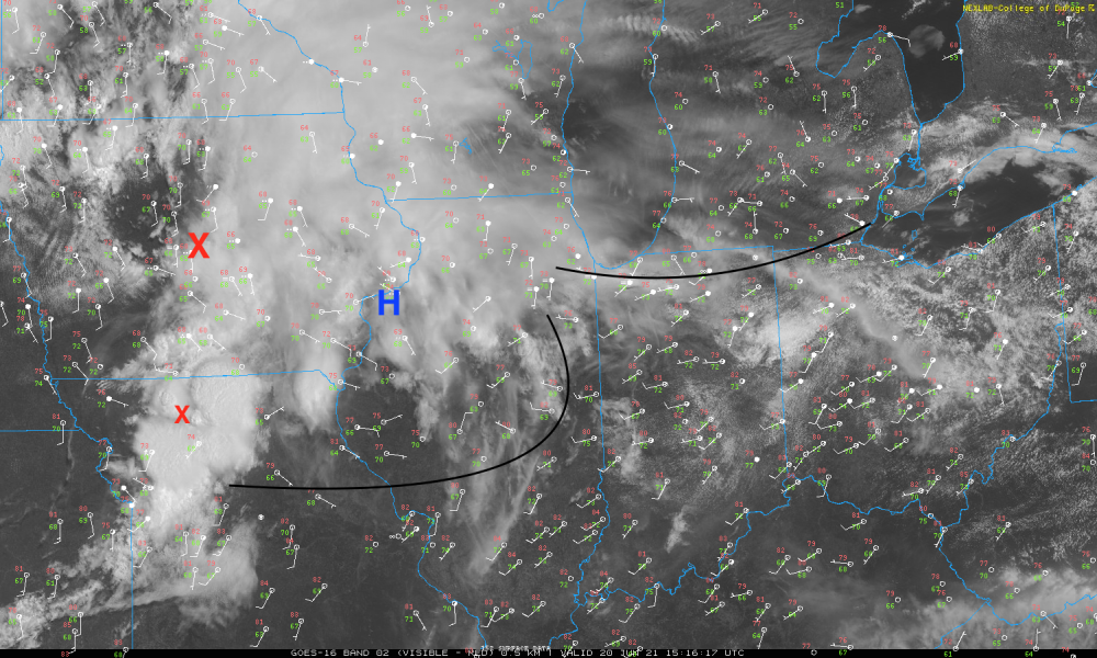
-
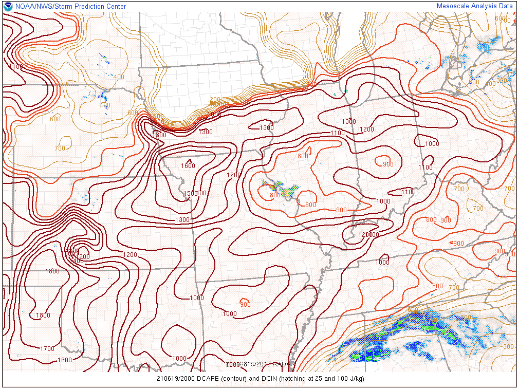
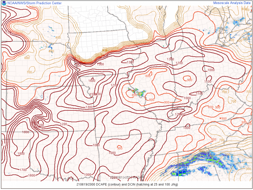
front/lake breeze/outflow combo coming together across chicago the next couple hours. latest hrrr and 3k NAM are a little more excited for a few thunderstorms this afternoon. those showers up north already have tops over 30k'. probably would be gusty given the steep low-level lapse rates and dcape in place.


-
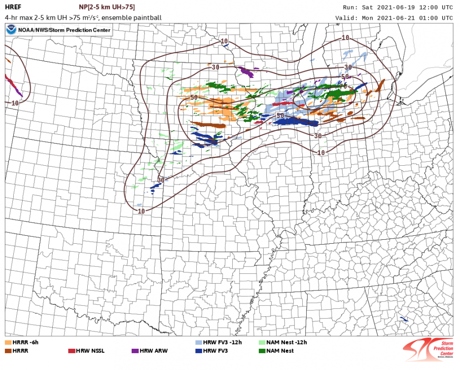
Would currently lean towards the southern edge of the 50/70% contours for the higher tornado and wind risk tomorrow, minus the lake influence in Alek's backyard, of course. Should be some 1-2"+ rainfall amounts in areas that need it most, too.
-
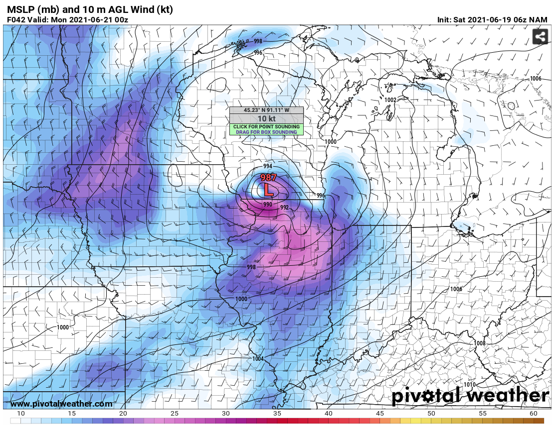
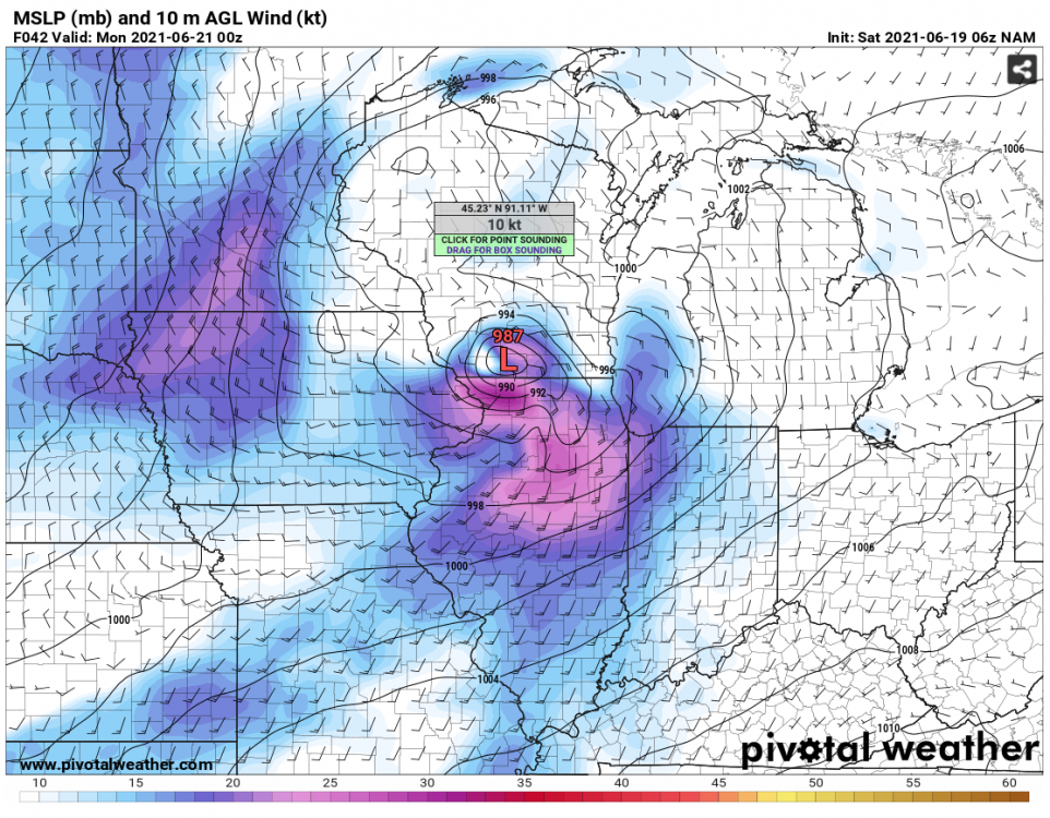
06Z NAM says move over Claudette. Obviously overdone, but definitely think you're right about creating its own threats, especially on its SE/S/SW flank where shear is enhanced and the effective warm front will reside.
-
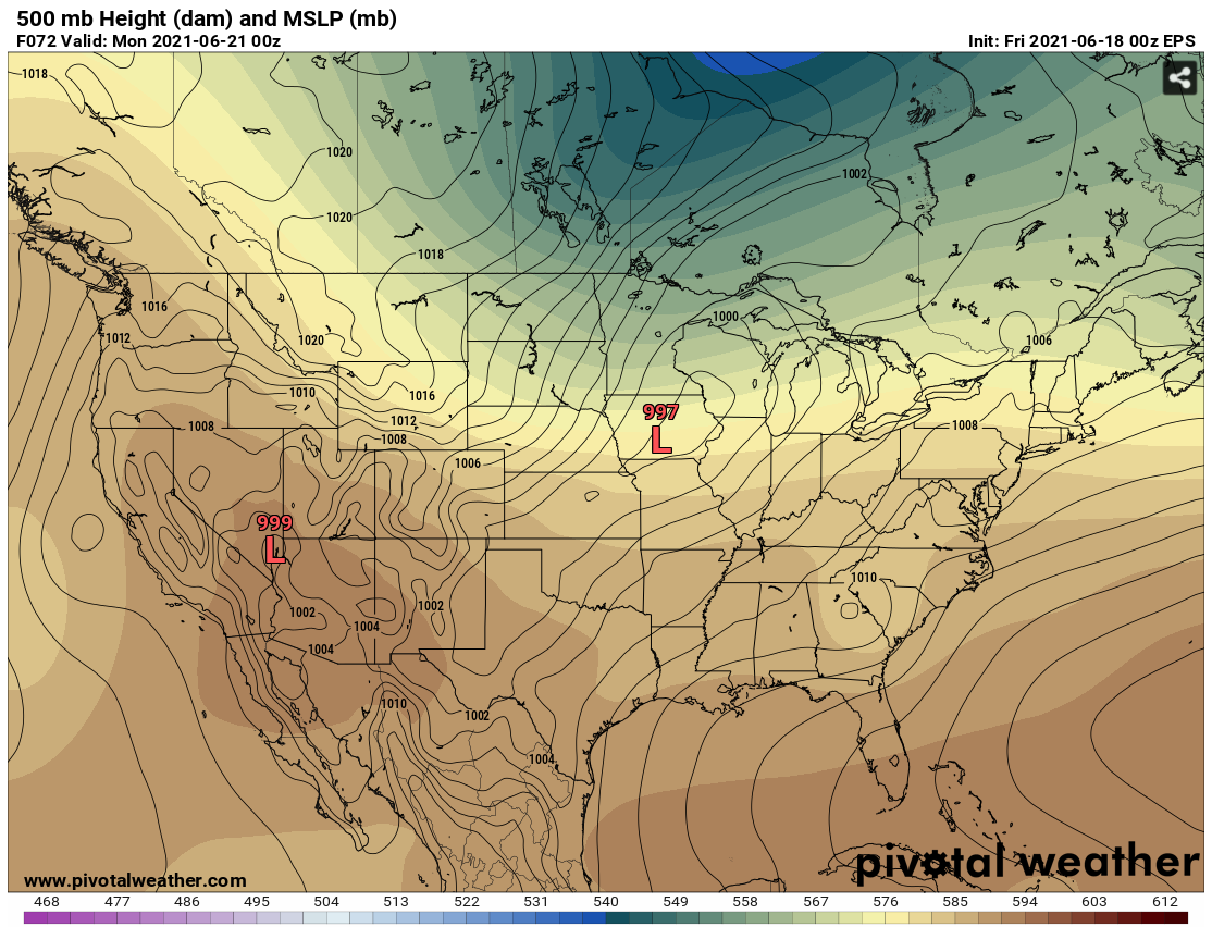
Looking at the bigger picture (EPS below), there is probably a relatively higher threat for tornadoes on Sunday. With the pattern change coming in, there is reasonable agreement on a deepening surface low tracking from IA into MI Sunday - Sunday night. Looks like more than enough deep layer shear for rotating storms. The lingering question for me now is instability due to moisture return being stunted by the Gulf/SE tropical. 12Z guidance is struggling w/ ongoing activity from Iowa into the Ohio Valley. Suspect some changes will be required on the late AM outlook.

-
Not doing too bad. MDW’s 25F is questionable but ORD is down to 32F on the 1-min data. edit: ORD Td now down to 27F.
-
It’s fun to be tracking WAA-driven nocturnal MCSs again, but a lot is dependent on tonight’s southward-moving convection and any debris-related impacts to heating tomorrow. Looks like a decent cap with the heat-wave associated EML advecting in. Long story short, too many mesoscale things at play to trust any guidance right now.